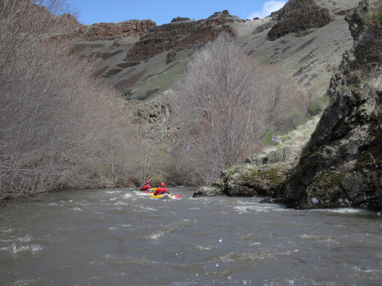
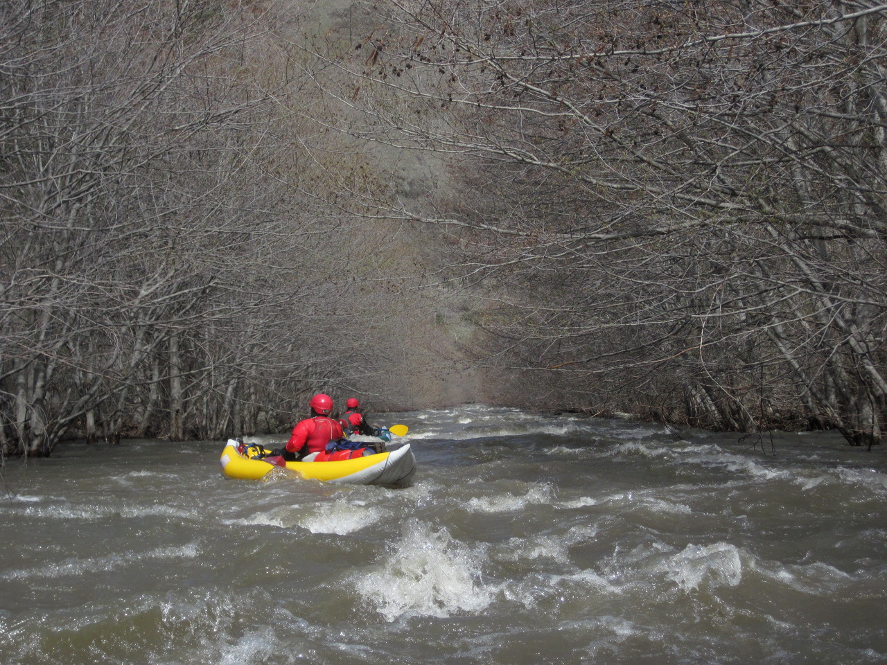
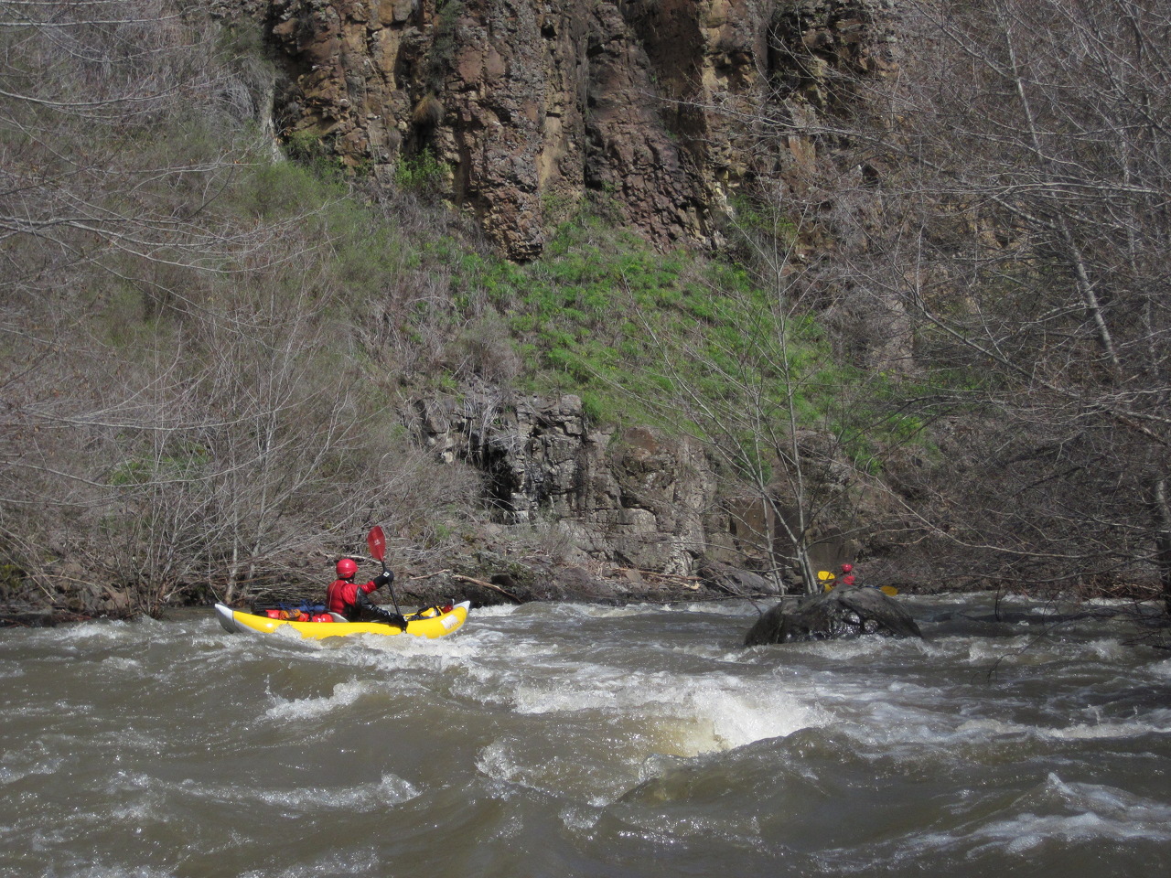
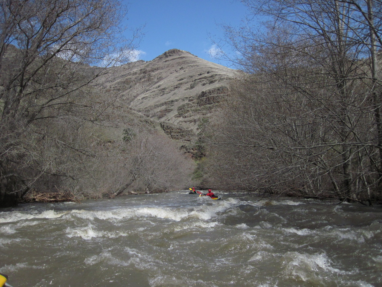
Whipface Creek in Oregon


Stretch: Cougar Creek to end of lower canyon
Difficulty: Class III with several logjams and some class IV
Distance: 40 miles, two or three days
Flows: kayaks 400 - 1000 cfs
Gauge: flow measured near take-out (WA)
Gradient: 49 fpm average, steeper in lower canyon
Put-in: Cougar Creek confluence, 2940'
Take-out: fishing access along USFS road, 980'
Shuttle: many miles (4.5 hours) one way, shuttle driver recommended
Maps: topographic maps, satellite images (Topo)
Season: mid spring, from rain and snowmelt
Agency: private, USFS
Notes: © 2011 Bill Tuthill. Photos © 2011 Brian Vogt.

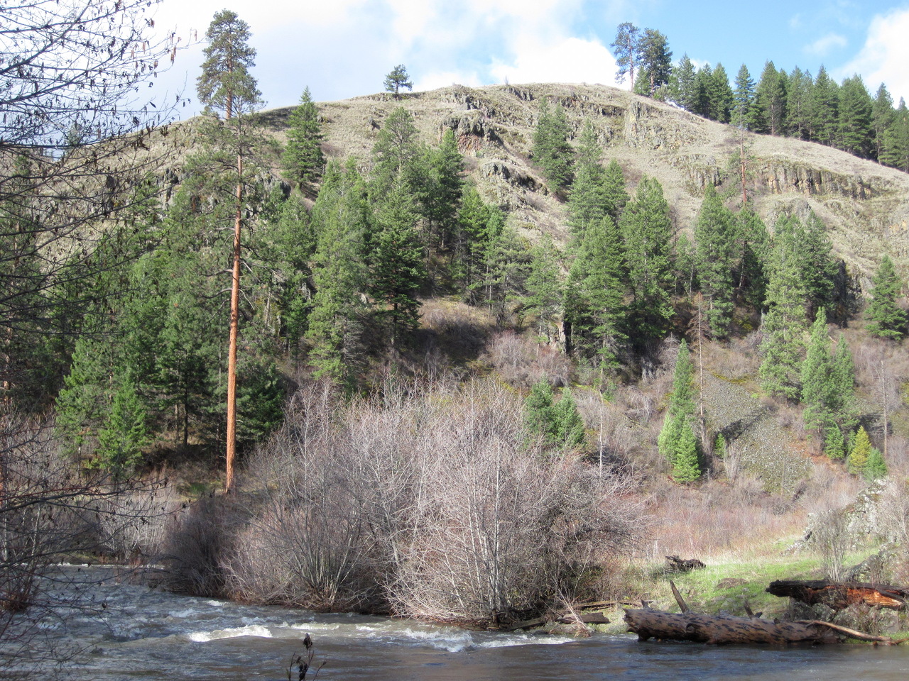
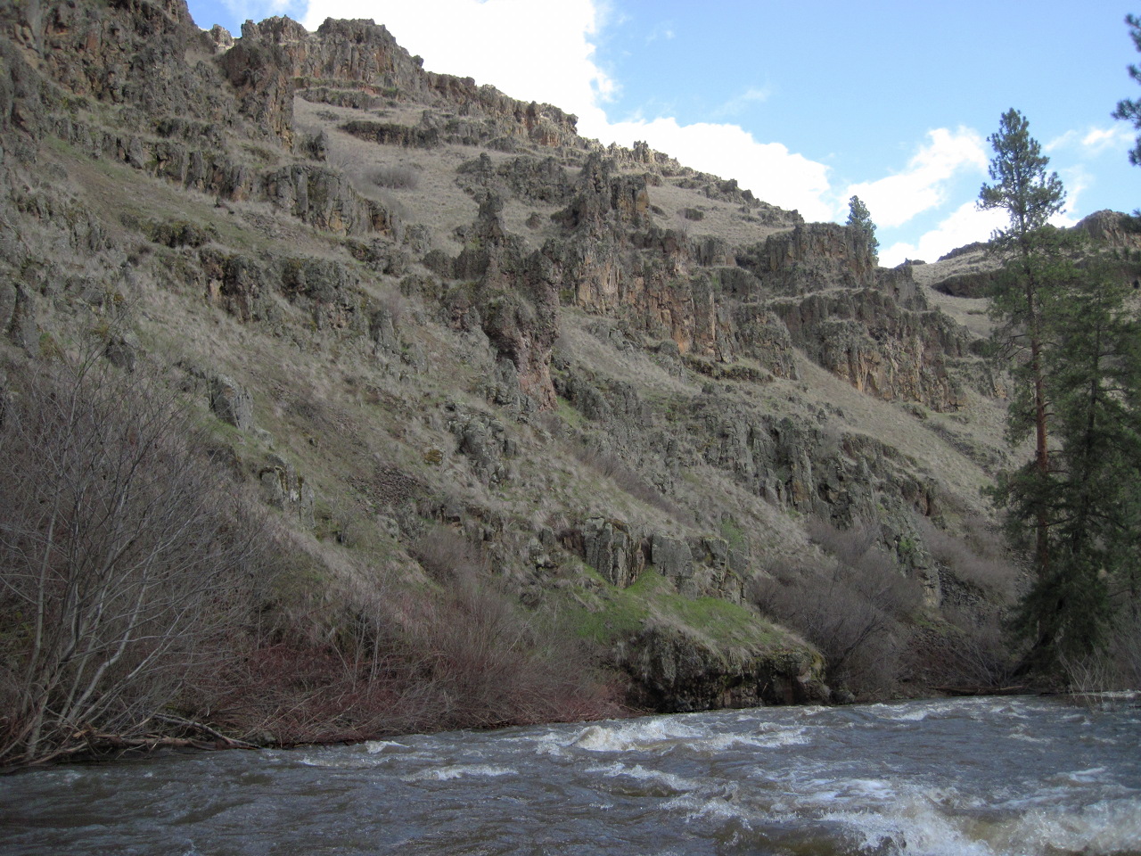
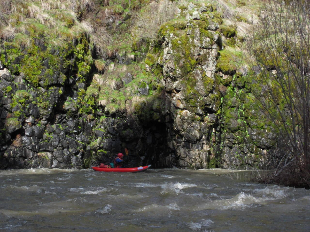
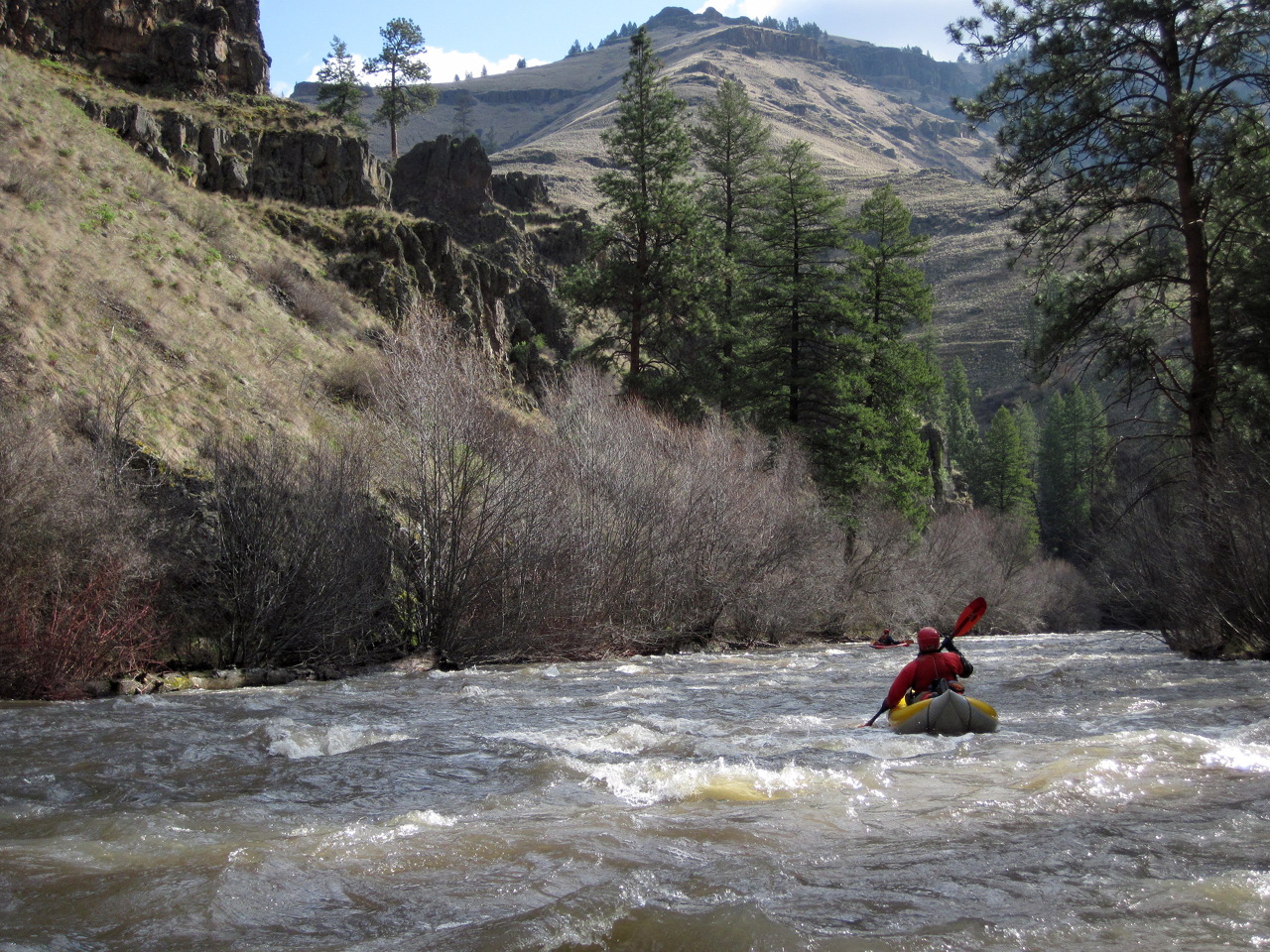
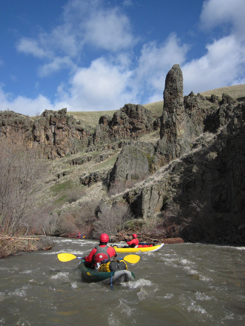
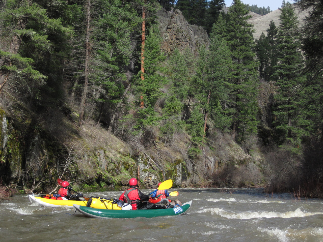
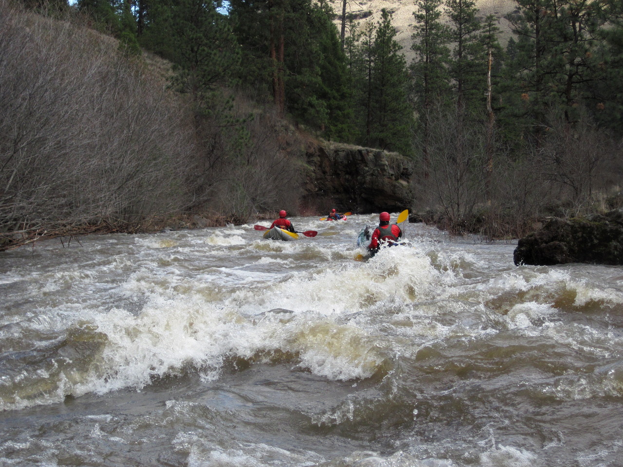
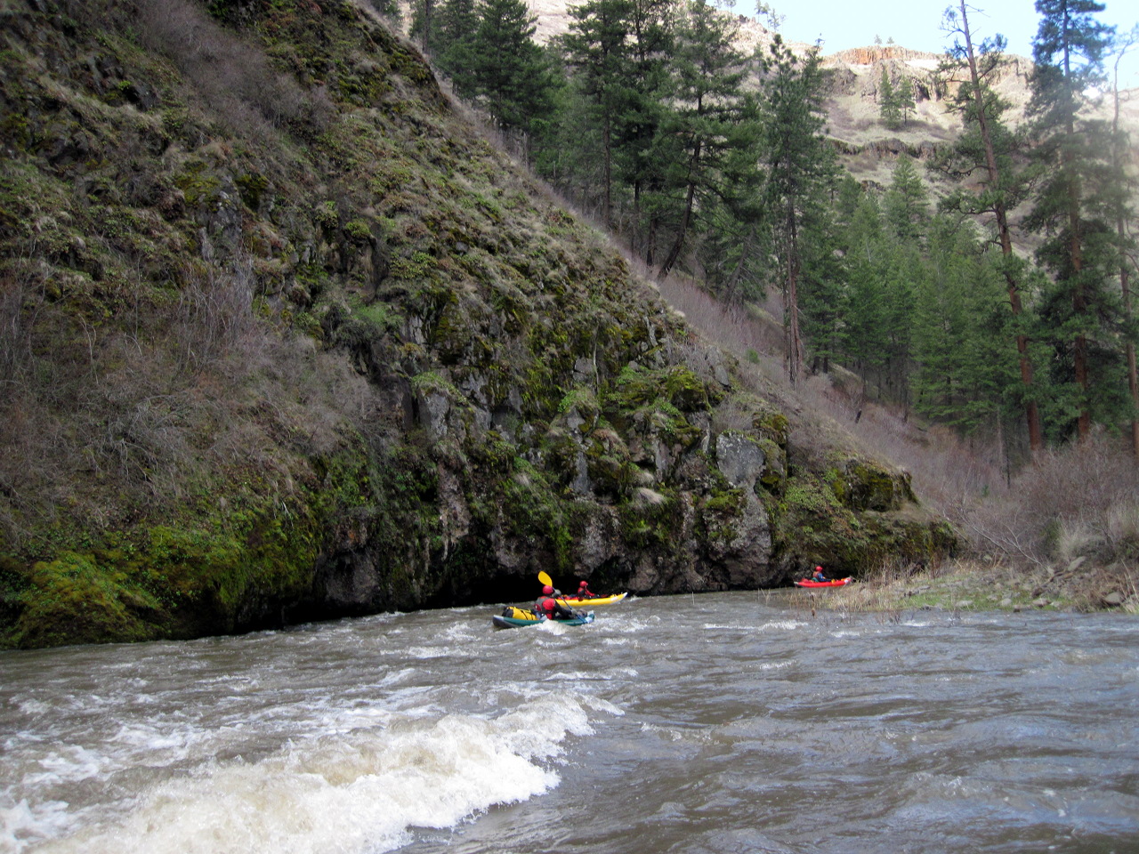
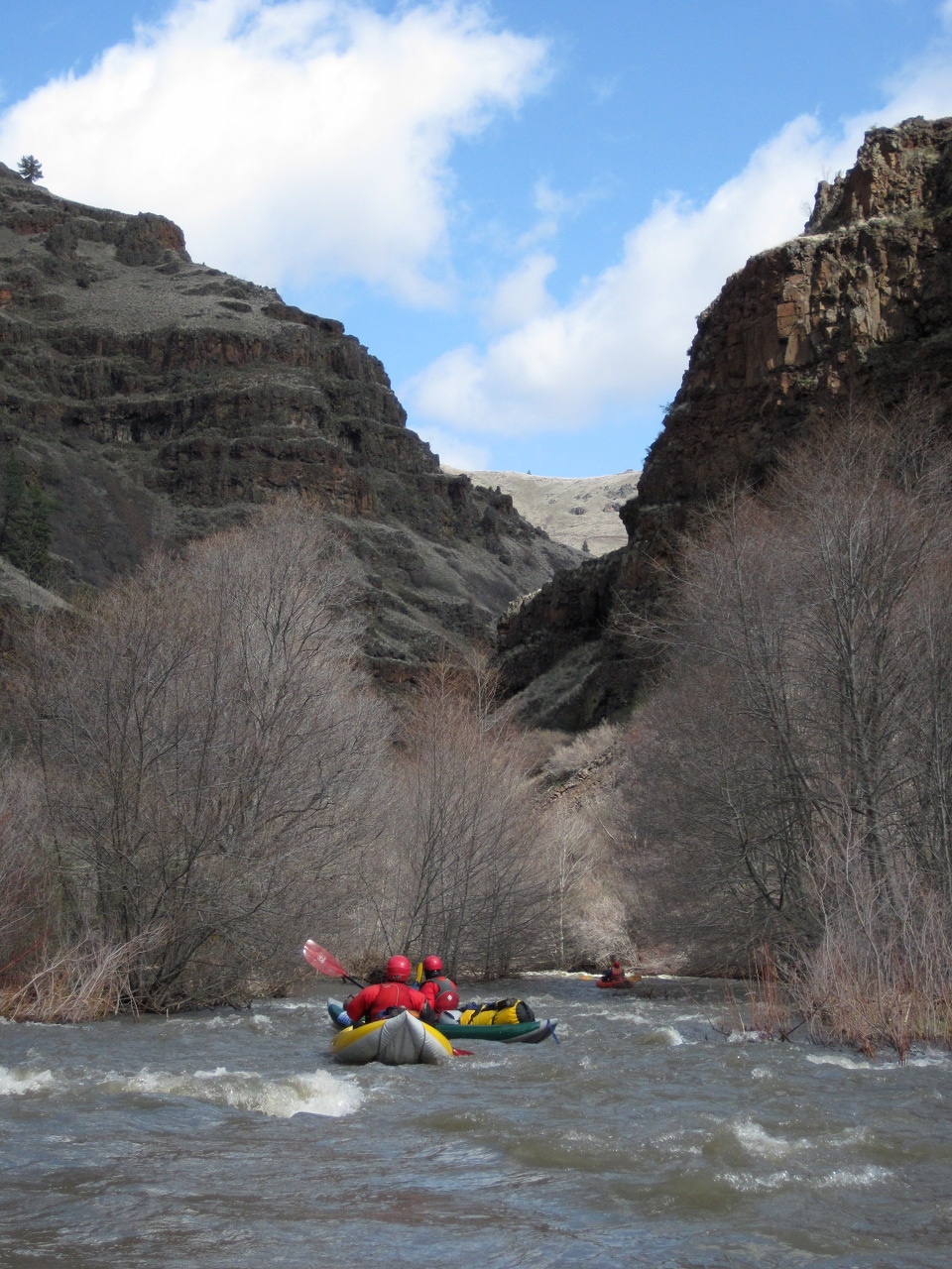
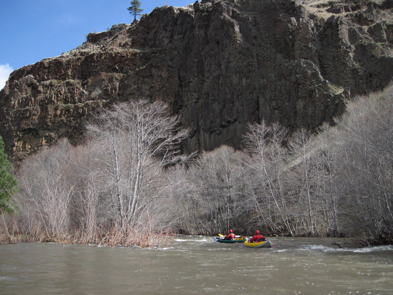
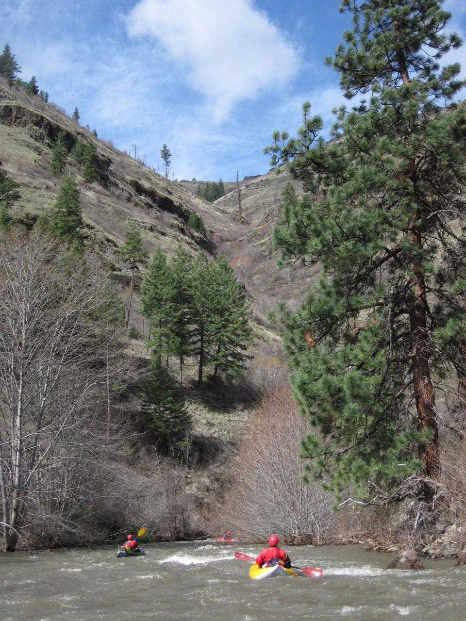
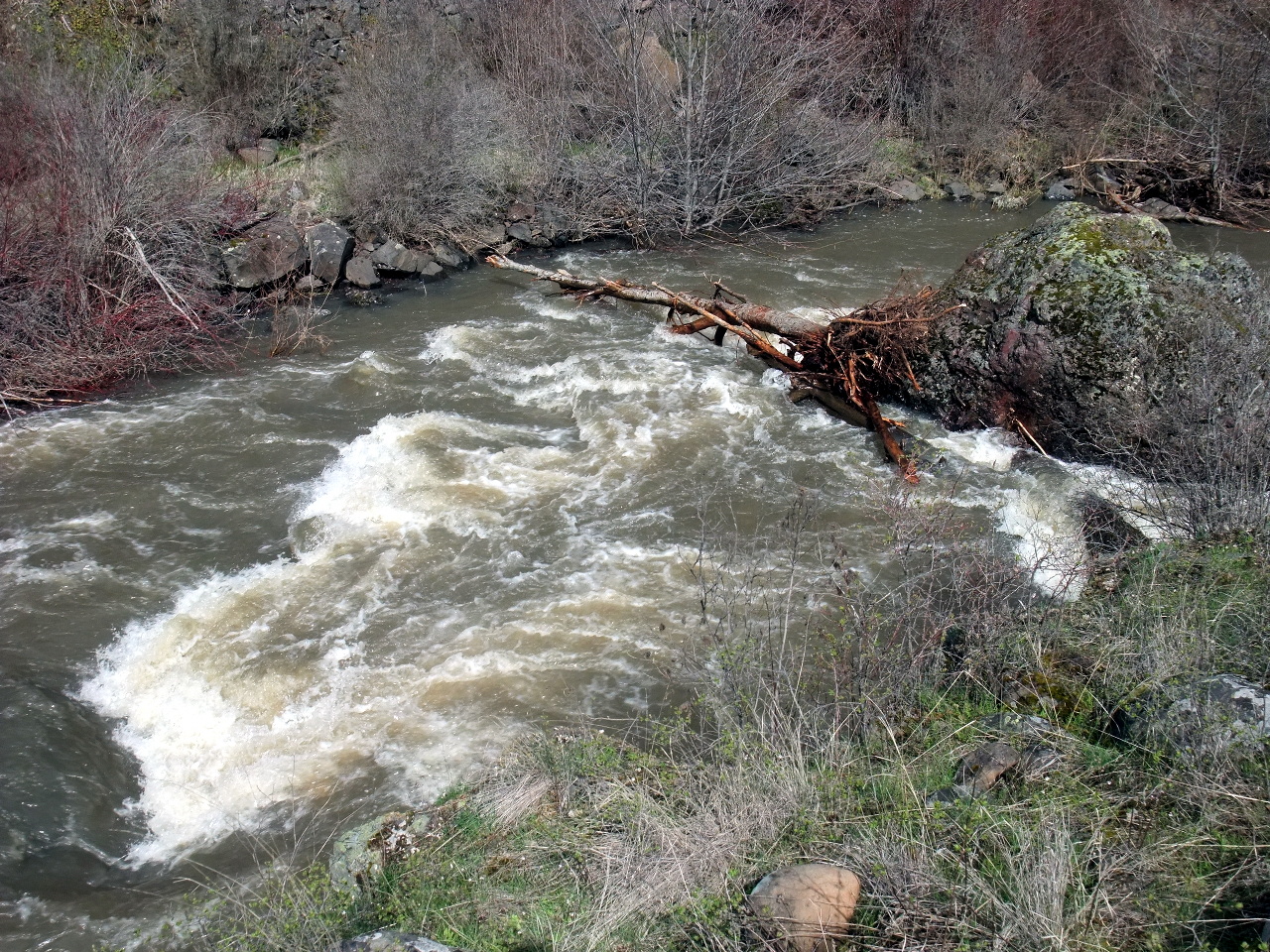
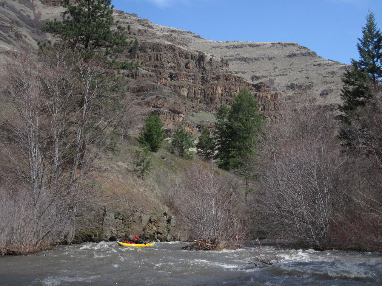
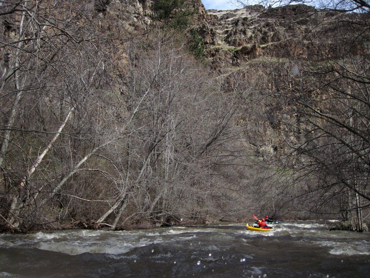
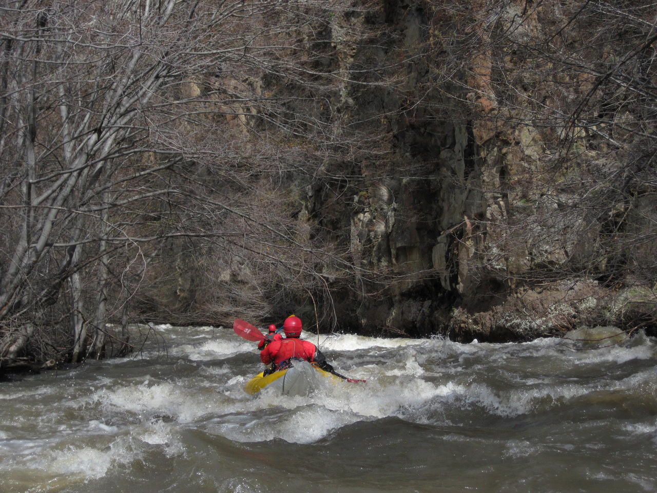
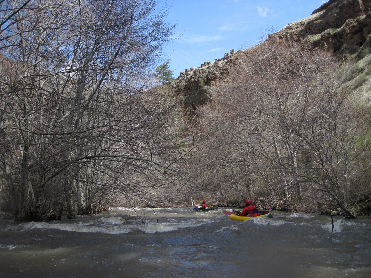
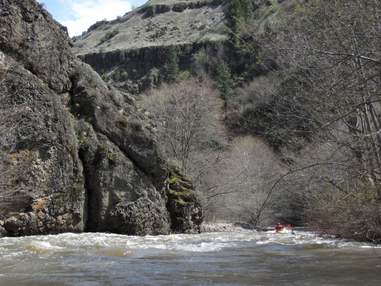
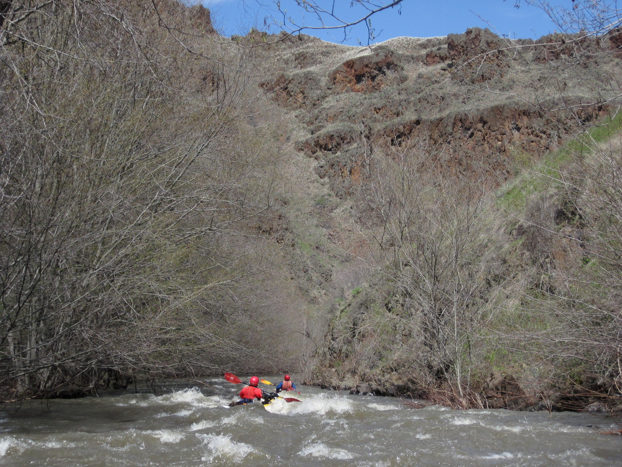
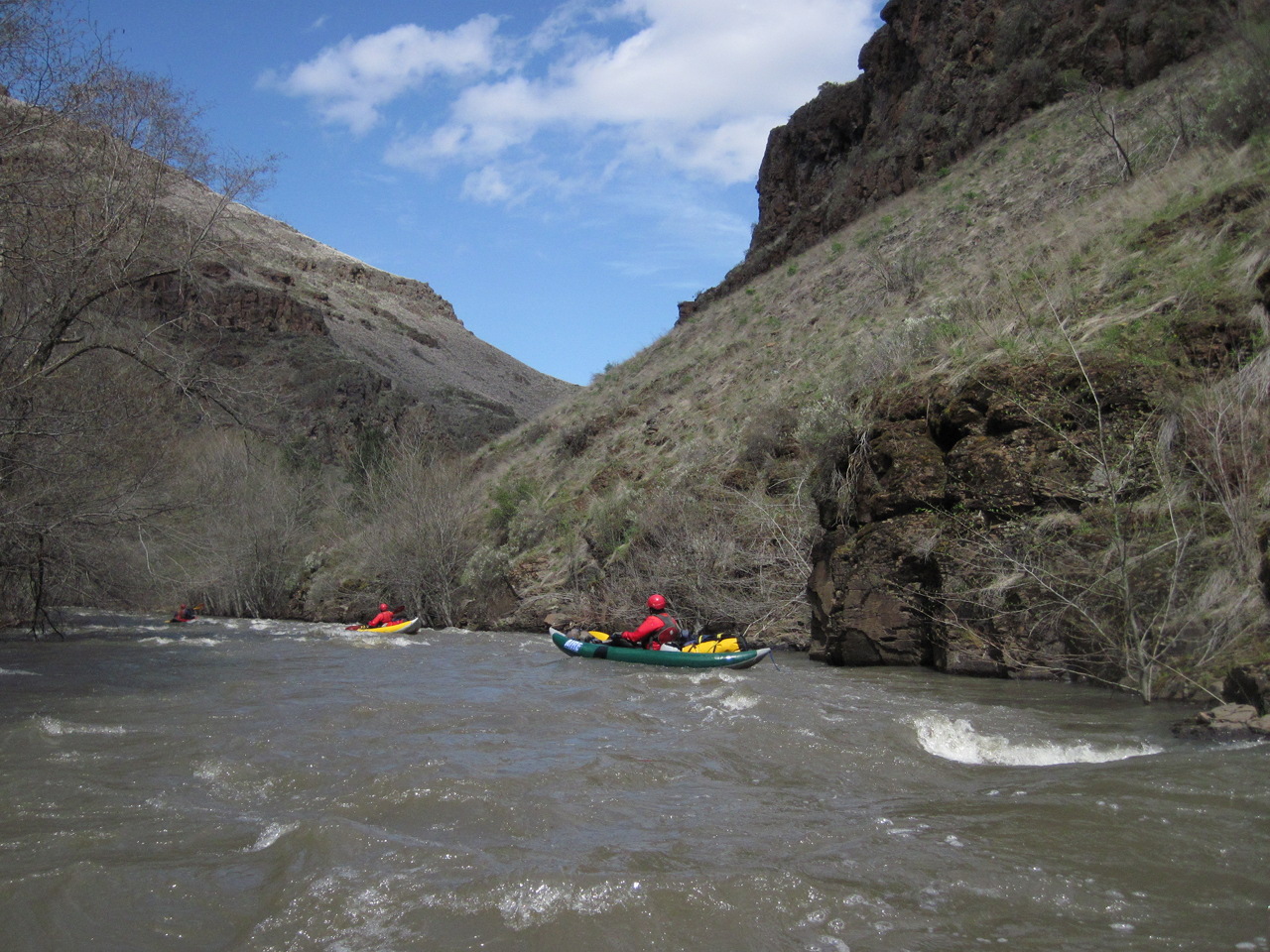
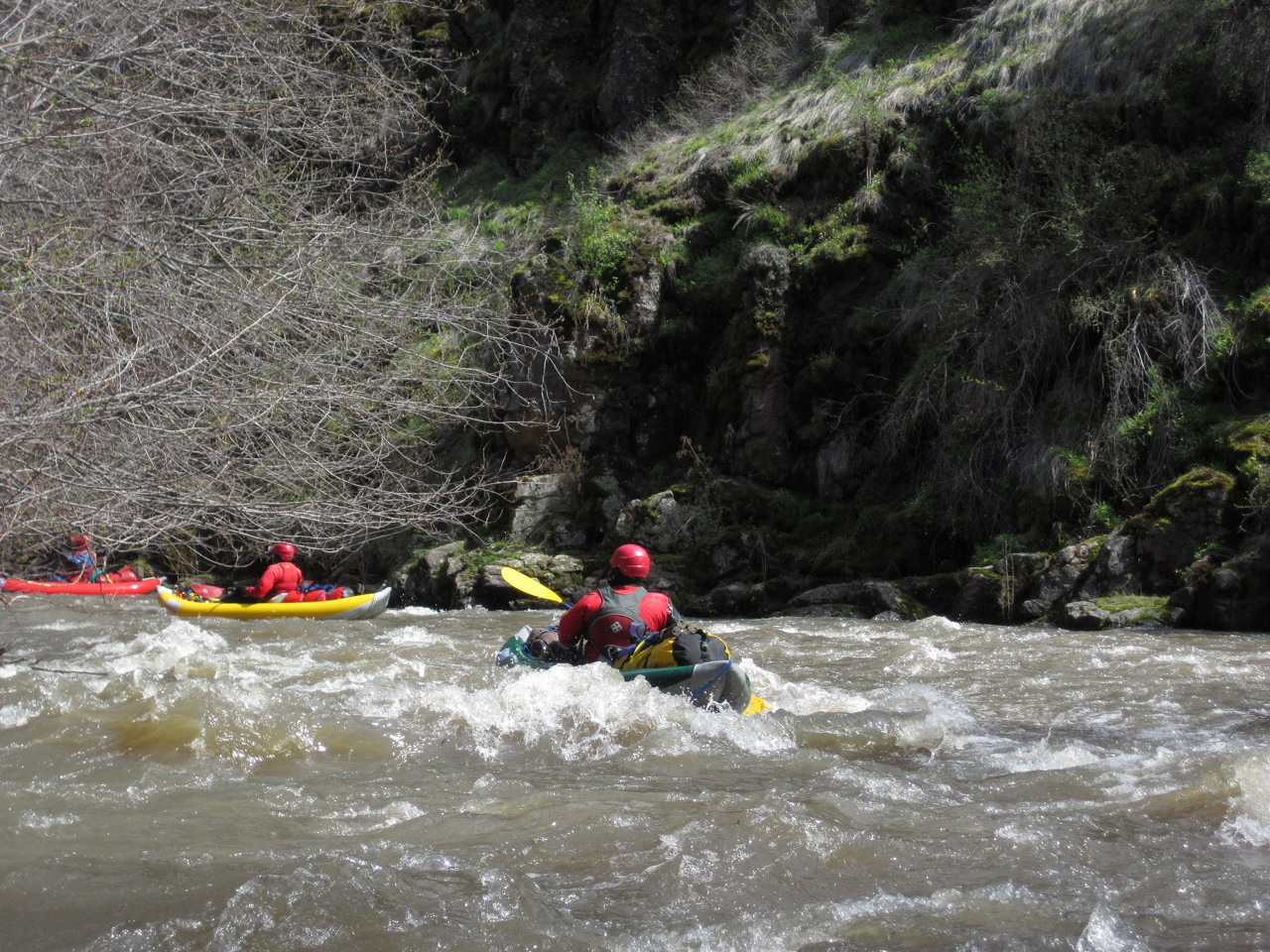
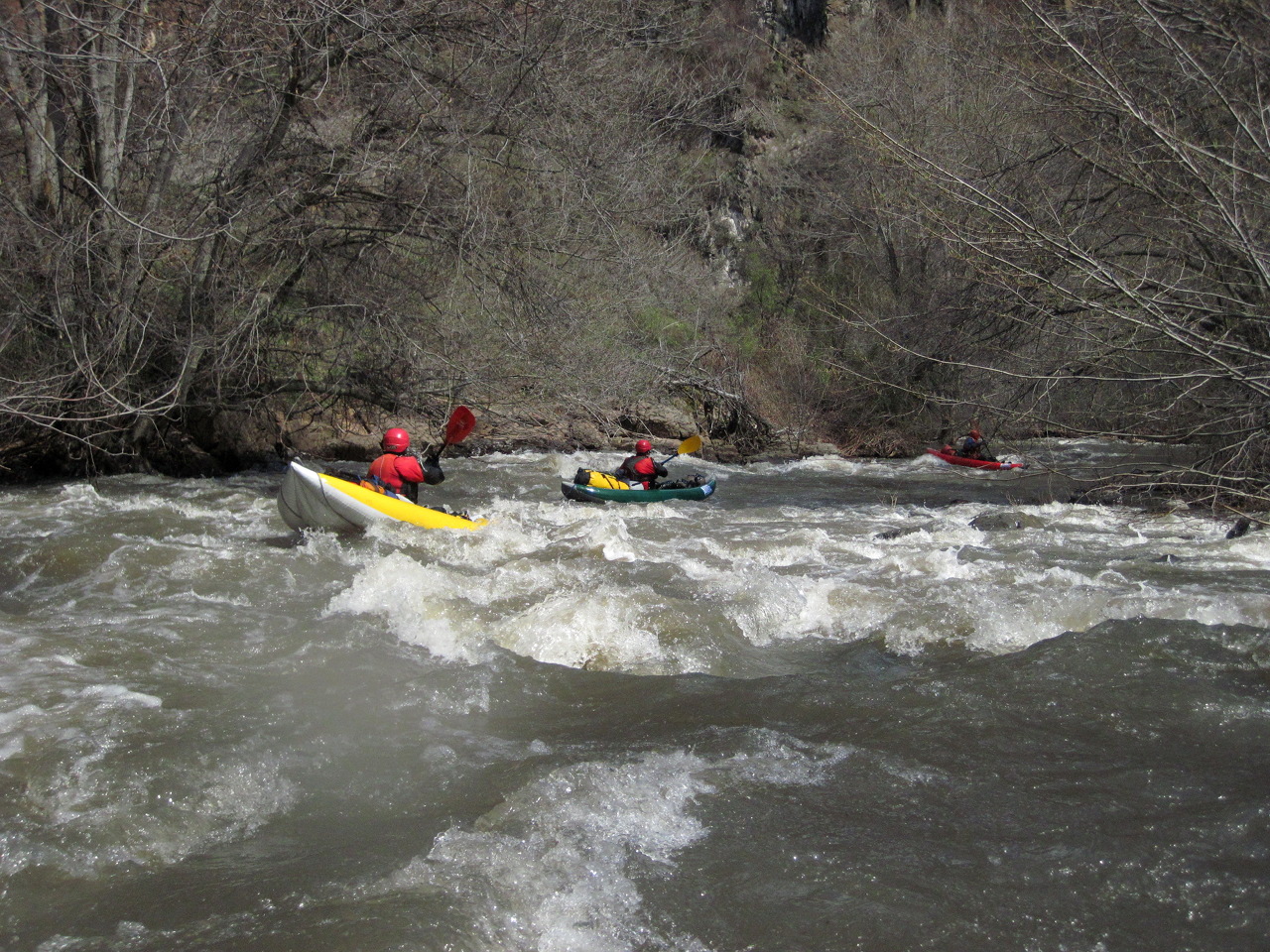
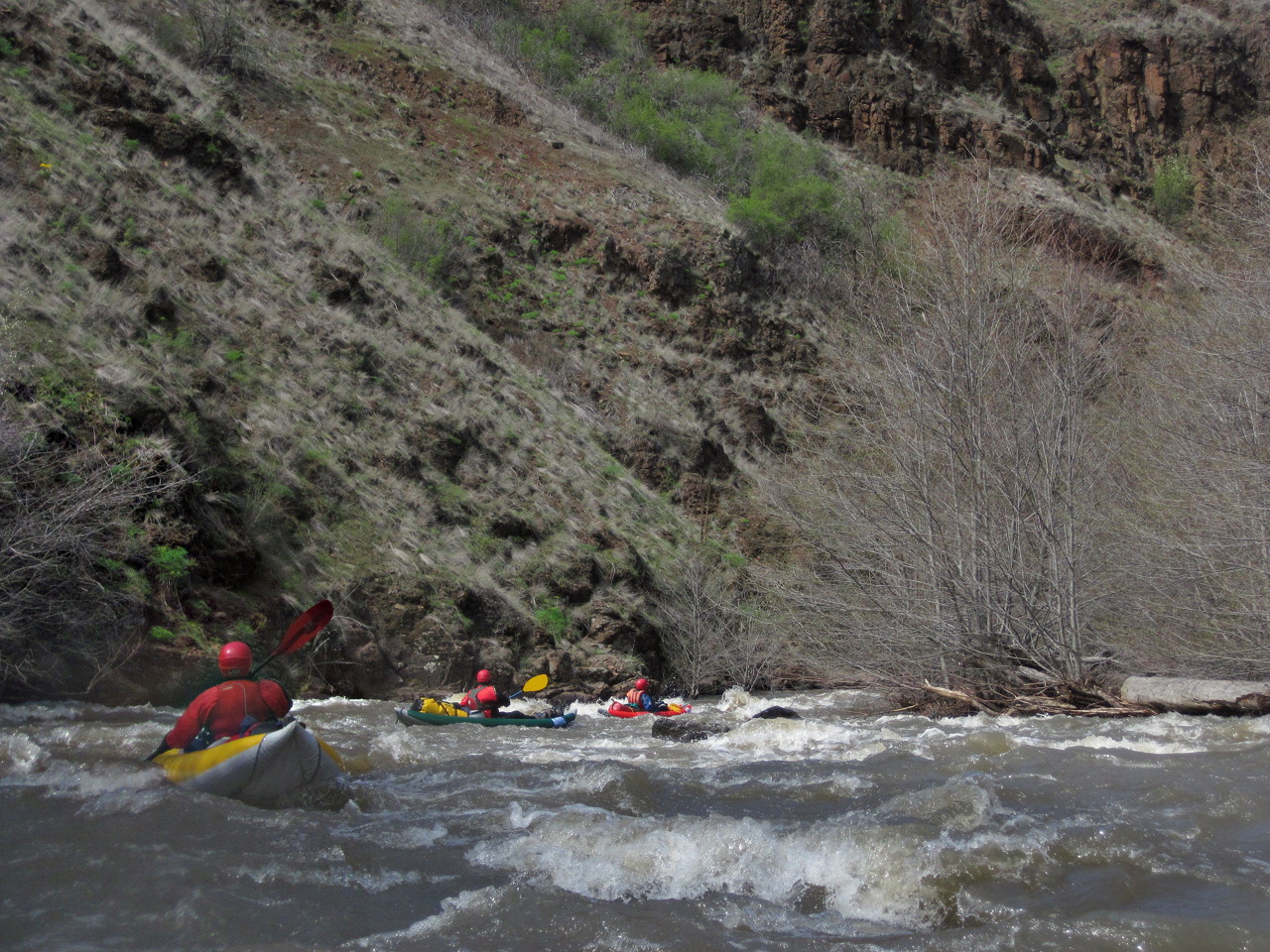
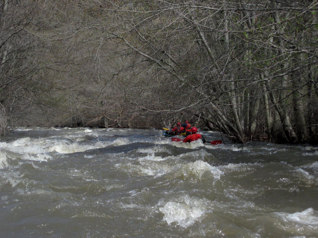
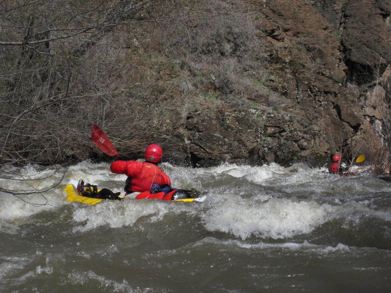
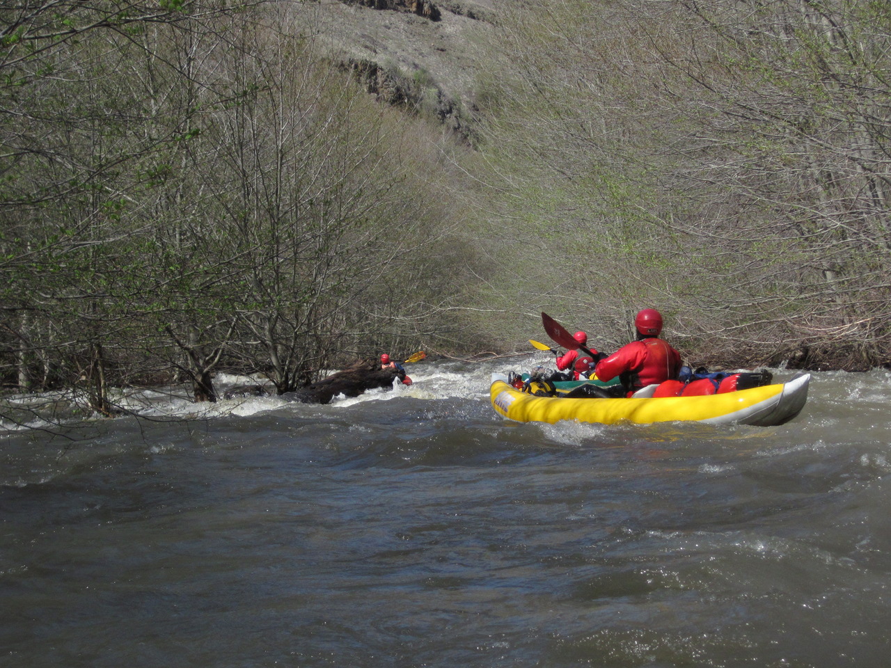
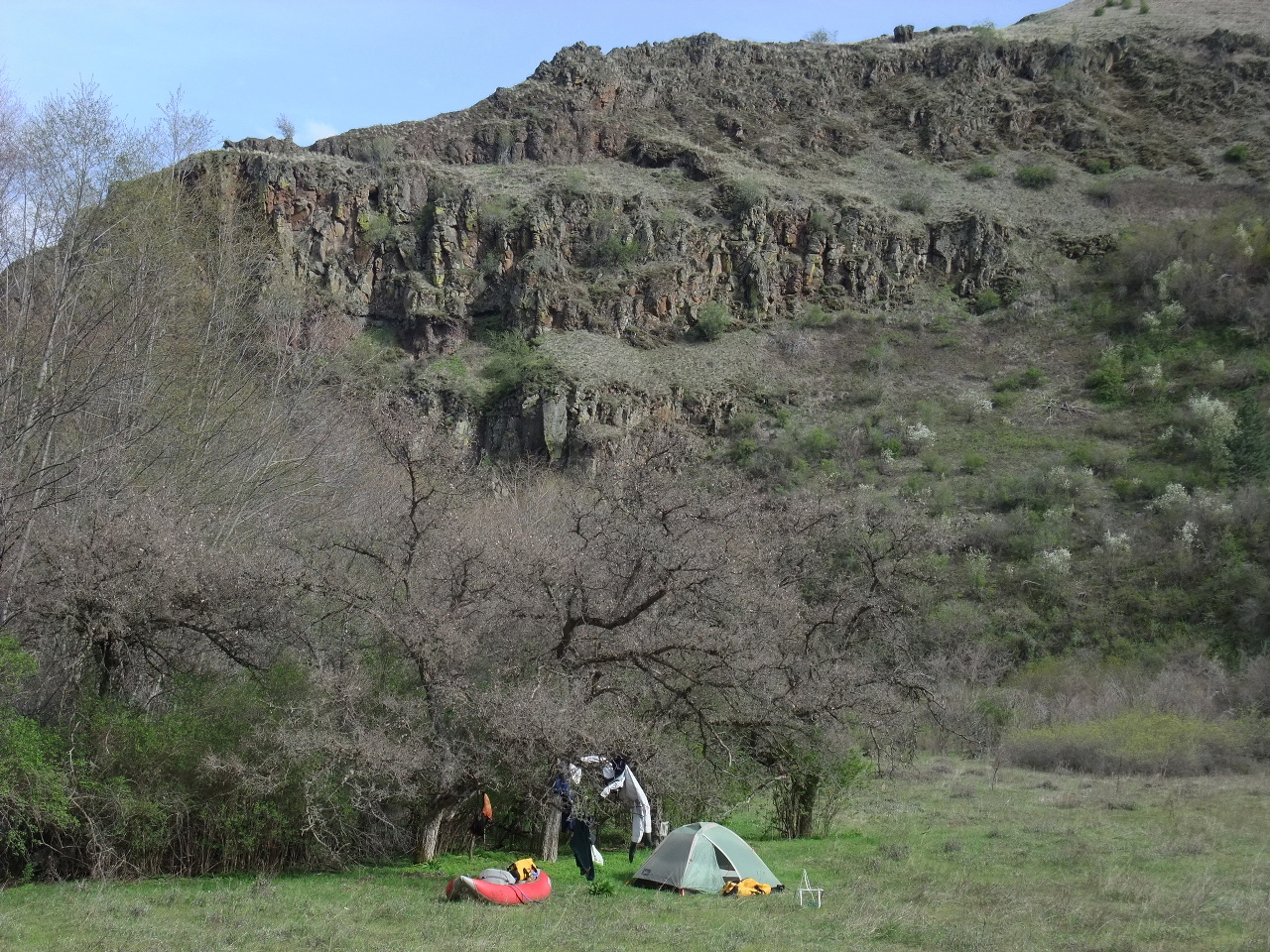
This is a classic run for boaters who equally enjoy whitewater and camping. It is basically a 36 mile (or longer) continuous class II-III rapid with several class IV rapids and logjams thrown in to keep you in suspense. Kayakers should have a reliable roll or self-rescue skills because recovery pools, if any, can be miles apart. The red basalt canyon (what you can see of it anyway) is very scenic. Pleasant campsites abound in the lower canyon, but during boating season it often rains in the upper canyon.

Recognizable landmarks are rare along this run, especially in the lower canyon where both banks are lined with willow trees, hence the name Whipface Creek. It is best to plan your trip before the trees leaf out and reduce visibility. Old cabins and side-creeks are sparse but the only way to mark your progress. Cattle graze along the creek except in steep canyon sections.

The AWA river inventory of Oregon has a writeup of this run. Their mile-by-mile starts about 4 miles upstream of Cougar Creek and continues below the take-out bridge to the Grande Ronde confluence. They give helpful information about put-in permission and shuttle drivers.

mile 0
Put in on USFS land at Cougar Creek, or upstream at a more open location.
6
Bench on the left with metal-roofed barn and cabin. Swamp Creek enters just downstream, significantly increasing the flow. Collapsed cabin on the right bank.
Whipface Creek OR Whipface Creek OR
River canyon viewed above Swamp Creek  The canyon deepens
Whipface Creek OR Whipface Creek OR
Interesting moss-covered basalt  Table Mountain high on right bank
Whipface Creek OR Whipface Creek OR
One of a few visible hoodoos  Ponderosa forest thick at times
Whipface Creek OR Whipface Creek OR
The rapids keep on coming  Mossy rock becomes less frequent
11.4
Defunct cabin on the right bank, marked on the topo map.
Whipface Creek OR Whipface Creek OR
The canyon narrows ahead  Willows not has thick as downstream
12.6
On the right bank, a white camping trailer is parked next to a rock. The first class IV rapid, log-choked in 2011, is just downstream.
Whipface Creek OR Whipface Creek OR
Highway 3 nearby but high above  Class IV rapid below white trailer
13
A dirt road climbs out of the canyon as a creek enters on the left.
Whipface Creek OR Whipface Creek OR
Ponderosa trees become sparse  Good view thru the willows
Whipface Creek OR Whipface Creek OR
Rapid into bare rock wall  A more-open section of canyon
17.2
Large bench on the left bank with ranch cabin. Rush Creek enters on the right, with an old trail heading upstream. Another cabin perches on the right bank near the creek. Active ATV trails for a few miles downstream.
Whipface Creek OR Whipface Creek OR
The canyon gradually becomes drier  Rapids continue down a straight section
Whipface Creek OR Whipface Creek OR
Canyon walls no longer moss-covered  Below the Ponderosa zone
Whipface Creek OR Whipface Creek OR
A very narrow part of the canyon  Red basalt benches on the right
28.4
Tamarack Creek enters on the right. According to the topo map, the pack trail leads up Tamarack Creek. Shortly below, the rapids intensify, verging on class IV at times.
Whipface Creek OR Whipface Creek OR
Willow jungles alternate with open sections  Few campsites in this steep canyon
Whipface Creek OR Whipface Creek OR
Procession of boats among willows  Good visibility at a woody corner
Whipface Creek OR Whipface Creek OR
Getting whipped to avoid the middle  Lead-in to one of the very steep rapids
35
The canyon starts to open up. As the Bennett guidebook says, the canyon spits you out in a whitewater fit. Good campsites are available on the left, then on the right.
Whipface Creek OR Whipface Creek OR
Braided channels among willows  First good campsite on the right
37
Hazard! Fish counting apparatus with steel cables across the creek, a decapitation risk. (2011)
37.2
First bridge over the creek. The Bennett guidebook says parking is available nearby, but local shuttle drivers do not agree. Frequent but non-continuous rapids occur, like a normal river, as the creek drops thru ranch country.
39.7
Take out just below the second bridge across the creek, at the parking area for public fishing access. The Grande Ronde confluence is about two miles further, but there is no good river access on the Grande Ronde until 2.2 miles below the confluence.

Shuttle Directions

From Enterprise, take highway 82 east towards Wallowa Lake. In 3.5 miles, turn left onto Crow Creek road (dirt). After 1.1 mile, take the first right (uphill) to stay on Crow Creek road. Stay on this road as it twists and turns. Continue slightly uphill along Prairie Creek to a low summit, then slightly downhill along Crow Creek. In 27 miles, shortly after crossing Chesnimus Creek, turn left onto J0seph Creek road, which looks like a driveway. (Elk Creek road, possibly snowbound, joins on the left 1 mile before Chesnimus Creek, which provides most of the flow.) Continue at least 6 miles along J0seph Creek road. Land ownership alternates between private and USFS. At one point you come to an unlocked gate amidst a mud puddle. The final locked gate is just past Cougar Creek. If that put-in looks too brushy, go back upstream and find a good spot. This leg of the shuttle takes about 80 minutes.

The Bennett guidebook describes the Elk Creek route, which is only a few minutes faster, and could be snow-bound, so the above directions recommend a lower-elevation route.

To reach take-out from Enterprise, drive on highway 3 north 42 miles to the state line, then (the number changes) on highway 129 north 36 miles to the town of Asotin. From Asotin, take the Snake River road 25 miles south to Grande Ronde road, then another 5 miles to J0seph Creek road. The take-out is at a fishing access just below the downstream bridge. Another bridge is upstream, with unknown parking status: the Bennett guidebook recommended it, but shuttle drivers do not. This leg of the shuttle takes about 3:15, but can be shortened to three hours (avoiding Asotin) if Montgomery Ridge road is open.


 Creeks Navigation

 Home
 Recommended Runs
 Map of Rivers
 Alphabetic Index
 Alphabetic Table
 Text Search

 Sponsored Links