| |
| Stretch: |
Soda Springs reservoir to Susan Creek or Cable Crossing |
| Difficulty: |
class II-III with some class IV- |
| Distance: |
25 to 32 miles, 2 to 4 days |
| Flows: |
kayaks 500 - 4000 cfs, raft minimum 800 cfs |
| Gauge: |
measured near put-in at Copeland Creek
(USGS site)
|
| Gradient: |
30 fpm average; more on upper runs, less on lower runs |
| Put-in: |
boat ramp at Boulder Flat campground, 1620' |
| Take-out: |
river access below Susan Creek campground, 880' |
| Shuttle: |
total 23.2 miles (30 minutes at most) one-way |
| Maps: |
USFS Umpqua, AAA Oregon,
Topo
|
| Season: |
runnable most of the time, from springs and snowmelt |
| Agency: |
USFS (Umpqua NF) and BLM |
| Notes: |
© 2019, 2026 Bill Tuthill,
CreeksYahoo |
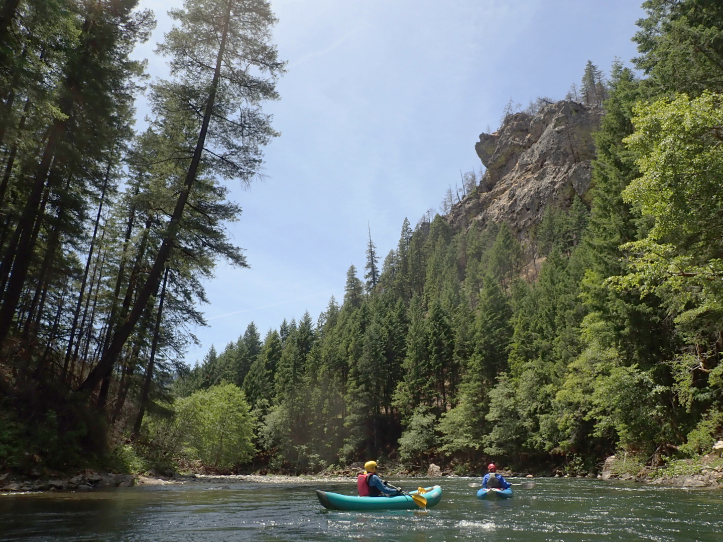
As a scenic class III river, the North Fork Umpqua is almost as wonderful
as sought-after permitted rivers such as the Rogue, Selway, or Middle Fork Salmon.
Oregon highway 138 follows the river,
and USFS campgrounds substitute for wilderness camping, but rapids are frequent and enjoyable,
scenic rock and forests line the river, and water is clear green or turquoise.
Considering river quality, crowding is minimal,
perhaps due to isolation between California and the Willamette Valley.
Reservations can be made at various USFS campgrounds.
Susan Creek campground has showers and is suitable for motorized camping vehicles.
Canton Creek campground, Horseshoe Bend, and especially Tokatee Lake campground
are distant from traffic noise on highway 138.
Anti-mosquito technology is recommended at all campsites.
Accommodations are available at Steamboat Inn and Umpqua's Last Resort.
You can hike in the morning and run four sections at a leisurely pace,
or start your hikes early and run two sections per day on successive days.
Sections are divided according to the USFS-BLM map available at kiosks:
- Boulder Flat to Horseshoe Bend, 6.3 miles
- Horseshoe Bend to Gravel Bin, 7.9 miles
- Gravel Bin to Bogus Creek access, 5.1 miles
- Bogus Creek to Susan Creek access, 6.3 miles
All sections are primarily class II-III although Pinball is rated IV,
and Bathtub might require portaging at low flow.
The fifth section below Susan Creek contains lots of flat water.
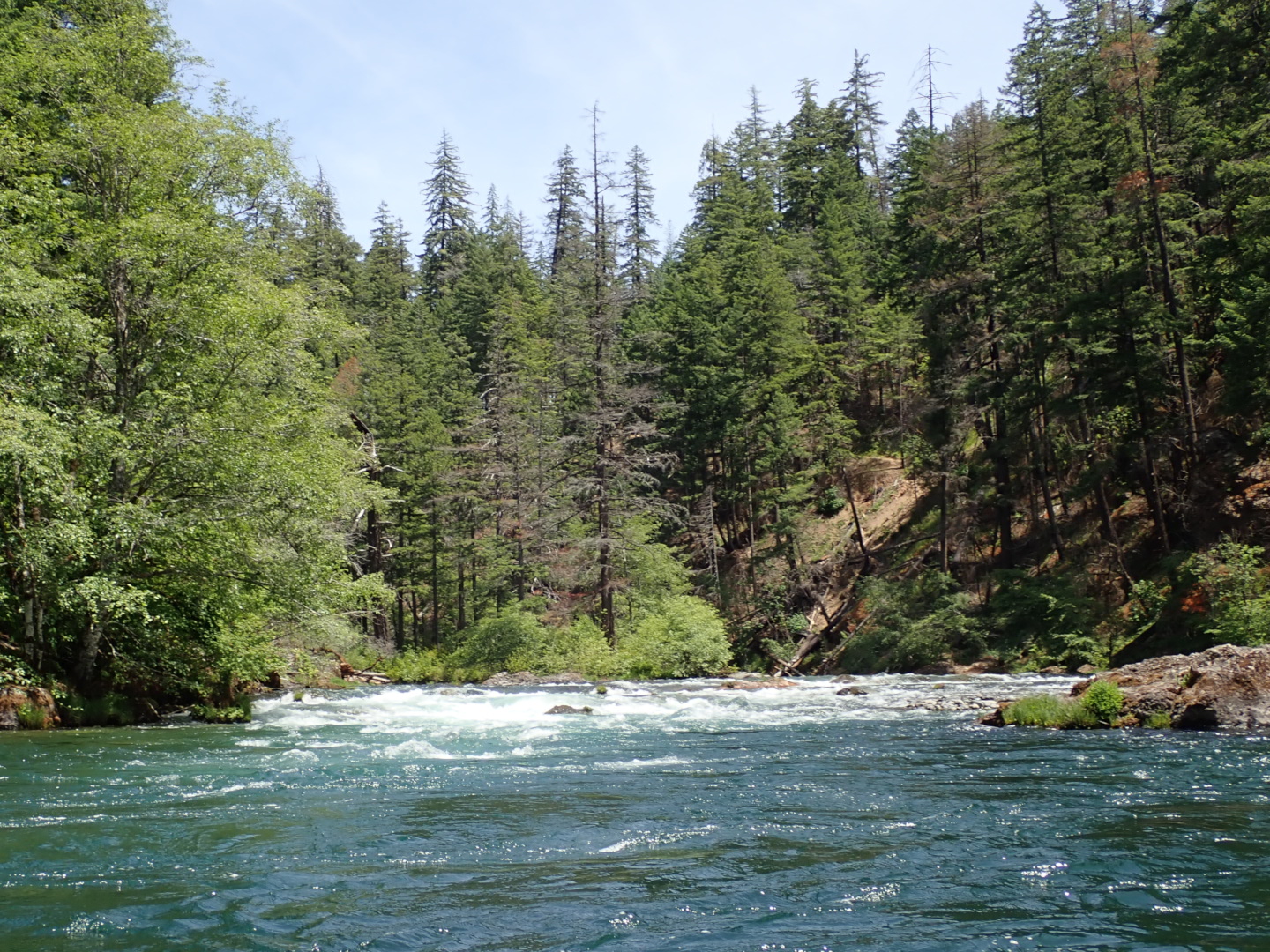
Photos were taken with the Copeland gauge around 1600 cfs.
Distances are in cumulative miles for each of the four sections,
and (in parentheses) miles above the South Fork Umpqua confluence.
- –1 (69)
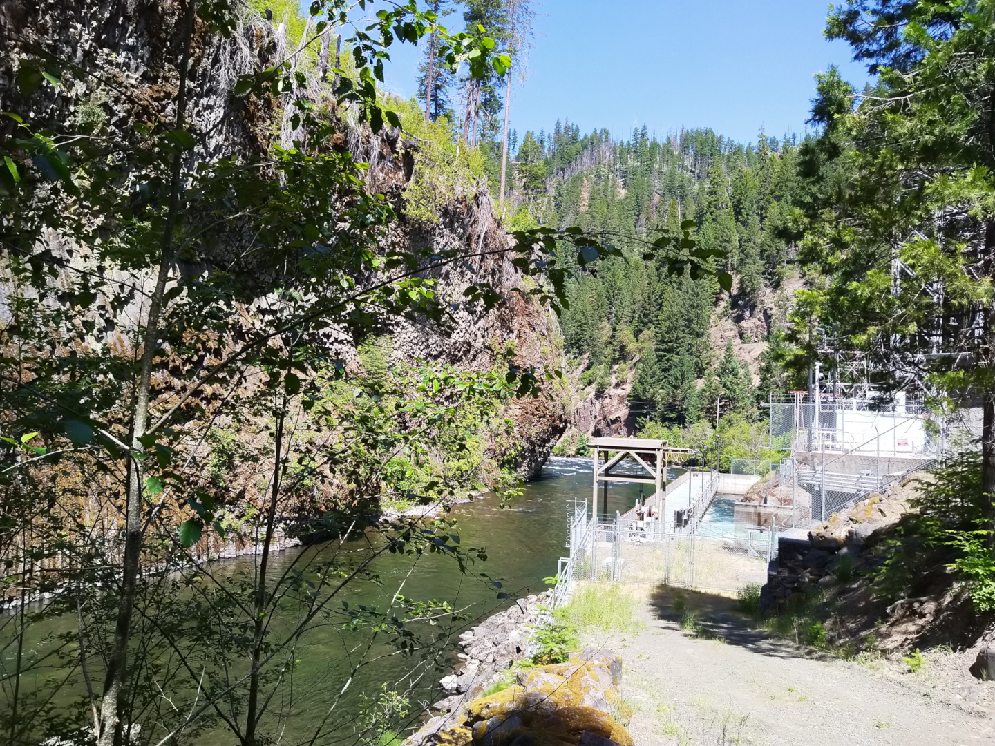
- Rafts can put in at the power plant,
if you don't mind lowering your boat and climbing down rip-rap.
An easier put-in for kayaks lies shortly downstream along a dirt road,
below the first rapid at an old stick gauge.
Rapids below the stick gauge are no more difficult than those downstream.
-
-
- 0 (68)
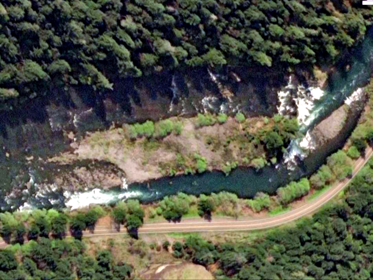
- Boulder Flat boat ramp is upstream of the campground.
It's a pleasant put-in with sun and shade from trees,
a large temporary parking area, changing rooms, and
a vault toilet near long-term parking spots.
- .1 (67.9)
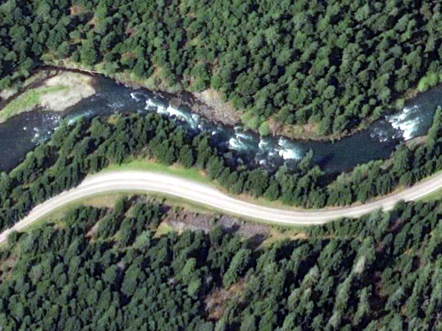
- Boulder Hole. A long rapid culminating in a steep chute on the right
with a rock below, and a sudden drop-off on the left.
Snag Rock follows on the kiosk map, but it's unclear whether this is
an island with possibly downed tree, a big rock in the middle,
a river-wide boulder slalom at .4, or a big rock on the right at .7 mile.
- .8 (67.2)
- Gauging station, which reports “at” Copeland Creek,
although the creek is actually .6 mile downstream on the left.
- 1.2 (66.8)
- The Wall. Most of the current piles into the right wall,
making a difficult ferry if you start right of the island above.
-
- 3 (66)
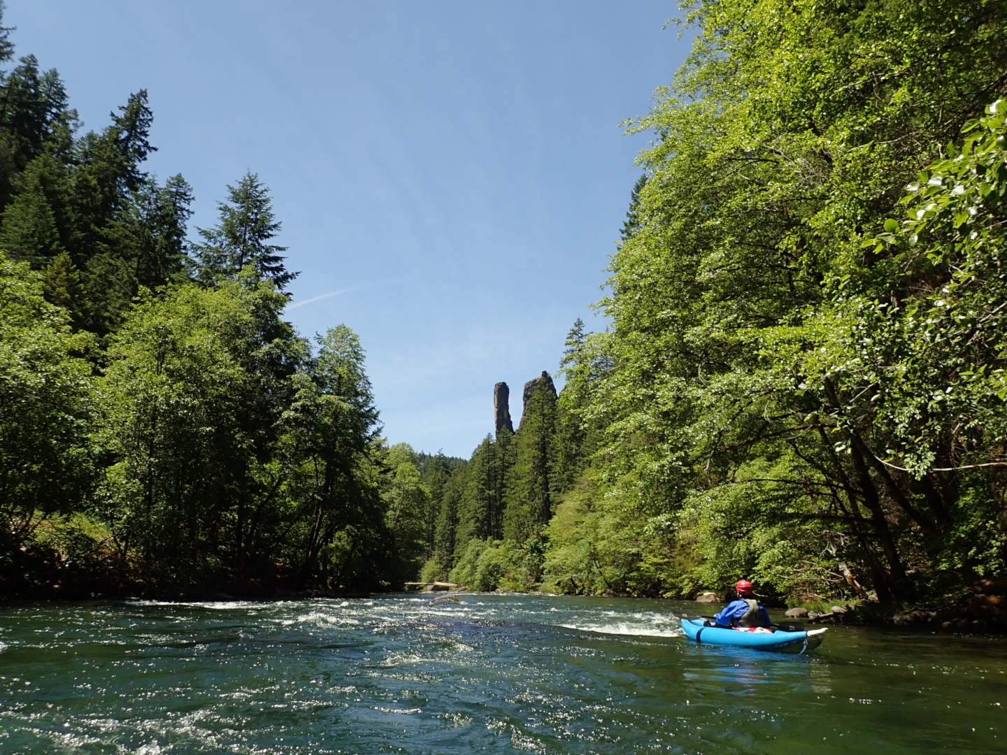
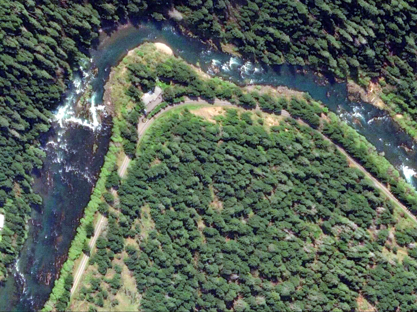
- Eagle Rock campground on the left, with a view of Eagle Rock from downstream.
- 3.5 (65.5)
- Weepers, possibly a big wave right of an island, or more likely,
a rocky rapid starting just before the highway bridge.
- 3.6 (65.4)
- Highway crosses from left bank to right bank.
Scarring from the 2017 Umpqua fire is evident on the left bank.
The road remains close to river level for almost 3 miles,
until it climbs to Umpqua's Last Resort and nearby convenience store.
-
- 4.7 (63.3)
- Lunch Counter, starting in a right bend, ending with a river-wide ledge
and a sharp right turn, with boulders everywhere.
- 5.6 (62.4)
- Dog Wave. After a fast shallow section with rocks, the river narrows
and creates a large wave and hole, usually avoidable to either side.
Even at low flows around 700, the wave and hole remain runnable.
- 5.8 (62.2)
- Cardiac Arrest, starting at an island. Most current goes left
into one of the smaller ledges, but kayaks can go right of the island.
After .1 mile you encounter a larger ledge, most easily run far right.
- 6.2 (61.8)
- Weird Weir, true to its name, also run most easily on far right.
A smaller ledge follows.
- 6.3, 0 (61.7)
- Horseshoe Bend river access, with parking area shortly downstream of
the bridge to Calf Creek.
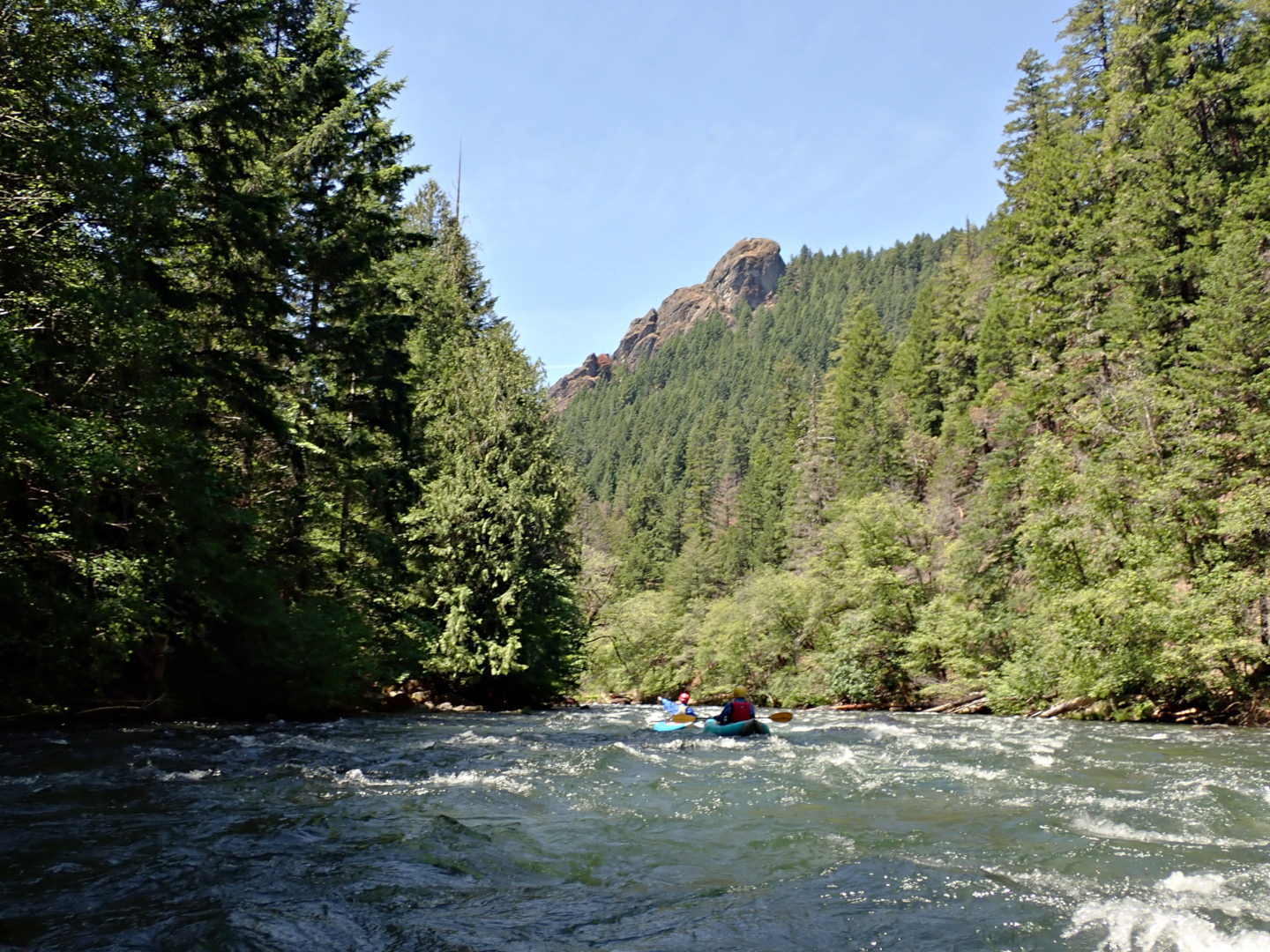
Here starts the most popular stretch for commercial rafting.
- 1 (60.7)
- First sandy beach of Horseshoe Bend campground, above a set of islands.
Other landing areas with rock then sand are downstream another .2 mile,
below the islands.
- 1.6 (60.1)
- After the river approaches the road and turns northwest,
you encounter five rapids in quick succession: Toilet Bowl
and Frogger 1, 2, 3, and 4. The river turns due west
during a short respite, and you encounter two more rapids.
- 2.5 (59.2)
- Rollout, with a large pour-over in the center at the end.
Four or five lesser rapids ensue.
- 3.1 (58.6)
- Eiffel Tower, AKA African Queen. Weirdly named rapid against the right cliff
with a large center hole near the bottom, and a big eddy below on the right.
- 3.3 (58.4)
- Left Ledge, not shown on the USFS-BLM map. A steep rapid with no obvious line.
High swim potential due to many rocks at low flows or holes at high flows.
After this rapid, the gradient eases.
- 3.9 (57.8)
- Apple Creek campground on right bank, with difficult river access.
Bridge to road up Panther Creek, which enters upstream of the bridge.
- 4.5 (57.2)
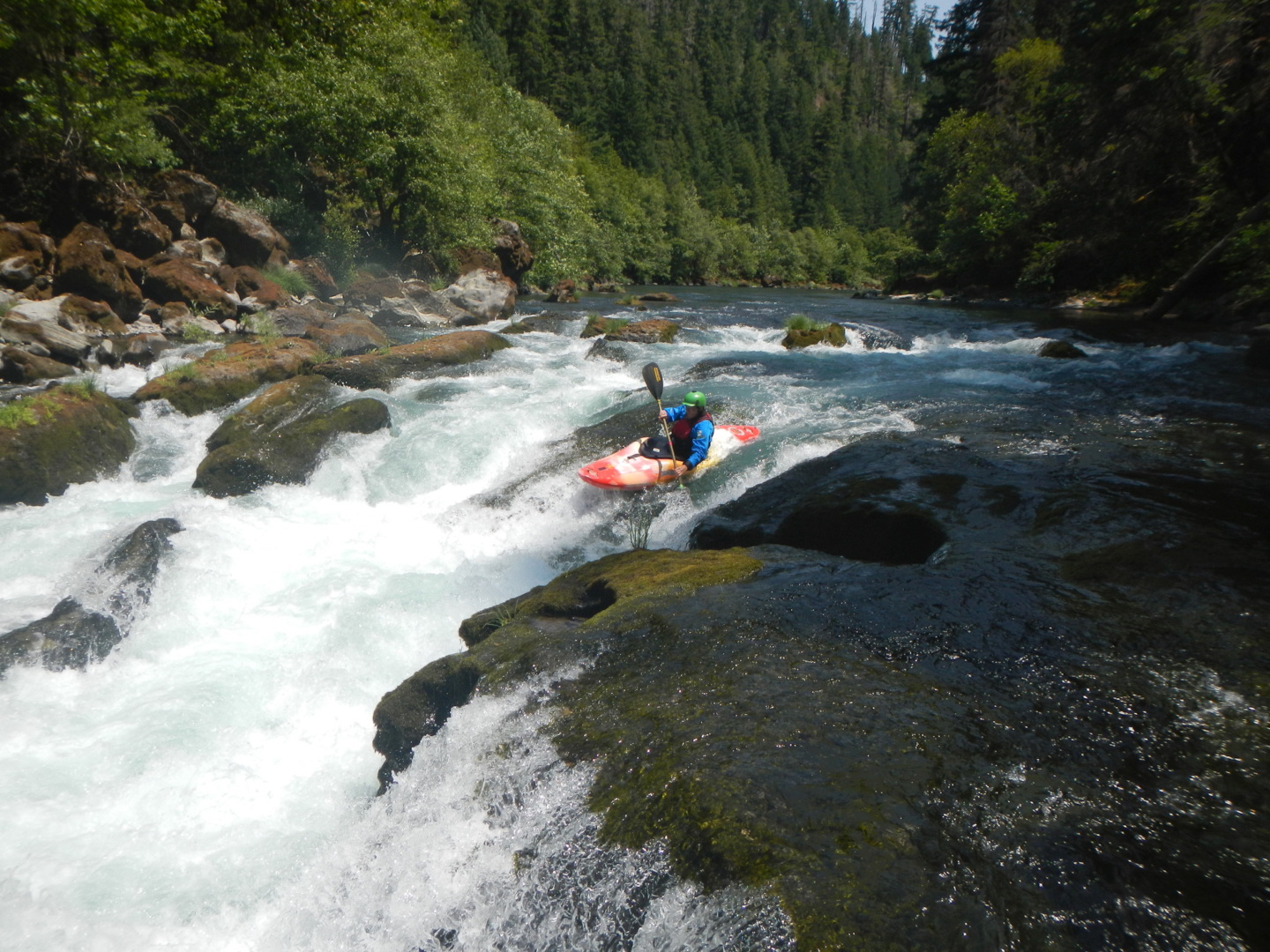
- Beginning of Pinball rapid.
On the right side, a series of waves culminates in The Alligator,
which tends to flip kayaks, and is best avoided to prevent swims.
The next obstacle is a maze of big rocks, which at typical water levels
is entered some distance to the right of a big rock on far left.
It's similar to Hell's Kitchen on the Tuolumne, with more room to maneuver.
-
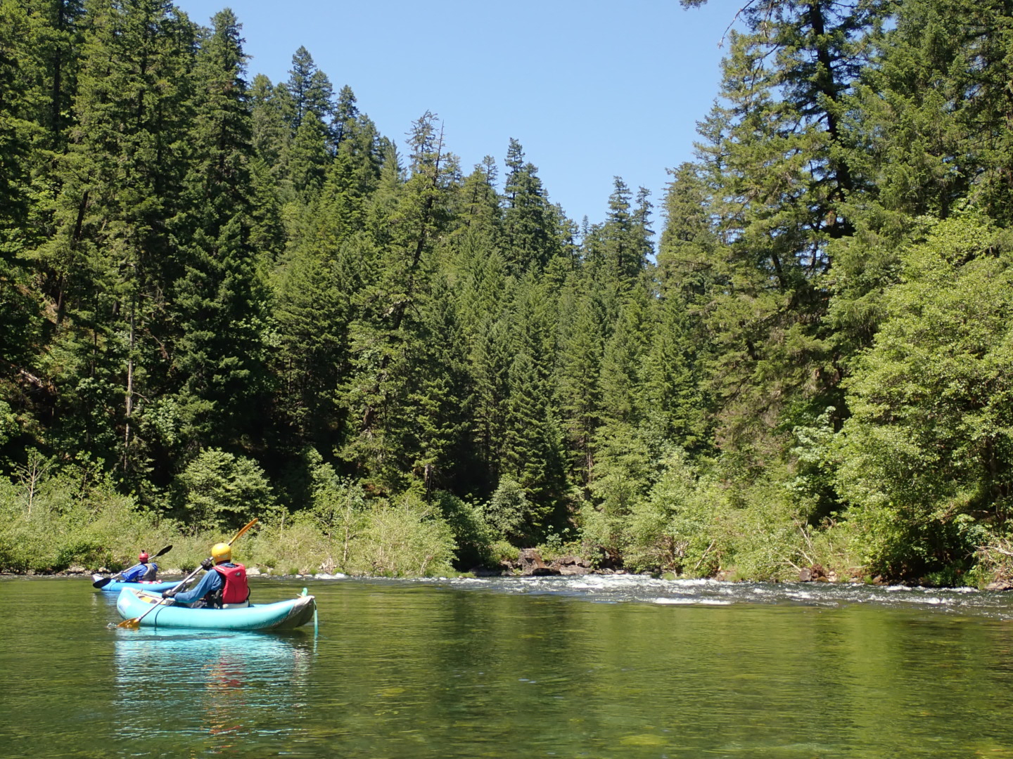
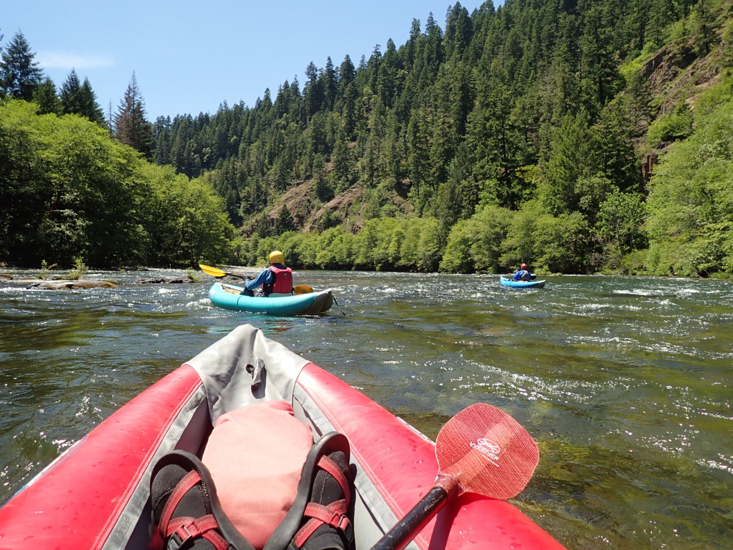
- The remainder of Pinball is easier. You could run it almost anywhere.
After a respite, discrete rapids occur for almost half a mile,
similar to the distant one shown below.
-
- 4.7 (57)
- Shortly after Pinball the USFS-BLM map lists Headknocker Moe
and Headknocker Curly. Larry was too smart to have his head knocked.
Honestly we could not tell which was which. All seem straightforward.
Five rapids come in quick succession, then one separated by pools,
then a long one, and finally a river-wide ledge.
Afterwards gradient eases as the river flows almost due north.
- 5.8 (55.9)
- A constriction rapid starts a long series of five or six rapids
culminating in Silk's Hole at the mouth of Redman Creek,
mile 6.2 (55.5).
- 6.6 (55.1)
- Another constriction rapid starts a series of rapids
with increasing space between.
- 7.7 (54)
- Island Campground, not to be confused with Island Rapid downstream,
although there is a rapid upstream of the campground beach.
The name seems to be a non-sequitur: there is no island here.
If you get a camp near a trail down to the river, you can tie up
your boats overnight and pretend you are on a permitted river.
- 7.9, 0 (53.8)
- Gravel Bin river access, an excellent place to take out or put in,
although shade is sparse mid-day and the gravel boat ramp is steep.
- .6 (53.2)
- Bridge to community of Steamboat on river left.
- .8 (53)
- Steamboat Creek confluence.
After this point the river channel is full of small islands
and fishing holes. Two shallow rapids occur, one just below
the confluence, another near the last houses of Steamboat.
- 1.1 (52.7)
- Steamboat rapid begins, slightly upstream of Steamboat Inn.
You should already be on river left, unless you have scouted
and want to run the class IV chutes on river right.
-
- Around the bend from Steamboat are two rapids with rocky islands,
then a more significant rapid at mile 1.7 (52.1) dropping into the right channel.
- 2.3 (51.5)
- A long rapid that drops quite a bit, though without drama.
Williams Creek enters on river right at mile 2.7 (51.1).
Around the corner .1 mile further is a sandy beach with parking above,
and in another .1 mile, a rapid with jutting bedrock on the left.
- 3.4 (50.4)
- Burnam rapid. Another long section of whitewater with maneuvering required
over multiple drops, some boulder infested. After Archie Creek enters
on river left, you encounter a v-wave rapid.
- 4.7 (49.1)
- Wildcat rapid. After mild entry rapids, most flow drops into a narrow channel
cut in the bedrock, which causes turbulent side eddies below.
This rapid is probably the second most difficult on this stretch, after Steamboat.
Cougar Creek enters on river left shortly below.
- 5.1, 0 (48.7)
- Bogus Creek river access. This one is not obvious from river level,
nor is the turn-out with parking well marked when you are driving downstream.
Somebody in your shuttle party should hike down and look at the take-out.
Campsite across the highway was closed after the 2020 fire.
- .1 (48.6)
- Bogus rapid, a big drop into the right channel.
- .6 (48.1)
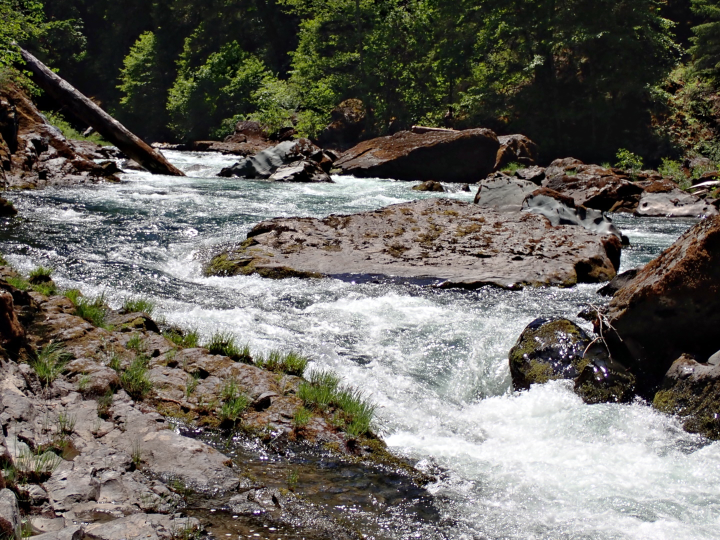
- Burial rapid, III+. So named because standing waves and holes are very deep
as the channel narrows and flow refracts off boulders on the left.
Currently (2026) it's best to start left, ferry right helped by an eddy-wave
behind a big rock, then turn sharp left about 4 feet from the right bank.
Good luck! Shortly below is the bridge to Wright Creek road,
where you can take out on river left if you miss the Bogus Creek take-out.
Another rapid lies just below the bridge.
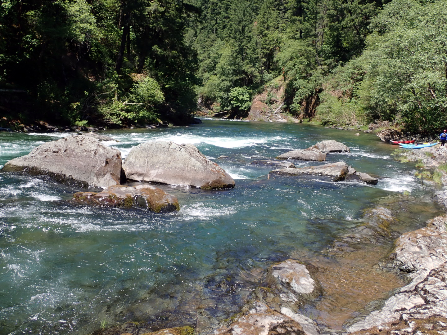
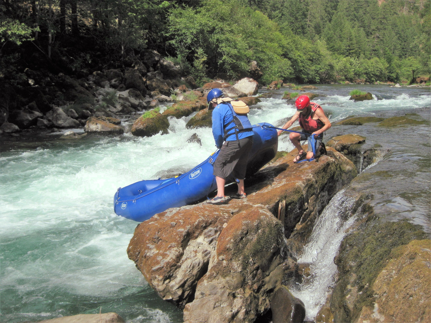
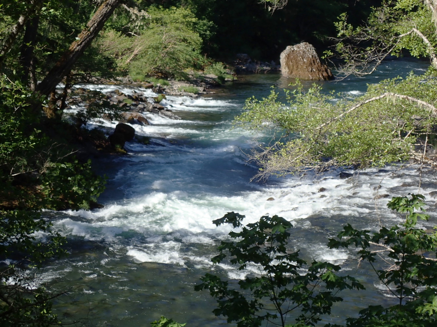
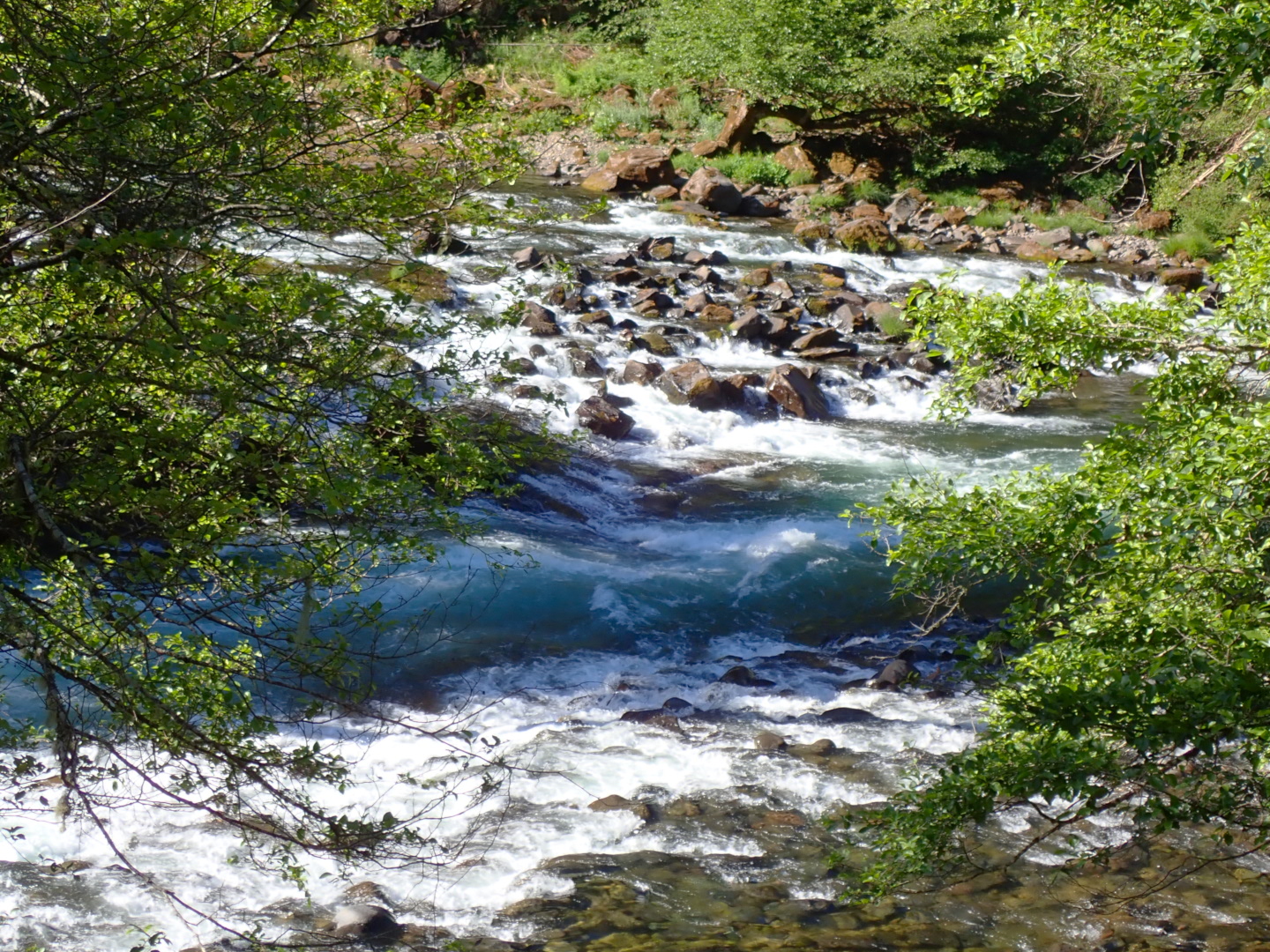
- 1.0 (47.7)
- Bathtub rapid. Possible portage on the left at low flows.
Even at moderate flows, watch out for a rock in the center at the bottom.
At higher flows, this rapid is easier to run.
First photo below by Ed Roseboom of Joshua Foster.
Second photo of Gary Rollinson and Larry Hazen.
-
- Shortly below Bathtub you encounter a minor rapid and a double ledge drop.
- 1.7 (47)
- Mailbox rapid. After a left bend, the right channel becomes stranded
and the left channel drops in the center between rocks.
Slow water and two rapids follow in quick succession.
- 2.2 (46.5)
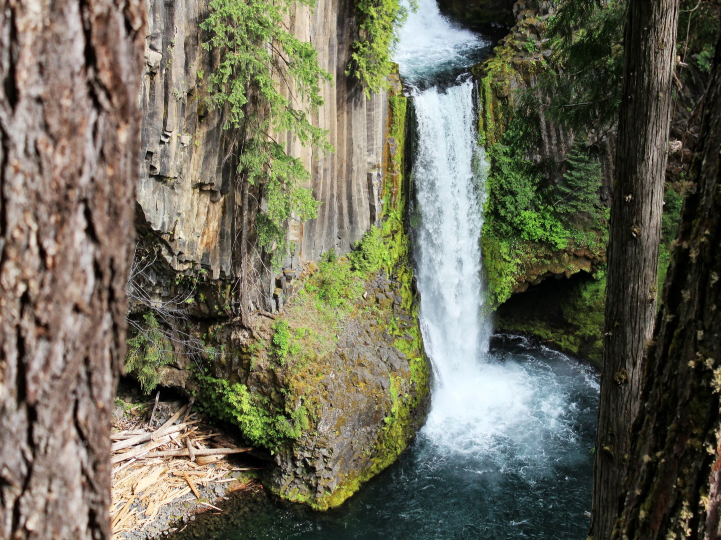
- Fall Creek enters on the right, with its side hike thru Job's Garden to the falls.
About .4 mile below is a rapid where you enter left then cut right.
- 2.8 (45.9)
- Rapid at Thunder Creek. Bedrock extends from the right bank.
A good route is available center right.
- 2.9 (45.8)
- Burnt Creek rapid. Debris fan from the creek on river right creates this one.
- 3 (45.7)
- Elevation Drop rapid, below a large rock outcropping on river left.
Steep and rocky but not as difficult as it looks.
- 3.3 (45.4)
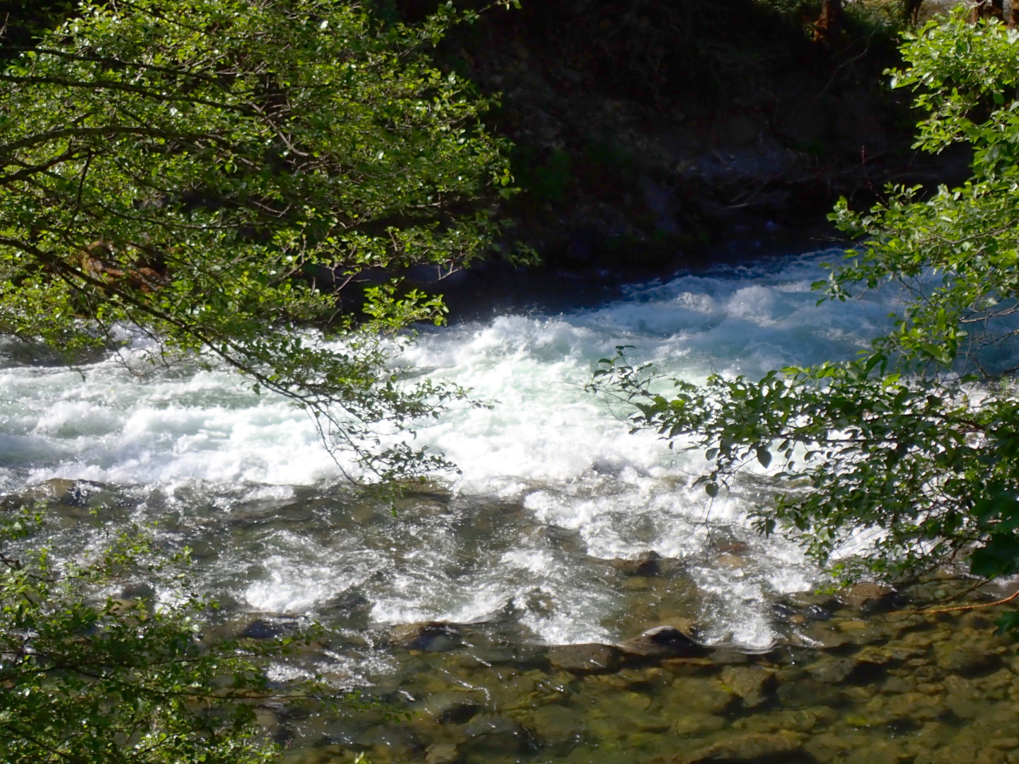
- Island Rapid begins. Stay to the right of the island! Left channel ends badly.
-
- Island Rapid has big waves at the top, and more big waves near the bottom.
The drop near the bottom is called Rooster Tail on the USFS-BLM map.
-
- 3.9 (44.8)
- Rapid at Swamp Creek. Then about a quarter mile below is another rapid.
- 4.4 (44.3)
- Ledges rapid, with multiple drops. Shortly below, Fox Creek enters
on the left. Umpqua National Forest ends and BLM management begins.
Another rapid after a quarter mile, then just moving water for a mile.
- 5.7 (43)
- Susie rapid. First a rock shelf with boulders, followed by a right turn,
than a drop among boulders, and finally a third easier passage.
Susan Creek campground is high on the right bank,
with trails down to the river.
- 6.3 (42.4)
- Good river access downstream of Susan Creek campground.
- If you continue, there is one good rapid above Tioga pedestrian bridge,
then not much until several rapids in a horseshoe bend (mile 40.5)
and Upper Baker (mile 38) followed by Baker Falls.
As the USFS-BLM map advises, take out before Deadline Falls!
Shuttle Directions
If you are arriving from I-5 near Roseburg,
take exit 124 onto highway 138 and cross the South Fork Umpqua.
Steamboat Inn is about 40 miles upstream from Roseburg.
If you are arriving from the east near Crater Lake,
take highway 230 north past Diamond Lake,
and turn west onto highway 138.
All access points are easily reached along highway 138.
There are many USFS campgrounds near the highway.
|
|
Creeks Navigation
Home
Recommended Runs
Map of Rivers
Alphabetic Index
Alphabetic Table
Text Search
Sponsored Links
|