|
Tule River above Springville |
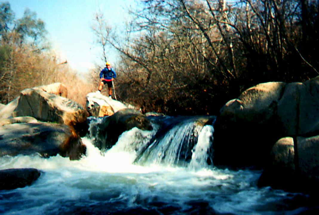
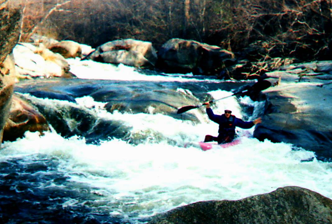
This run has always looked interesting on maps, although the small drainage and relatively low elevation are warning flags. The Tule has no major dams above Success Reservoir, and all parts of the north fork originate in national forests (the south fork originates mostly on Tule River Indian land). It was not until his 3rd edition that Lars Holbek included a run on the Tule. I have seen the put-in and most of the V+ run in the Holbek/Stanley book: V+ is probably a good estimate. Right from the confluence of the North Fork of the Middle Fork, there are plenty of 5-10' drops without clear routes, and at flows high enough to run (200 cfs or more) they would be pretty close together. Keep in mind that the flow at that put-in is about 50-65% of what you would have in Springville, the end of the second run. We divided our run into two parts. The upper section put-in is at Lumbeau picnic grounds, involves 2 miles through rather constant but brushy III, and ends at an old diversion dam, which had been dynamited or damaged on river right, allowing for a possible (but dangerous) unclean 10' class V- drop. We opted for the very easy portage on the right. Also at this point a diversion ditch adds a welcome 50-60 cfs. Just downstream, there is a an old footbridge, either an escape or river right put-in for the lower section. Though this requires a trespass, we simply parked our car at a turnout, left a note “kayaking friends of Peter” on the windshield, and had no problem. Downstream is another 2-3 miles of class II-III with one very fun IV drop where the river branches around a maybe 1-acre flat rock “island” (we always ran the left side, shown in one of the photos). The gradient is noticeably less after this point, but probably still exceeds 25 fpm. About .5 mile above Springville, the North Fork of the Tule comes in on the right. Take-out is at one of 2 or 3 bridges in Springville. We found the middle one to be best, because it is far from houses, and makes an easier escape, but requires a mile long run through the backyards of Springville. In this section there are good drops, but you need to know the “route” through the brush. As I remember, stay left, make a not very obvious cut to the right about 2/3 of the way through, and finish on the left. After the middle bridge boaters encounter class II water to another possible take-out at a golf course, and although rapids are constant and fun, we did not run this section the second day.
Two things stick with me about this run. First, it was a bit brushy, but no worse than the San Lorenzo. (Keep in mind we ran this 4-5 years ago, so it is likely that big storms of the late 1990s significantly debrushed the creek.) According to Peter, a friend of my paddling buddy, this did happen, but the boulders have been moved around somewhat, making the run more difficult and dangerous. Second, unlike the nearby Kaweah, where hostile landowner stories abound, people on the Tule were extremely friendly, almost suspiciously so. Numerous people saw us in Springville, every one waved and smiled. When a car key snafu forced us to hitch a shuttle, we instantly found 2 locals very interested in helping. I am certain that we could have even stayed the night with them if we wanted, but lodging in nearby Porterville was a mere $16 per room, the cheapest in the state, another plus for this area. The friendliness is probably due to the fact that Springville and environs are inhabited by good middle class Christian families, not misanthropic or xenophobic hermits and rednecks (as on Arroyo Mocho), and find kayakers amusing guests, not threatening foreigners. Unless things have changed, no commando put-in is needed here. I would ask for permission, but would be very surprised if I didn't get it. Finally, the last mile of the Holbek/Stanley run, the mile upstream from our put-in at Lumbeau picnic area, has half the gradient of the first 4 miles, “only” 120 fpm, which is probably not too much more than the first 2 miles of our run. It would be worth seeing if a higher up put-in is possible. My memory is that there was a road leading upstream on river left, which might lead to a good alternate put-in. It may require permission, but I have already covered that issue.
|
Creeks NavigationHomeRecommended Runs Map of Rivers Alphabetic Index Alphabetic Table Text Search
Sponsored Links
|