| |
| Stretch: |
Boca (Little Truckee) to Verdi Nevada |
| Difficulty: |
class II+ to III with two class IV rapids |
| Distance: |
6 miles or 15.8 miles (with diversion dams), 1 day |
| Flows: |
rafts (400) 600 cfs minimum, kayaks 400, IK 250
|
| Gauge: |
more fun above 800 cfs, flow measured at Farad
(FAR) |
| Gradient: |
39 fpm average, much steeper near Floriston |
| Put-in: |
Boca, near confluence of Truckee and Little Truckee, 5520' |
| Take-out: |
Farad powerhouse, or Verdi at Crystal Peak county park, 4890' |
| Shuttle: |
8 miles (10 minutes), or 16 miles (20 minutes) one-way |
| Maps: |
USFS Toiyabe NF, AAA Tahoe Region,
Topo
|
| Season: |
spring and summer, from snowmelt and dam release |
| Agency: |
private, USFS,
guided Whitewater Rafting |
| Notes: |
© 2011 by Erik and the guides at
IRIE Rafting.
|
For information about rafting and kayaking around Lake Tahoe, see the
About Lake Tahoe
page. For navigation, see the
Truckee River Recreation Map,
which shows landmarks and rapids on the Truckee river from Lake Tahoe to below Reno/Sparks.
Tahoe to Truckee Section
Starting at the outlet of Lake Tahoe near Fanny Bridge (on highway 89) to
3 miles downstream at River Ranch (.7 mile uphill of Alpine Meadows road),
the Truckee is gentle class I.
Rental rafters ply the river, consuming mass quantities of beer,
and generating stories of how they got stuck on a rock or fell out of the boat.
From River Ranch, the site of annual slalom and downriver races
until creeping Yuppification pushed out those thrifty downscale kayakers,
the river is continuous class II-III for another 2.7 miles.
At flows above 1000 cfs, be very careful of low bridges.
For intermediate boaters,
this is the most worthwhile stretch of the Truckee above I-80,
although it is short.
From near Squaw Valley road, the river tapers off to class II
for the entire 8 mile stretch to beautiful downtown Truckee.
There are many houses along the river,
so this is by no means a wilderness run,
but the alpine scenery is fine for a change of pace.
Again, at flows above 1000 cfs, be very careful of low bridges.
Local agencies have closed the river at very high flows.
This section has a convenient shuttle by Truckee municipal bus.
From Truckee for 10 miles to the Little Truckee confluence at Boca,
the river is mostly fun class II with some flat spots,
although boaters encounter a class III rocky drop
before downtown, and a class III boulder garden
just below the Truckee sewage treatment plant.
Despite an interstate highway right along the river,
the surrounding mountains are beautiful,
so this is a good run if you are in the area.
Below the Little Truckee, the Truckee river has a longer season,
gaining the release from Boca reservoir.
This means you can run it in warm weather, rather rare at this altitude.
Flow on this section of the Truckee, including outflow from Boca reservoir
on the Little Truckee, is available on the
USGS site.
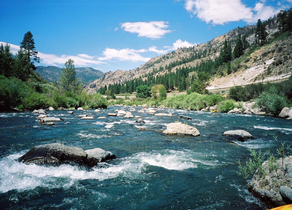
The rapids are class II for 5.5 miles,
then class IV for almost a mile, then mostly class II again,
except for three dramatic drops over diversion dams.
There used to be a diversion dam below class IV Bronco rapid,
and older guidebooks recommended taking out above this dam,
and putting in at Farad powerhouse for a different run.
However Floriston Dam washed out during the New Year's 1997 flood,
so you can continue by running from Floriston to Farad powerhouse or below.
Between Floriston and Farad is perhaps the most consistent and fun section
on the Truckee, however half-day commercial rafters take out at Floriston.
Whitewater Touring Section
Mileage is from the confluence of the Lower Truckee and Little Truckee
(mileage in parentheses is from Lake Tahoe outflow, to match the Truckee River Recreation Map).
- mile -0.1
- Boca Dam river access (dirt side road) above the Little Truckee River,
just upstream of its confluence with the lower Truckee.
Commercial put-ins are at approximately 10:00 AM and 2:00 PM daily during the summer.
-
- 0 (24.0)
- Confluence of the lower Truckee and Little Truckee.
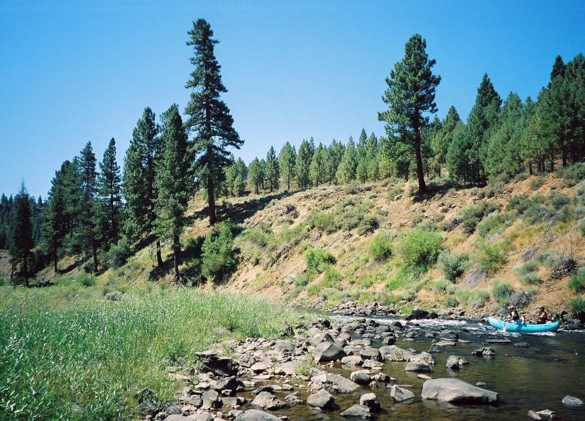
Class II boulder gardens start just below the confluence and continue down to
the I-80 bridges, where the river soon flattens out into a scenic swimming area.
- .6 (24.6)
- Old Boca Bridge river access on river left at the old bridge.
- 1.37 (25.37)
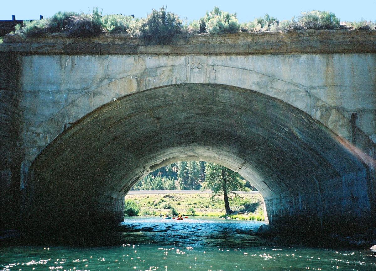
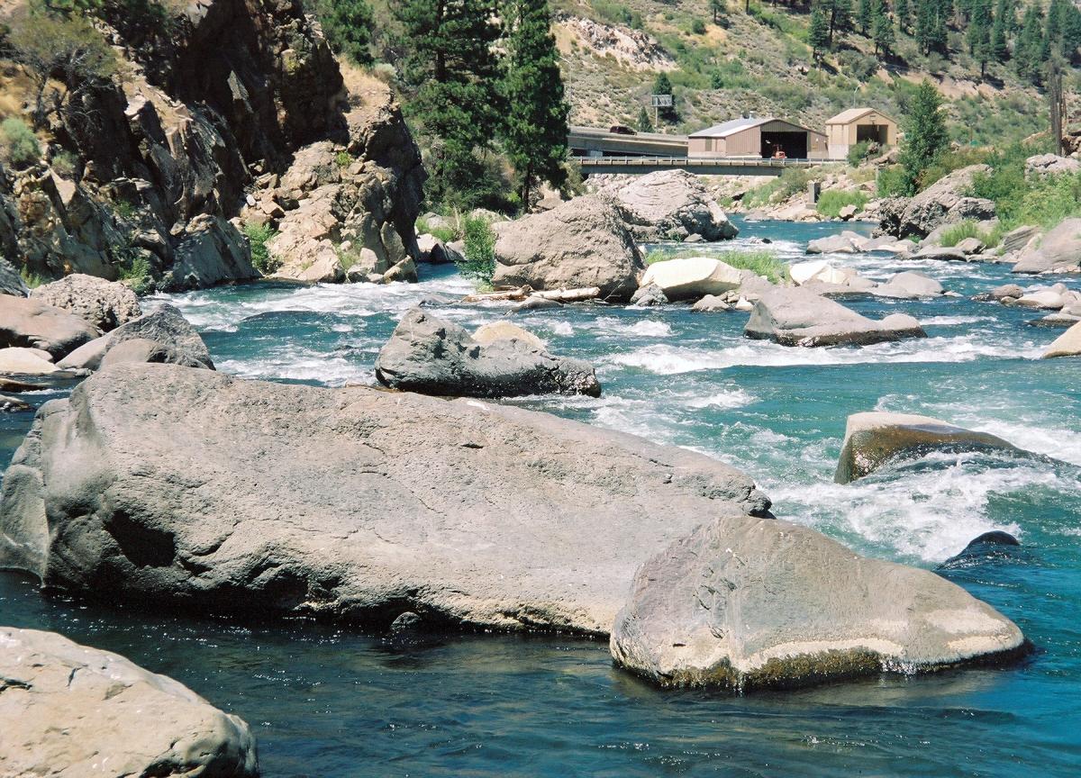
- I-80 bridges and overpasses.
- 2.4 (26.4)
- Wake Up Rapid (AKA Menace Rapid), class II+
A fun rapid with a wave at the bottom (Wake Up) at optimum flows.
A right to left move through the big entrance boulders lines you up
for a smooth run down the main current in the middle, but beware of
a rock in the middle of the channel about a third of the way down;
at flows below 1000 cfs you should go left of it.
- Kiss of Death rock on the right is good for cliff jumping,
but is on private property. After that, class II down to Hirschdale.
- 2.87 (26.87)
- Hirschdale bridge to the town of Hirschdale.
Private property on both sides, and the locals are not that fond of boaters.
Please refrain from putting in or taking out here.
- 3.17 (27.17)
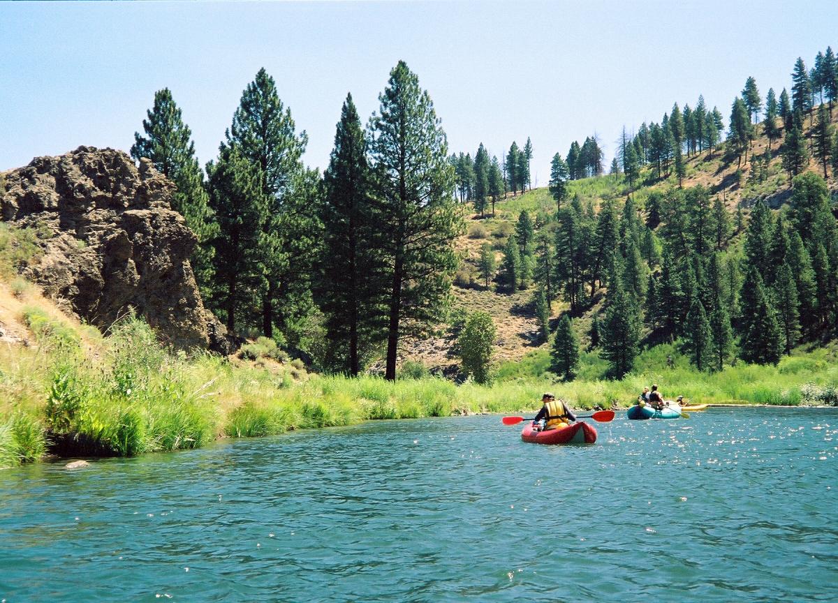
- Juniper Creek enters on the right.
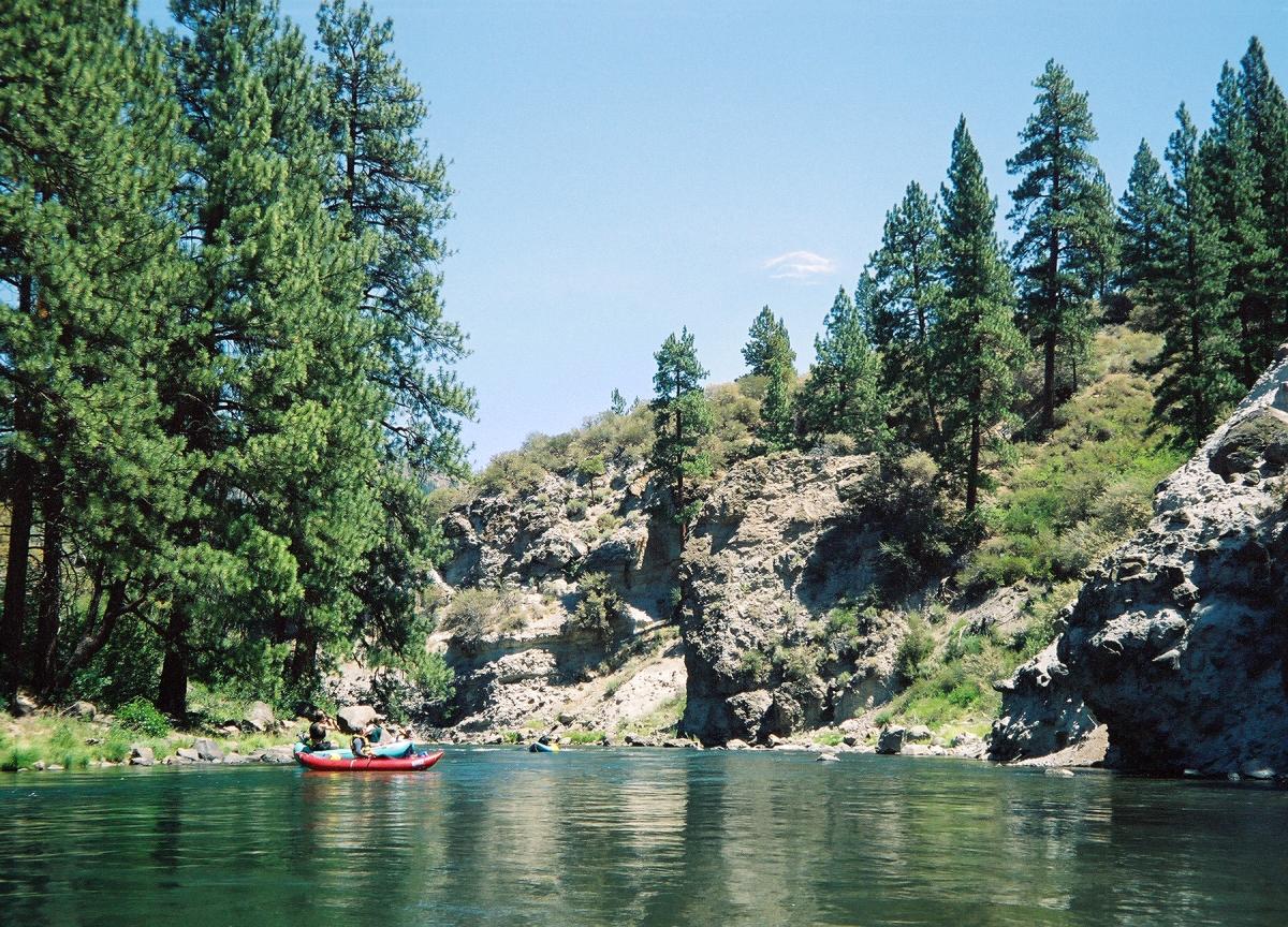
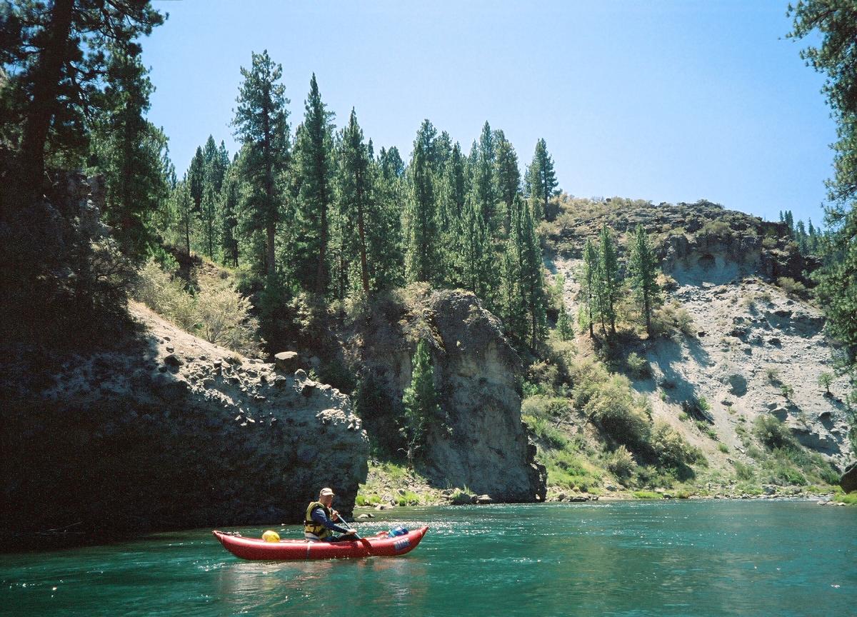
A cave visible on the right bank marks the beginning of a scenic volcanic canyon,
formed by 4 - 5 million year old pyroclastic flows and lava flows from Mt. Pluto.
Erosion has created interesting craggy cliffs.
-
- 3.3 (27.3)
- Airplane Turn Rapid, class II+
At the top of this rapid, an airplane wing sticks out of the water
on the far right side. The wing apparently was washed down from the old junkyard
across the railroad tracks, hence the former name of this rapid, Junkyard Rapid.
At all flows the line is down the right bank, avoiding the small sleepers up top,
then moving center at the bottom to avoid the larger sleepers on the bottom right.
Below 600 cfs the entrance begins to get bony.
- After that, class II continues for approximately one half mile.
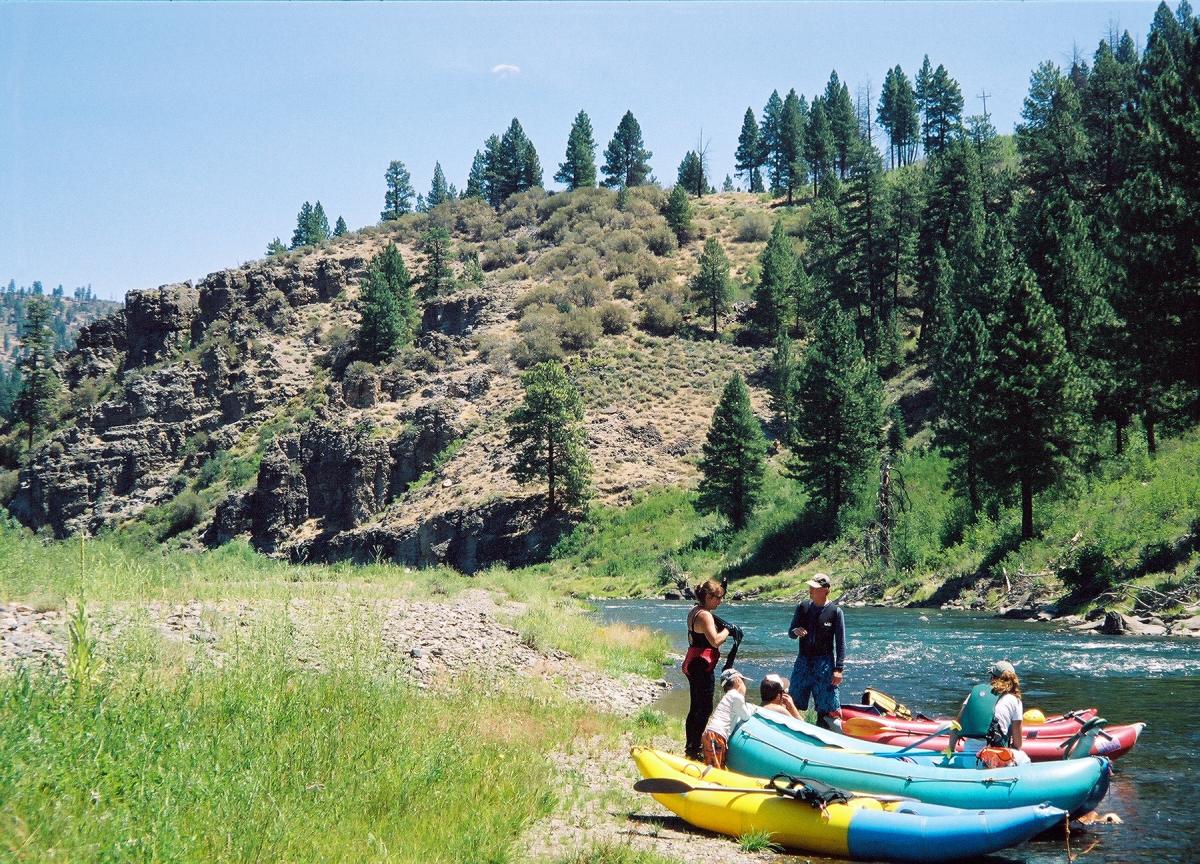
- 4.0
- Campground on river right.
At most flows you can go right or left of the island below the campground.
- 5.21 (29.21)
- Casey Canyon Creek enters on the right. Slow section.
- 5.77 (29.77)
- Grey Creek enters on right, just above railroad bridges.
- 5.8
- Railroad Rapid (AKA Rock Garden) class II-III
A long rocky rapid. At low flows the top is best run on the right,
avoiding the sleeper in the middle of the current at the bottom.
Just below is a picket fence, which is also best run on the right bank
or between the two largest rocks. A large tree in the middle of the river
that you must go left of at low flows marks the beginning of lower Rock Garden,
more technical than upper Rock Garden. You must enter left and move center
to avoid numerous small rocks. Once in the center, maneuver to avoid obstacles.
At high flows many more lines emerge in both upper and lower sections,
and you can run either side of the log.
- A couple of small class II rapids follow, as the suspense builds.
- Just upstream of the Bronco Creek inflow, in the middle of the river,
is a single piece of rebar that can puncture boats below 1000 cfs.
A railroad tie on the right bank marks the location.
- 6.92 (30.92)
- Bronco Creek enters on right, as the river jogs left.
- 7.0 (31)
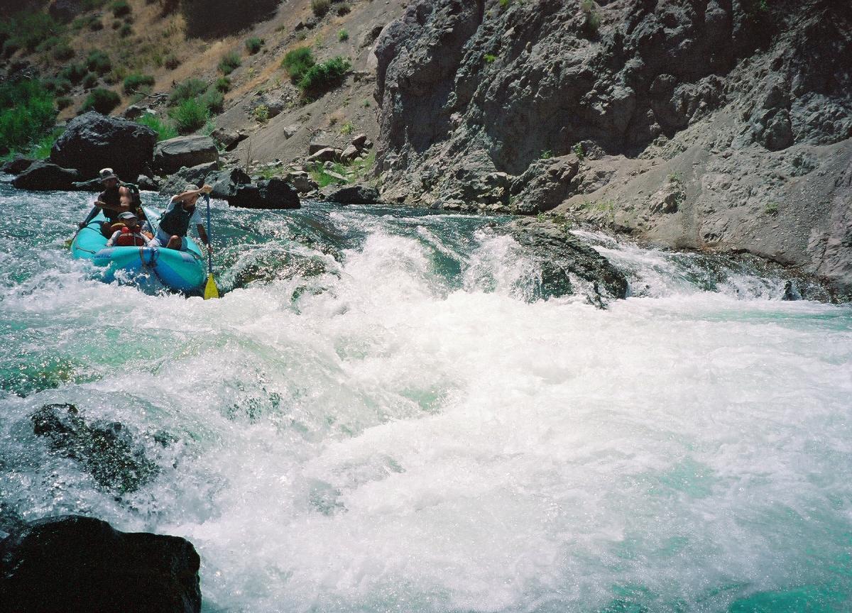
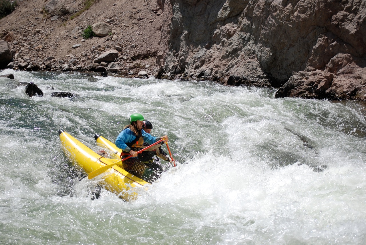
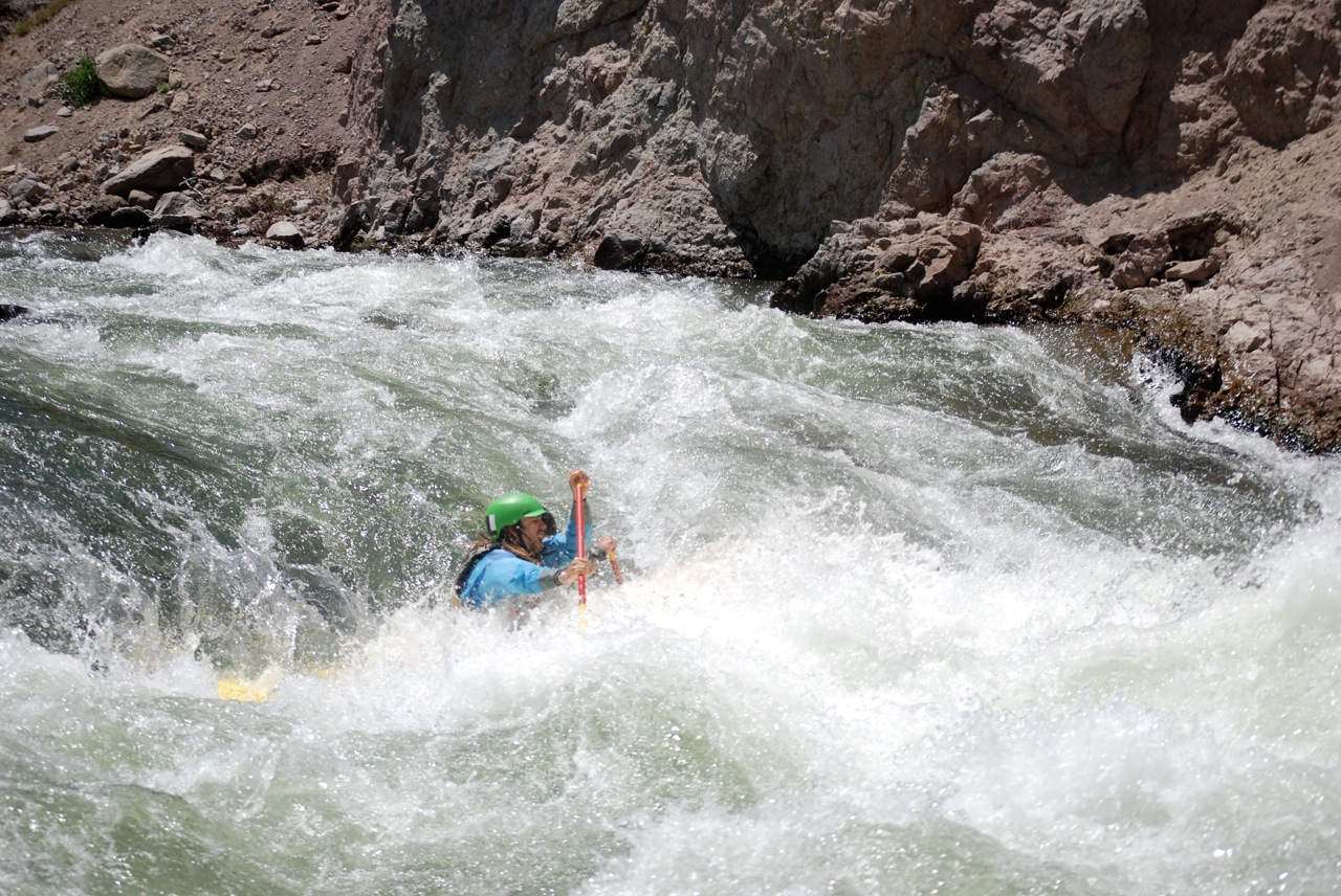
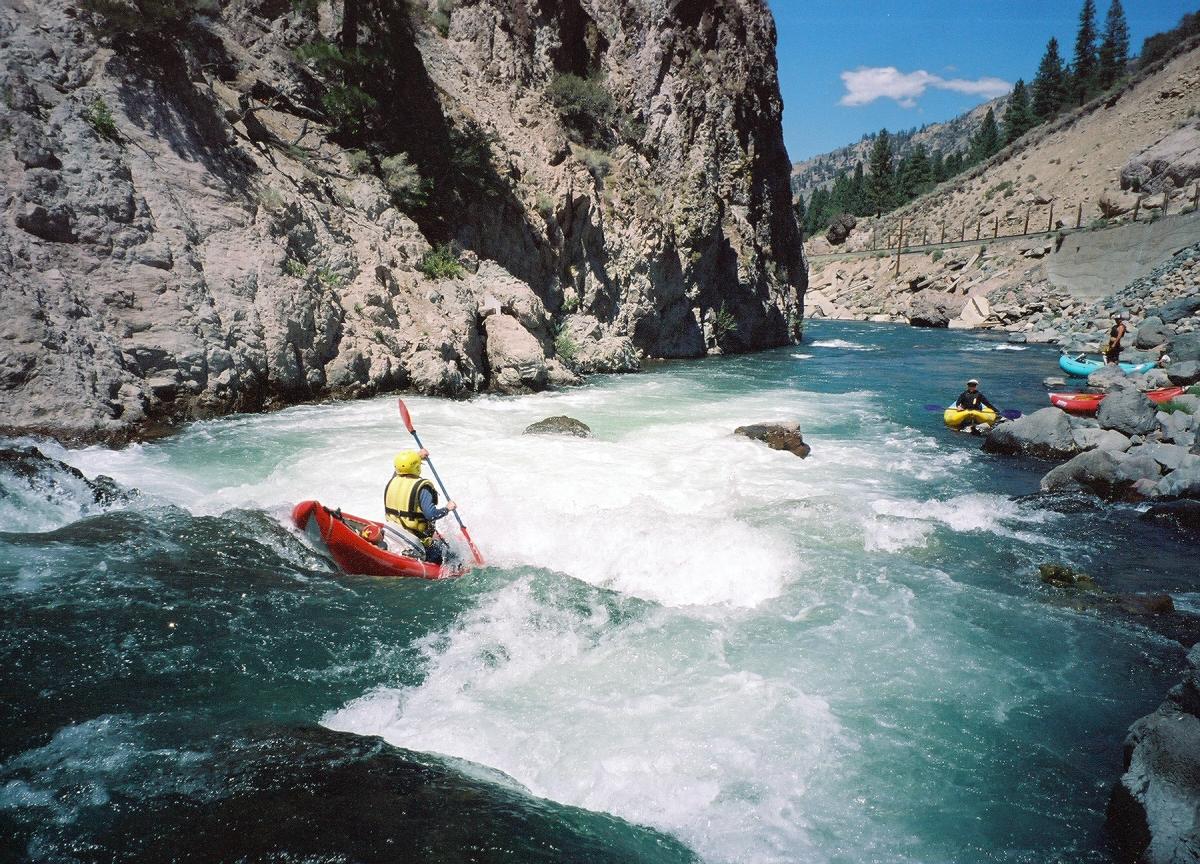
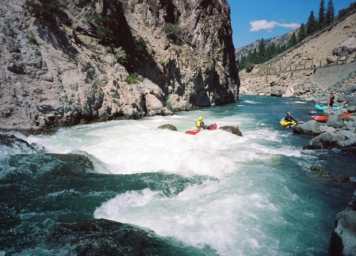
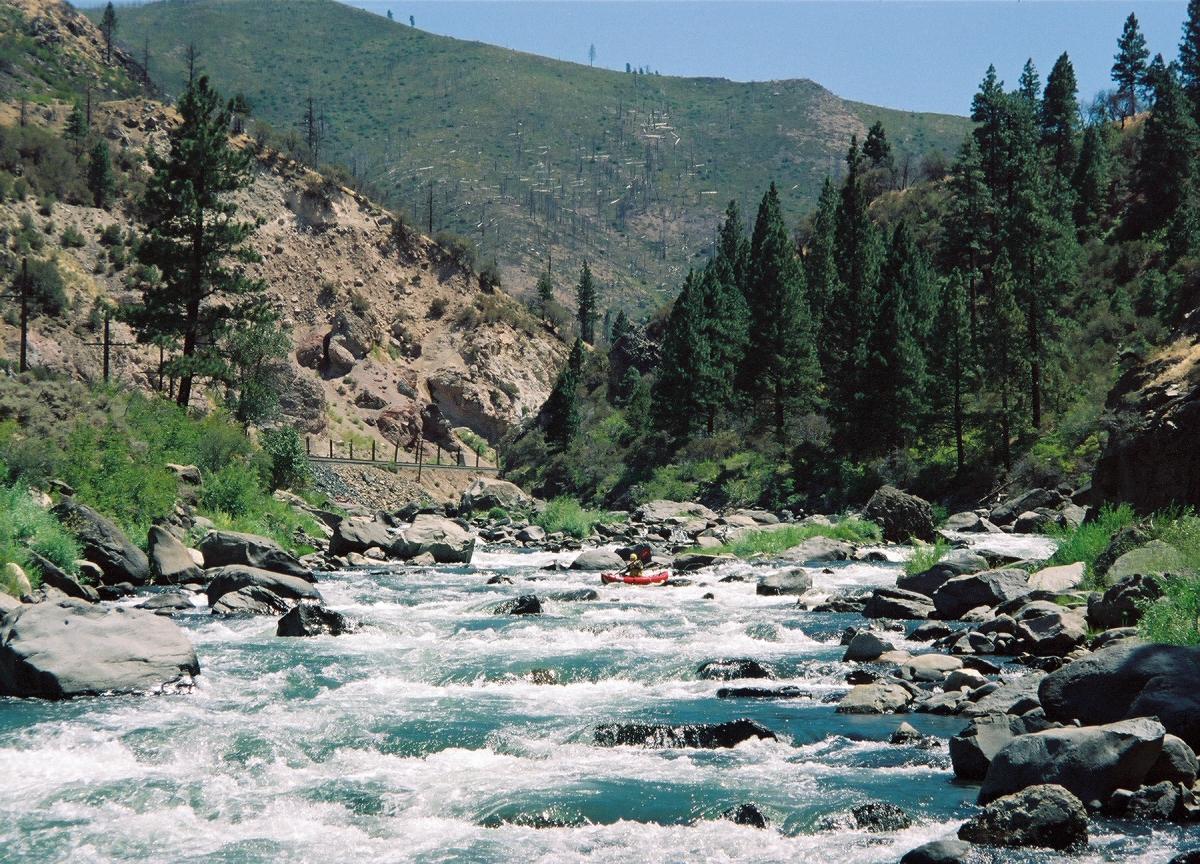
- Floriston Gorge begins, continuing for .8 mile, class IV
The entrance to Floriston Gorge is marked by two large house-rocks
on either side of the river. You can scout the gorge on river right
from the pool up top – walk down the railroad tracks.
- Kabob Rapid, class II+ to III
Most of the current moves to the right bank and into so-called Kabob Rock.
At most flows you can go right or left of the rock. The right is a narrow slot
against the right bank. Over about 1000 cfs you can go over it. Afterwards,
two small class II drops lead into Jaws.
-
- 7.4
- Jaws, class III to IV, scout right
A rock, pushed down off the tracks by the railroad company,
guards the right side of the drop and makes the entrance move more difficult.
At lower flows moving left to right off the two rocks that make up the main drop
sets you up to run between the two “teeth” below.
The middle of the main drop (the actual “Jaws”) will
dump a raft most of the time. At high flows the drop creates a hole
that can be run or skirted to the right or left.
-
-
- Hazard: Rebar and concrete slabs on the right bank just above Bronco Rapid.
- 7.5
- Bronco Rapid, class III-IV, possibly pre-scout during shuttle
Just around the corner the river drops into a long congested boulder garden.
The entrance is made up of several large boulders on the left side of the river,
called Pinball Machine, below which the current pushes right toward the middle island.
Working left of the island brings you to Bronco Ledge, a channel-wide ledge hole
best run far left below 700cfs. A short pool leads into the bony entrance to lower
Bronco, a rapid with two large pyramid rocks just right of center and a flip rock
in the middle of the narrower exit of the rapid. There are many possible lines.
- At flows above 1200 cfs or so you can go to the right of the island.
The entrance to this channel is at the top of the rapid just below the large tan
house-rock on river right. The right channel is narrow with small drops leading
into a flip rock on the right bank. Moving left at the bottom of the right channel
sets you up to run lower Bronco on the right or in the middle.
- At flows above 2500 cfs the three rapids (Jaws, upper Bronco, lower Bronco)
blend together and all three develop many holes and waves that can flip rafts.
-
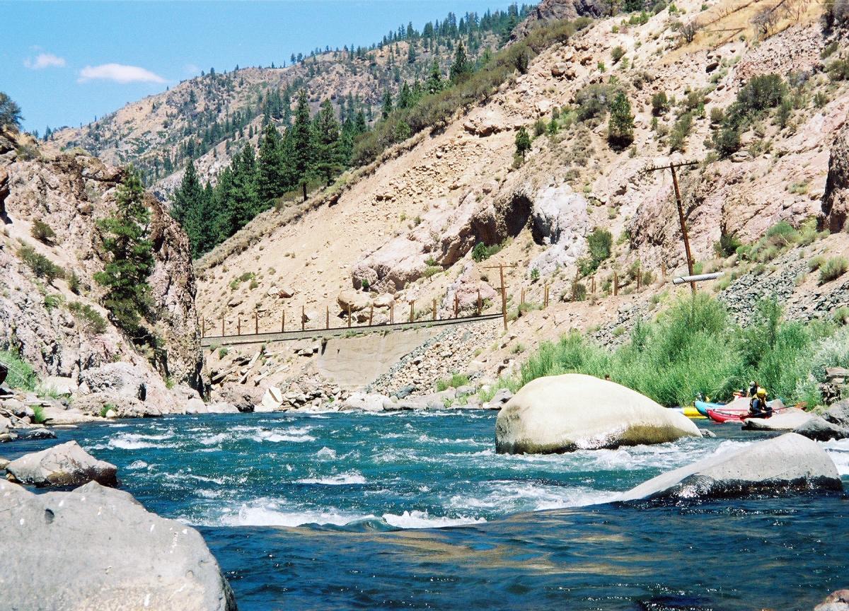
- 7.79 (31.79)
- Floriston river access and I-80 Bridge
The access points are on river right underneath the Frontage Road bridge,
or on river left below that bridge and above the I-80 bridge.
This is the commercial take-out for half day Truckee trips.
Floriston is an old railroad stop, elevation 5300'.
- 7.8
- Under the Bridge, Class II
A fun rapid that is best run left or center.
-
- 7.82 (31.82)
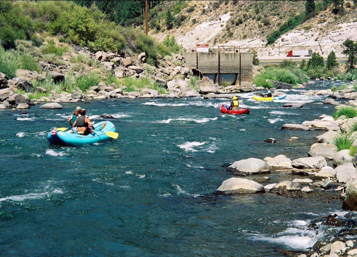
- Blow Out Rapid, Class II+
The old diversion dam here was washed out in 1997 leaving a rapid
with many holes and waves. Enter on the left bank and stay left
or move center just above the old dam structure on river left.
Near the bottom on river right is a nice surf hole made by a concrete slab.
- Rocky class II continues down below the next I-80 bridge.
The section between Floriston and Farad has a gradient of 77 fpm.
- 8.52 (32.52)
- I-80 crosses again, this time from river right to river left.
Many class II rapids for the entire distance to Farad.
- A couple hundred meters upstream of Farad Powerhouse, on the right side of
the river, is a large piece of jagged metal that looks like wood from above.
It is easily avoidable to the left
- 9.77 (33.77)
- Farad powerhouse on river left, elevation 5170', the traditional put-in
for the run down to Verdi, now a good take-out for small groups.
- 10.38 (34.38)
- USGS gauging station on river left.
- 12.17 (36.17)
- Railroad bridge in a scenic canyon.
- 12.9 (36.9)
- Survey Area: a sign warns of “scientific monitoring equipment
in the river” but it can be hard to see. As you come around the island
look out for metal T-stakes marked by white PVC. Just below the island
there are two unmarked T-stakes, one just right of center and the other
about 4 meters to the left. Both are just out of the water at 1300 cfs.
- 13.19 (37.19)
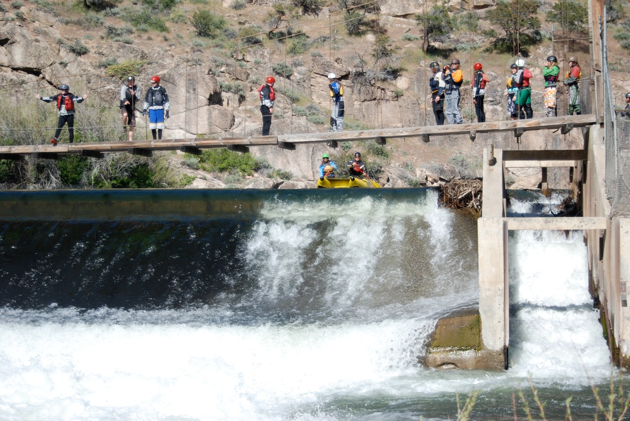
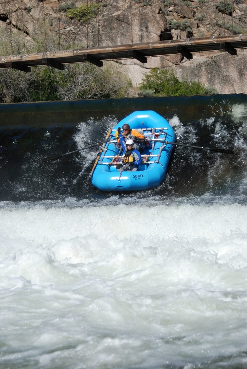
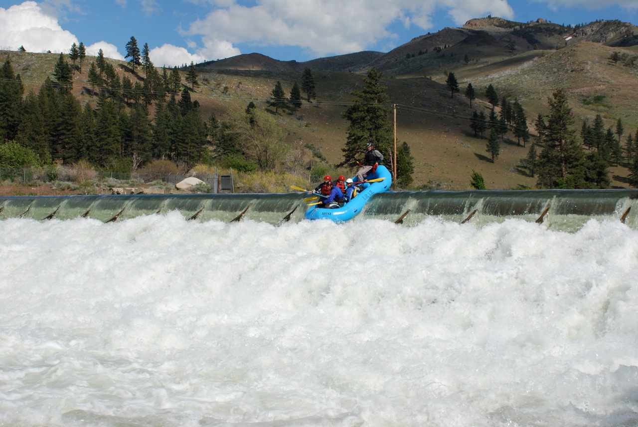
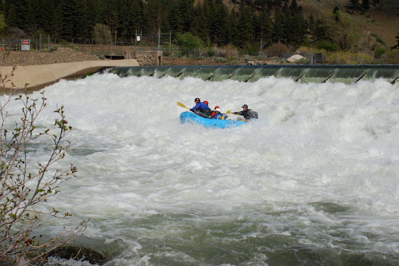
- Fleish Diversion Dam (AKA Head Hunter), scout and possibly portage left
A tall cliff on right and signage in the bushes on the left mark the first dam.
It is runnable on the far right or the far left, as long as you have
enough headroom to get under the suspension bridge above the drop.
The far left of the dam can collect debris at the top,
and there is a metal T-stake in the eddy at the bottom on the left.
The hydraulic at the bottom does look bad at some flows,
but the angle of the dam at the bottom lets you skip over it.
-
- Below Head Hunter the river picks up quite a bit and the continuous
class II to II+ in between the listed rapids down to the final dam
creates one of the best sections of whitewater on the river,
rivaling the Floriston Gorge.
- 13.50 (37.50)
- Dead Mans Curve (AKA Exit Stage Left) class III-IV, difficult scout either side
The river splits around an island. The left channel
flows into a rock jumble that is not runnable at any flow we have seen.
The right channel starts with a tight boulder garden best run far right,
then hits the cliff and makes a hard left turn creating a large pillow
that will flip rafts if they fail to make the move left.
-
- 13.60 (37.60)
- Son of Dead Mans Curve, class II-III
A scenic .1 mile pool with the water flume up on the right cliff
leads into a rapid that can be run right center or left.
All routes lead to a fun river-wide ledge hole.
- 14.15 (38.15)
- California-Nevada state line.
- 14.26 (38.26)
- Steamboat Canal diversion dam (AKA Edge of World) scout and possibly portage right
Signage on the left bank marks this hazard.
The partially washed-out diversion dam can be run left of center over the main drop,
avoiding the fan rock on the right in the drop and the wrap rock on the left below.
After the drop the current takes you over the whitewater bulge on the left bottom,
if you don't work right. These holes do get sticky above 2500 cfs.
There is also a harder line on the right down a bumpy, difficult boulder chute.
Either way there is rebar in this dam from when it was washed out,
and a swim anywhere would not be good.
- 14.50 (38.50)
- Staircase rapid, class III to III+
Similar to Dead Man's Curve: enter far right through the boulder garden,
then as the current hits the bank and turns hard left into a wave train
with a pillowing flip rock on the right bank, make the move left of it.
- Boulder Slalom #1,
a class II boulder garden between Staircase and Fleish Powerhouse.
At good flows a large standing wave develops at the bottom.
- 15.57 (39.57)
- Fleish Powerhouse on river right, returns flow from Fleish Diversion Dam.
Railroad bridge just below.
- 15.60 (39.57)
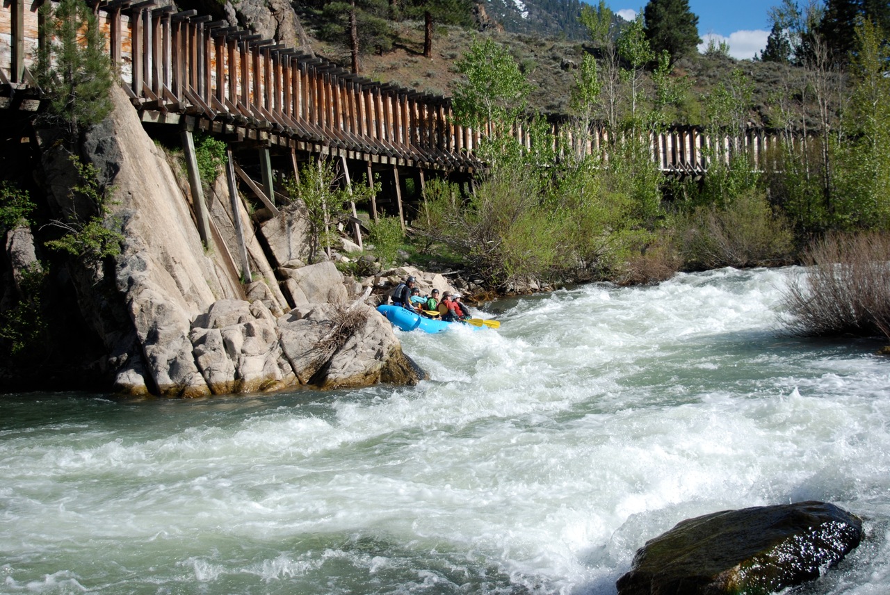
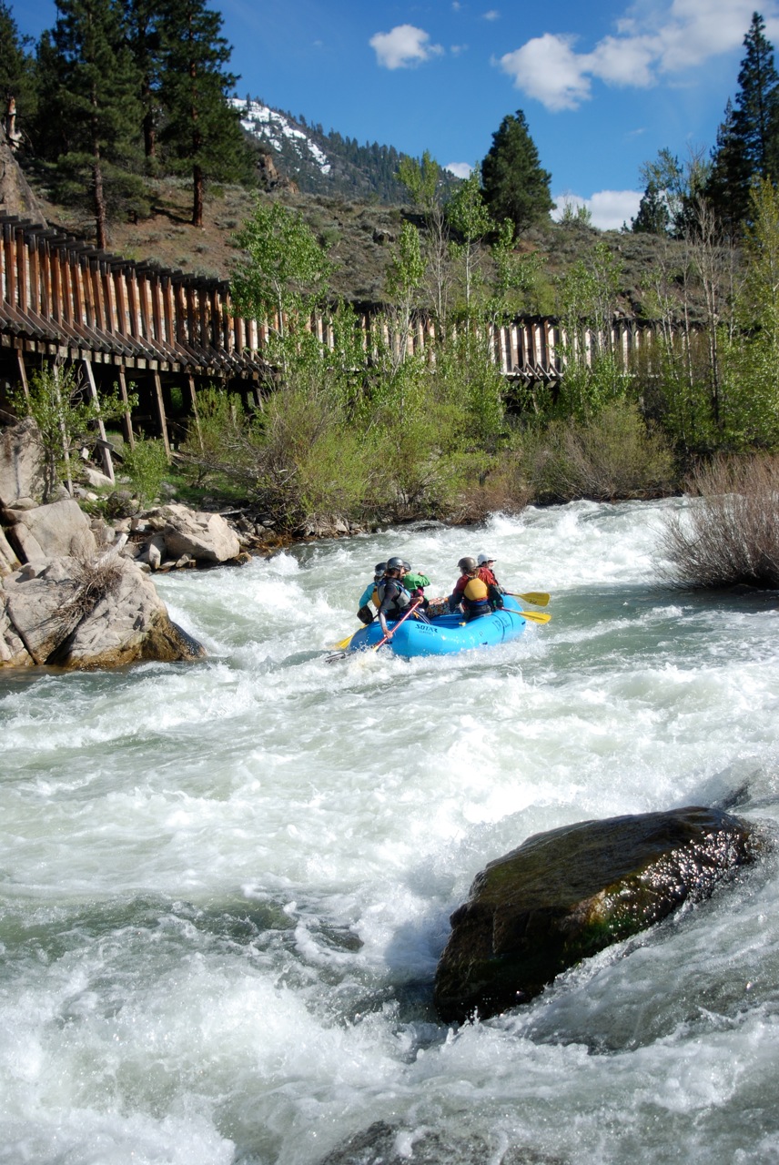
- Manassas Gap (AKA Fleish Falls) class II-III
The river flows around two bridge supports, creating three channels at high flows.
Moving left to right down the middle is the cleanest line through some holes and
down to a right-hand turn with two rocks that create the exit move at the bottom.
- Boulder Slalom #2,
a fun technical class II-III boulder garden that continues for about a quarter mile.
- 16.39 (40.39)
- Verdi Diversion Dam (AKA Eight Seconds) scout and possibly portage left
A large pool and signage on river left mark this dam.
It is a three-tiered diversion dam with wooden beams in the top tier.
Provided your boat is long enough to span the first tier,
it should be able to slide over the beam just fine.
Hold on for the ride, it's not as long as a bull ride but bucks just as hard
and swimming here is strongly discouraged.
-
- Mellow class II down through Verdi and under the I-80 bridge.
- 17.97 (41.97)
- Crystal Peak Park river access, on river right just upstream of the US 40 overpass.
This is the commercial take-out for Truckee full day runs.
Restrooms and picnic facilities, but no camping is allowed.
Downtown Reno's Whitewater Park
In 2003 the first segment of a whitewater park was completed in downtown Reno!
Other segments followed. Wingfield Park is an island in the middle of the river.
Human beavers diverted all the water into the south channel
while building a series of four artifical drops in the north channel.
Then water was diverted into the north channel
while human beavers added seven features to the south channel.
At low flows, one or the other channel can be closed off.
To get there from I-80, take the Virginia Street exit south,
and drive thru the downtown area.
After about a quarter mile a bridge crosses the Truckee river.
The whitewater park is to your right.
Find a place to park and carry boats to the river.
To find nearby food and lodging, type Truckee or Reno into the box and click Search.
|
|
Creeks Navigation
Home
Recommended Runs
Map of Rivers
Alphabetic Index
Alphabetic Table
Text Search
Sponsored Links
|