|
San Lorenzo River near Santa Cruz |
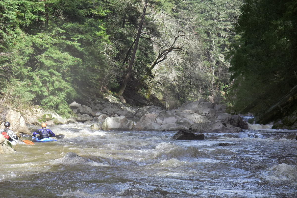
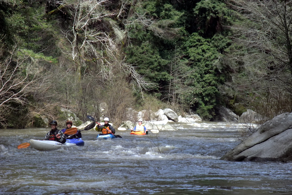
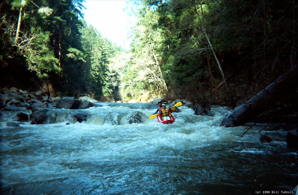
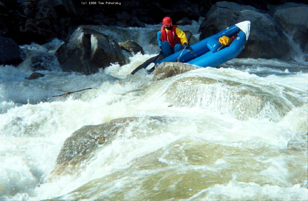
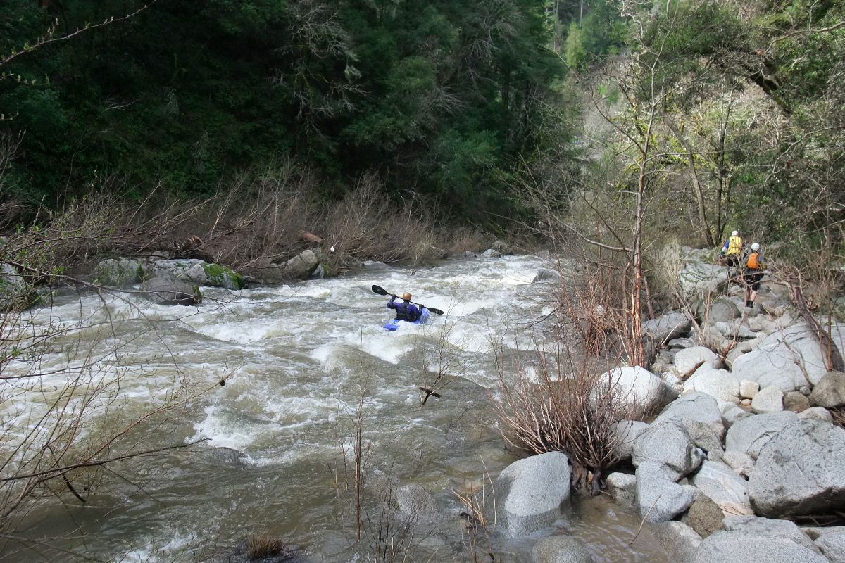
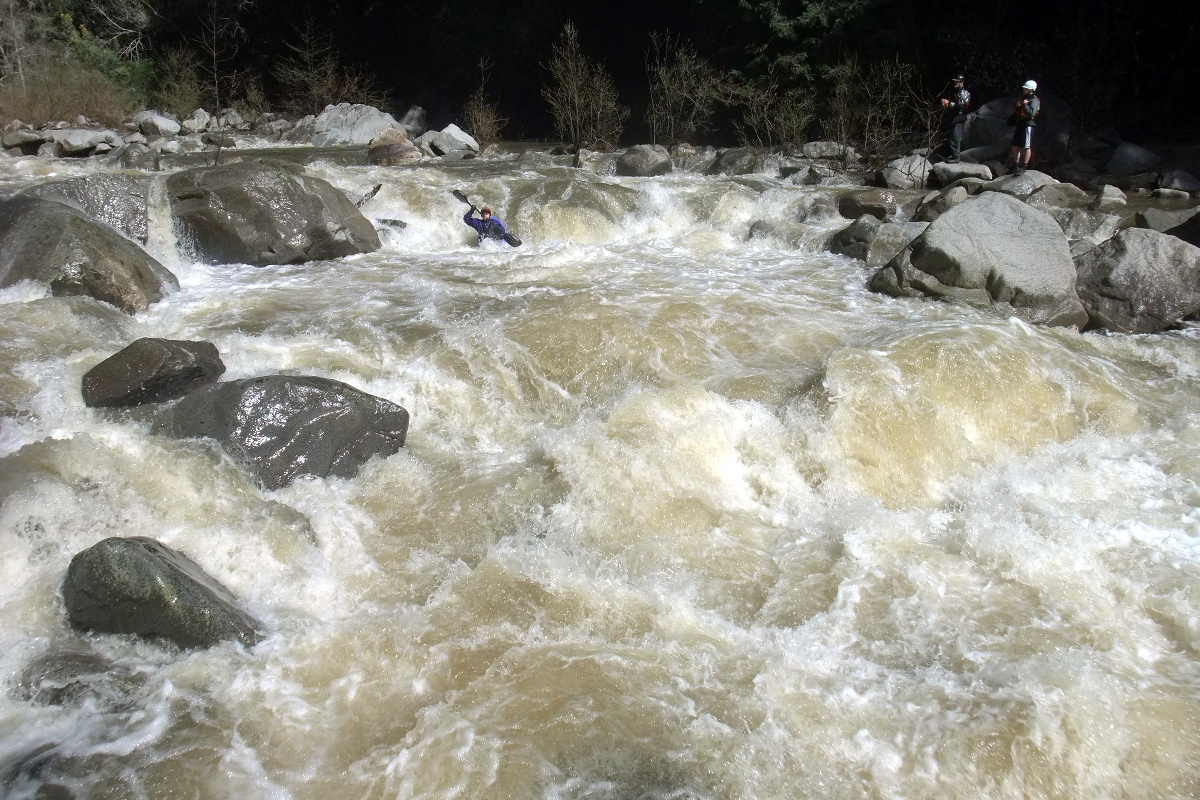
Pleasant scenery and a few kilometers of technical rapids, combined with proximity to Silicon Valley, make this a popular wintertime run for local boaters. The water quality leaves a lot to be desired, though. Not only is the water muddy from driveway runoff, but septic tank overflow causes high microorganism content after floods. Capital spending by the private sector could mitigate both problems. As Uncle Dan Dunlap was fond of saying, “there's a lot of wildlife, it's just that you can't see most of it.” A count of fecal coliform bacteria is available on this website. Optimum flow for inflatable kayaks is between 250 and 450 cfs, although 150 cfs is boatable if you don't mind a few ultra-shallow rapids (in particular, Grovel Bar and Grovel Island below The Waterfall). Hardshell kayaks or small rafts need 300 or 500 cfs and up. Holbek/Stanley list the kayak minimum as 500 cfs, but that is definitely more than absolutely required. Some kayakers say 500-600 is the optimum, not minimum, flow. Downstream of this recommended run, the San Lorenzo is runnable, but brushy and not very exciting, all the way to the ocean. Rumors indicate that boating near downtown is illegal, however. Upstream of this recommended run, the San Lorenzo and several of its tributaries are runnable after sufficient rain. Just above this run, rapids are mostly brushy class I-II with occasional cement dams. Further upstream is a fun run (immediately after rain) with some class III drops over cement dams. Description and pictures here. In the ultra wet winter of 2006, several new logjams developed, one of which (in the Waterfall) was quickly removed. Logjams are common on this stretch due to big trees near the river. Willows also thrive in the wet riverbed, creating brushy conditions after a string of drought years. Below the put-in bridge, the river winds past residences on the right and the open space of Henry Cowell park on the left. A hiking trail from park headquarters follows the San Lorenzo on the left bank until a railroad bridge, where in summertime (only) the trail crosses the river on a temporary bridge. Another hiking trail descends steeply from highway 9 to a gauging station just above the class III gorge. This is an alternate put-in if you prefer boat-carrying to flatwater paddling. Just below the flow gauge (alternate put-in) is a minor left-right drop. This is followed almost immediately by three boulder gardens, which merge together at high flows. The second is the steepest.
After a pool, or slow moving water at higher flows, comes a steep class III drop at a gradual right curve around a boulder bar where hikers congregate in warm weather. Just below is a big eddy on the left and a surfable drop on the right, with good recovery pool even at high flows.
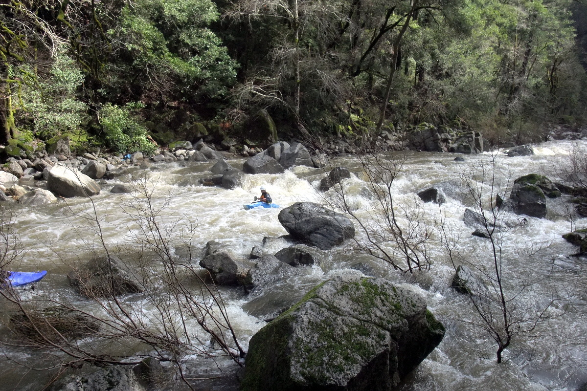
After the recovery pool comes a steep drop with cliff on the left and debris-accumulating eddy on the bottom right. Especially at low flows the far left offers the easiest line. After a relatively calm section comes another right hand bend, which looks similar to the one upstream, but is much easier. After the bend you might want to beach on the right to scout.
Hogsback, class III+, possibly scout right
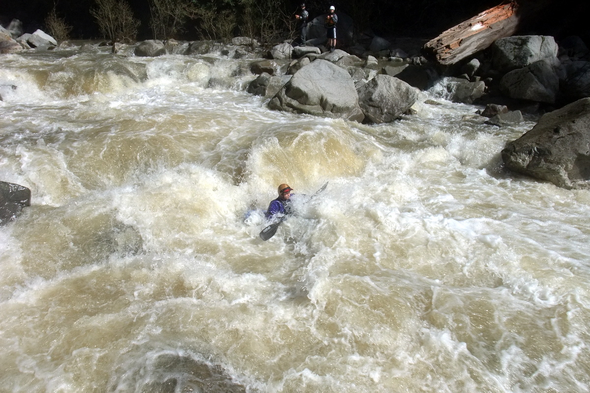
The Waterfall, class IV, scout either side, possibly portage right
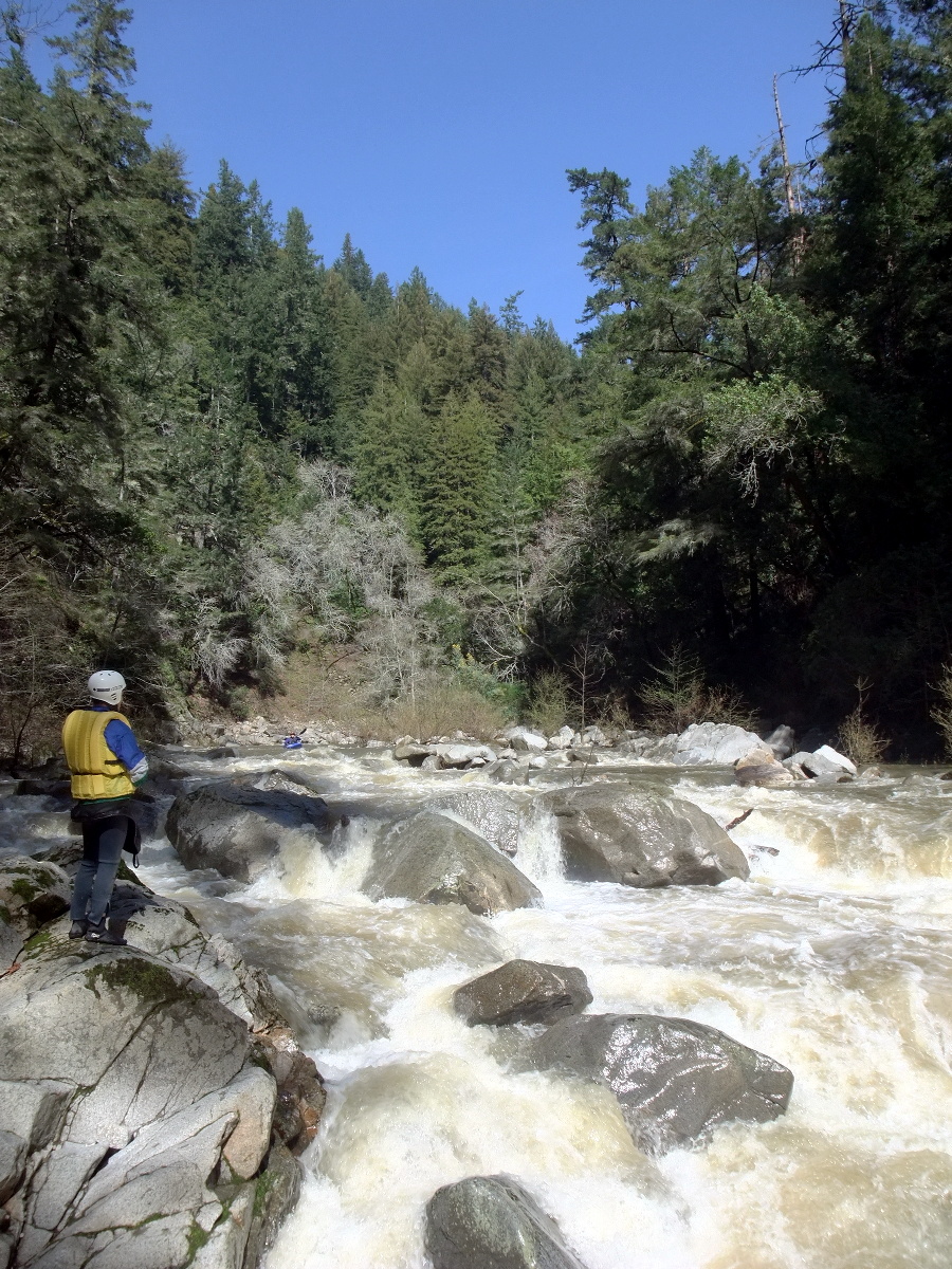
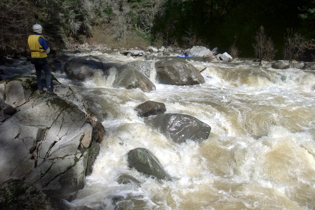
Soon after The Waterfall, in fact too soon for self-rescue, comes a class III drop between large rocks. Shortly thereafter comes Grovel Bar. The normal route is down the right side, cutting left near the bottom. It is also possible to cut left near the top, avoiding the brushy right channel. In 2003 a tree spanned the right-side, making a short left jog necessary. Grovel Island follows; recently its right channel has become runnable. Another rapid is followed by slabs of concrete fallen from the railroad, a possible spot for logjams, but currently clear (2010). Amazingly, in this section the San Lorenzo looks like the North Fork Smith, but without the crystal clear water. Rincon Take-out. There is a fire road on river right around mile 2.5, where the San Lorenzo makes a sweeping left turn around a big island. The hike out is about a half mile uphill, and deposits you right onto highway 9, greatly simplifying your shuttle, or enabling a quick hitchhike-assisted rerun. Most people prefer the easy take out at Paradise. In several rapids below Rincon, you might have some close encounters of the brush kind. One willow-choked rapid contains a big rock/hole just where the brush ain't. At higher flows more water filters thru willow trees on the right, fortunately, otherwise the willows would be impassible. Brush can also get intense below the Paradise covered bridge. The take-out beach comes after a high bank with road on the left. To reach take-out at Paradise, take highway 17 south to Ocean Street. Where the freeway ends turn right, curve right past Denny's, and drive under the highway 1 overpass. Where Graham Hill Road bears right and starts climbing steeply, turn left, at a cemetary, onto Ocean Street Extension. Drive past residences and thru thick redwoods until the road comes within sight of the San Lorenzo. Keep a low profile to avoid conflicts with Paradise residents. If this take-out becomes posted against trespassing, a long brushy paddle to the cemetary will become necessary. To reach put-in from there, return to the highway 1 overpass and turn right onto the uphill entrance to highway 1 north. After crossing the San Lorenzo on a bridge, turn right on River Road, which becomes highway 9. Drive several winding miles thru scenic redwoods until you reach the entrance to Henry Cowell Park. Park along highway 9 past the park entrance (in south Felton) and carry your gear to the bridge, which offers a good put-in spot underneath.
|
Creeks NavigationHomeRecommended Runs Map of Rivers Alphabetic Index Alphabetic Table Text Search
Sponsored Links
|