|
San Joaquin River South Fork |
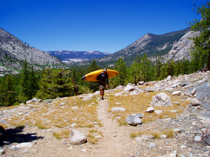
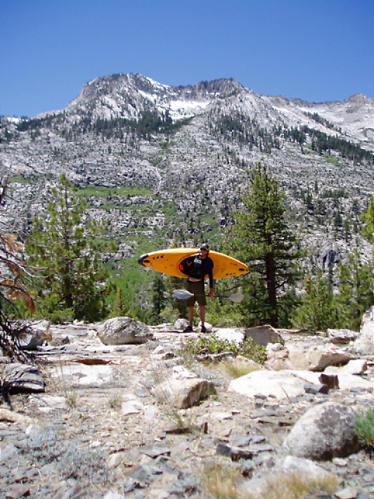
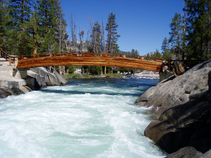
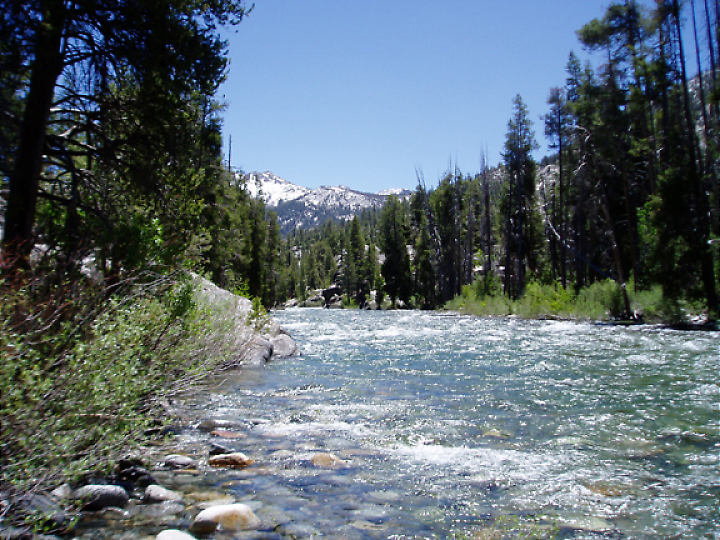
The South Fork of the San Joaquin above Florence Lake is a spectacular High Sierra run. It makes an excellent day trip and as noted by Holbek/Stanley has natural flow, runs every year and "is great, go do it!" We did the entire section from the Paiute Creek Bridge to Florence Lake. This involved 5 miles of flat water, 8 miles of hiking, and 8 miles of whitewater. This is a big day by any standard. Another highly recommended option is to do only the last 2.5 miles of the South Fork. This section contains almost all the whitewater and some of the best scenery and is described under the section Short and Sweet. It should be noted that the Holbek/Stanley book does an excellent job of describing the logistics of the trip. Additionally the times they give for the paddle across the lake, the hike to put-in on Paiute Creek as well as the description they give for identifying the mandatory portage are all very accurate. We started across the lake at about 9:00am on June 5th 2004. We arrived at the outlet to the South Fork at 9:45 and spent a few minuets resting and taking photos of the scenic and significant last drop. This drop and the portion of the river visible upstream provide an excellent place to judge the flow. We estimated about 1500cfs. I would guess that the last two and a half mile gorge would still be worth doing with half this much. Additionally it would be possible to do this run with much more water maybe 3000cfs although the gorge would probably be more difficult. As it were the eddies were often small and right against the walls of the mini gorge. Our run through this section was greatly expedited by the fact we had hiked up and scouted much of this section the day before. We commenced hiking at 10:10. The trail begins by crossing a footbridge to the North side of the river then continues up and away from the river for about a mile and a half. The trail then levels off and descends slightly to meet the river at the west side of Blarney Meadows at about mile 2.5 (this is before you reach the turn off onto the private land at Muir Trail Ranch). In the future I would put in here as described in the Short and Sweet description below.
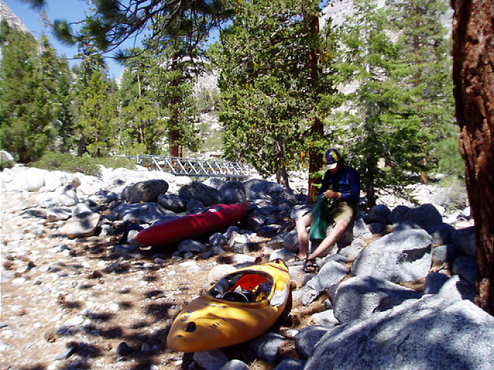
We continued hiking past Blarney Meadow through meadows of wildflowers and ever-present mosquitoes. Above Blarney Meadows the trail joins the John Muir Trail and is mostly out of sight of the river until reaching the bridge on Paiute Creek. This section of is very scenic with great views into the high country. We arrived at put in at 2:45 totally spent. Knowing we had about 8 miles of whitewater ahead we took a long break. It looked like there was some great boating further upstream on Paiute Creek but we were too tired to check it out.
We put on at 3:15 on a section of very busy continuous class IV-V. There were numerous river wide holes and no eddies. I immediately proceeded to roll four times splitting open my elbow through my dry top. After a non-stop quarter mile Paiute Creek dumps into the relatively placid South Fork.
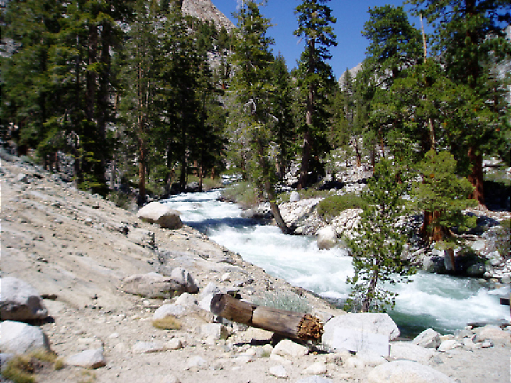
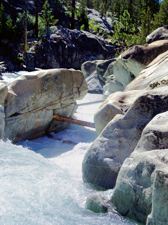
The next few miles were characterized by low gradient riffles that did not require scouting. As warned by the guidebook we were on constant look out for the mini-gorge with the inviting class III lead-in. It can be identified by a sharp bend to the left and a granite mini gorge (I believe this was the first granite bed rock encountered on the run). Do not run the inviting lead-in drops or you will be forced to eddy directly above a ten footer into a death hole. We portaged on ledges on river right which took about ten minuets. Following the portage is a short section of class II leading to Blarney Meadows. We stopped about a half mile above the Meadows and searched for a hot spring on river left. After about half an hour of bush whacking we were unable to locate it and continued down stream. I am told it is quite nice if you can find it.
The paddle through Blarney Meadows is very scenic. The river meanders though the meadow and we were often paddling right between trees. We passed over two or three barbed wire fences. I believe we had to get out of boats once when we followed a channel that lead into a logjam. This scenery is marred only by the buildings of the Muir Trail Ranch.
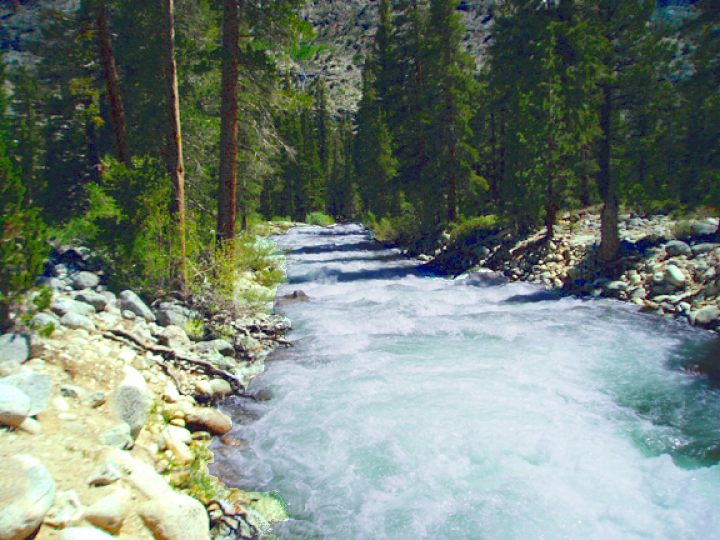
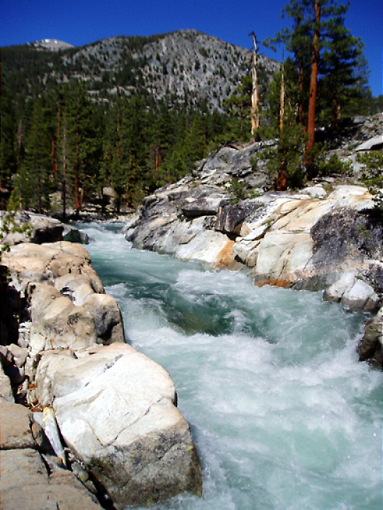
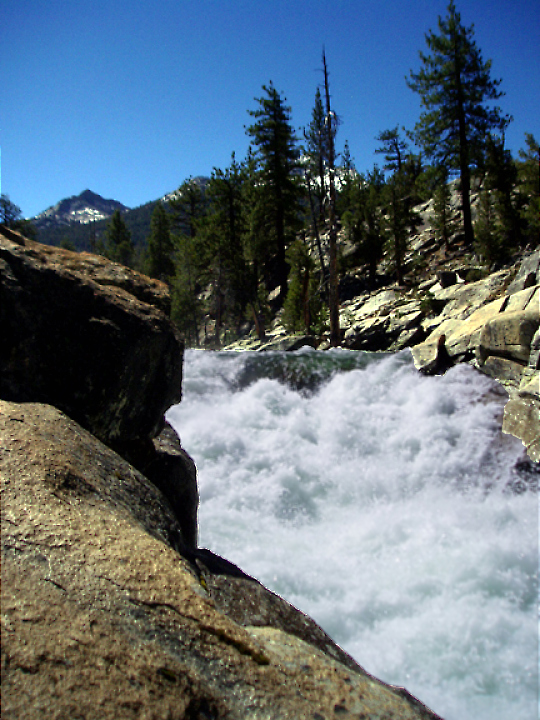
As you exit the meadow the gradient picks up and the fun really begins. The Last two and a half miles from here to the lake contain essentially all the good whitewater on the run. The river flows though a spectacular water carved granite mini-gorge set in a large glaciated valley. The river through this section is Continuous Class IV/V interspersed with a few distinct drops. The rapids are almost exclusively low angle bedrock affairs creating exceptionally sticky holes. I took one of the longest surfs of my life in a hole I was unsuccessful in punching. Many of the drops are boat scoutable but we had hiked along most of this section the day before which allowed us to make rapid progress. In one section we were fighting though a wave train while looking directly into the sun and we were nearly clotheslined by a one inch steel cable stretched across the river a chest height. We both rolled just in time to slip by unscathed. The last drop on the river is a spectacular low angle falls that passes under the footbridge and ends right in the lake. At about 12 feet tall it is the largest on the run and lots of fun. Finish by paddling back across the lake or hiking back up and doing it again! Short and SweetThe West end of Blarney Meadow at about Mile 2.5 would be an excellent place to put-in. If you put-in here you only have to hike between two and three miles. This took us about an hour and a half with a few short breaks. All the good whitewater between the Paiute Creek Bridge and Florence Lake with the exception of the quarter mile on Paiute Creek is in this last two and a half mile section. I believe that it would be more fun to do this section twice than to do the run as we did it and as described by Holbek/Stanley. If you want to see the scenery upstream it would be more fun without a boat on your shoulder. LogisticsFlorence Lake is Located about 90 miles North-East of Fresno. From Highway 99 make your way to HWY 168 East toward Shaver Lake. Continue Past Shaver following the signs to Huntington Lake. From the North East Side of Huntington Lake drive over Kaiser Pass and follow the signs to Florence Lake. Allow three hours from Fresno. Park at the trailhead parking lot above the boat ramp. Paddle across the lake angling right (south) until you reach the river. We began hiking at the campground on river left where the river empties into the lake. Within a quarter mile cross the river on a beautiful wooden footbridge and continue uphill and away from the river for about 1.5 miles. Upon reaching the top of a hill the trail tends back toward the river. Once on the trail it was quite well signed toward the John Muir trail and ultimately to the bridge over Paiute Creek. The hike took us almost five hours. While in the area check out Mono Hot Springs and the South Fork below Florence Lake (we had planned to do this section but SCE shut off the water the day before we got there). FlowsThis run is undammed and runs naturally every year. I would estimate that when the South Fork San Joaquin below Florence Lake is in the boatable range the section above the lake would definitely be good, if a bit on the high side. The South Fork above Florence probably continues to run for about two additional weeks after the outflow from Florence is shut off. Another way to judge South Fork Jan Joaquin flow is by analogy with another high-elevation south Sierra river such as the Kern.
|
Creeks NavigationHomeRecommended Runs Map of Rivers Alphabetic Index Alphabetic Table Text Search
Sponsored Links
|