Salmon North Fork above Sawyers Bar


Stretch: Idlewild Campground to town of Sawyers Bar
Difficulty: class IV, class V above 1500 cfs?
Distance: 7.9 miles (more by hiking), 1 day
Flows: kayaks 800 - 1500 cfs, IK minimum 500
Gauge: estimate 25% of the flow at Somes Bar (USGS site)
Gradient: 81 fpm average
Put-in: Idlewild pack bridge at end of dirt road, 2800'
Take-out: wide gravel bar near Sawyers Bar, 2160'
Shuttle: 8 miles (20 minutes) one-way, 2 miles on dirt
Maps: USFS Klamath NF, AAA Northern California, Topo
Season: spring, from snowmelt
Agency: USFS, private
Notes: © 1998 Bill Tuthill, CreeksYahoo

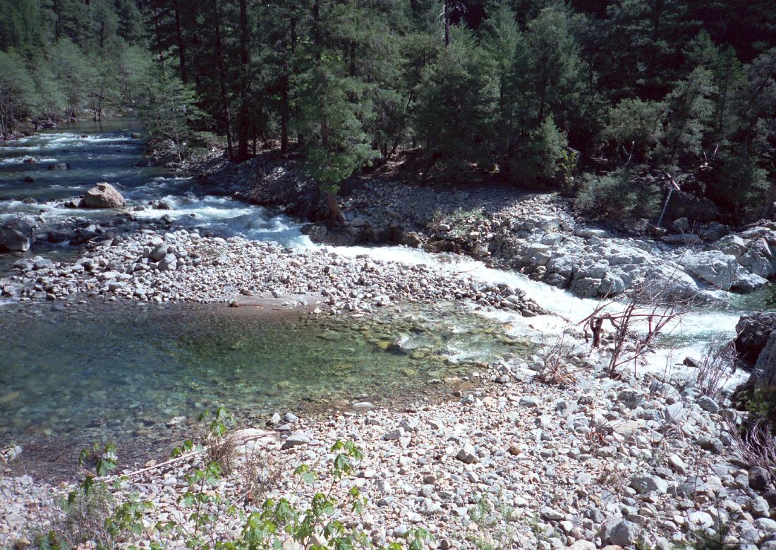
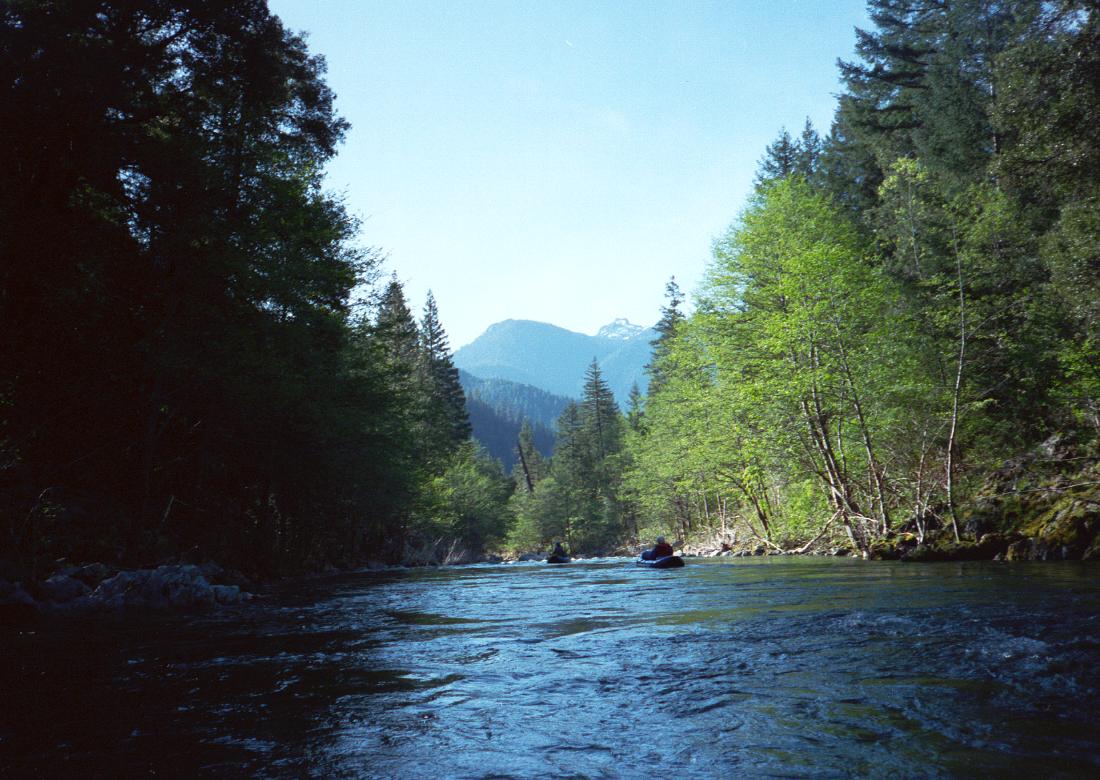
This is one of the best class III-IV runs in California, although it is a long way from population centers, and has a relatively short season. The Idaho-like continuous rapids are mostly class III individually, but add up to class IV because there are no pools, or only short pools, in between. Pristine water, mostly intact forests along the river, and snowcapped peaks in the distance add up to a scenic extravaganza.

Even in the 3rd edition, Holbek warns of a portage around a wooden bridge hanging down in the river, but this bridge has either been removed or has washed away, so there are no portages necessary on this run.

Excellent camping is available at put-in, and also along the 2 mile dirt road from the main highway, but the forest shade and cool temperatures because of high elevation might not give your gear much chance to dry out. In May, it is unlikely that you will freeze your patuchi off, as did Lars Holbek. Sometimes there is enough snow to keep this run running into June.

Because these 7.8 miles can be boated in about 2 hours, you might want to combine this run with something else. You can hike your boats upstream five miles to the confluence of two creeks that create the north fork Salmon. Rapids are reportedly continuous class III+, similar to those below Idlewild.

Downstream of Sawyer's Bar are more than 2 miles of easy class II rapids to a confluence with the Little North Fork, where begins the lower run described by Holbek. We did this lower run in 1996, and didn't like it very much. It contains a lot of boring class II in the middle, and some bad class V rapids near the end; moreover, clearcuts and ugly mining debris are often visible.

mile
0
Put in either above or below the pack bridge that crosses the river from the Idlewild campground into the Marble Mountain wilderness. Continuous class III rapids begin immediately. Note: the defunct wooden bridge hanging down into the river that Holbek warns about, even in the 3rd edition, is long gone.
.5
A long rapid divides around a gravel bar and then drops over a steep boulder pile. This rapid can be seen from the shuttle road. Downstream, the river enters a small gorge, and several more rapids verge on class IV. The hardest one is where the river narrows, bends left, and drops thru some narrow rocky chutes.
North Fork Salmon River near Sawyers Bar CA North Fork Salmon River near Sawyers Bar CA
First class IV rapid from shuttle road Snow-capped mountains from Idlewild
1.5
Gradient eases and rapids become more class II-like as the river widens and approaches campgrounds near the main highway. Good views of snowcapped mountains to the south.
2
Road bridge below Idlewild campground. The river enters a wide valley and drops mildly over gravel bars. Brush can be a problem at times.
3
The river enters another small gorge with many pleasant class III rapids. For emergency purposes, the highway is never far away.
5
An iron bridge overhead signals the beginning of a very long section with continuous whitewater. Rapids are continuous class III for 2 miles, with an occasional class III+ drop, adding up to class IV. A swim here could easily result in the loss of your boat.
7
Gradient eases and rapids become class II+ affairs with pools between. Soon houses of Sawyers Bar are visible on the right.
7.5
Bridge for the dirt road connecting Sawyer's Bar to Cecilville.
7.8
The main highway approaches very closely to the river, but the bank is steep, access is poor, and parking is unavailable.
7.9
A wide gravel bar on the right provides an excellent take-out spot. You can drive high-clearance vehicles right next to the river, or walk across a flood channel to ample parking near the highway.

To reach put-in, drive from Etna over an often-snowy pass towards Somes Bar. The highway follows a creek to its confluence with the north fork Salmon. Just after a concrete bridge, turn north onto a dirt road and proceed 2 miles to a USFS campground with very fine outhouse near the pack bridge.

To reach take-out from there, return to the main highway and drive west for six miles to the small town of Sawyers Bar. Just past the narrowest part of town with USFS dormitories, turn onto a dirt road towards the river, and possibly drive across a high-water channel to the gravel bar highpoint near the river.


 Creeks Navigation

 Home
 Recommended Runs
 Map of Rivers
 Alphabetic Index
 Alphabetic Table
 Text Search

 Sponsored Links