| |
| Stretch: |
River Bridge (below Takelma Gorge) to North Fork Park |
| Difficulty: |
Class III, sometimes verging on IV |
| Distance: |
5.2 miles, one short day |
| Flows: |
rafts and kayaks 800 - 4000 cfs, IK minimum 400 cfs
|
| Gauge: |
measured, not transmitted, estimated
(AWA) |
| Gradient: |
43 fpm average, steeper in mile 2-3 |
| Put-in: |
near River Bridge campground, 2825' |
| Take-out: |
on left above PacifiCorp's Prospect dam, 2602' |
| Shuttle: |
10 miles (15 minutes) one-way |
| Maps: |
USFS Siskyou NF, AAA Southern Oregon,
Topo
|
| Season: |
year round: springs and snowmelt |
| Agency: |
USFS, private |
| Notes: |
© 2012, 2016 Bill Tuthill,
CreeksYahoo |
This is a good run any time of year,
especially in mid summer when other runs fall too low.
You can run it in conjunction with a Rogue River wilderness trip,
or as part of an extended Oregon rivers tour.
Some of my friends say this run is their favorite anywhere.
I would not go that far, but it is excellent for whitewater and scenery.
Upstream are two interesting runs.
The 3.8 mile run immediately upstream is rated IV+ in the AWA river database,
however it passes thru Takelma Gorge, which because of logs is usually class V.
The 3 mile run above that from Natural Bridge to Woodruff Bridge
is also rated class IV+ but is popular at low flow when it more like class IV.
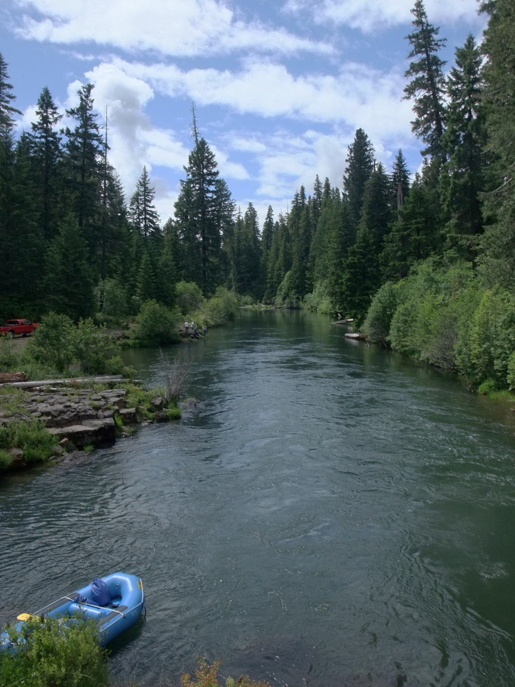
- mile 0
- Good access at the River Road bridge near River Bridge campground,
or upstream in the campground itself, at a shaded turn-around area.
You can also put in two miles upstream below Takelma Gorge,
but this involves a long carry to the river.
- .2
- Long and winding class II rapid around some islands.
- .5
- First ledge with low-water passage on the right side.
The middle and left are runnable only at high flows.
Afterwards you encounter only mild rapids for another half mile.
-
- 1.0
- Class II rapid before a left bend, marking the start of larger rapids.
- 1.1
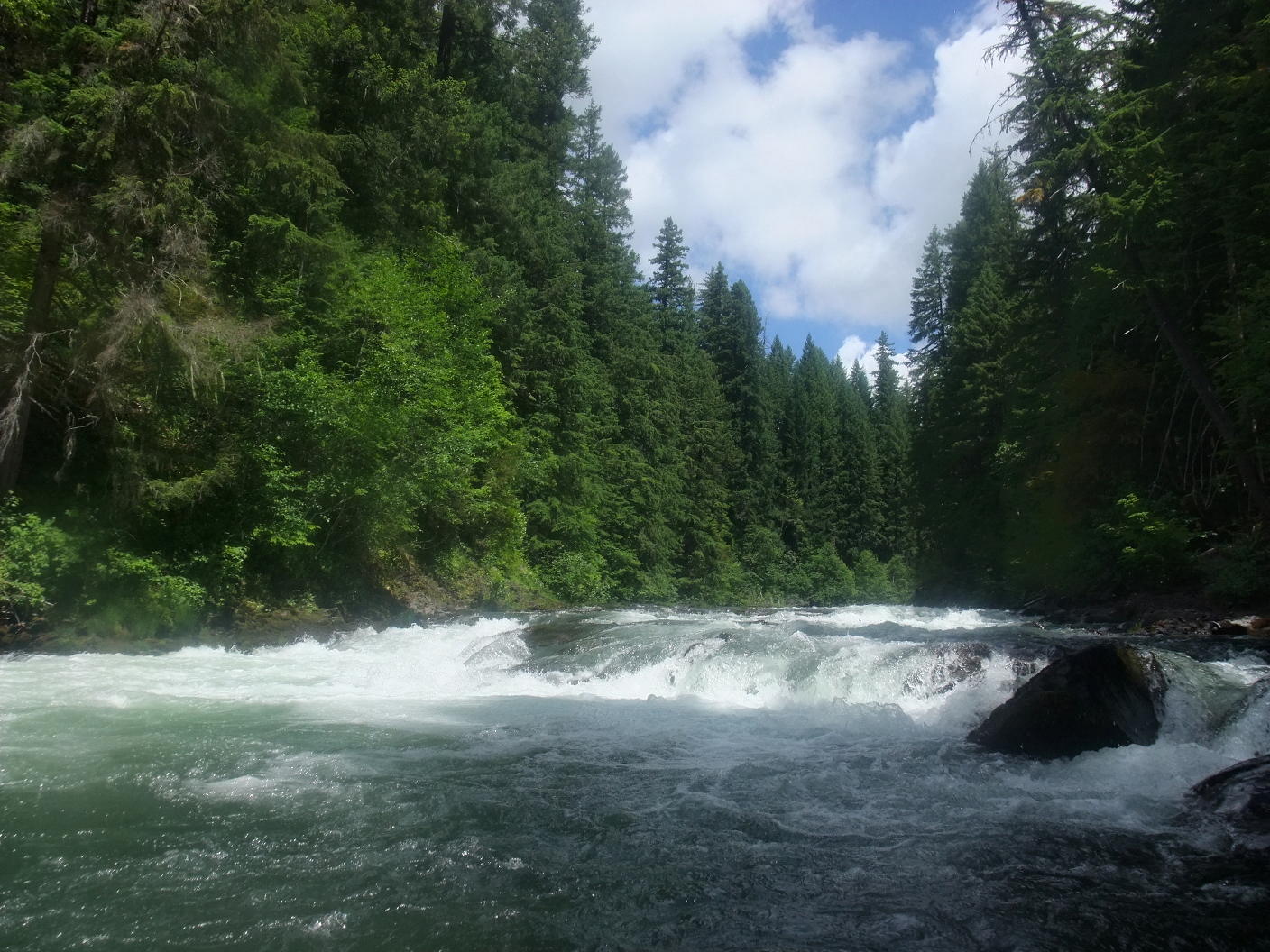
- Second ledge, class III-III+ usually.
Easy whitewater leads to a sudden river-wide drop,
possibly recirculating at high flows.
At low flows the best route slants center to left.
- 1.3
- Class III rapid where the river turns right at a rock outcropping.
A less-significant rapid follows in .2 mile after a left bend.
-
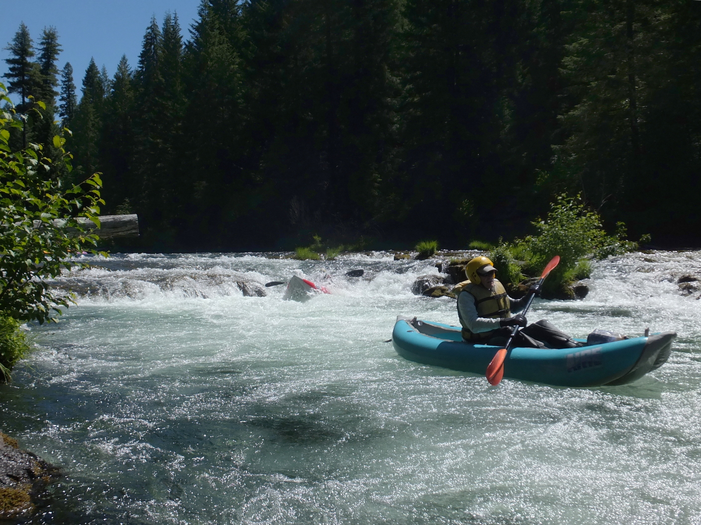
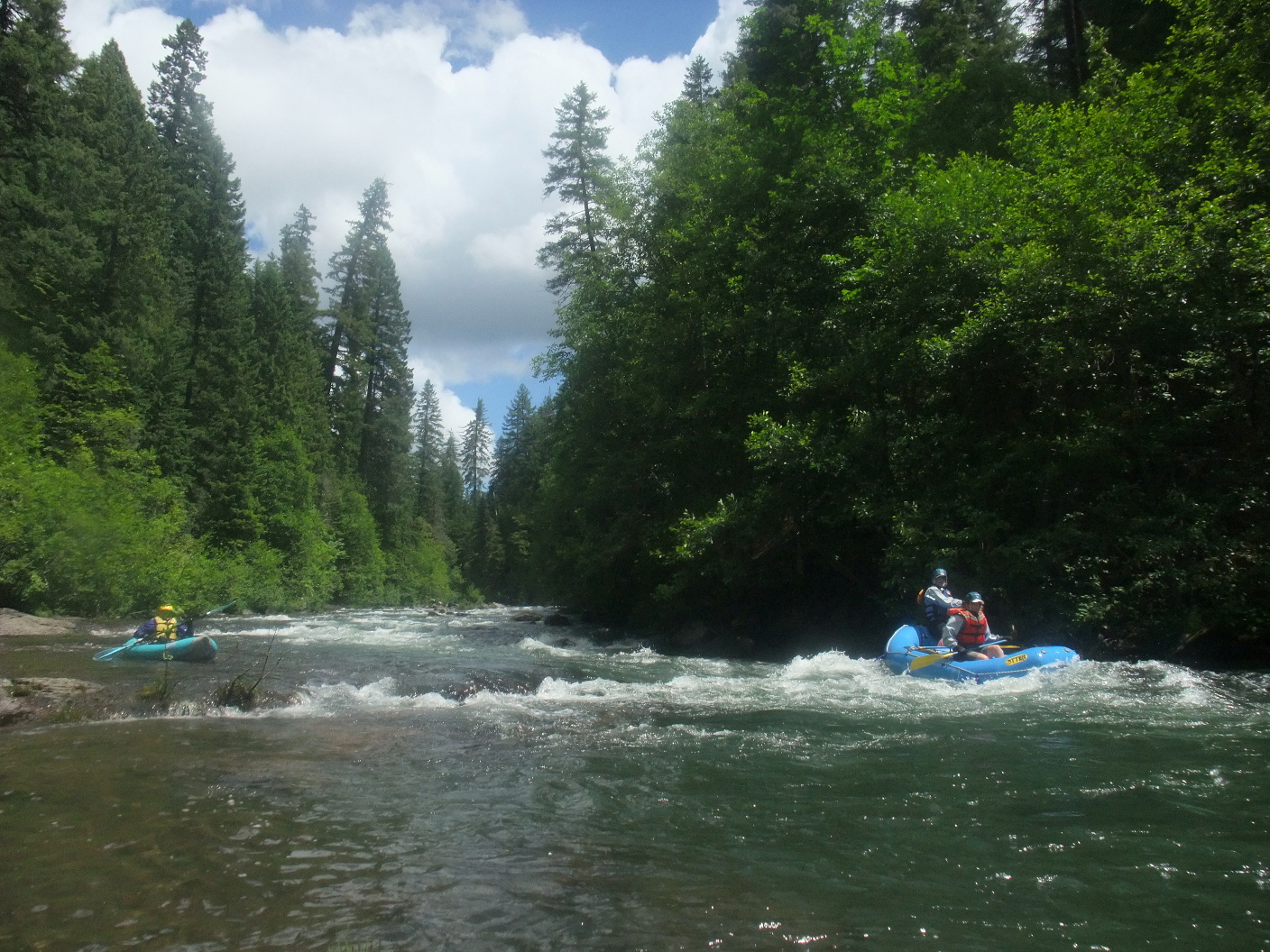
- 2.2
- Switcheroo, class III+, perhaps the most difficult rapid on this run.
You usually need to start on river left because of rocks on the right,
but unless you work far right before the end, you will encounter
some flipper holes and/or large rocks. Many lesser rapids follow.
- 2.4
- Curves, a series of rapids at a left bend, then a right bend.
-
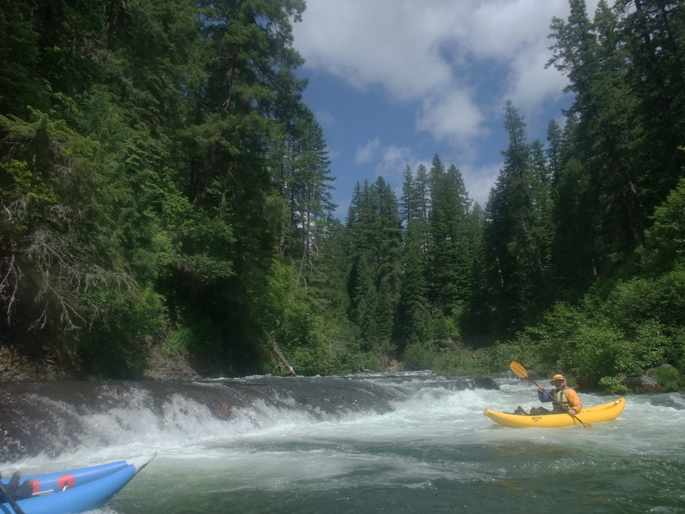
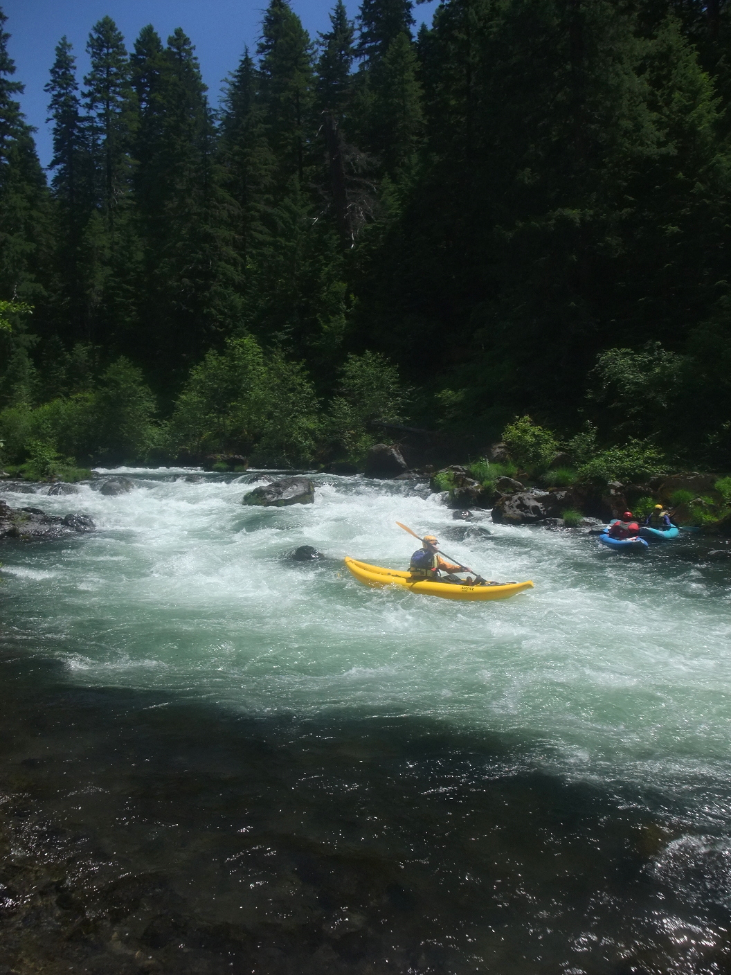
- 2.7
- Exception, similar to Switcheroo but you can finish center or right.
Another left-finisher is .15 mile below. After this rapids taper off.
- 3.5
- Habitations visible on the left bank.
- 3.8
- Gauging station, unfortunately not with transmitted flow.
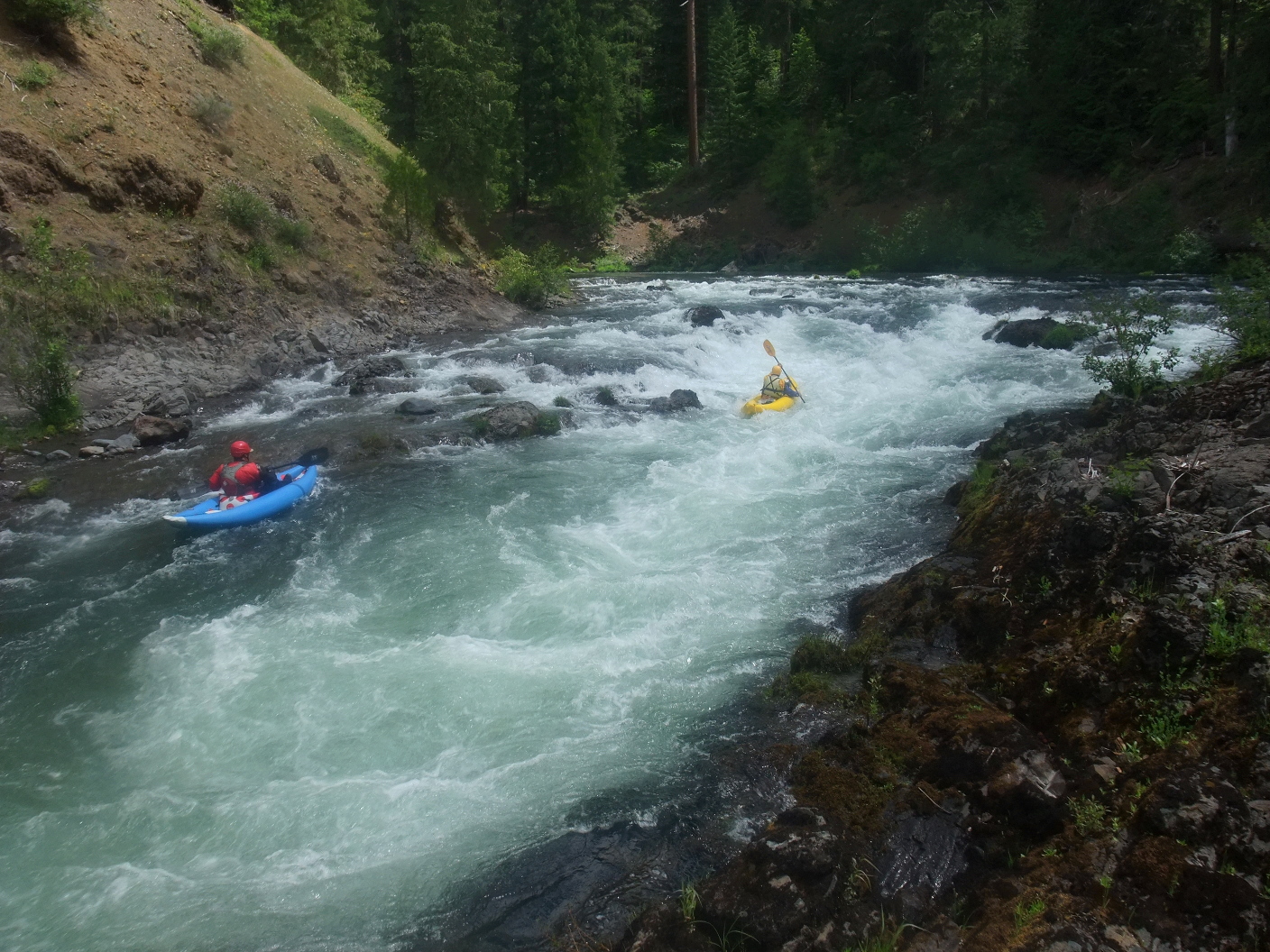
- 4.1
- Island, class IV- on left, class III on right.
At lower flows the left channel contains a choice of airplane turn,
tight slot, or steep falls.
- 4.3
- Slack water of reservoir begins,
though the banks remain forested for another half mile.
-
- 5.2
- Take out on the left within sight of the dam.
Shortly uphill is a nice picnic area and gravel parking lot.
Downstream of PacifiCorp's Prospect dam the river is dewatered for 1.2 mile,
but you can hike downhill .3 mile from Mill Creek Drive
and put in at the confluence of Mill Creek, below Mill Creek Falls.
The 1.3 miles below there is continuous class III creekin' with 10-14 class IV drops,
depending on flow. At that point the diversion from Prospect dam enters,
and you have another 2 miles of big-water class III until Lost Creek reservoir.
Shuttle Directions
To reach take-out from Medford, turn north at exit 30 onto highway 62 east,
and drive about 40 miles towards the small town of Prospect.
Along the way, good camping is available near Lost Creek reservoir.
About two miles past the penstocks and .7 mile past the river bridge,
just past milepost 45, highway 62 crosses a canal.
Turn left immediately on a dirt road marked North Fork Recreation Area
and proceed .4 mile to the picnic area and parking lot.
To reach put-in from there, return to highway 62 (east).
Food and lodging are available off-highway in nearby Prospect.
Drive north four miles and turn left on a dirt road to River Bridge campground.
You reach the put-in bridge after .9 mile.
To find nearby amenities and services, type Medford into the box and click Search.
|
|
Creeks Navigation
Home
Recommended Runs
Map of Rivers
Alphabetic Index
Alphabetic Table
Text Search
Sponsored Links
|