| |
| Stretch: |
Ranchland in Nevada to Three Forks |
| Difficulty: |
Class III with one IV and one V |
| Distance: |
69 or 90 miles, 5 to 6 days |
| Flows: |
rafts and kayaks 1000 - 6000 cfs (at Rome) |
| Gauge: |
measured way downstream near Rome
(USGS site)
|
| Gradient: |
fairly continuous 10 fpm |
| Put-in: |
YP launch from Petan Ranch, or Paiute El Paso pipeline, 4660' |
| Take-out: |
Three Forks launch site below North fork, 3950' |
| Shuttle: |
285 miles (6 hours) one-way |
| Maps: |
BLM Owyhee Bruneau map, AAA Oregon
(Topo)
|
| Season: |
March maybe into June, from snowmelt |
| Agency: |
BLM, private |
| Notes: |
© 2011 Bill Tuthill, Photos © 2011 Doug Soulé |
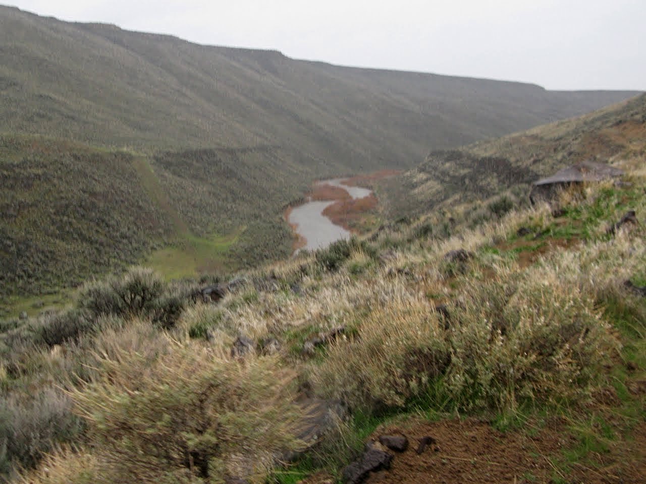
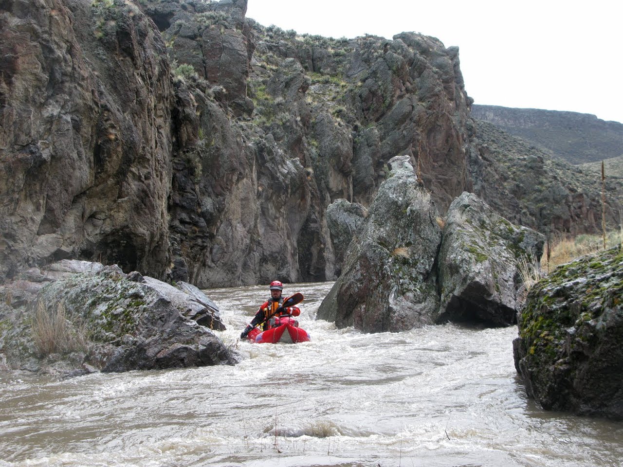
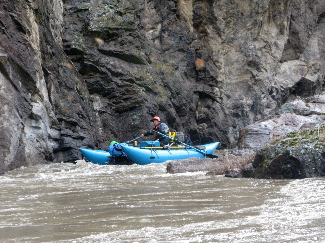
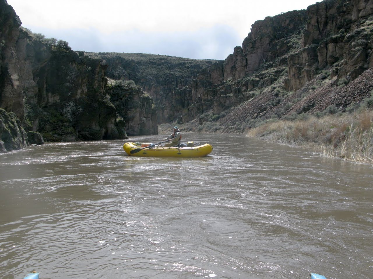
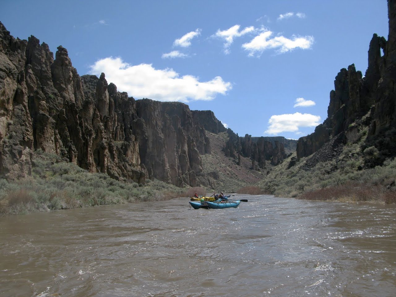
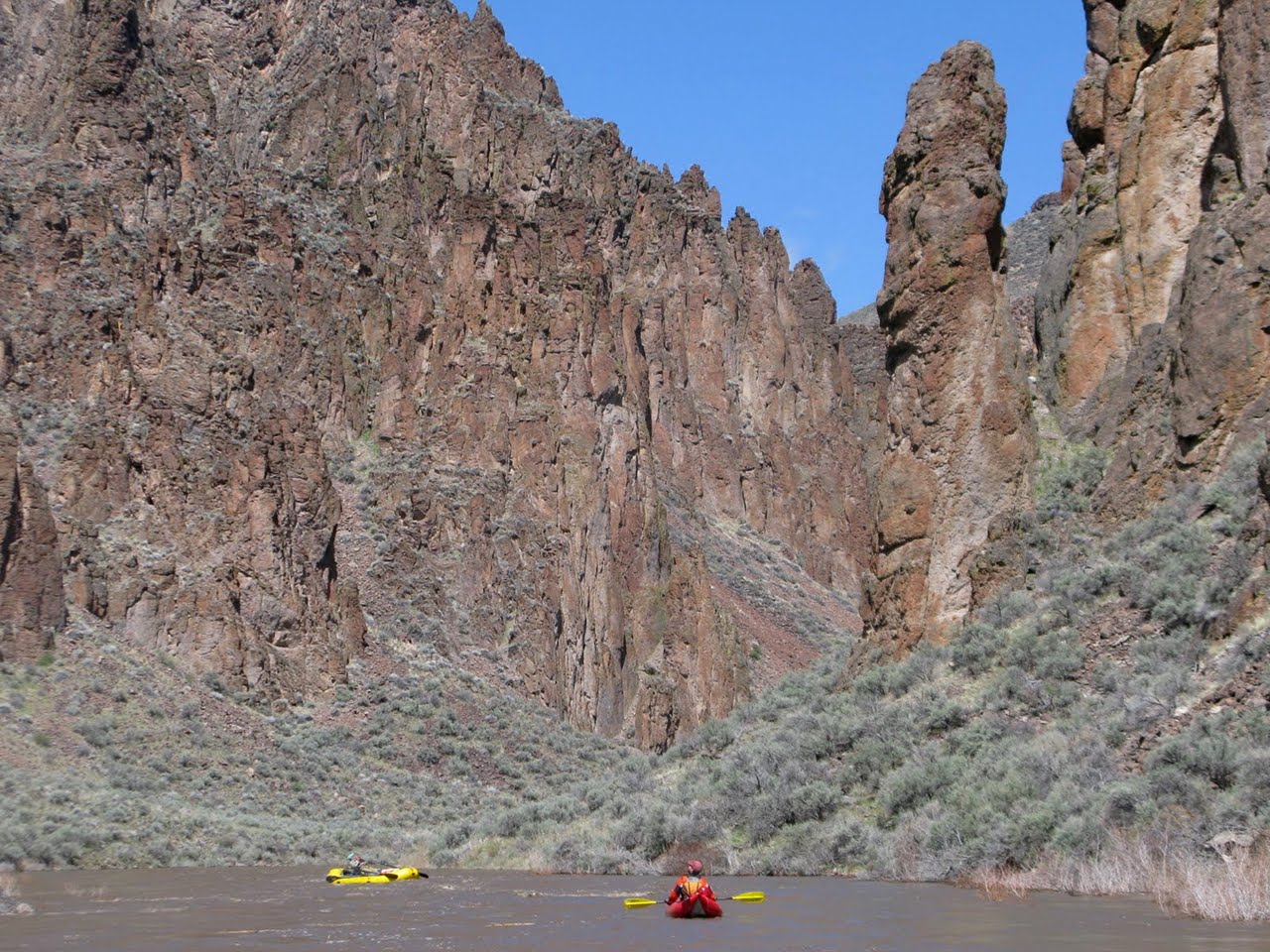
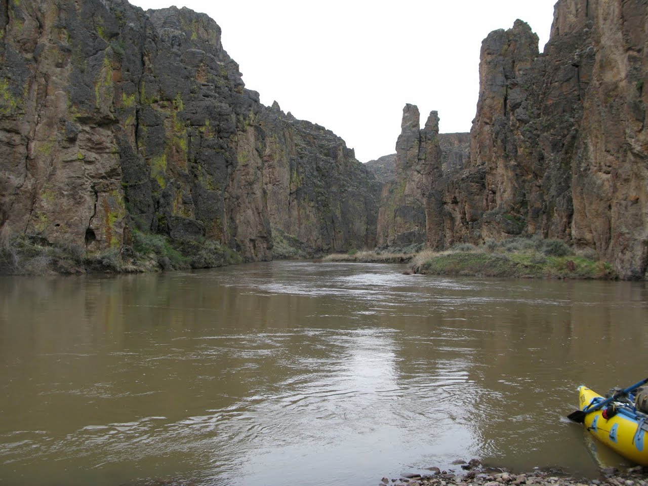
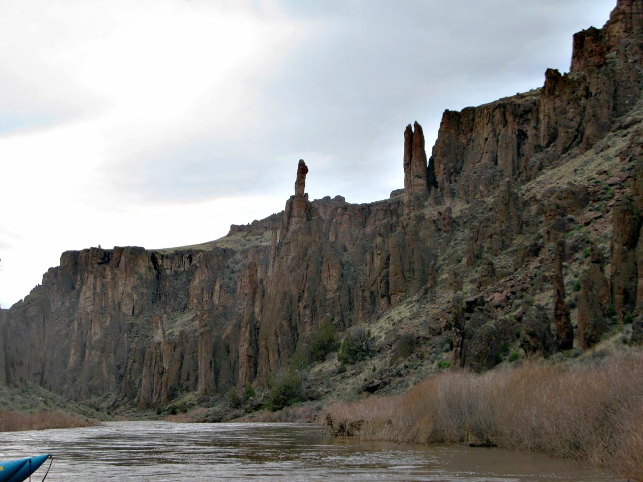
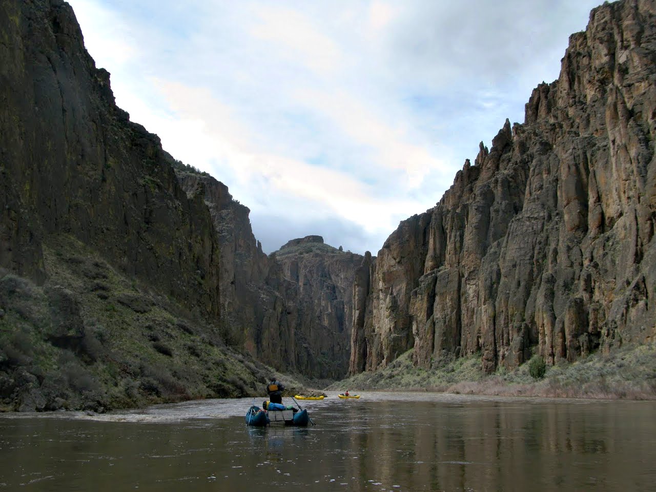
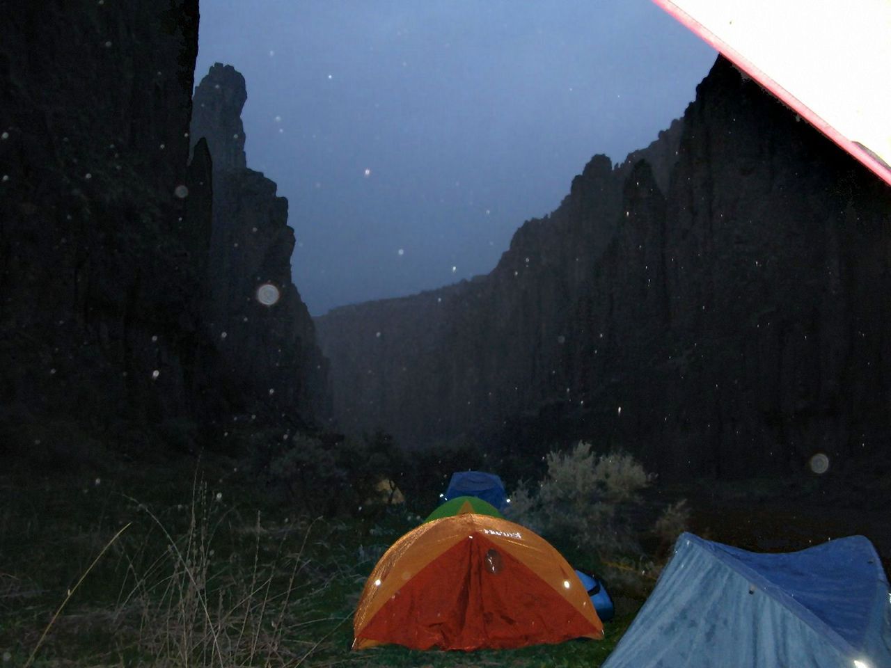
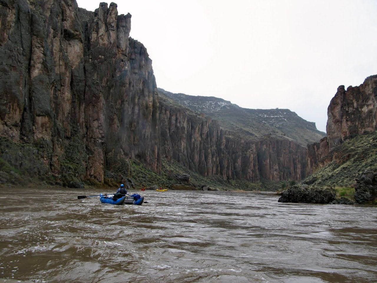
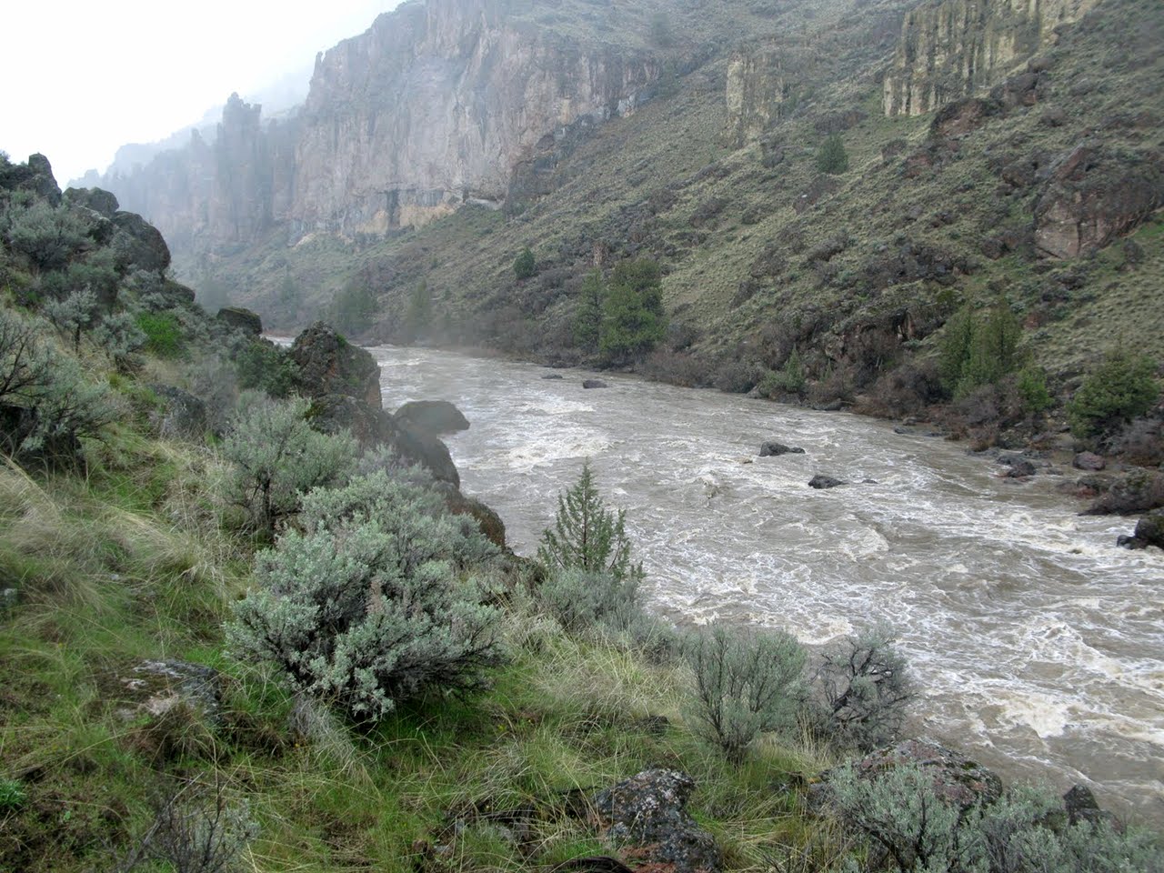
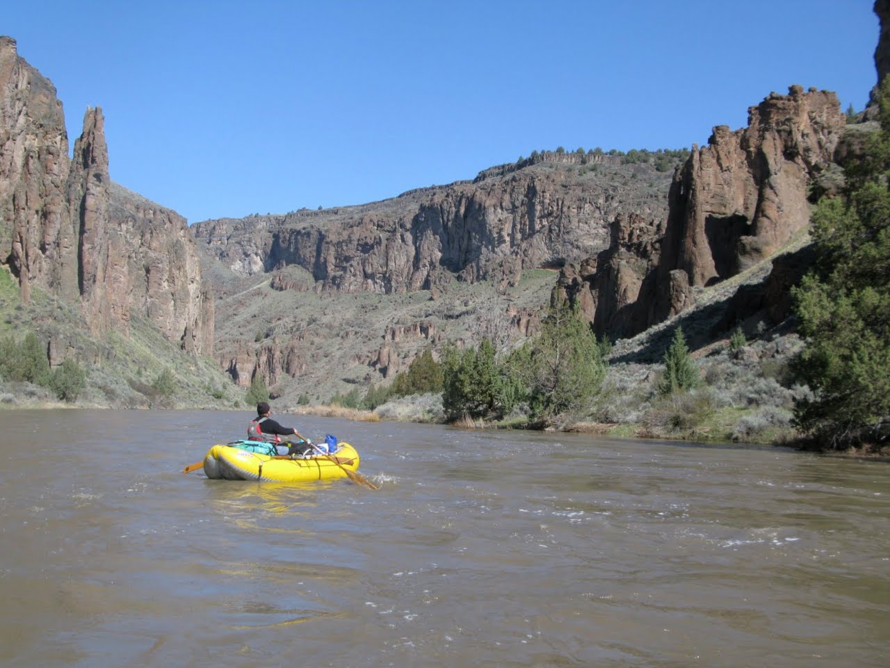
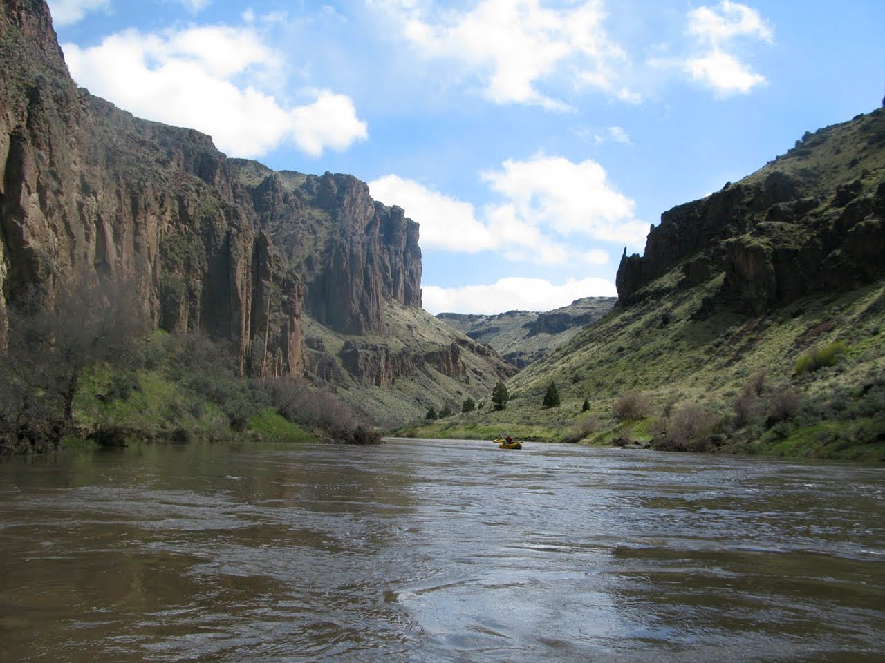
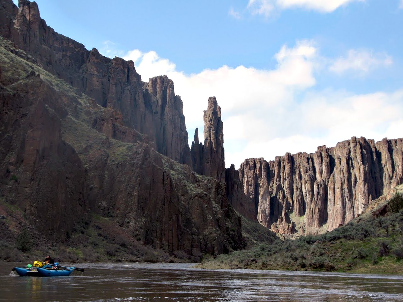
The upper Owyhee has spectacular scenery,
mild rapids except for a long class IV and a short class V in the middle,
and a world-class hotspring shortly above take-out.
The South Fork Owyhee is the easiest way to access the upper Owyhee.
You can also access it from the East Fork,
but that route involves a long portage around Owyhee Falls,
whereas the South Fork has fun rapids mixed with flatwater, and no portages.
The shuttle is no worse and approximately the same length.
You could continue below Three Forks and run the middle Owyhee,
but that stretch has several class IV rapids and one V that is
more difficult to portage than the class V on the upper.
Here is a great story:
Upper Owyhee Trip Report
(16 - 23 April 2011) by Jason Shappart.
During years with above-average snowpack,
the Owyhee runs for at least several weeks when temperatures rise,
perhaps on several occasions if late-season storms occur.
Unfortunately it is difficult to plan a trip more than a week in advance
because weather in the high desert is extremely variable.
Furthermore, this run requires a dry spell to make access roads passable.
Aside from two difficult rapids,
the principal hazards are isolation and rattlesnakes.
When you hike, keep an eye on the ground ahead.
It is possible to walk out of the canyon in many places,
but help (humans in any form) are a very long distance away.
Temperatures vary unpredictably during boating season,
so be prepared with summer and winter clothing.
Distances start at the highest practical put-in,
and reset at the pipeline (continuing in parentheses).
- mile 0
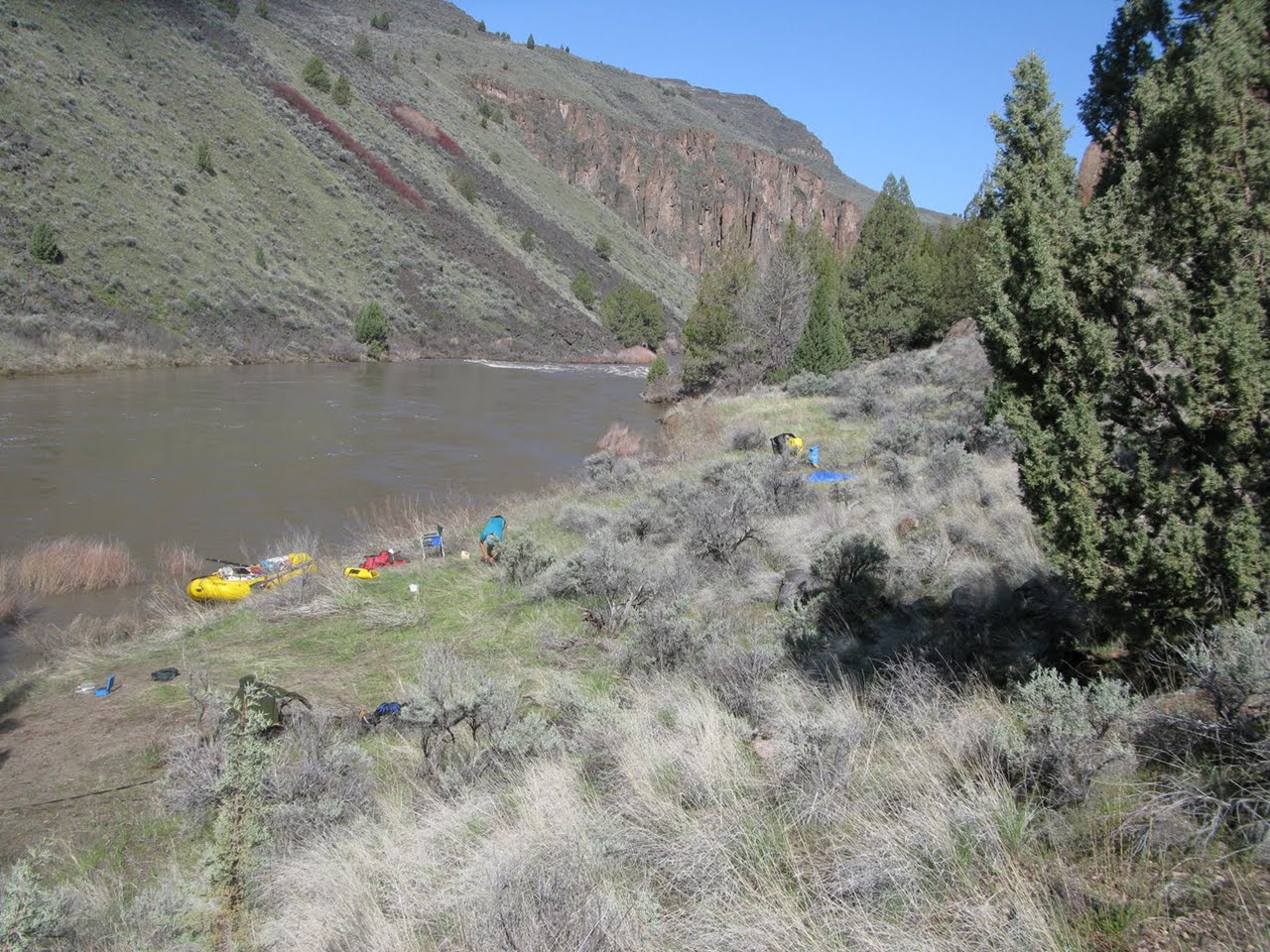
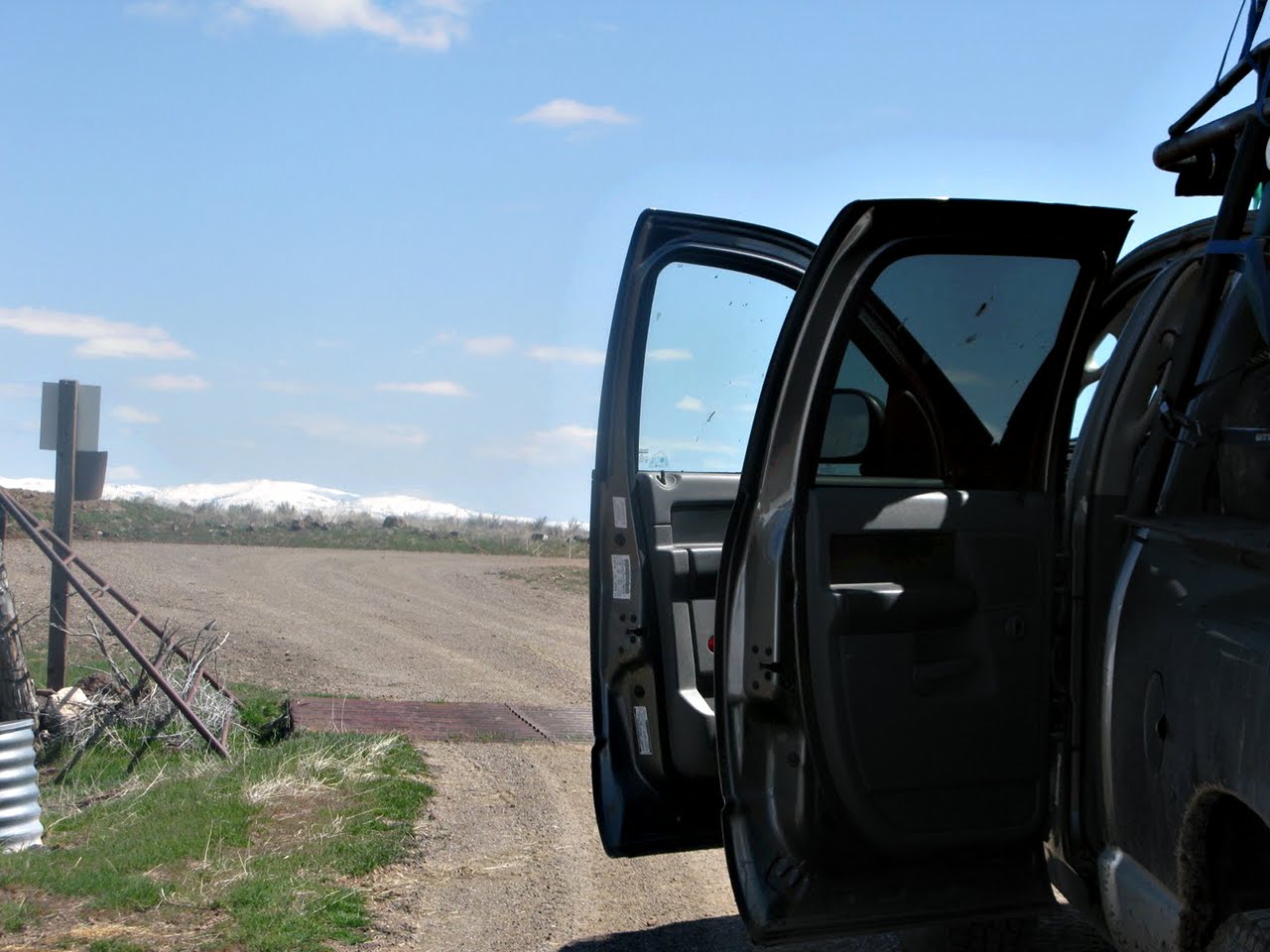
- The YP launch site is as far downstream as ranch roads go
along the river. BLM land begins shortly below.
- 4
- Fourmile Creek enters on the left, with possible upstream hike.
The river is very scenic despite the shallow canyon.
- 8
- Twelvemile cabin, where dirt roads lead to a low-water crossing.
- 19.7
- Devil's Corral rapid, before a left-right bend, followed by
the Paiute El Paso gas pipeline. The canyon deepens.
-
- 0 (21)
- Pipeline launch site, at the north-most hairpin turn in the road.
- Less than a mile downstream, class II-III rapids begin
and continue past the Nevada-Idaho state line.
The BLM map calls this series of rapids Devil's Pinball.
-
- 3.7 (24.7)
- Nevada-Idaho border. The last Pinball rapid is .3 mile further,
and another rapid is one mile downstream.
- 7.6 (28.6)
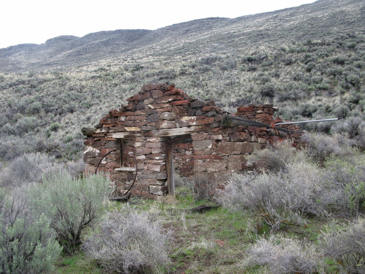
- Bull Camp on the right, a defunct stone cabin and remains of another.
-
- 12.7 (33.7)
- Rapid at a leftward curving horseshoe bend.
- 15 (36)
- Coyote Hole, with freshwater spring and old homestead on the right,
private land. On the left are steel posts and camp-junk of a poacher
who murdered two game wardens in 1981.
-
- 17 (38)
- Sentinel Rapid, class III.
Low-water BLM photo.
- 17.9 (38.9)
- Sentinel Canyon visible on the right.
Sentinel Creek enters below, with hiking trail up the canyon.
Unnamed canyon enters on the left .1 mile below, with another trail.
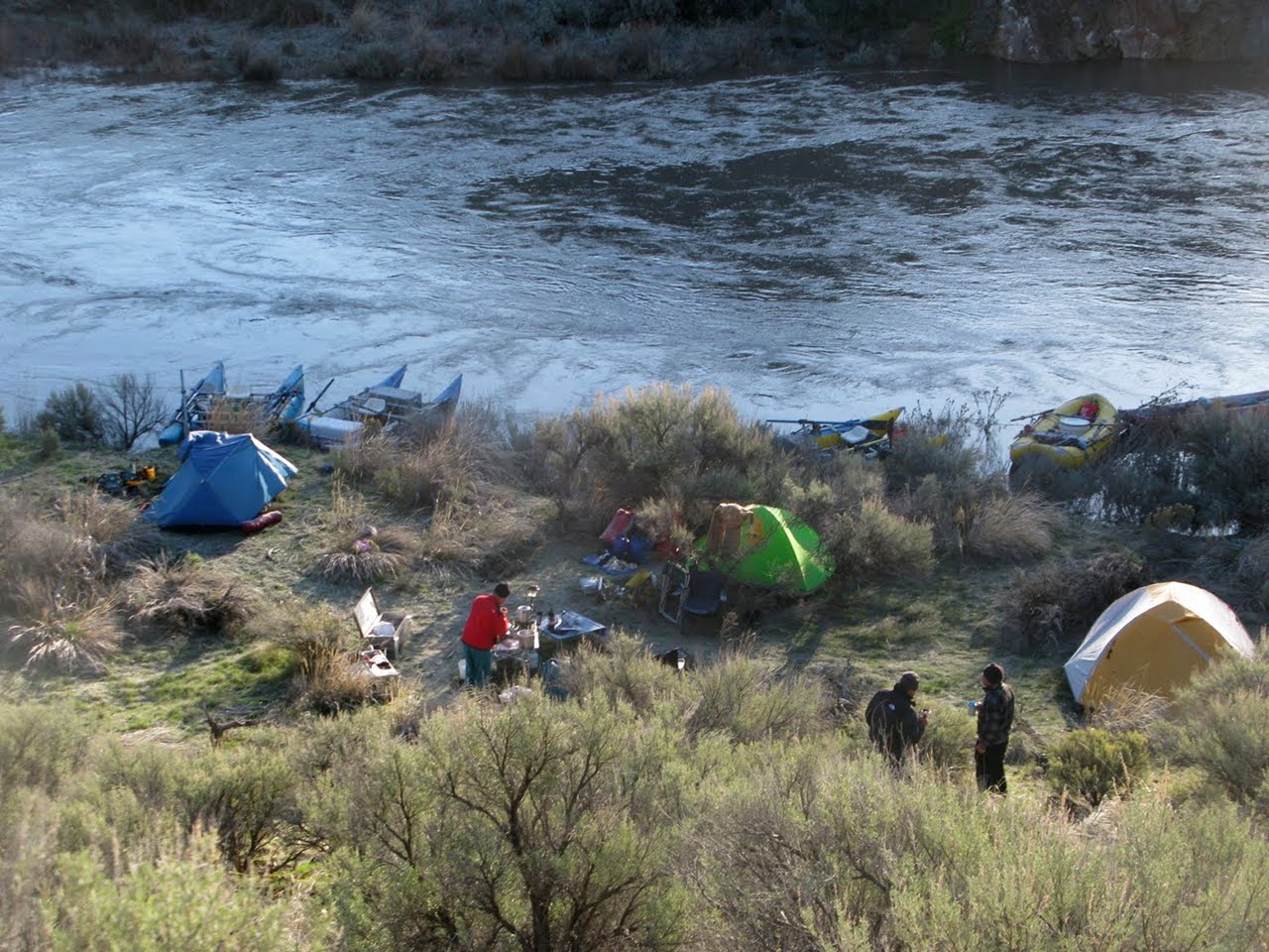
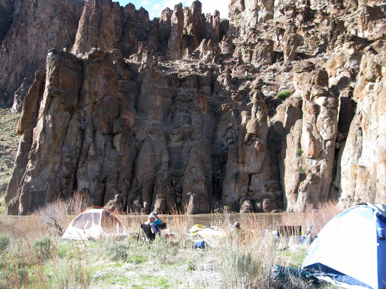
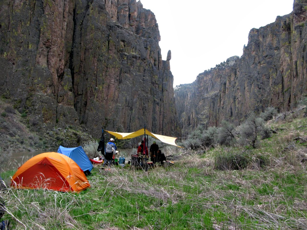
Several good campsites in this area. The canyon is spectacular.
-
- 22.4 (43.4)
- Unnamed canyon enters on the right, with good side hike.
- 23 (44)
- Forty-Five Dam rapid.
- 24 (45)
- Little Owyhee River canyon on the left.
On the right is 45 Ranch launch site,
reachable in 2WD vehicles when roads are dry,
but an impractical access because most boaters prefer longer runs.
-
- 27 (48)
- Spring Creek basin on the left, possible side hike.
Several camps in this area.
- 30.5 (51.5)
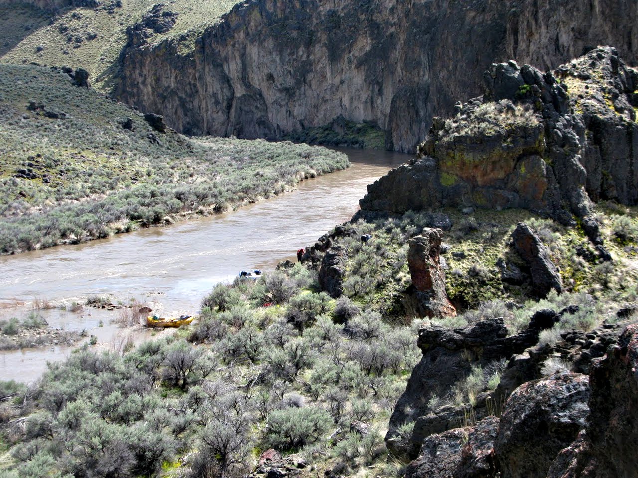
- Box Canyon on the right, possible side hike.
Many campsites from here to the confluence.
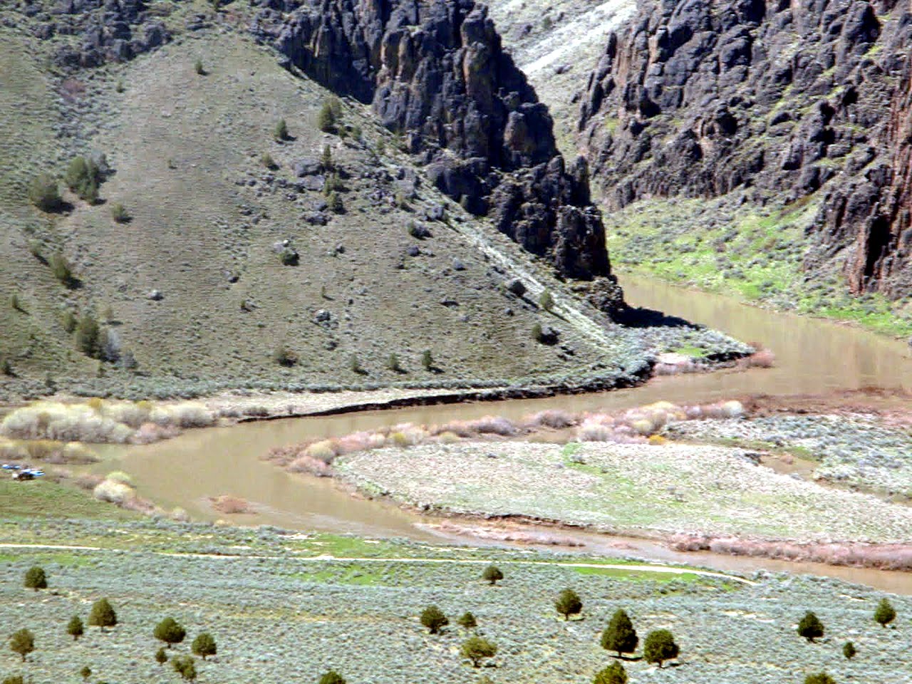
- 37 (58)
- East Fork Owyhee enters on the right, approximately doubling flow.
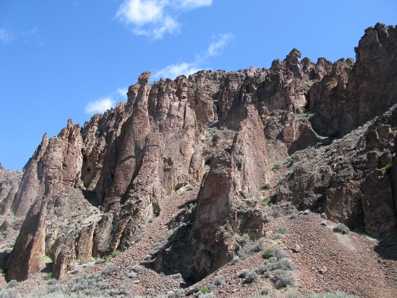
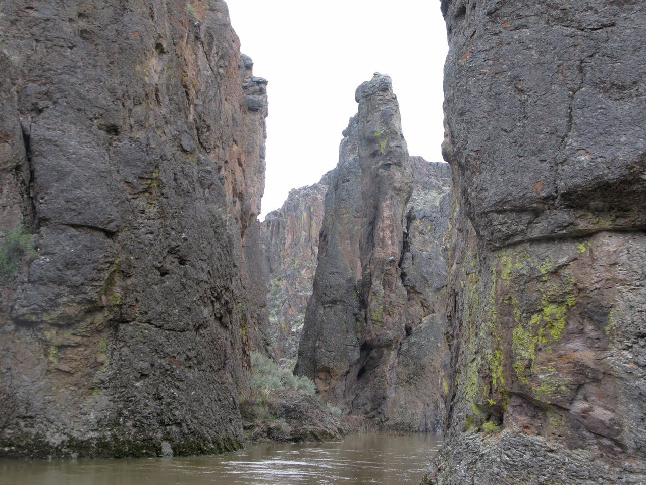
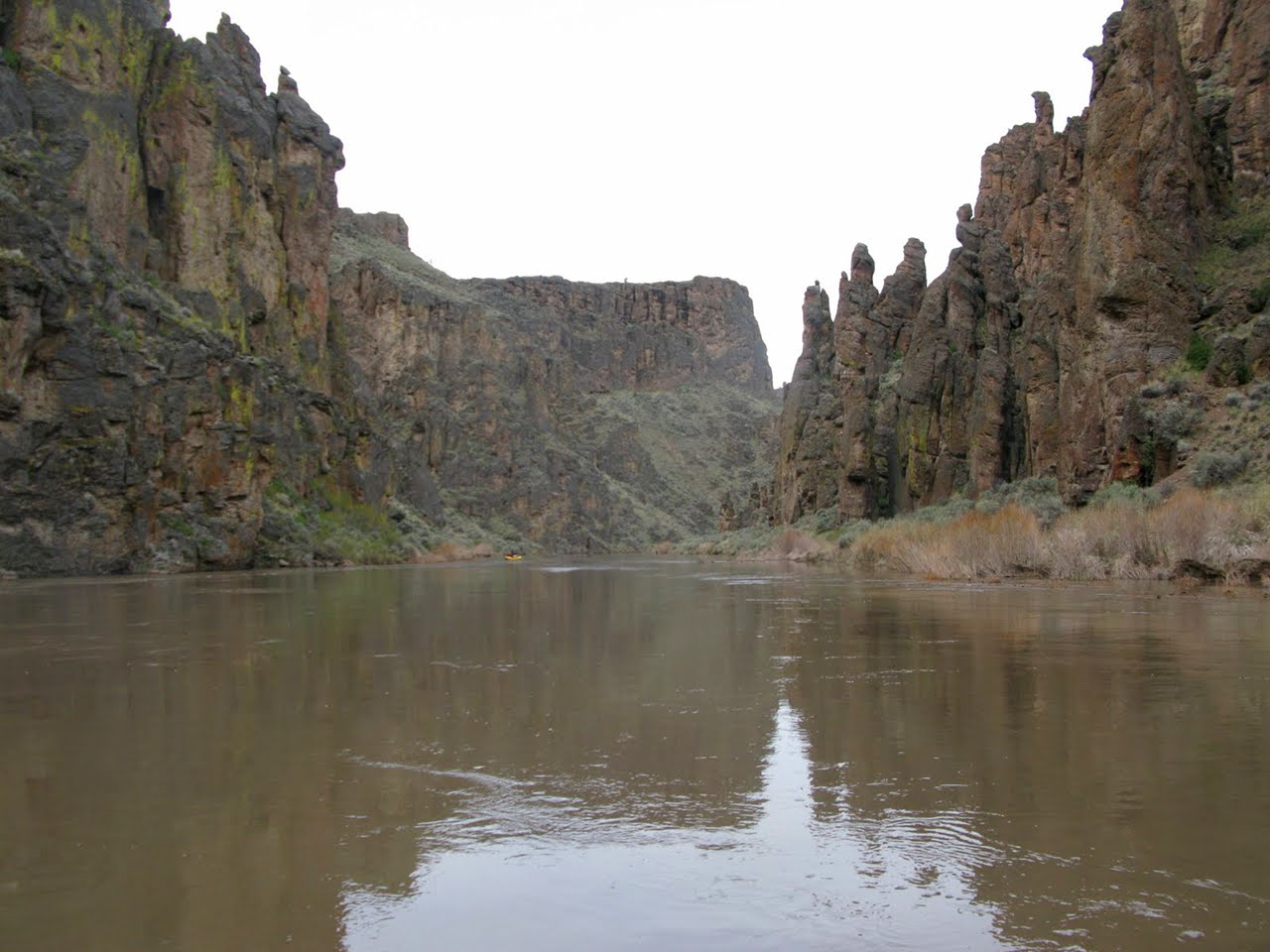
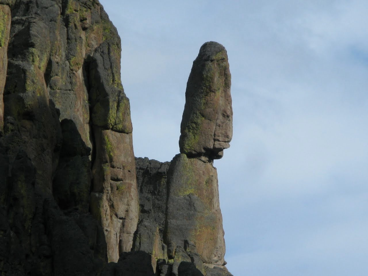
Many stupendous rock spires appear near the confluence.
Crutcher Crossing is 2 miles upstream on the East Fork,
an alternate put-in or take-out, but with poor 4WD road.
-
- 38.5 (59.5)
- House Rock rapid, more noticeable at lower flows.
-
- 39.9 (60.9)
- Class III rapid near the mouth Bald Mountain Canyon on the right,
where you find a good campsite and long potential side hike.
-
- 38.5 (64.3)
- Dukes Creek on the right, a possible side hike.
- 46 (67)
- Idaho-Oregon border. Firepan required below this point.
-
-
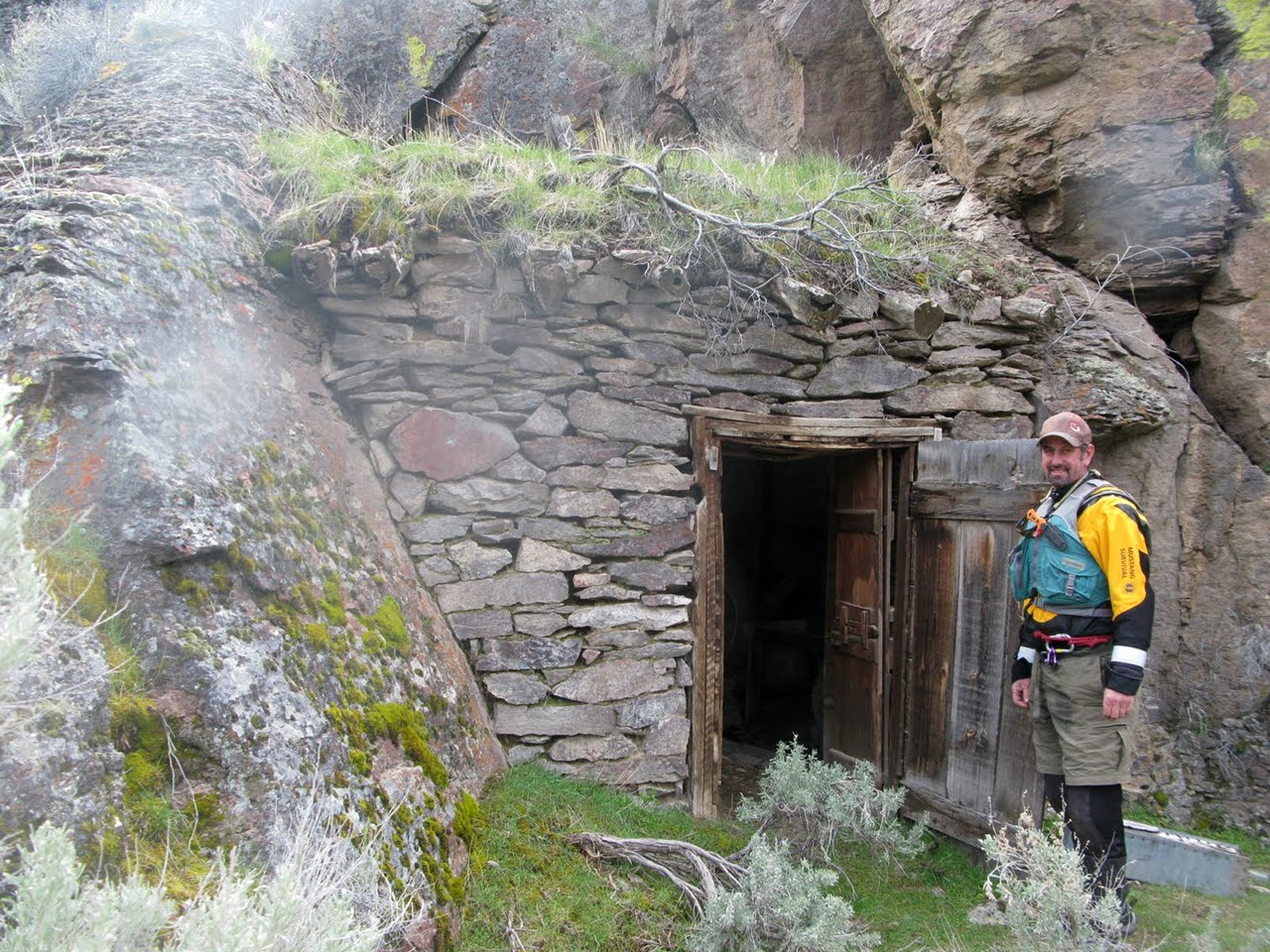
- 49.5 (70.5)
- Cabin, sometimes called Stateline Cabin, on the river bench on right,
built by Beaver Charlie. Many geographic features are named after him.
The cabin currently has no roof and is overgrown with sagebrush.
Cabin Rapid is a ways downstream, almost out of hearing.
-
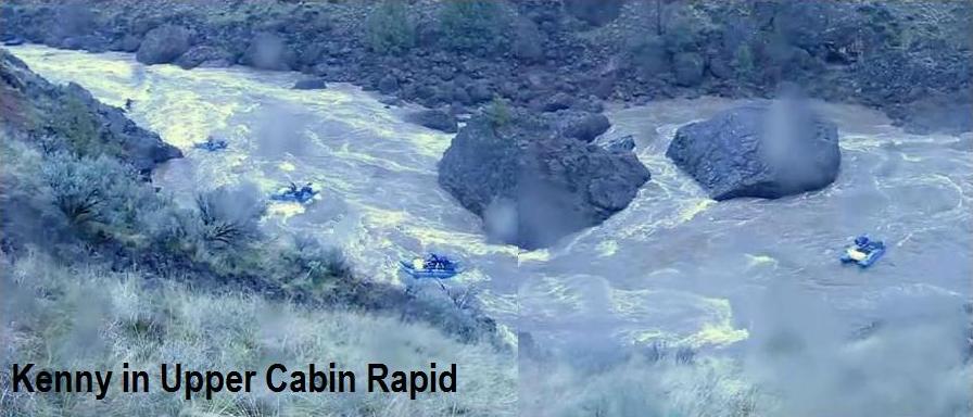
- 49.7 (70.7)
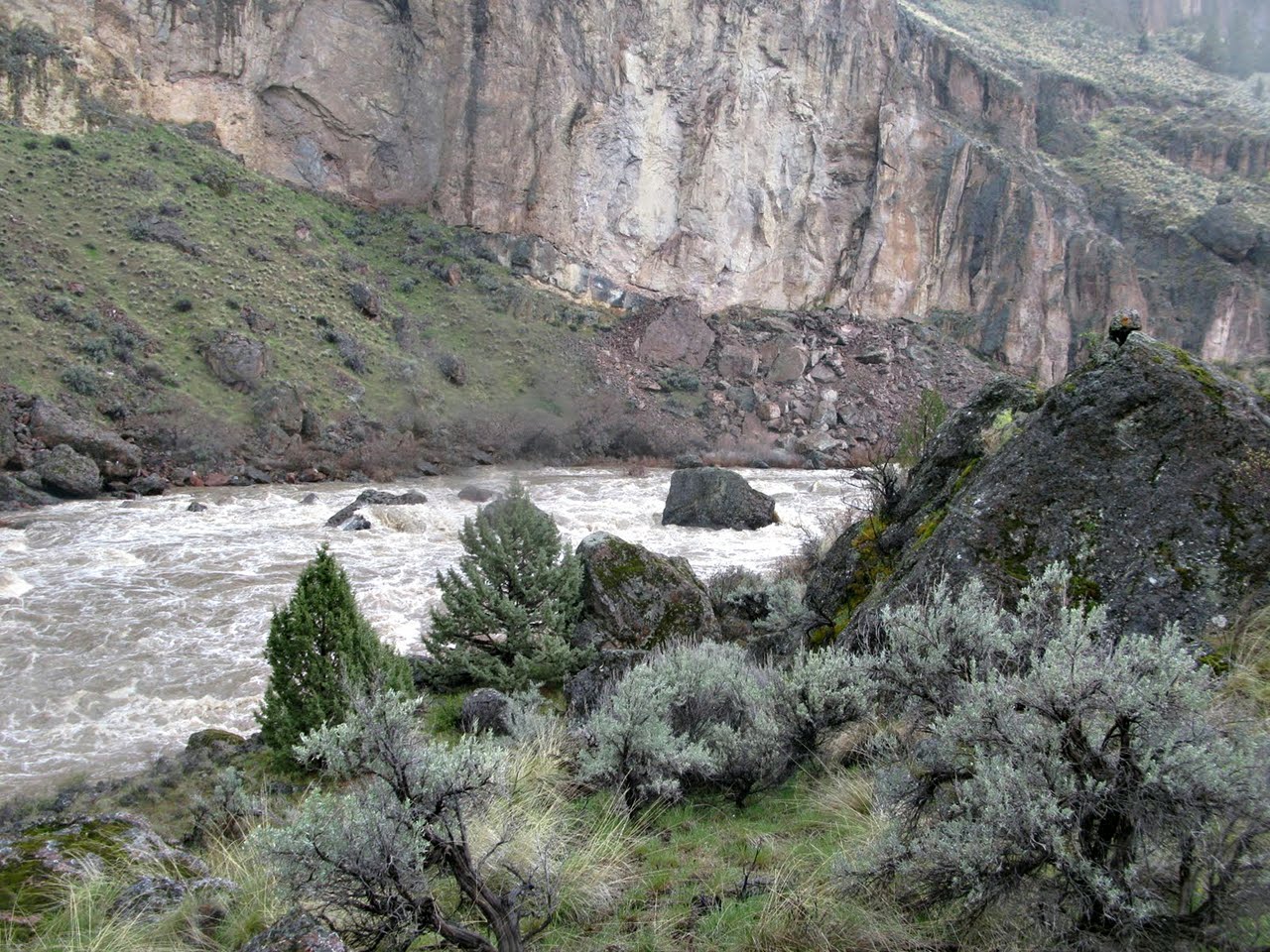
- Cabin Rapid, class IV, scout left
At low flows the first drop is class IV around a big rock on the right,
then away from the left wall, followed by a series of class III drops.
At high flows the most difficult section is after an island at a left bend,
where the current piles into Pillow Rock, a huge boulder blocking the channel.
-
If you make the move left of Pillow Rock, the remainder is a long class III.
Including all parts, Cabin Rapid is almost a mile long.
-
- 50.6 (71.6)
- Good campsite below Cabin Rapid, not marked on the BLM map.
-
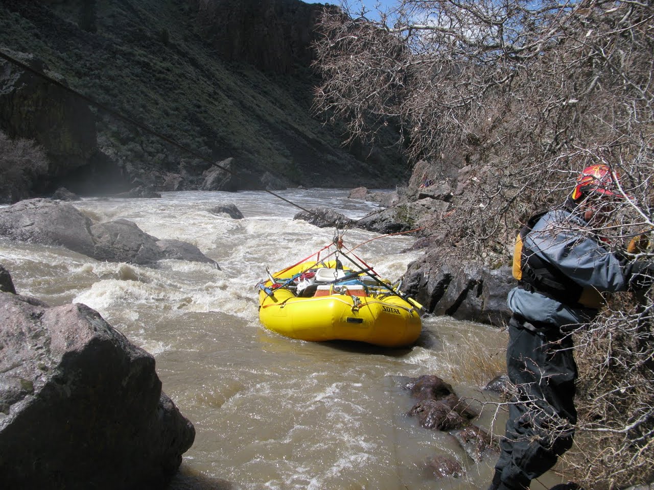
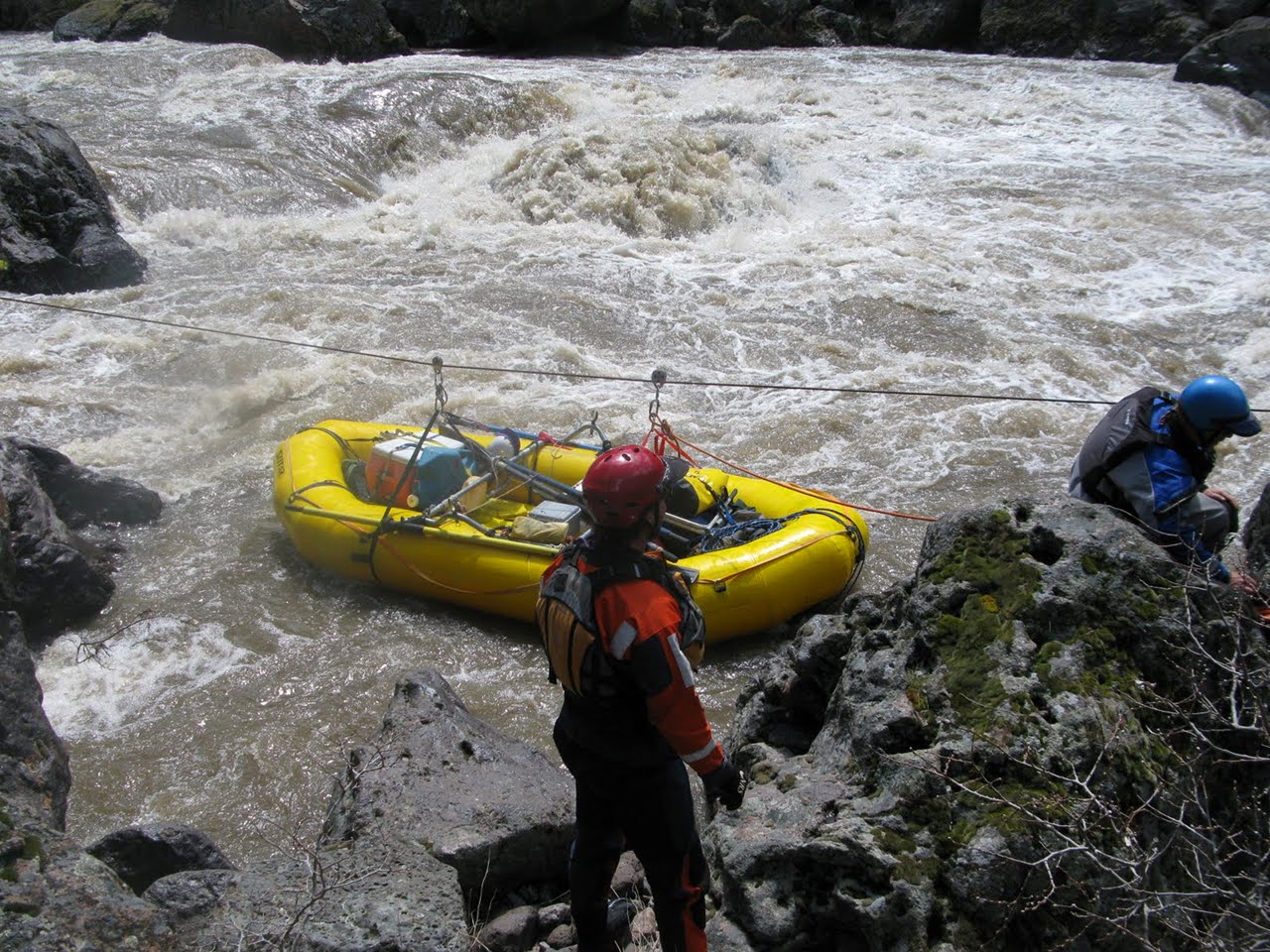
- 51.9 (72.9)
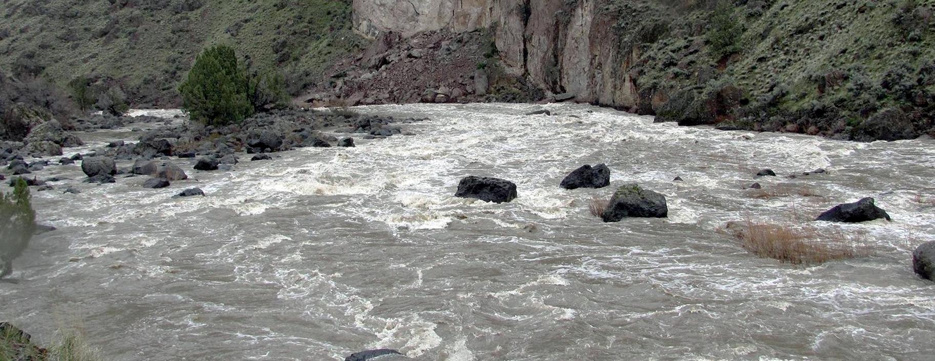
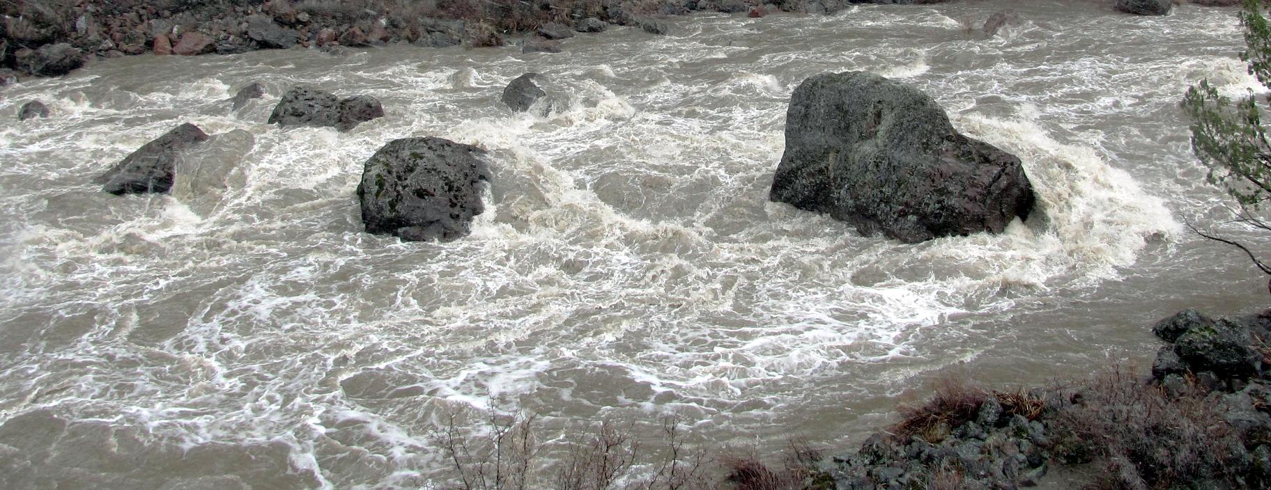
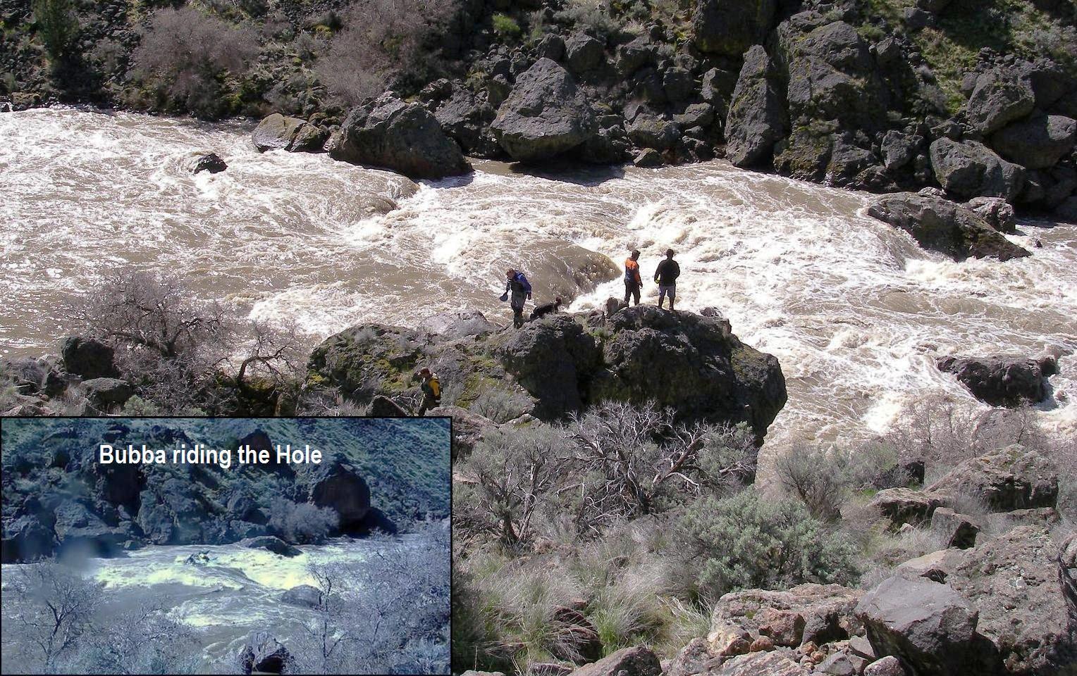
- Cable Rapid, class V, scout and possibly portage right
The right side drops steeply, ending in a rock sieve.
If you intend to run this rapid, the better routes are on the left side
with a left-right S-turn maneuver to avoid big holes in the middle,
then passing a rock and hole on the bottom left.
A cable was installed by fishing guides Helfrich and Pruitt in 1951,
and is still usable for portage assist at flows above 2500 cfs,
if you bring your own pulleys.
The portage over rocks on the right is not bad for kayaks.
-
-
- 57.8 (78.8)
- After a relatively straight section of easy water, the river bends left.
South Cross Canyon enters on the right, with campsite,
and another camp below mile 52 (79).
-
- 59.4 (80.4)
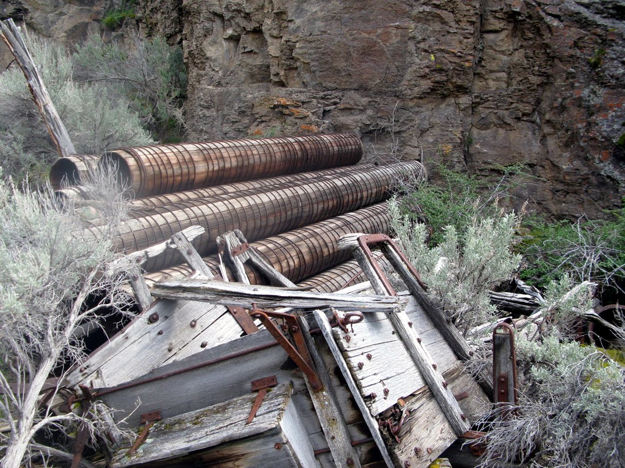
- To quote Grant Amaral's guidebook, Five Bar Ranch on the left
“is one of the most interesting historic sites on the river.
After inspecting the cabin be sure to wander further back to [see] an
old forge built into a cave [and] a stack of wooden water pipes.&rduo;
- The West Little Owyhee exits Louse Canyon and flows west of a spire,
joining the river half a mile downstream of the cabin.
A hiking trail climbs Louse Canyon, following the old access road
that the Loveland brothers built to the canyon rim.
-
- 61.8 (82.8)
- Big Antelope Creek enters on the right, with hiking trail.
- 64 (85)
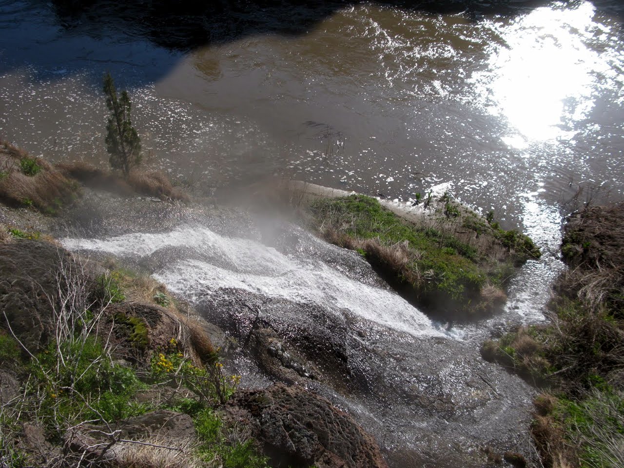
- A series of warmsprings begins on the right bank and continues
for more than three miles.
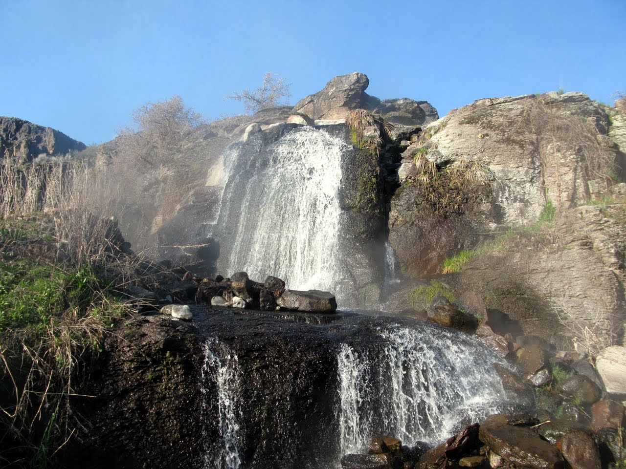
- 67.3 (88.3)
- World-class hotspring on the left bank.
Pools are deep enough to stand up in, and the warm water cascades
over a beautiful moss-decorated cliff.
A 4WD road from Three Forks reaches the right bank just downstream.
The BLM map has a campsite marked on the left near mile 68 (89).
-
- 69 (90)
- The North Fork Owyhee enters just above the take-out and launch site.
Muddy tracks lead to the river, but cleaner grass banks are available.
-
Owyhee is a last-century spelling of Hawaii,
so named because three Hawaiian trappers were lost and presumed dead
when initially exploring this area during the winter of 1819-1820.
Shuttle Directions
Shuttle drivers will save you lots of time
and can be hired out of Jordan Valley,
for example from Owyhee River Shuttle Services.
To reach put-in at the Paiute El Paso pipeline crossing,
turn west onto YP Desert road (dirt)
just south of the Idaho-Nevada border,
but north of Owyhee NV, and drive towards 45 Ranch.
Where this road crosses the Paiute El Paso pipeline,
turn southwest and follow the difficult road along the pipeline.
As it reaches the canyon, the road turns north and descends to put-in.
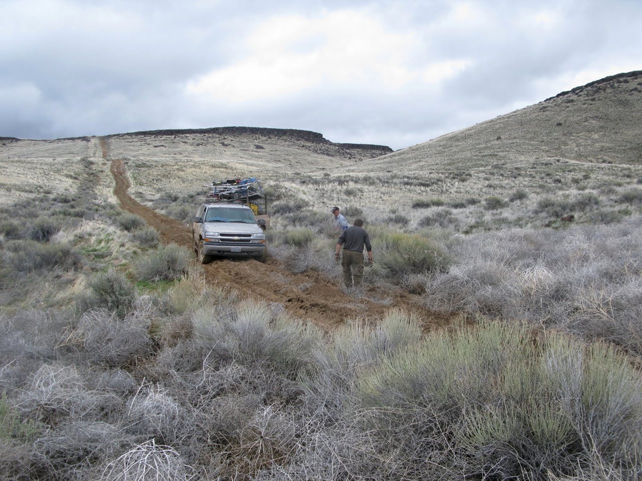
Trailers are not advised, and 4WD vehicles are recommended.
YP launch site, accessible thru Petan ranch,
is reachable with 2WD vehicles when the roads are dry.
This launch requires permission from the landowner
and adds 21 miles to the trip, mostly flatwater in a shallow canyon.
To reach take-out at Three Forks, turn south off highway 95,
17 miles southwest of Jordan Valley or 16 miles northeast of Rome,
where a small sign marks the road to Three Forks launch site.
The 36 mile dirt road is accessible by 2WD vehicles in dry weather.
The crossing of Soldier Creek can be exciting after recent rain, however.
Most of the road is on top of a plateau until it gets close to put-in.
|
|
Creeks Navigation
Home
Recommended Runs
Map of Rivers
Alphabetic Index
Alphabetic Table
Text Search
Sponsored Links
|