| |
| Stretch: |
Fordyce Reservoir to Eagle Lakes and Spaulding Reservoir |
| Difficulty: |
class V with several portages, harder as flows increase |
| Distance: |
7 or 12 miles, 1 or 2 days |
| Flows: |
rafts 300 - 600 cfs, kayaks 200 - 600, IK minimum 150 |
| Gauge: |
reservoir release
(Dreamflows) |
| Gradient: |
103 fpm average (150 210 120 80 50 80 110 90 120 220) |
| Put-in: |
below outlet from Fordyce reservoir, 6040' |
| Take-out: |
boat ramp on Spaulding reservoir, 5010' |
| Shuttle: |
16 miles (1 hour) one-way, 4WD recommended |
| Maps: |
USFS Tahoe NF, AAA Tahoe Region,
Topo
|
| Season: |
summer or early autumn, from dam release |
| Agency: |
USFS |
| Notes: |
© 1993-2002 Brad Klaas, photos by Darren Cavalli |
“Imagine the South Yuba along I-80 without the freeway, without bridges,
powerlines, or any human habitation. This is Fordyce Creek.” --Lars Holbek
Discovered by kayakers in 1983,
although probably first run long ago by native Americans,
this is one of the finest expert runs in California,
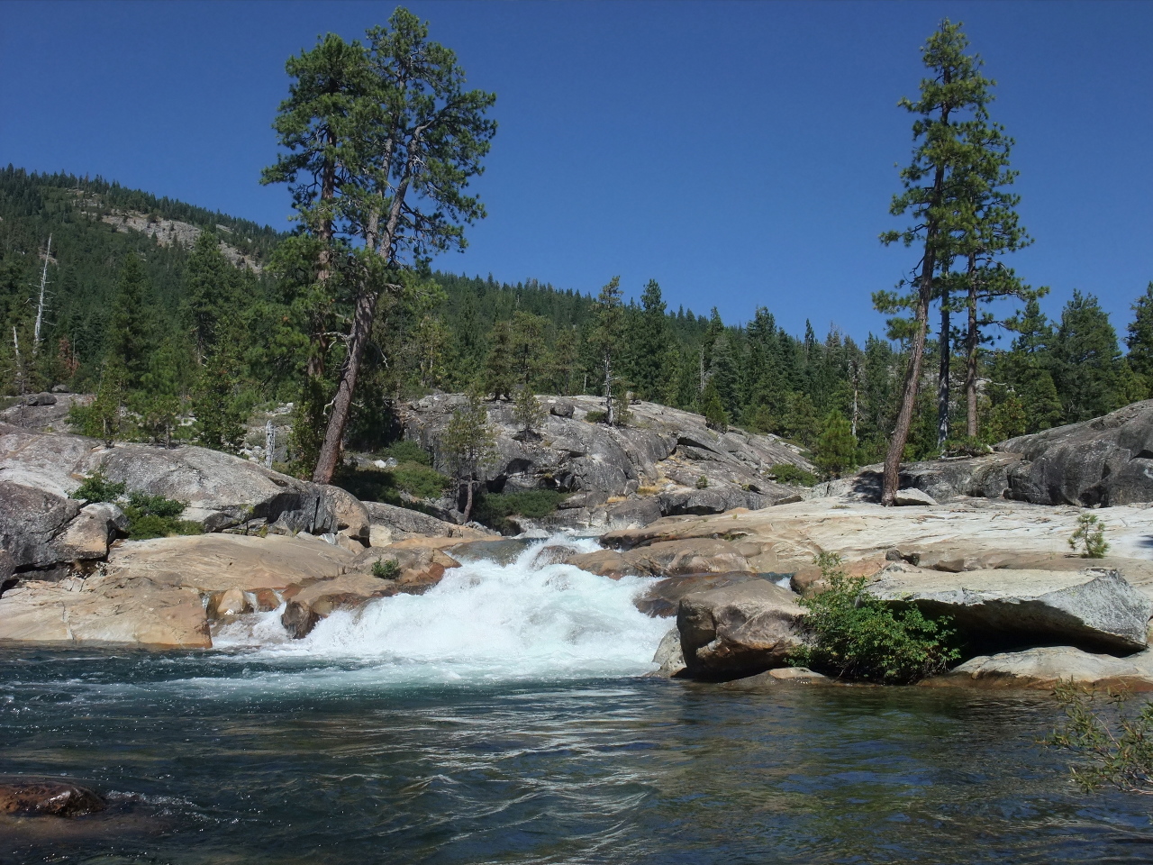
primarily for its excellent high-elevation granite scenery,
and secondarily because it flows in summer when little else is running.
The first 1.5 and last 1.3 miles are the most difficult.
Down logs are an ever-present danger, sometimes shifting from week to week.
Maximum release of the dam's hydropower valve is 600 cfs.
Higher flows result from spill or floodgate release.
Lower flows occur as the reservoir drains down, or for Jeep jamborees.
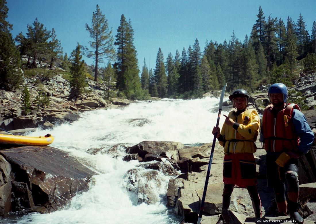
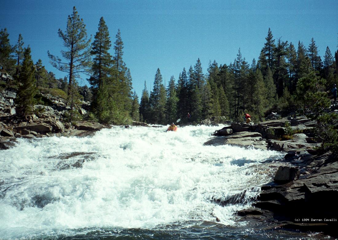
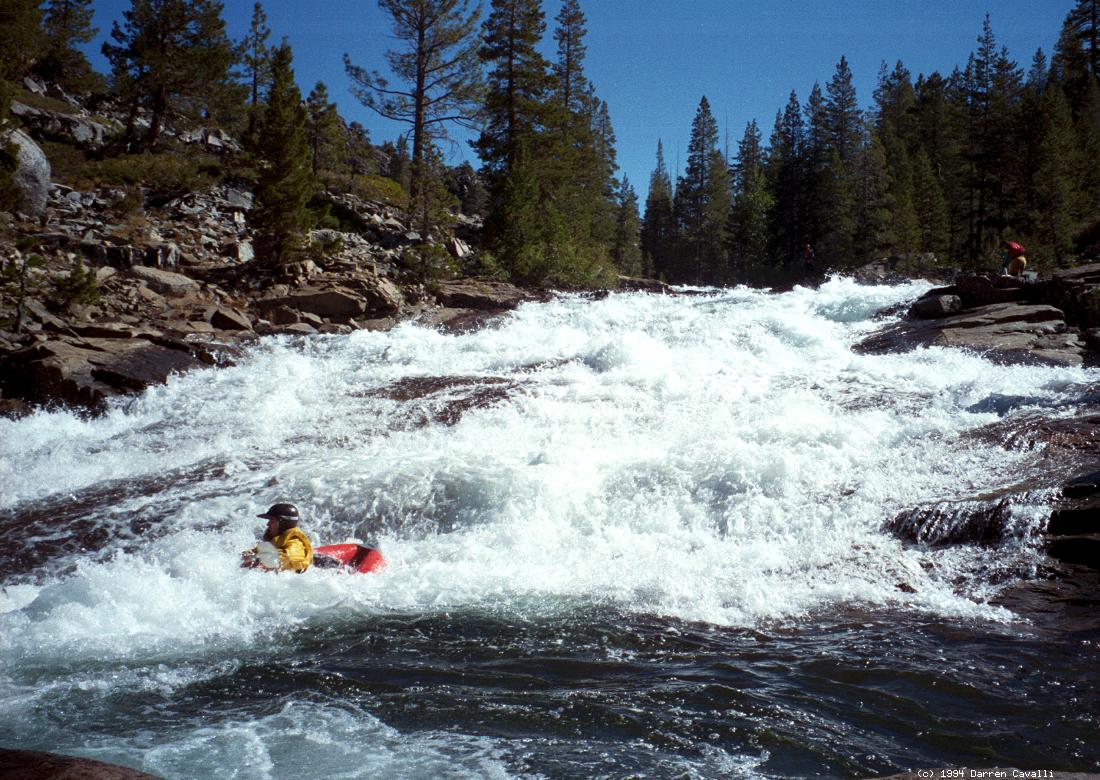
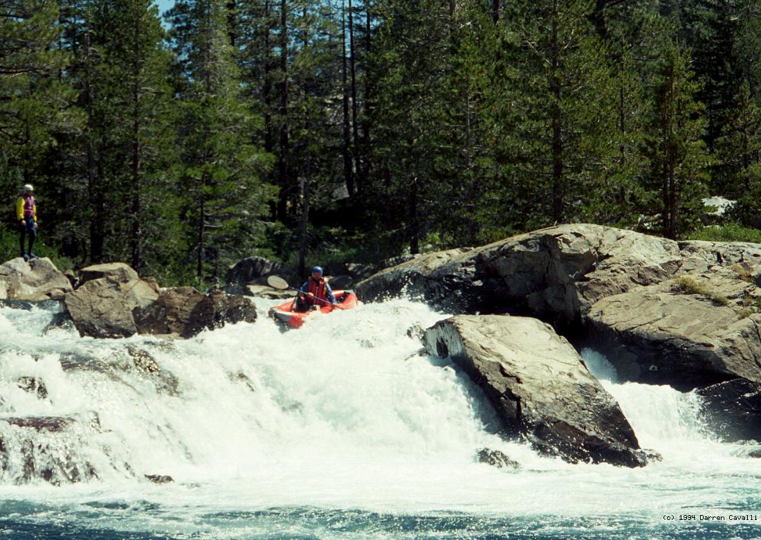
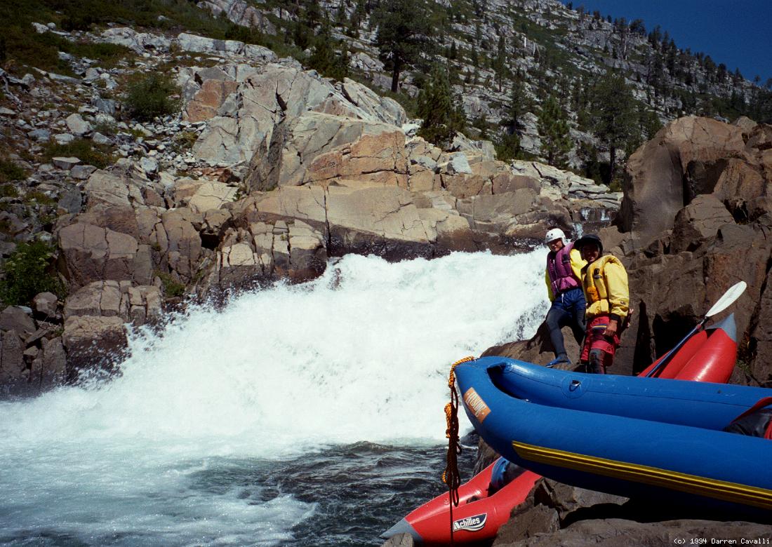
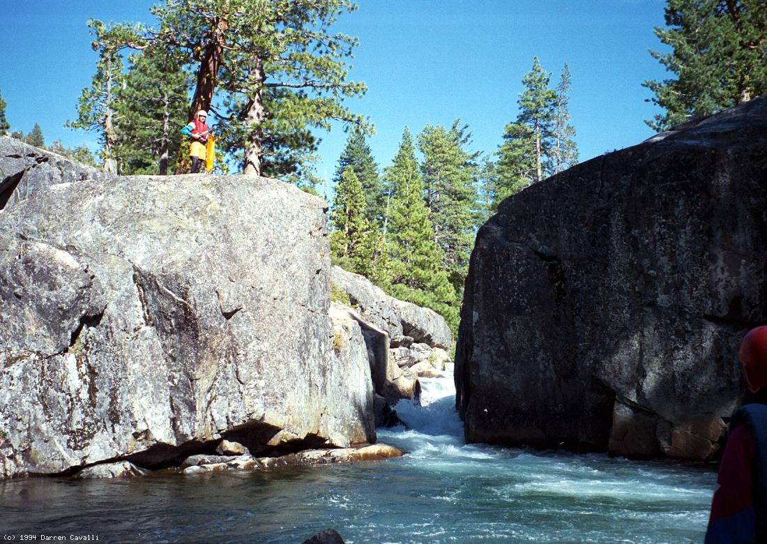
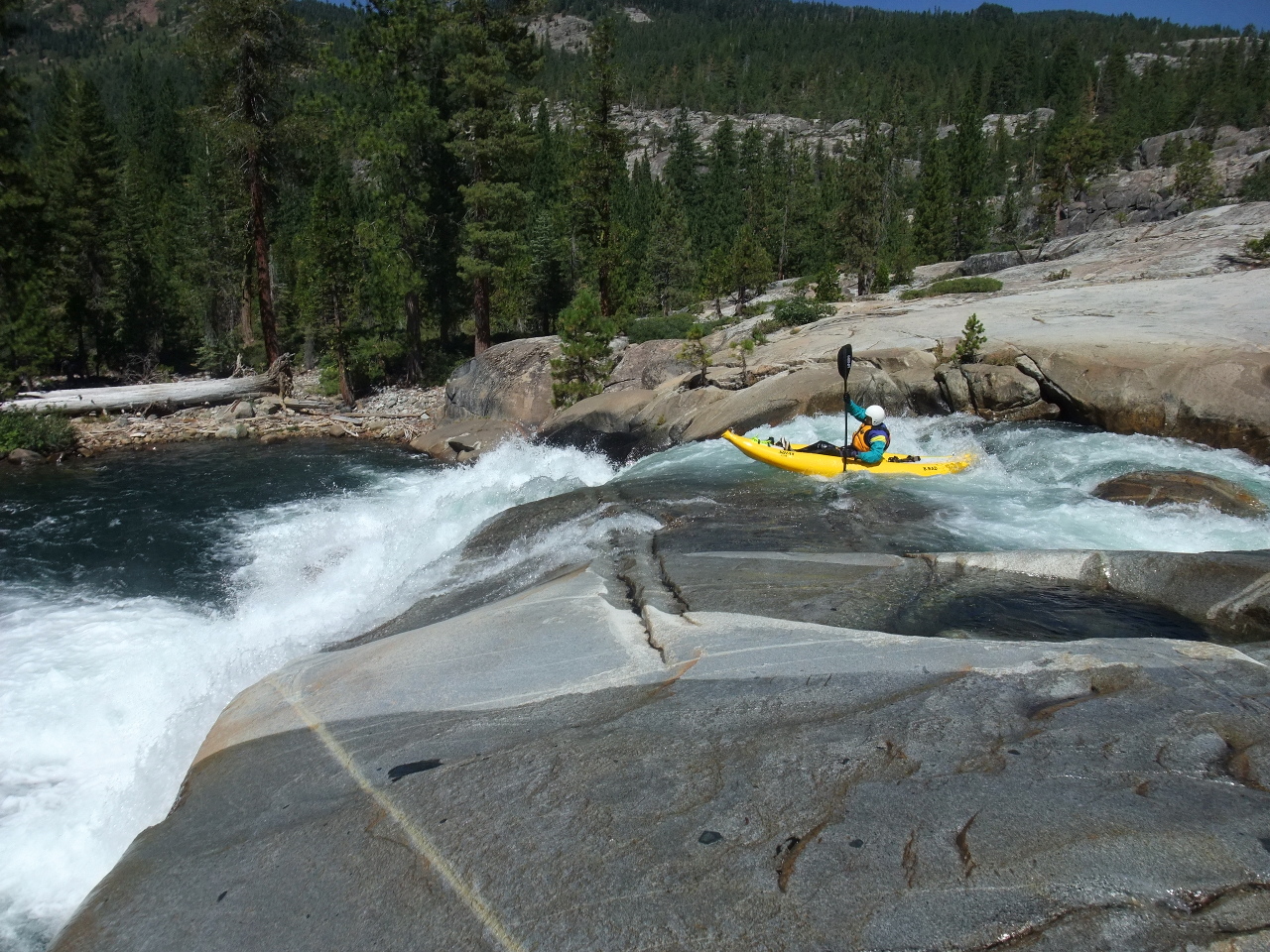
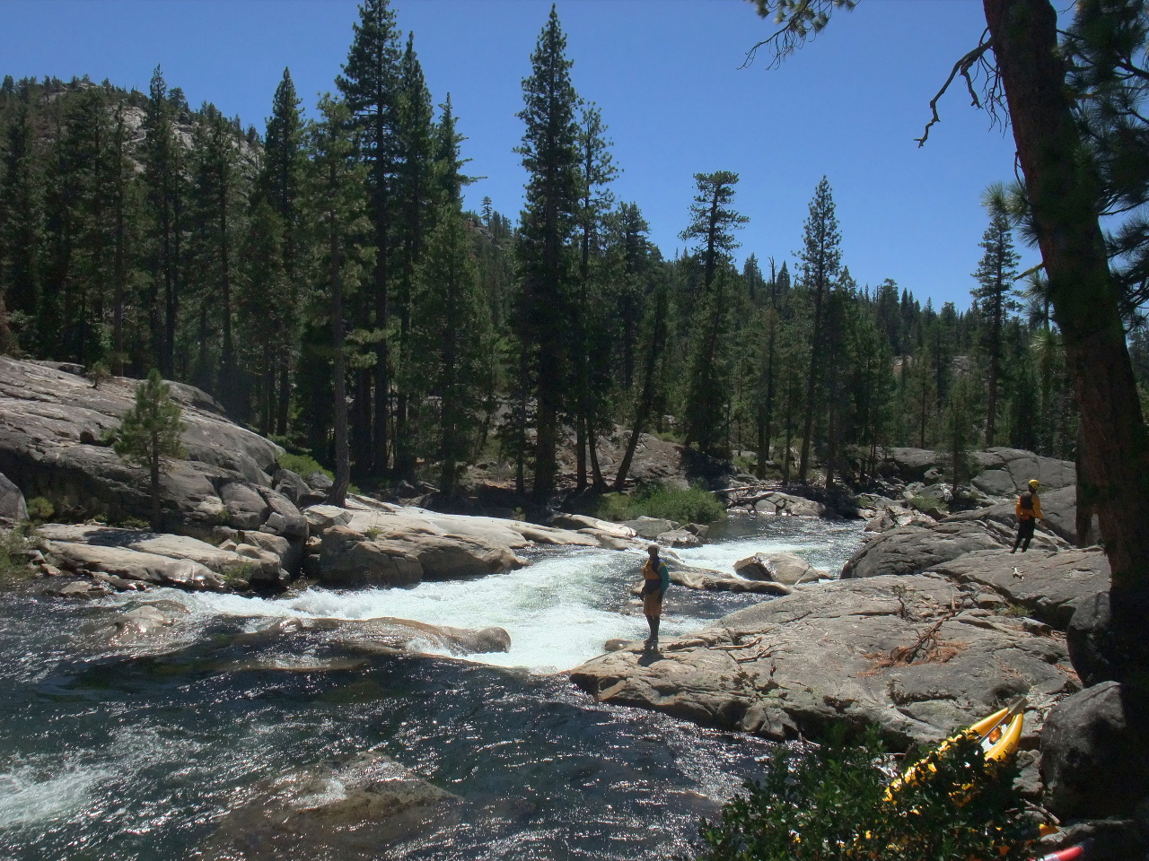
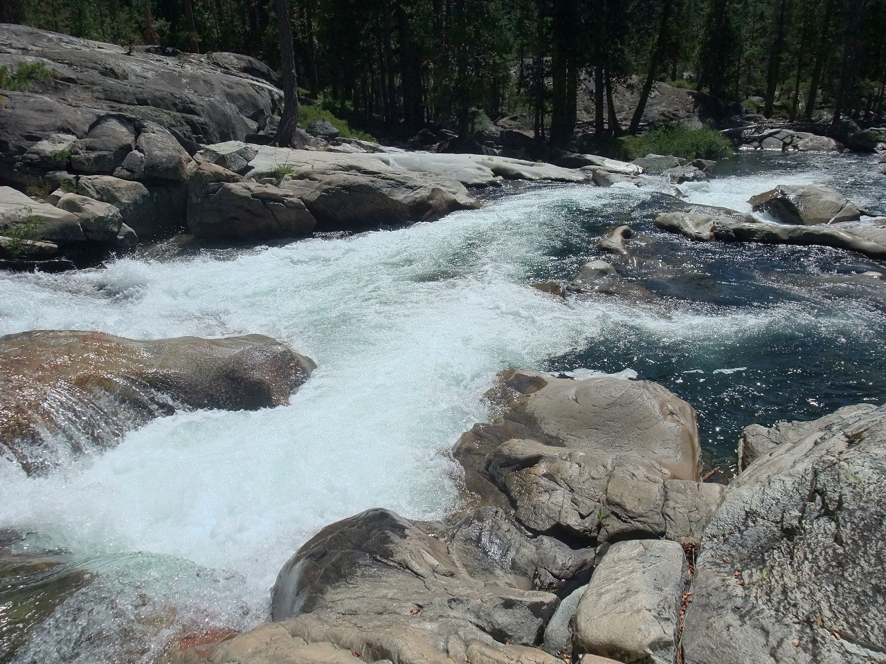
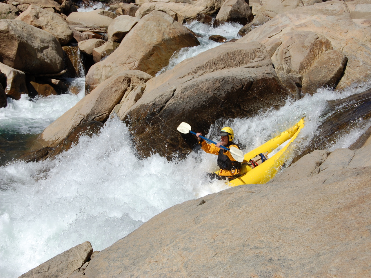
Ten miles of class V rapids and 2 miles paddling across a reservoir
makes for a very long day, especially if you are one of those careful
(still alive) boaters who likes to scout dangerous rapids.
The best idea is to split the run into two days,
camping a bit more than halfway down near Eagle Lakes.
See the shuttle instructions for details.
- mile
- 0
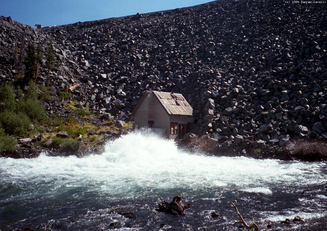
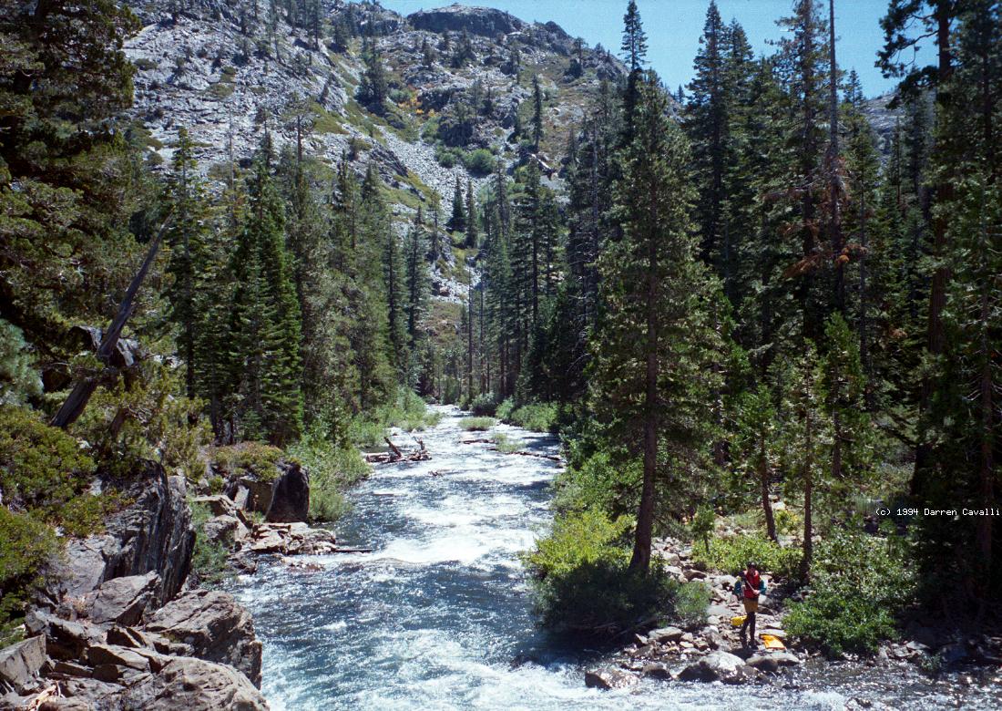
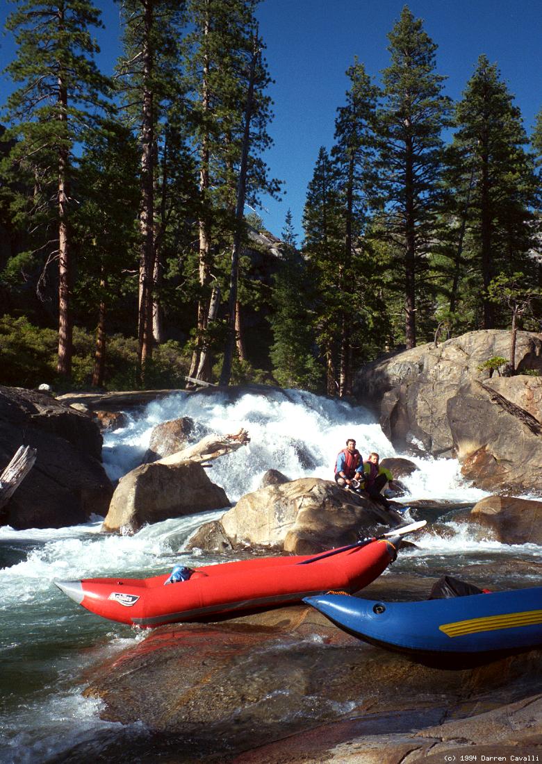
- Put in at the bottom of Fordyce dam, hoping it does not rupture
until after you get your boats inflated. A road traverses the top
of the structure to some buildings, visible in the photo.
-
- .2
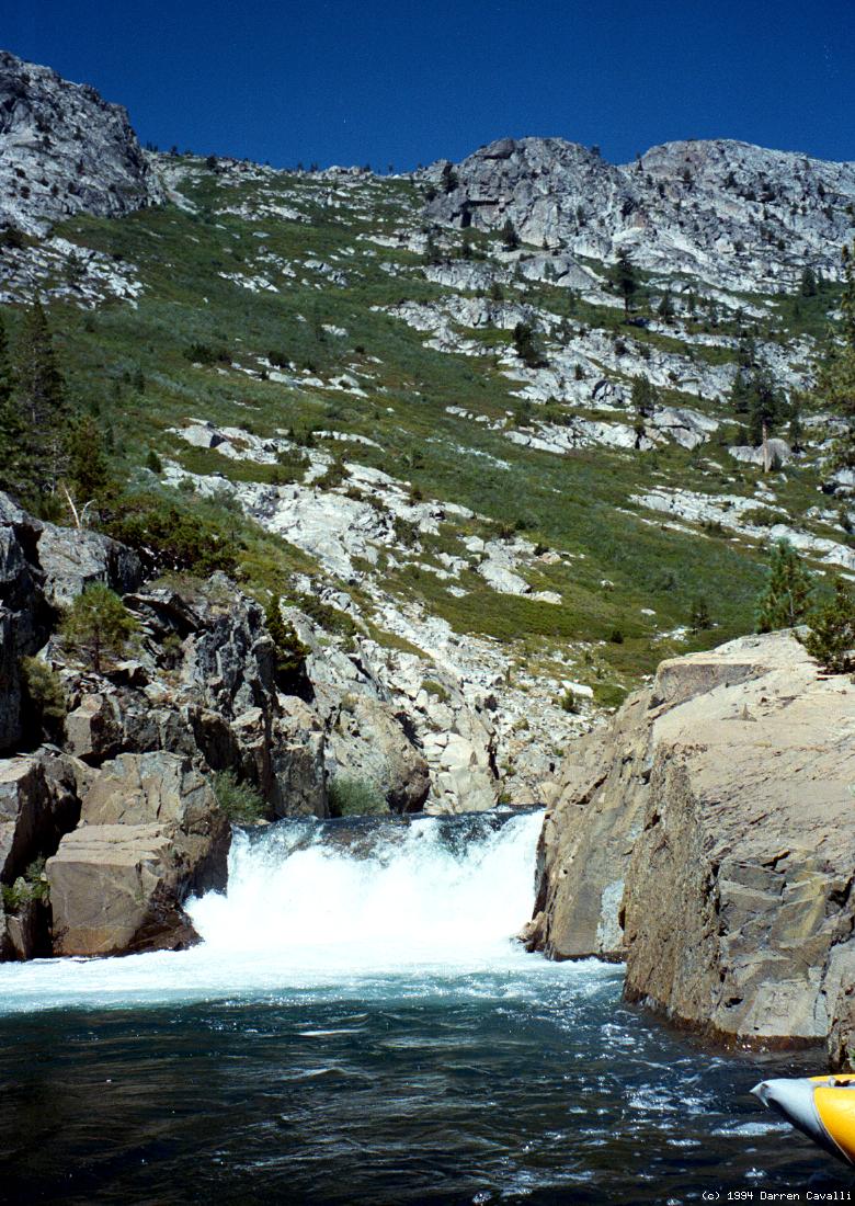
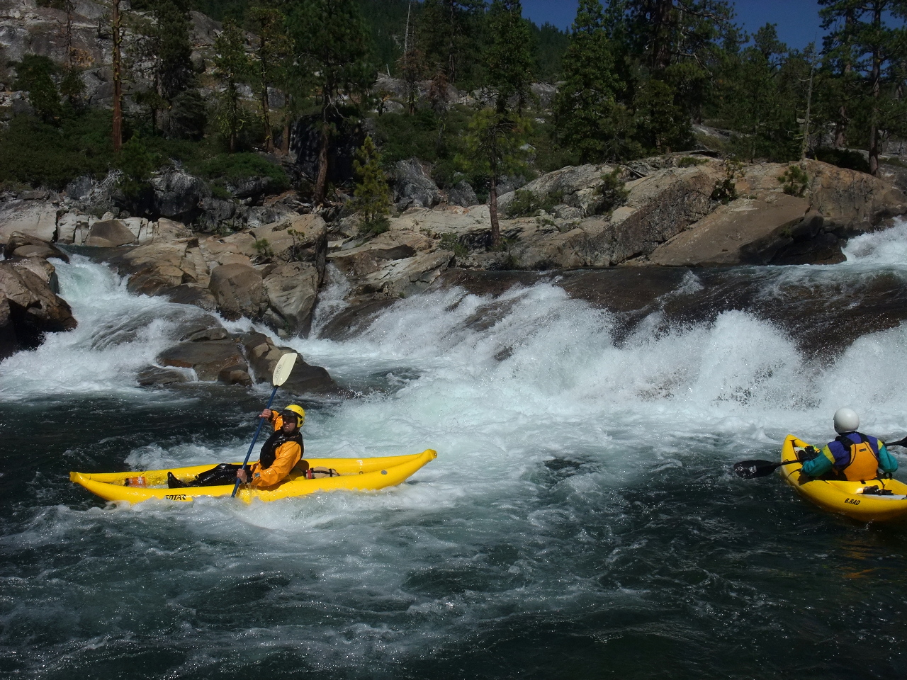
- Eraserhead, class V, scout left
A surging drop over barely submerged granite, with deep holes and
big rooster tails. It's amazing that a relatively small flow can
create such large hydraulics.
-
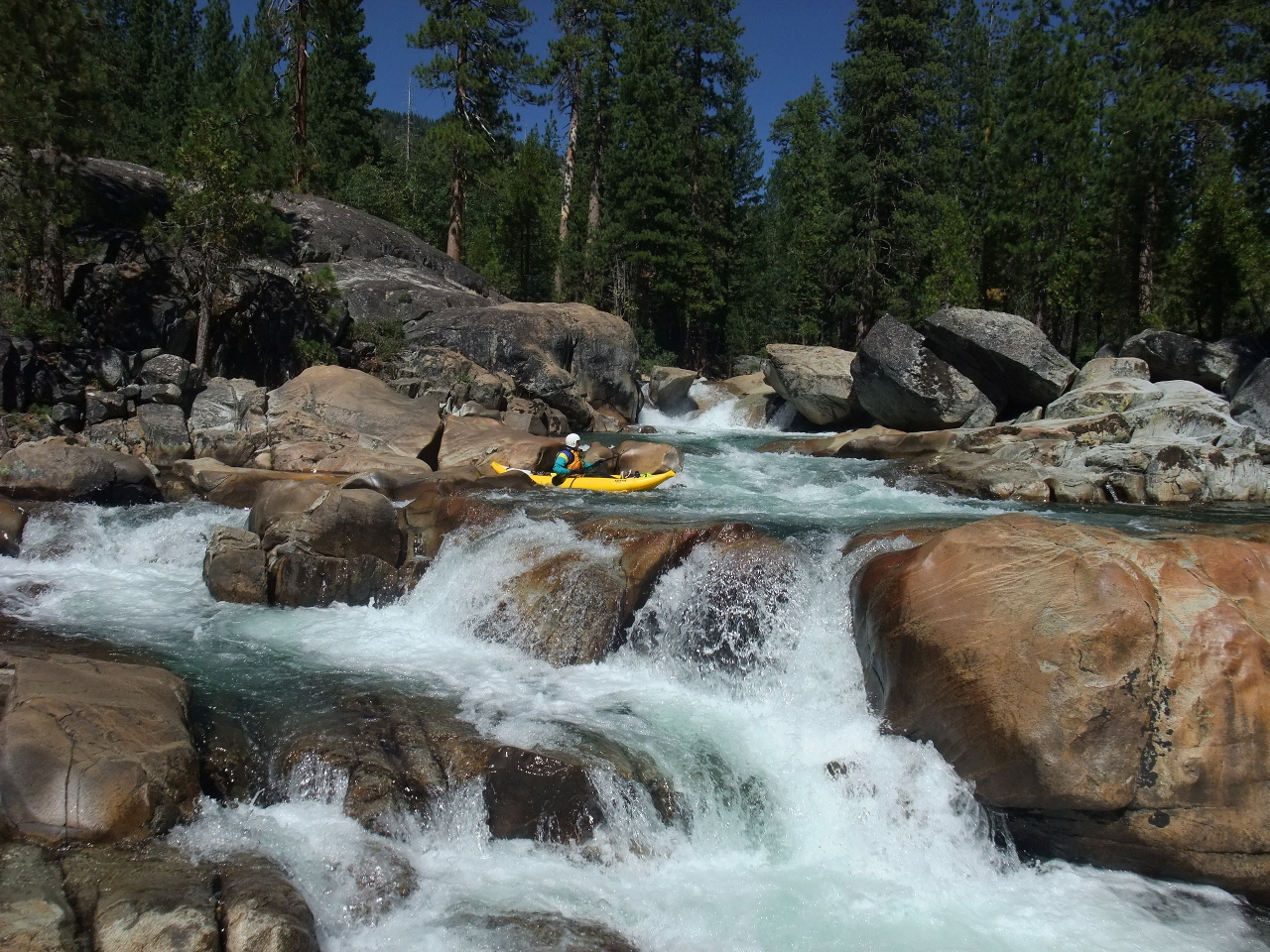
- .4
- Fountain, class IV, a short 7' cascade on the left. Continuous
class III rapids follow.
- .65
- Fast and Furious, class IV, a sluice box of ledge holes with some
bigger ledge holes near the end.
- 1.05
- Old Man, class IV+, scout right
The far left channel squeezes down to almost nothing, but a good
rightward traverse leads to a relatively clean drop. Kayakers should
beware of a turbulent eddy fence below the entrance on river right.
Below, the canyon opens up as Old Man Mountain towers above.
-
- 1.2
- Insanity Falls, probably unrunnable, portage left
It would be hard to stay upright in this explosive falls/ramp (in
Holbek's words), and there are many submerged rocks that could cause
injury or entrapment considering the violent pace of the current.
-
- 1.3
- Loco[motive Falls] 2, class V-, scout left after portaging
The right side drops into a rock wall, where one kayaker pitoned and
broke both ankles. Left of center is a clean 9' drop into a pool.
- 1.35
- Bishop's Balcony, class V- to unrunnable, scout right
The river pours over a horseshoe drop into a series of rocks, where
both kayaks and rafts have pinned. A cleaner channel on the left
pours into a trough undercut on the left wall. Sneak route on the
far right, which hardshells could traverse at higher flows or where
inflatables could be lined at lower flows.
- 1.37
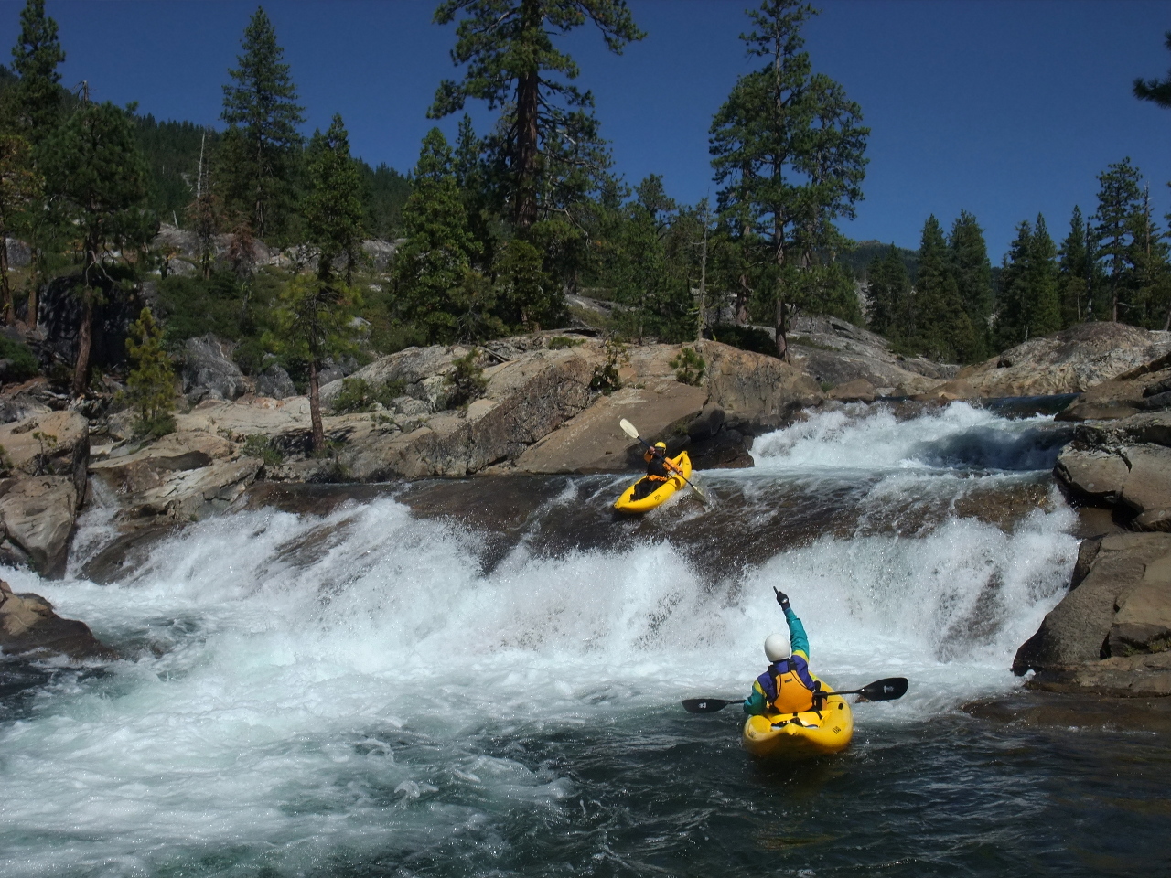
- Tailstand, class IV+, a 6' high river wide drop among boulders,
the entrance of which closely follows Bishop's Balcony.
- 1.39
- Mini Gorge, class IV to IV+, after a small pool, a series of ledge
holes beginning at a sharp left bend. The current forces boats into
a pyramid rock. When the river bends left again, proceed cautiously.
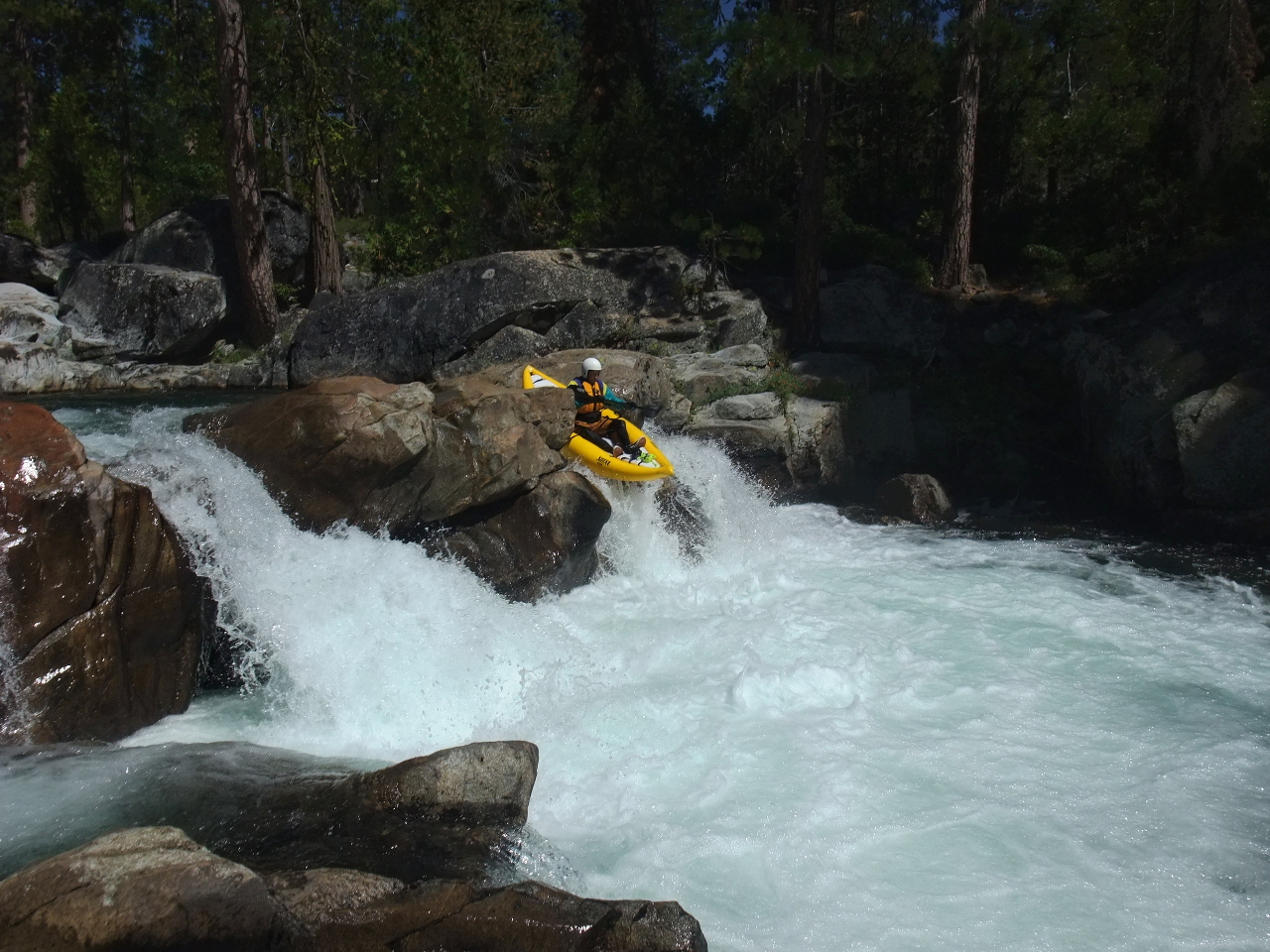
- 1.5
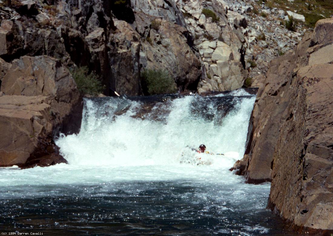
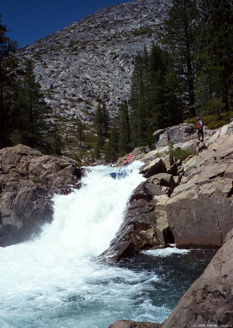
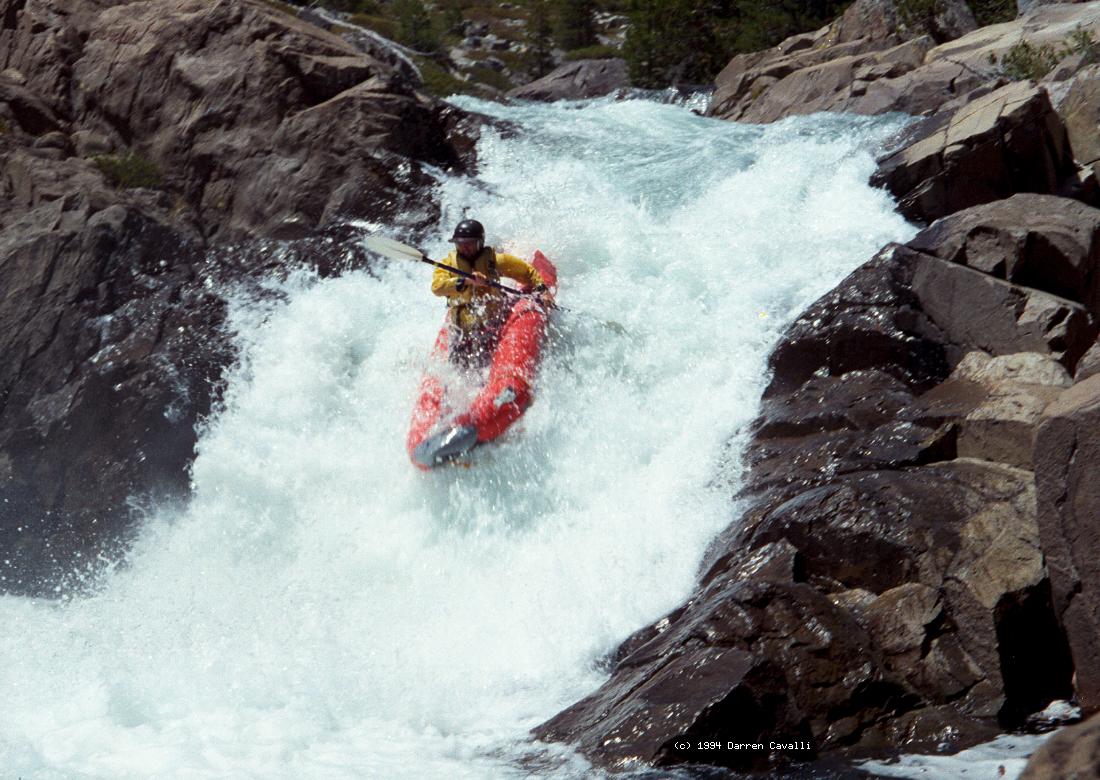
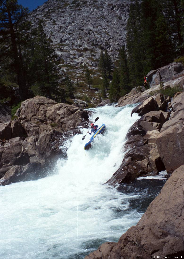
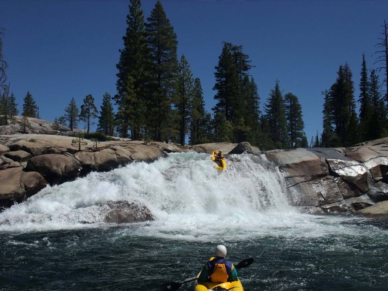
- Rotator Cuff, class V, scout left
A 20' waterfall so named because hardshell kayakers often dislocate
shoulders in the turbulent bottom, less of a problem with inflatables
because they do not tend to bury as much. Even the entrance drop is
difficult; you might want to start facing upstream from a kayak-wide
rock eddy on river left near the top. The force of current speeds you
over the falls into the hole below, which is not sticky and has a good
recovery pool. Often a left-to-right angle and ferry is advisable.
Boats usually flip counterclockwise, contrary to how the water looks.
-
- 1.6
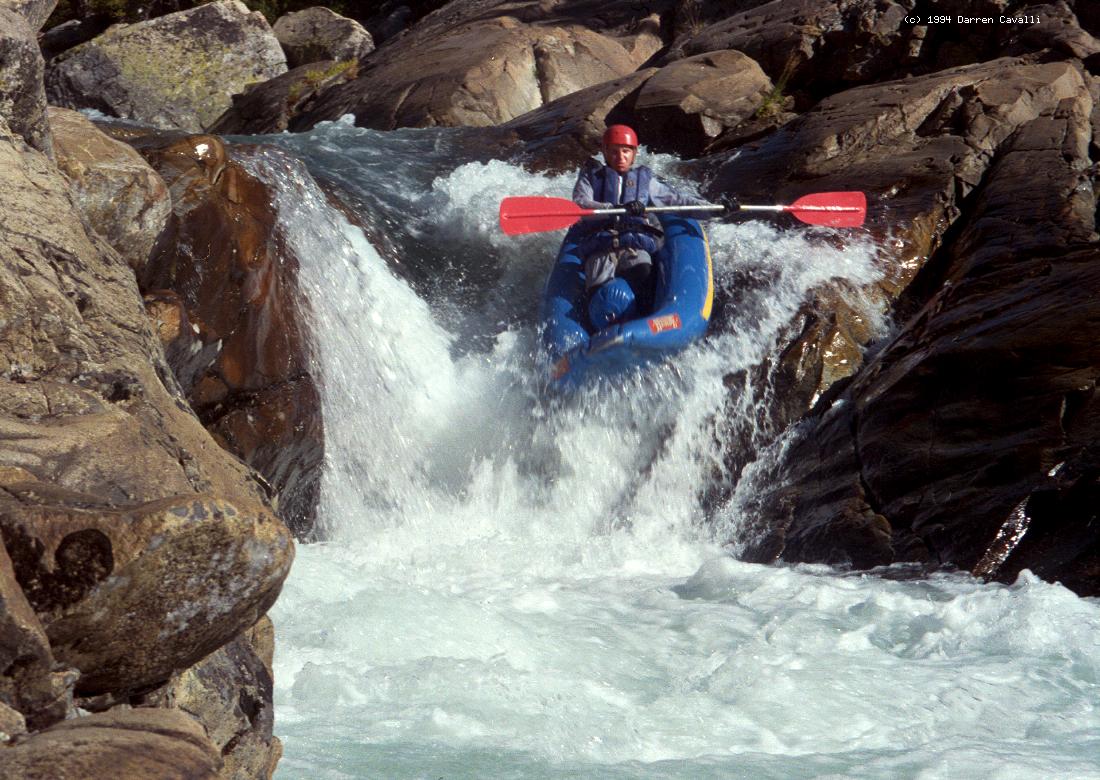
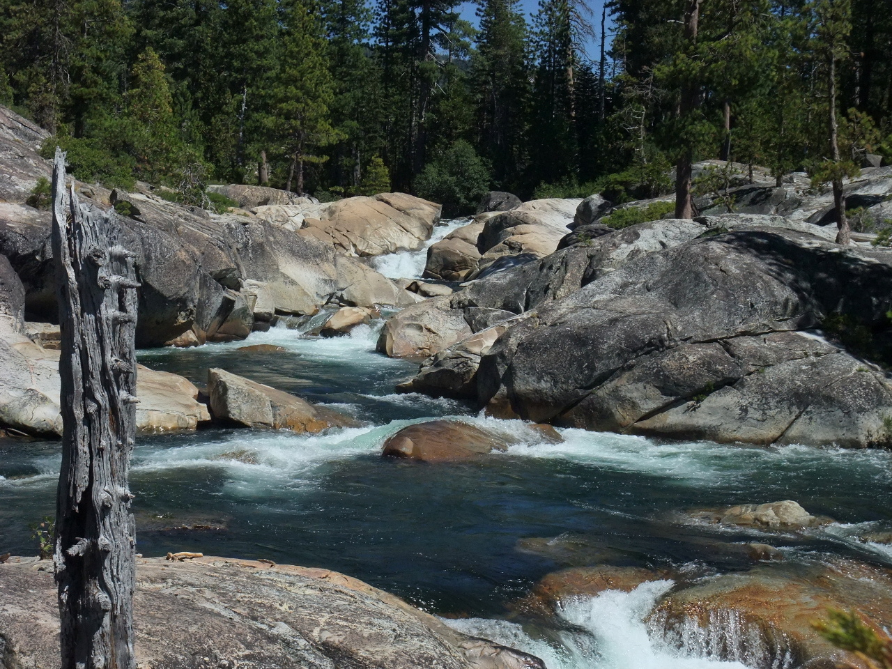
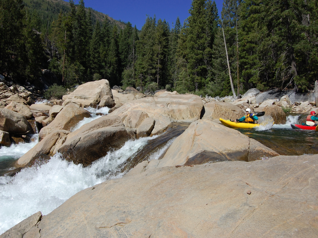
- Autobahn, fun class III action.
- 2.8
- Mini Gorge 2, class IV+, scout right
The river makes a sharp U-shaped left turn, and twists thru a series
of ledge holes. The current likes to force boats into a pyramid rock.
- 3.5
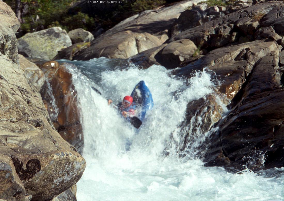
- China Squirt, class IV+, scout either side
A 12' falls into a deep hole sends kayakers almost to China, from
where buoyancy might squirt you back out! Boof right, staying out
of the recirculating undercut on the left.
- 3.9
- Tim's Crack, class IV
After a long scenic section, the current leads along the right wall
into a hidden V-shaped crack. Kayaks can cross a boulder picket fence,
but rafts must make a difficult left move at the brink of the crack.
- 4.02
- Little Squeeze, class IV+ to unrunnable
The water constricts between a granite wall and a house-size boulder.
Boats wider than 74" must portage. Just below is a magnificent pool
with a great campsite on river right.
- 4.7
- Limbo Log, class IV-, in the midst of negotiating a rapid, just below
where a 4WD trail crosses the river. In 2002 the limbo log fell down,
necessitating a short portage. Stay right in the falls below.
- 5.5
- Big Squeeze, class V to unrunnable, scout right
After a long scenic section, the river splits; most current goes left,
as you should. Eddy out on the right where the channels rejoin.
Below a steep drop, the creek narrows down to a meter-wide slot.
Although initially considered a portage, kayaks often run it now.
Rafts and fiberglass kayaks should definitely portage! Portaging
on the right is easiest if you go around the granite dome. In 2002
a tree had fallen and a large log remained in the drop.
-
- 6.2
- Lost+Found, class IV-, where the 1997 flood short-circuited a U-turn
by choking it with logs. High water during 2002(?) appears to have
returned this rapid to its previous condition.
- 6.4
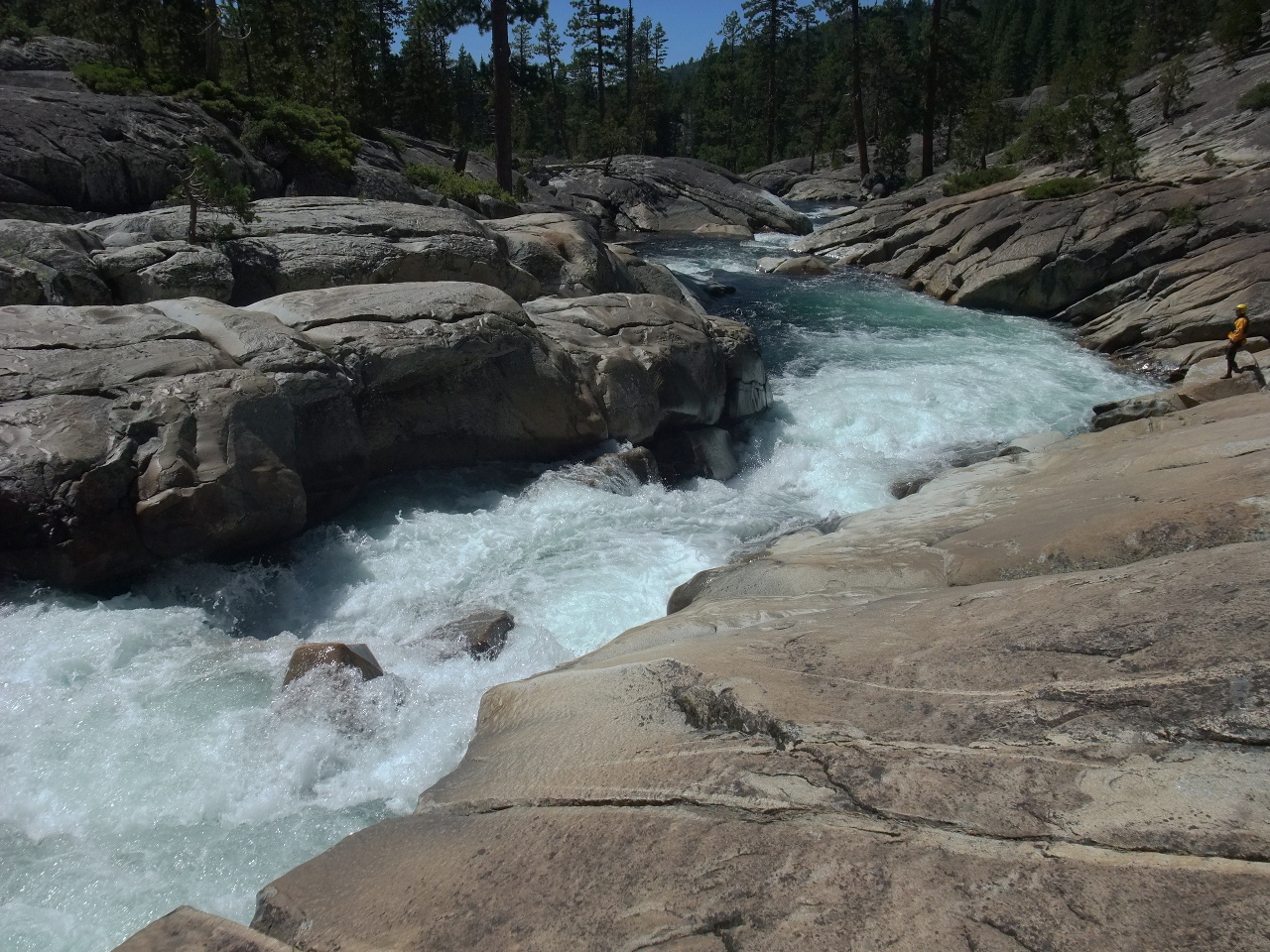
- Where's Barry?, class V to unrunnable, scout right
The river drops 6' over a ledge angled 45° to the current, while
less water folds in from the left. This folding wave formation is
bad enough, but is followed by a boxed-in hole and a huge undercut
cavern. Be sure to set safety in case of swimmers. In recent years
a jammed log on the right makes this drop virtually unrunnable (2002).
Easy portage on the right, with possible seal launch.
-
- 6.9
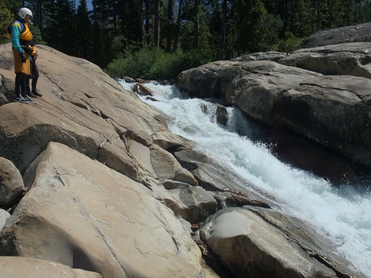
- Bad Seed, class V+, portage right
A mess of big boulders in a tall steep drop act as a log strainer;
even if clean there are few viable routes. Possible seal launch below.
-
- 7.1
- Hiking footbridge, concrete and green metal, and trail to Eagle Lakes.
A hiking trail leads north to Beyers Lake. This is a good place to
leave your boats overnight and camp at vehicles left near Eagle Lakes.
-
Take the right channel where the river splits below.
- 7.2
- Sidewinder, class IV+, scout right
A long technical boulder slalom over and around a series of ledges,
with easy eddy hopping, and ending in a large rock/hole combination.
- 7.5
- Pierce Meadow Trailhead. This is another place to leave your boats
overnight, and hike up and downhill about 3 miles to vehicles left
near the South Fork Yuba. There used to be a 2WD road to Pierce Meadow
over private land, past an A-frame cabin, but it was torn up (2010)
to prevent motorized access. Easy water for a while, past good camps
accessible by trail on the right bank.
- 8
- Typewriter, class IV+
The second of two ledge drops has undercuts at each corner,
so boats can get surfed like a typewriter carriage side to side.
The creek is extremely scenic in this section.
- 8.7
- In Your Face, class 4e (IV moves, V danger), scout right
The bulk of the current traverses rightward, falling gradually off
a ledge, into a big boulder on the right. You can pick an exit point
where there are no submerged rocks at the bottom. Named after a
rafter who struck and injured his face on a crewmember's helmet.
-
- 8.98
- Unnamed Drop, class III+, an horizon line and 10' ramp below a split
in the channel.
- 9.02
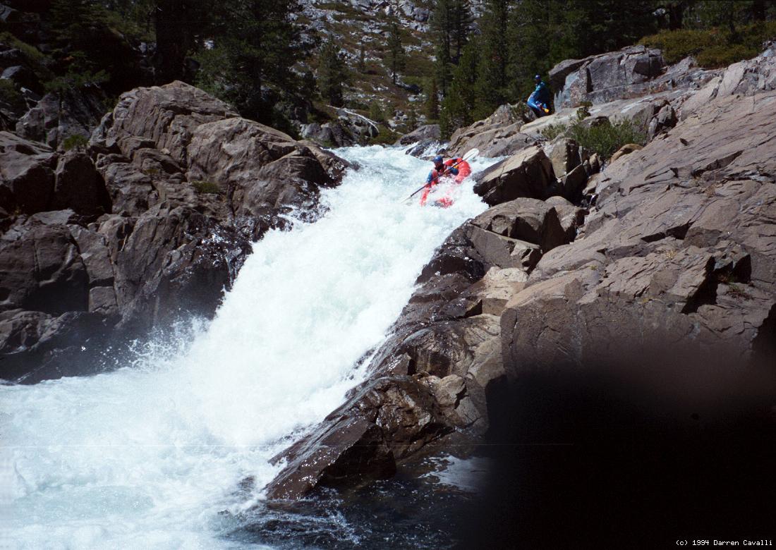
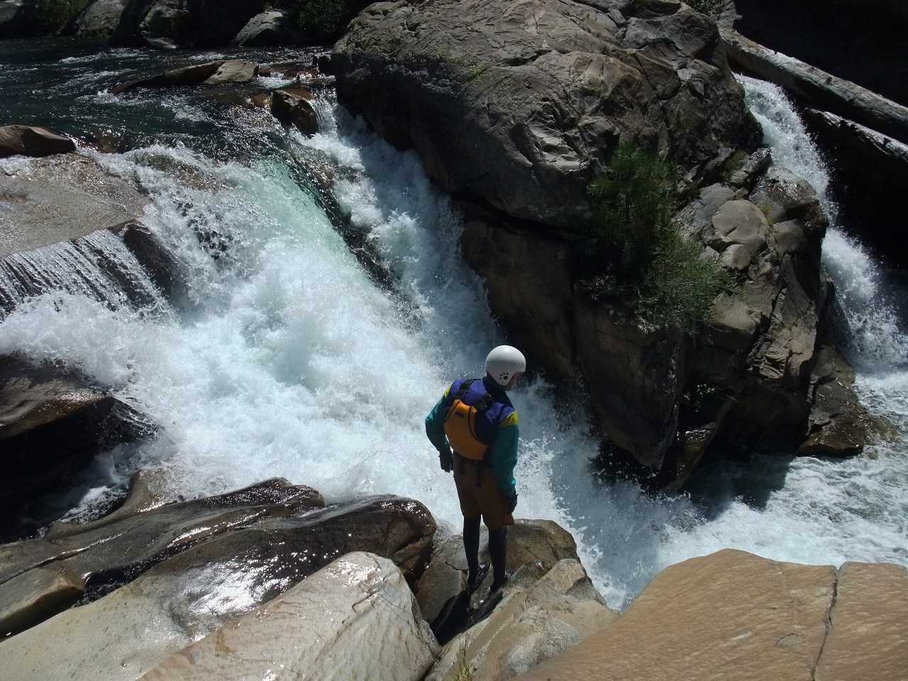
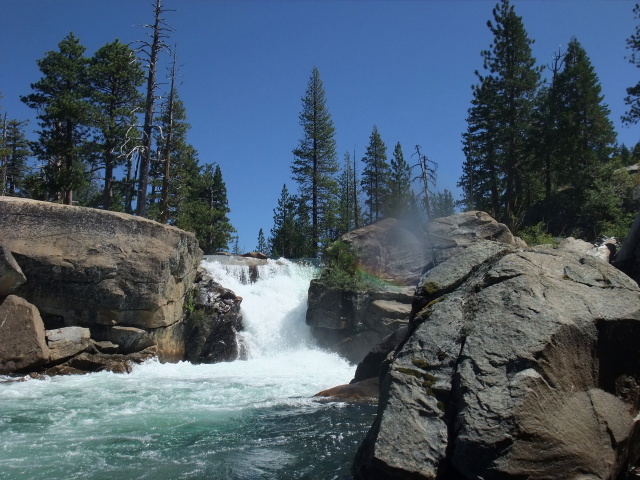
- Fordyce Falls, class V+, portage right
A 25' falls that has been run, though not always successfully.
-
- 9.1
- Narrows, class III+, where the river constructs thru a narrow chute.
- 9.2
- The Hole that Ate the Donner Party, class V+, scout right
A small creek enters on the right at a hard left bend. The river
plummets 20' down an undercut and boulder-choked chute ending in a
river-wide hole. Portage recommended on the right.
-
- The scenery borders on unbelievable.
-
- 9.3
- Knobs, class V+, portage right
A treacherous entrance with knobs of granite protruding from the
riverbed, causing great pinning or pitoning hazards.
-
- 9.4
- Just a Big Class IV, class IV+
After an entrance hole and some boulders requiring precise maneuvering,
the current drops down a ramp into a hole, trying to push you into
the right wall. The second drop is a fun granite slide, followed soon
by a rocky multi-channel drop.
-
- 9.5
- Meat and Potatoes, class IV-V
The first drop is meaty at high flow and narrow at low flow.
The second drop has a nice waterfalls on the far left.
-
- 9.6
- Hide and Seek, class V-
Two separate jumbled drops are separated by a short section of
fast water. Named after a kayaker who disappeared temporarily
underwater in the second drop.
- 9.7
- Ninja, class V-
After a calm section, a granite outcropping appears on the left,
and huge boulders block the river. Named after the one required
precise (and strong) paddle stroke. The flood of 1997 made available
an alternate sneak route.
- 9.8
- The Boulder Field Begins, class V-
Work back and forth to find a good route.
- 9.9
- No Man's Land, class V to V+, including short log portage
An irrigated boulder field, followed by a granite wall on the left,
forcing the water to bend sharp right. A portage trail starts on
river left just before this granite wall. In the next .1 mile,
the river plummets 40' thru a boulder jumble.
-
- 10
- High water mark of Spaulding reservoir. When the reservoir is low,
some good 8' to 10' drops appear.
- 12
- Take out on the Spaulding reservoir boat ramp, south of the dam.
To reach overnight camp at Eagle Lakes,
take I-80 to the Eagle Lakes exit, just west of Cisco Grove.
Cross the South Yuba river, curve left,
and pass the entrance to Indian Creek campground.
Before crossing the river again on a concrete bridge,
turn right onto a dirt road.
Soon, after the Indian Springs 4WD staging area,
this road may require 4WD in spots.
After about 1.3 mile you reach a Y intersection.
The right branch leads to Eagle Lakes, the left to Pierce Meadows.
To reach put-in from there, return to I-80, and drive a short distance east
to Cisco Grove. Cross the freeway and the South Yuba river, then turn left
at a stop sign. Within 200 meters, turn right onto Fordyce Lake [sic] Road,
just before the entrance to a private campground,
closed due to Bubonic Plague (2002).
Drive 5 miles uphill on a good dirt road to a summit.
Continue downhill, where the road worsens, but does not require 4WD (2002).
Before the rock-fill dam, turn left onto a rocky plateau above the creek.
To reach take-out, take highway 20 northwest from I-80.
After 2 miles, turn right onto a road marked “Lake [sic] Spaulding”
and drive about 1 mile to a parking lot overlooking the boat ramp.
|
|
Creeks Navigation
Home
Recommended Runs
Map of Rivers
Alphabetic Index
Alphabetic Table
Text Search
Sponsored Links
|