| |
| Stretch: |
Black Butte Confluence to Dos Rios |
| Difficulty: |
Class II then IV (one V) |
| Distance: |
32 miles, 2 or 3 days |
| Flows: |
rafts 800 - 4000 cfs, kayaks 800 - 5000, IK minimum 700
|
| Gauge: |
flow measured at Dos Rios
(DOS) |
| Gradient: |
19 fpm average, much steeper near end |
| Put-in: |
near confluence with Black Butte river, 1460' |
| Take-out: |
near confluence with main Eel at Dos Rios, 860' |
| Shuttle: |
25 miles (45 minutes) one-way |
| Maps: |
USFS Mendocino NF, AAA Mendocino and Sonoma,
Topo
|
| Season: |
winter into early summer, rain and snowmelt |
| Agency: |
BLM, private |
| Notes: |
© 1997, 2018 Bill Tuthill,
CreeksYahoo |
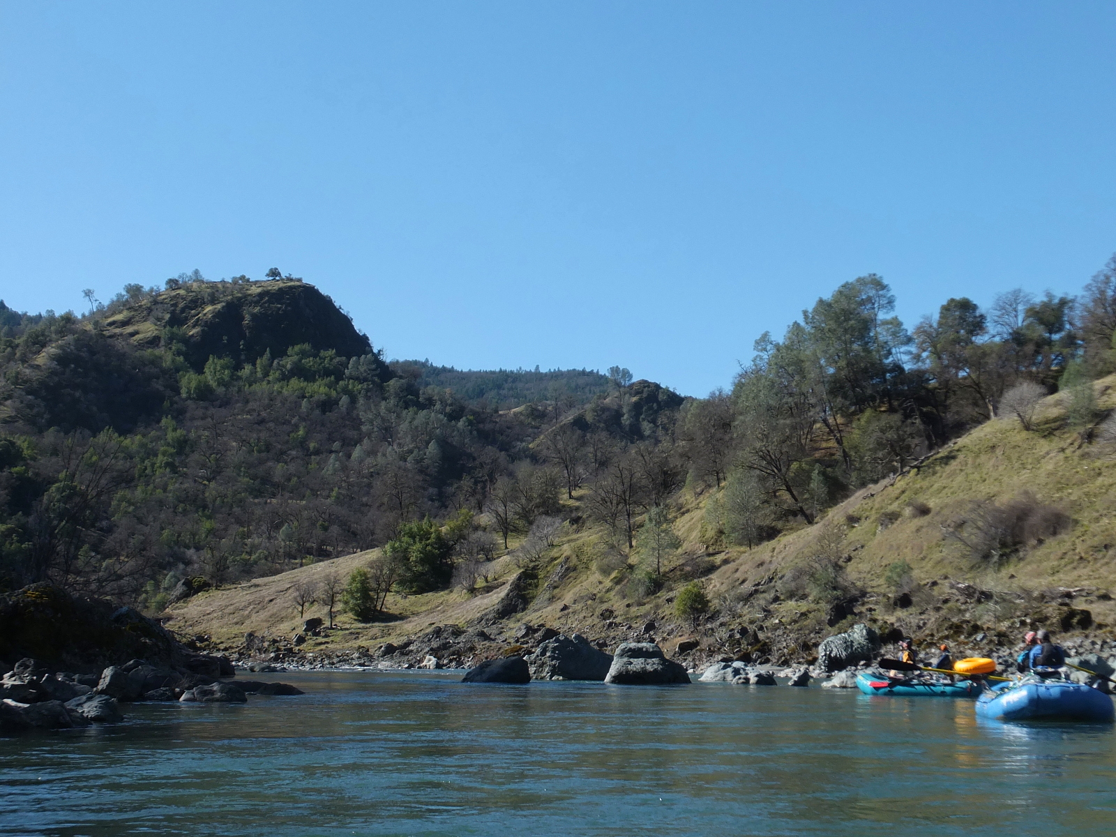
This is a fine wilderness run, although somewhat schizophrenic.
The first two-thirds are very easy and scenic at times,
while the final third is relatively difficult,
especially at higher flows, with one long class V rapid.
Generally, intermediate boaters are too intimidated to try this run,
while advanced boaters might be bored by the first half.
As Uncle Andy sez, “the first 25 miles are pretty - pretty flat and boring!”
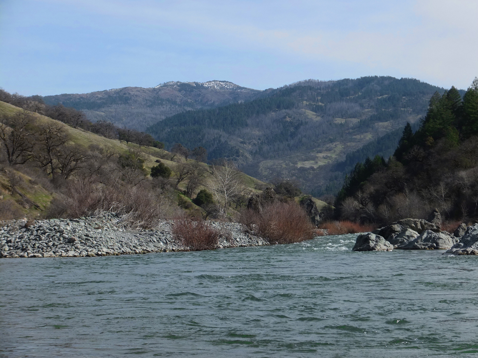
With a large drainage including snowy mountains over 7000 feet,
this river often has a long season, sometimes into late May.
This is a good trip to select on a sunny winter weekend
before the high Sierra season begins in earnest.
Perhaps because of logging in the headwaters,
the water is silty brown immediately after a storm,
but turns whitish green after several days.
The flow at take-out is available on the web, and except after storms,
is only slightly higher than the flow near put-in.
When flow is declining, estimate flow to the end of your trip.
Float days are very long at the 800 cfs minimum.
Best flows for rafting and kayaking are 1000-2000 cfs.
Below 1000 Coal Mine Falls gets very rocky,
and above 2000, it becomes more difficult to run or line.
At low flows with short winter days, rafts should plan on three days.
Kayakers can do this run in a single day,
with an early start, at flows above 1000 cfs.
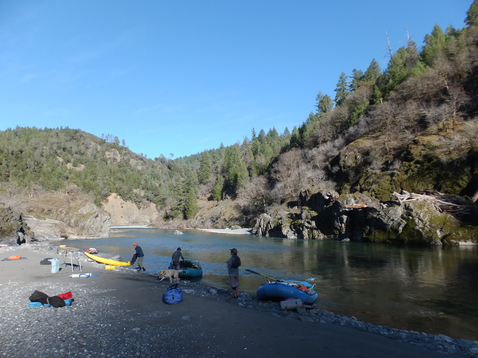
Near put-in is a USFS campground, closed in winter,
across the road from an RV park operated by Black Butte River Ranch.
It's probably best to get a relaxed start and spend a night along the river,
where good campsites abound. A popular half-way spot is Thatcher Creek.
Shuttles and accommodations are available from the Black Butte River Ranch
(general store, cabins, campground) near put-in, phone 707-983-9438.
Mileage is marked in trip distance and river miles from the confluence
(in parentheses).
- 0 (32)
- Put in about a quarter mile below the highway bridge over
the middle fork, where a trail leads down from the parking area.
This was the washed-out old road, still extant on the other side
as it climbs along the Black Butte to a bridge across that river.
Shortly below at the confluence, flow almost doubles.
-
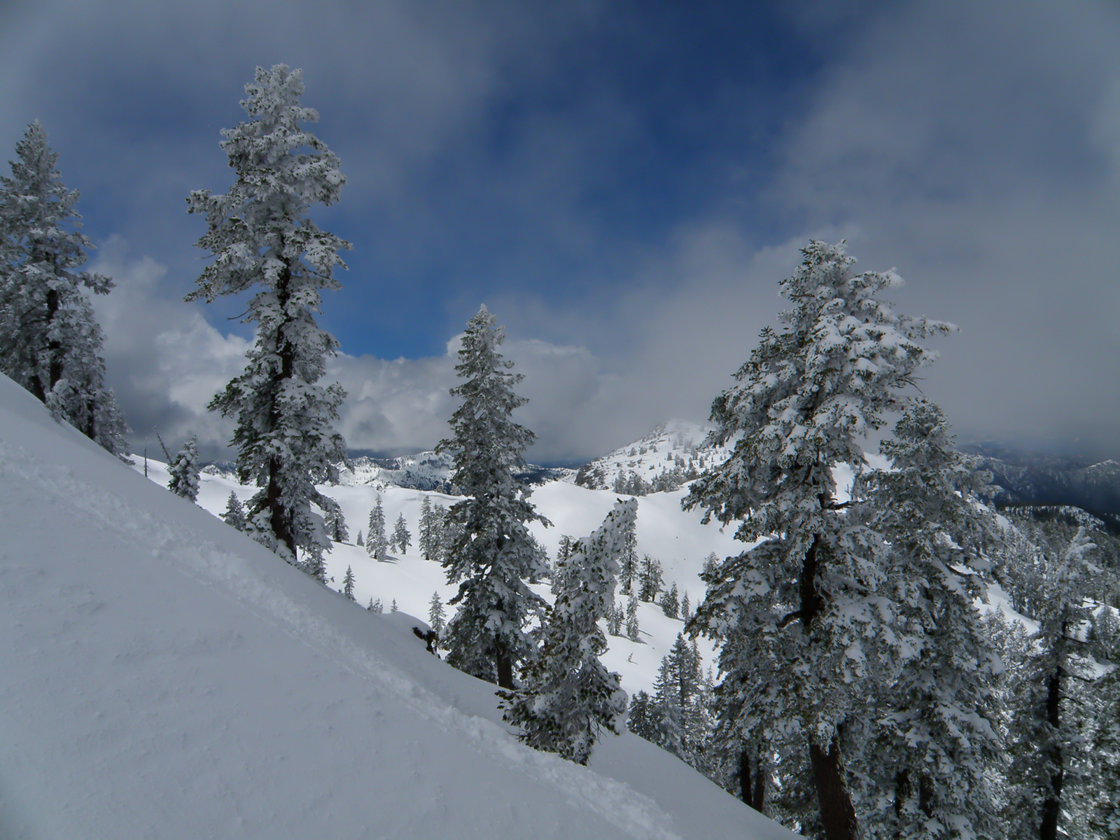
- “Snow on South Yolla Bolly” photo © 2011 Brent Heffner
- 3 (29)
- Williams Creek enters on the right, and the highway leaves the river.
- 4 (28)
- Round Valley Indian reservation for the next half mile on the right.
After another half mile, the mini-canyon ends and ranch land begins.
- 6.4 (25.6)
- Good high-water camp on the left, where a ranch road crosses (at low flows)
from river right to left, then climbs the left bank to an oak-dotted flat.
- 7 (25)
- Etsel Flat ends, the river enters a forested canyon, and for the next
several miles, flows thru three large but progressively tighter horseshoe bends.
- 8.5 (23.5)
- Nice low-water camp with gravel beach (almost sand) at the end of a boulder bar.
-
- 9.4 (22.6)
- George Lambert canyon on the left, and shortly below, Green Lambert canyon.
- 11 (21)
- Forest turns to brush, and many structures are visible before Mill Creek enters
on the right, along which a private road enters the canyon.
- 11.9 (20.1)
- Doe Canyon on the left. The river soon enters a beautiful rock-lined narrows.
- 14.1 (17.9)
- Grizzly Gulch on the right. A rough dirt road comes near the river.
- 15.1 (16.9)
- Hayshed Creek enters on the left. Terrain is too steep for comfortable camping.
About a mile upstream, high on the north bank, are some ranch structures.
- 15.4 (16.4)
- Thatcher Creek enters on the left. The gravel and sand deposits along the river
might be too steep to pitch a tent, but on the upriver side of the creek you can
climb to a grassy flat among oak trees. During boating season there is likely
to be flowing water in pristine Thatcher Creek, due to its large drainage.
- 16.9 (15.1)
- Elk Creek enters on the left. A dirt road reaches the river down this canyon,
with many side roads and at least one building. A dirt road reaches the river
on the right bank also, where there is another building on private property.
- 17.5 (14.5)
- Another good campsite on river right, on the outside of a left bend,
with a sandy area near large rocks, and a small lake cut off from the river.
The dirt road on river right is still or again visible for another mile.
- 19.9 (12.1)
- Salmon Creek on the right. Then after a left curve is a straight-away for
almost a mile. It would be longer except for a jog left.
- 19.9 (10.6)
- Bald Mountain Canyon on the right. A house is visible not far above the river.
Just below is a gigantic rock on the left. You can land boats above or below it
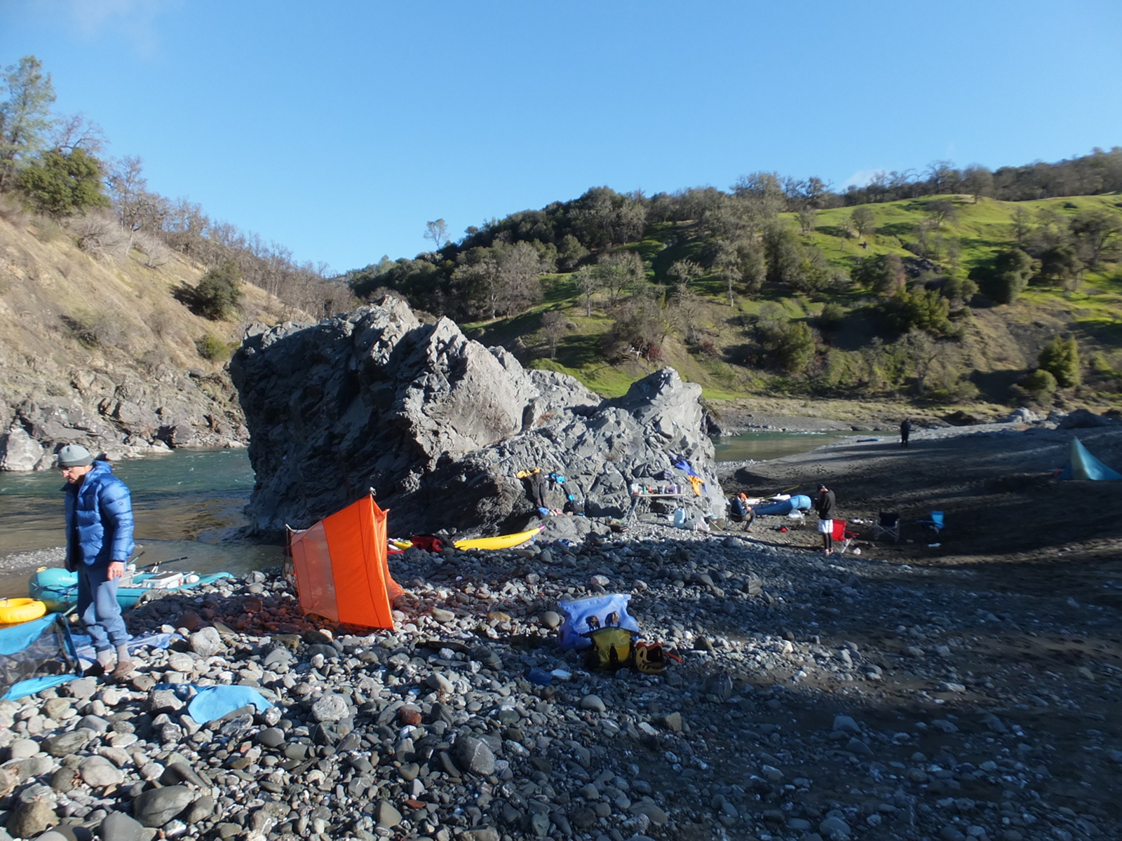
to stay at a large flat campsite with fine gravel (almost sand) higher up.
This is a good place to stay on a three-night trip.
-
- 22.4 (9.6)
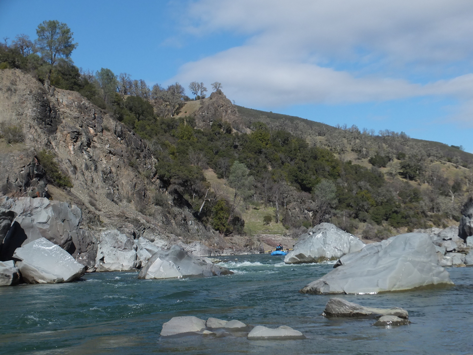
- After passing some minor rapids near Round Mountain on the right,
a blue-gray rock slide creates a significant rapid downstream.
Green serpentine rock veins are visible as the river flows southwest.
The river splits around a gravel island; both channels are passable (2018).
- 23.1 (8.9)
- The river turns right and flows northwest.
- 23.8 (8.2)
- After a left turn with boulders on the right and gravel bar on the left,
a dirt road reaches the river at a large triangular shaped gravel bar,
which provides low-water ford access to several dirt roads on the left bank.
Several houses are visible uphill, as the river arcs around this gravel bar.
- 24.9 (7.1)
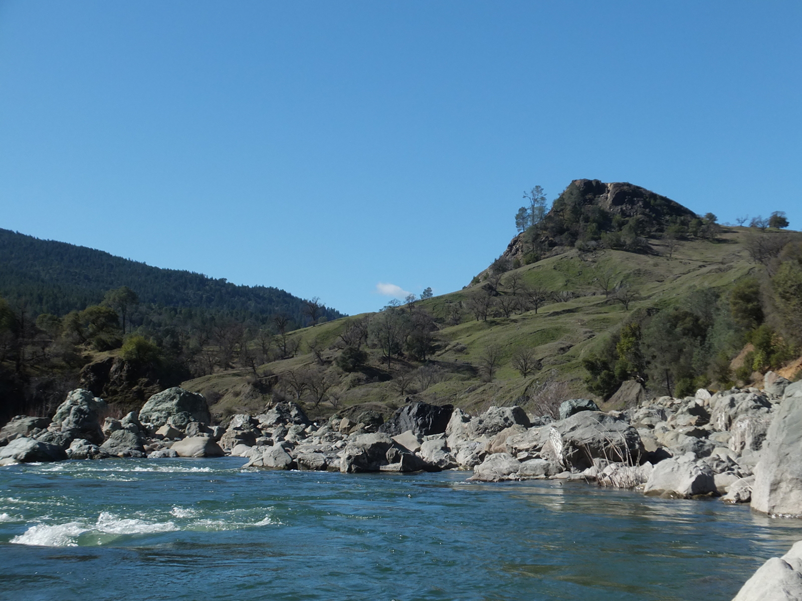
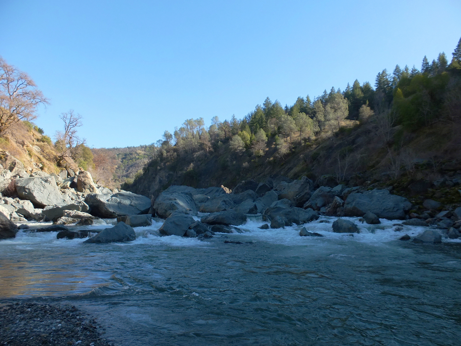
- The river is fairly calm before and after passing Kelly Canyon.
At low flows you wonder, where is Skinny Chutes?
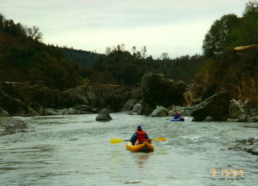
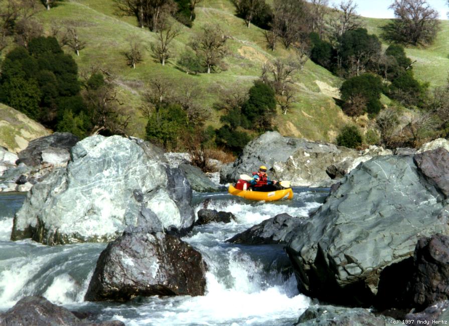
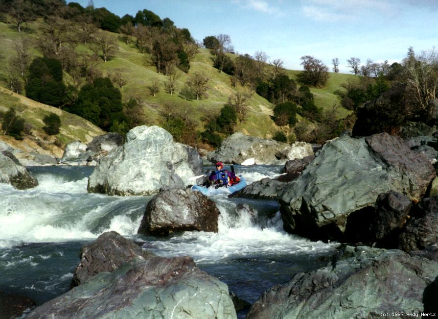
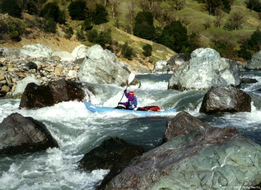
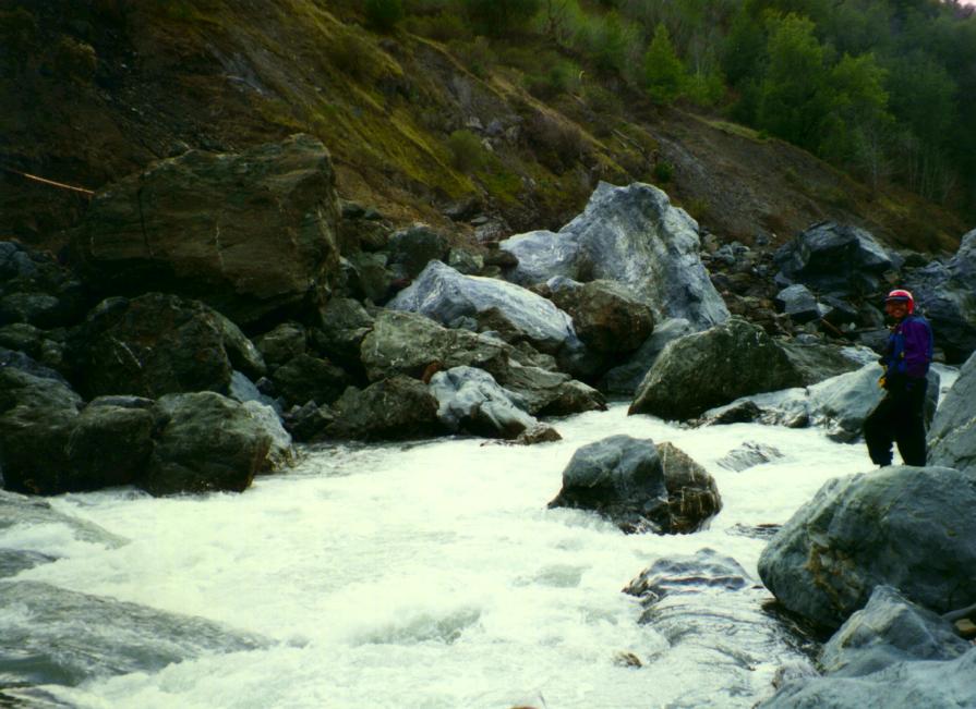
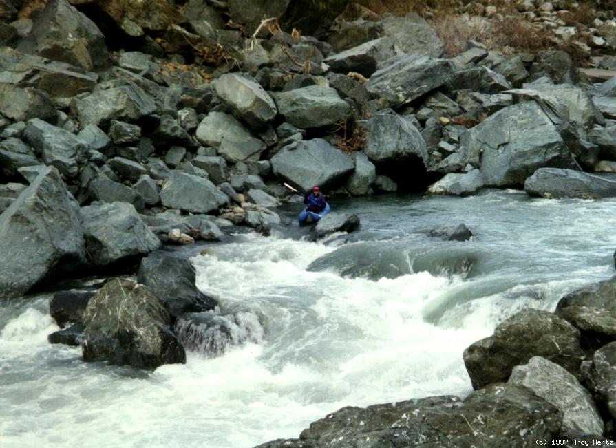
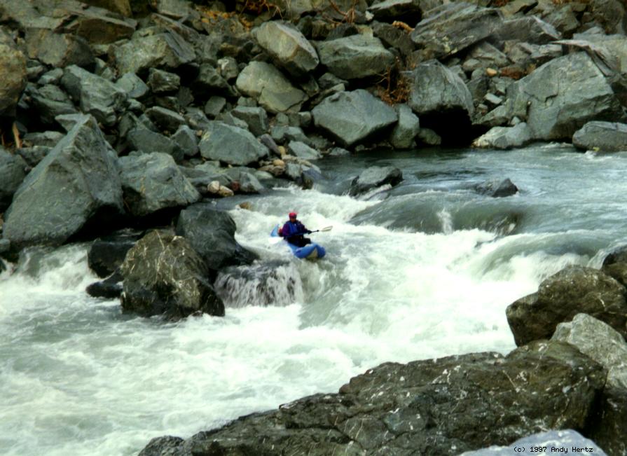
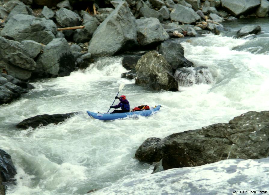
- Two photos from upriver, and three photos by Andy Hertz at Skinny Chutes.
-
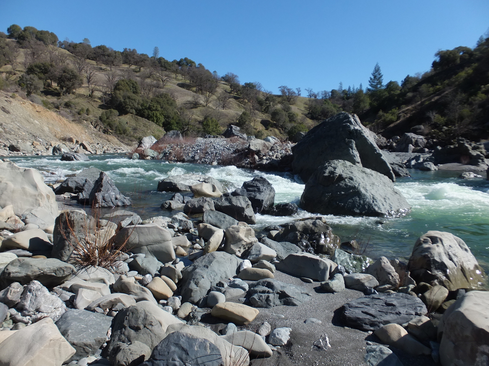
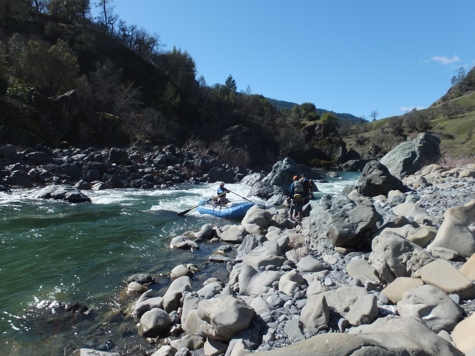
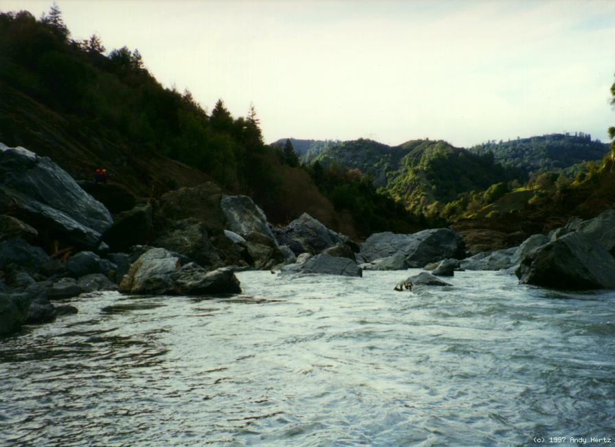
- 25.9 (6.1)
- Skinny Chutes, class IV, scout right or possibly left
Recognition: heavily eroded rocks on right bank,
and “mine” mountain (according to maps) ahead.
The current moves left and drops steeply over a boulder bar,
with a good scouting eddy below except at very high flows.
Afterwards, the current passes thru some narrow drops among big boulders.
At moderate flows the best run is probably on the left side moving right.
At higher flows the right side requires less tricky maneuvering.
At low flows it is hard to get a raft thru here.
-
-
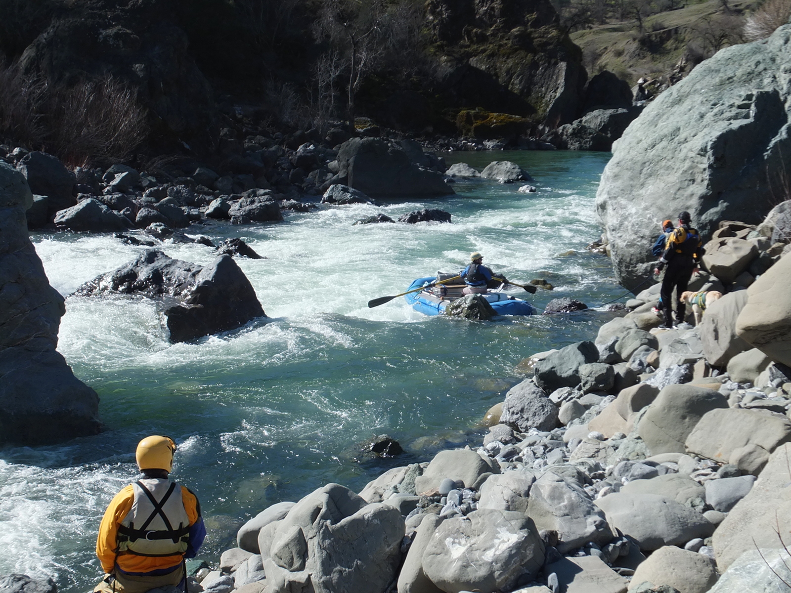
- 26.4 (5.6)
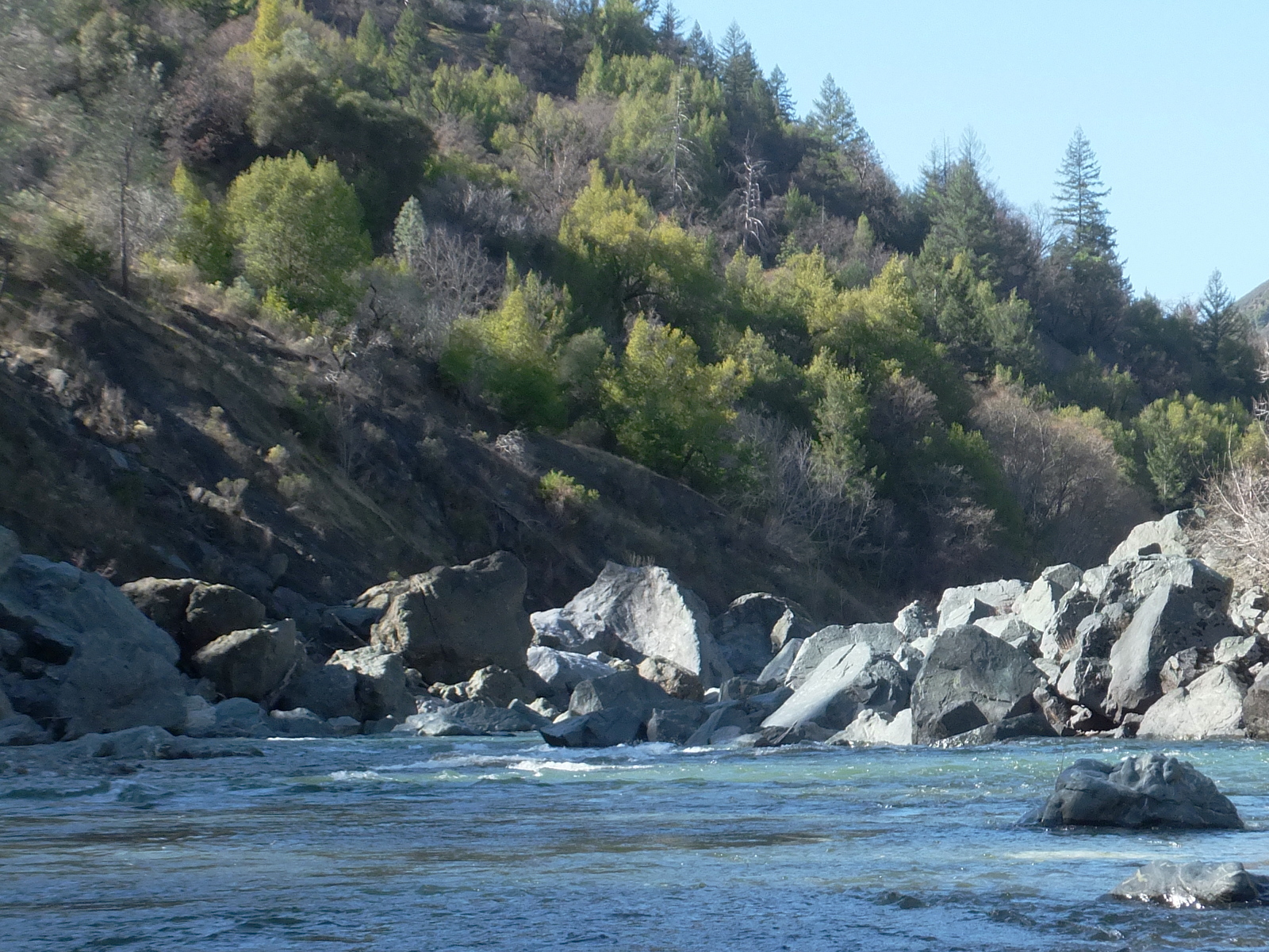
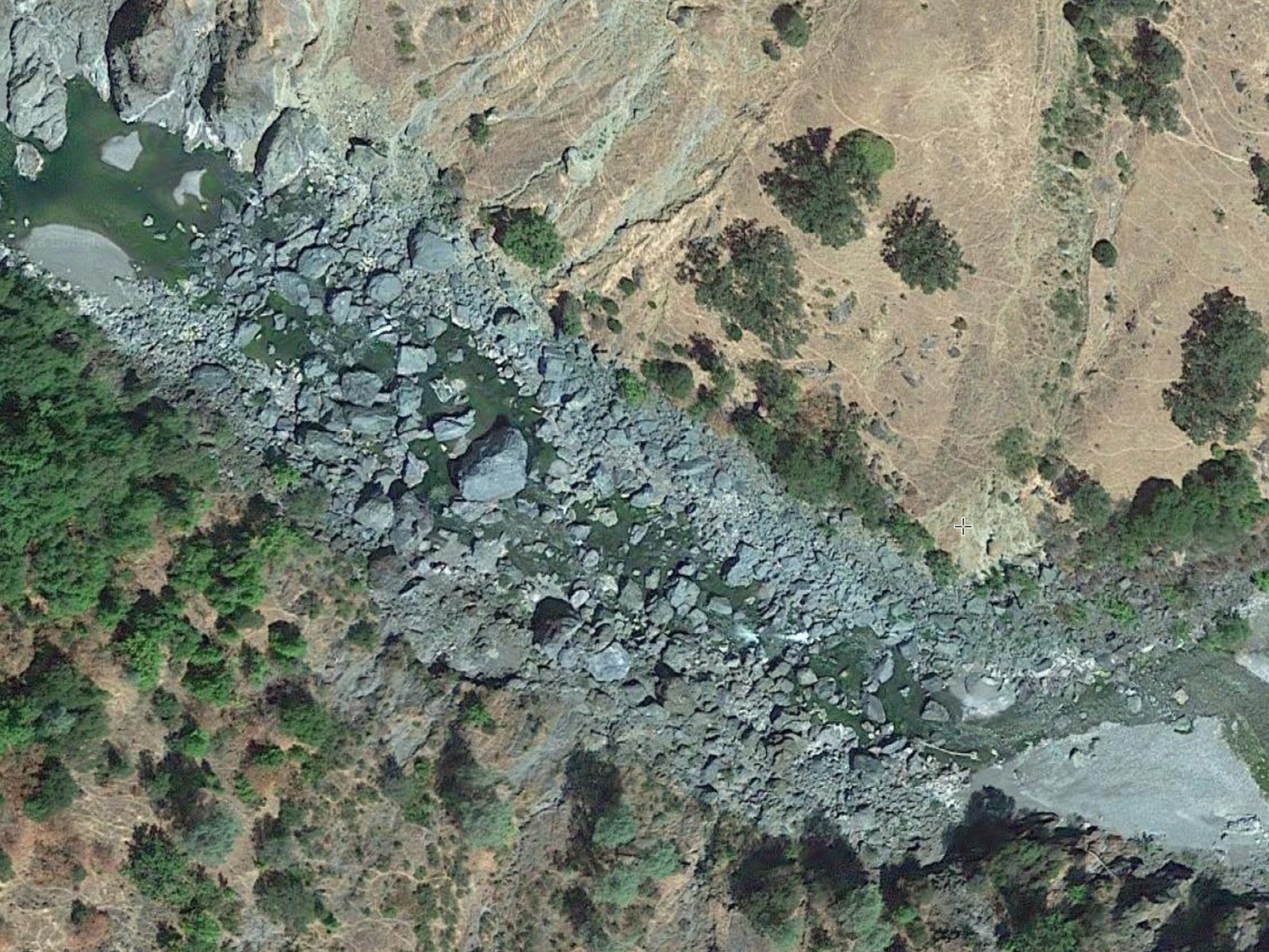
- Salt Creek enters on the left, followed by long Salt Creek rapid,
a left curving gravel bar, a calm section, then drops between boulders.
Some calm water remains before the falls, but don't get sucked in.
The coal mine after which the falls is named was actually upriver
on the mountain left of Skinny Chutes, based on satellite imagery.
- 26.9 (5.1)
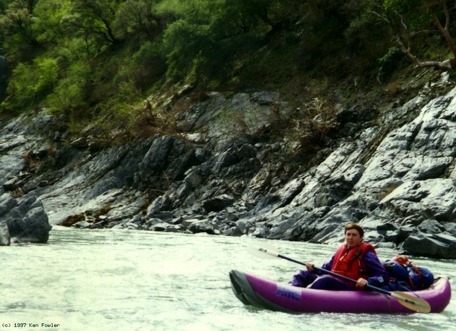
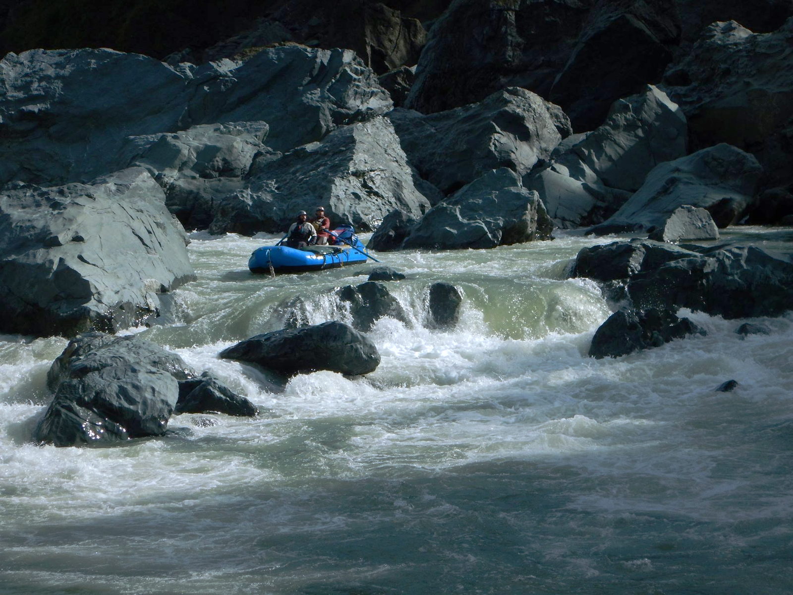
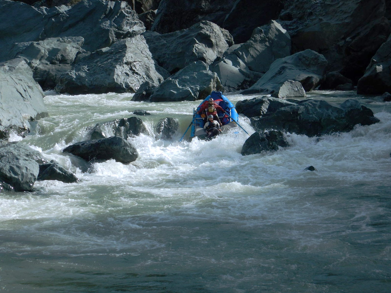
- Coal Mine Falls, class V-, scout right.
This rapid may change from year to year, especially after floods.
In some years it can be easily lined on the right,
or run starting from a small eddy on the right. Kayakers sometimes carry
the crux drop on the left and then run the remaining big drops.
A kayak carry on the right is also possible, as is a passenger-assisted raft lift.
The crux drop is the toughest, because of steepness, menacing holes,
rocks in the wrong spot, and undercuts below.
The remaining drops are easier, and at moderately low flows,
there is time and space to set up safety between the sections.
-
-
-
- Thanks to Doug Soule for the 2009 raft photos above.
Below are Andy Hertz photos from a 1991 kayak trip.
-
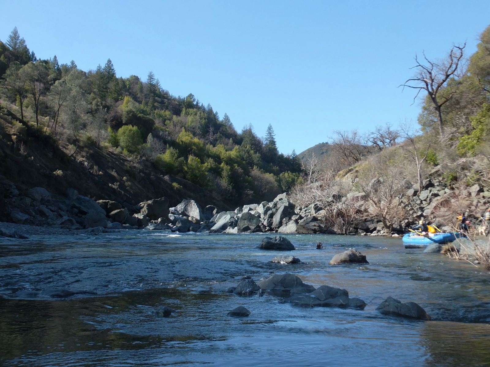
- 27 (5)
- After Coal Mine Falls, which is over one-tenth mile long,
the river enters a canyon containing many class II rapids.
Sand Bank Creek enters on the right half a mile below.
- 28.1 (3.9)
- Big Water Canyon on the left, followed in .6 mile
by Little Water Canyon on the left,
and .4 mile later by Hosea Creek on the right.
This was the planned site of controversial Dos Rios dam,
which Governor Reagan cancelled, remarking,
“we've already done enough to the Indians.”
Covelo and most of Round Valley would have been flooded.
- 30 (2)
- Pickrell Creek enters on the right, near several houses.
The highway is not very far up the right bank.
Eastman Creek enters on the left at mile 30.7 (1.3).
- 31.1 (.9)
- Swallow Rock, class III-IV
The river turns right, pours down a relatively easy boulder bar,
and swings sharply around a 150' monolith, home to many birds.
At the base of the monolith to the right is a rapid containing
some powerful holes among a maze of large boulders.
This rapid is visible and can be scouted from the shuttle road.
At mile 31.3 (.7) Goforth Creek marks the end of this rapid.
- 31.6 (.4)
- Covelo Road bridge overhead. About .2 mile downstream, a gravel bar
offers a good take-out, but a bad climb up to the parking area
near the bridge. Around the corner, Dos Rios bridge lacks parking.
- 32 (0)
- Confluence with the main Eel.
To reach take-out, go east from highway 101 on Covelo road,
and drive 16 miles to a bridge where the road crosses the middle fork.
From a parking lot near the bridge,
an old road leads down to a gravel bar on river left.
With maintenance budgets what they are,
it is unlikely you will be able to drive down to the river.
To reach put-in, cross the bridge, turn right, and continue on Covelo road
to the town of Covelo. One mile north of town,
turn right onto Mendocino Pass road (follow highway 162 signs)
and continue about 10 miles to where the road crosses the middle fork.
Black Butte River Ranch is on the right just after the bridge.
|
|
Creeks Navigation
Home
Recommended Runs
Map of Rivers
Alphabetic Index
Alphabetic Table
Text Search
Sponsored Links
|