|
Cottonwood Creek North Fork Upper Run |
After particularly heavy rains, and against my better judgement, Arn Terry, Jim Pepin and I started down upper North Fork Cottonwood Creek. Having hiked most of this upper stretch the previous fall, I was amazed at the raging current we encountered on March 12th 1995 at the Sunny Hill Road access. More than 400 cfs must have been spilling from Rainbow Lake down that 20 foot wide stream bed! Flooded stream-side vegetation and very fast, blind curves, and lots of hard class IV were the norm that day. (Photos taken at moderate flows in winter of 1999.)
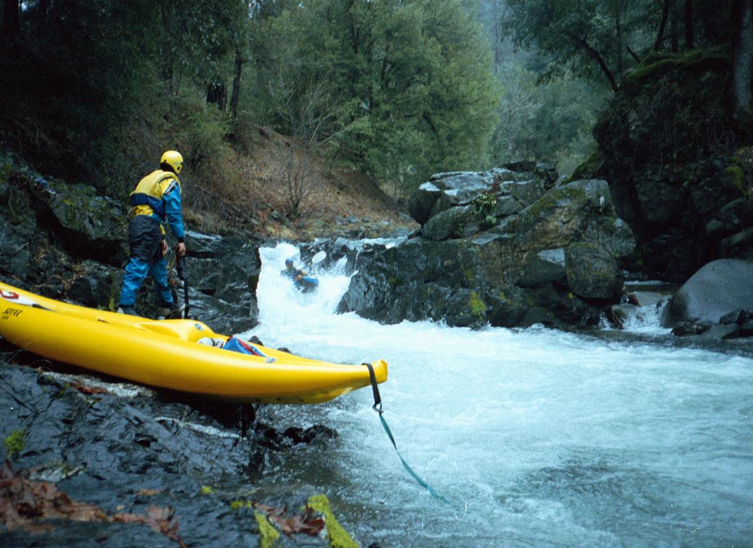
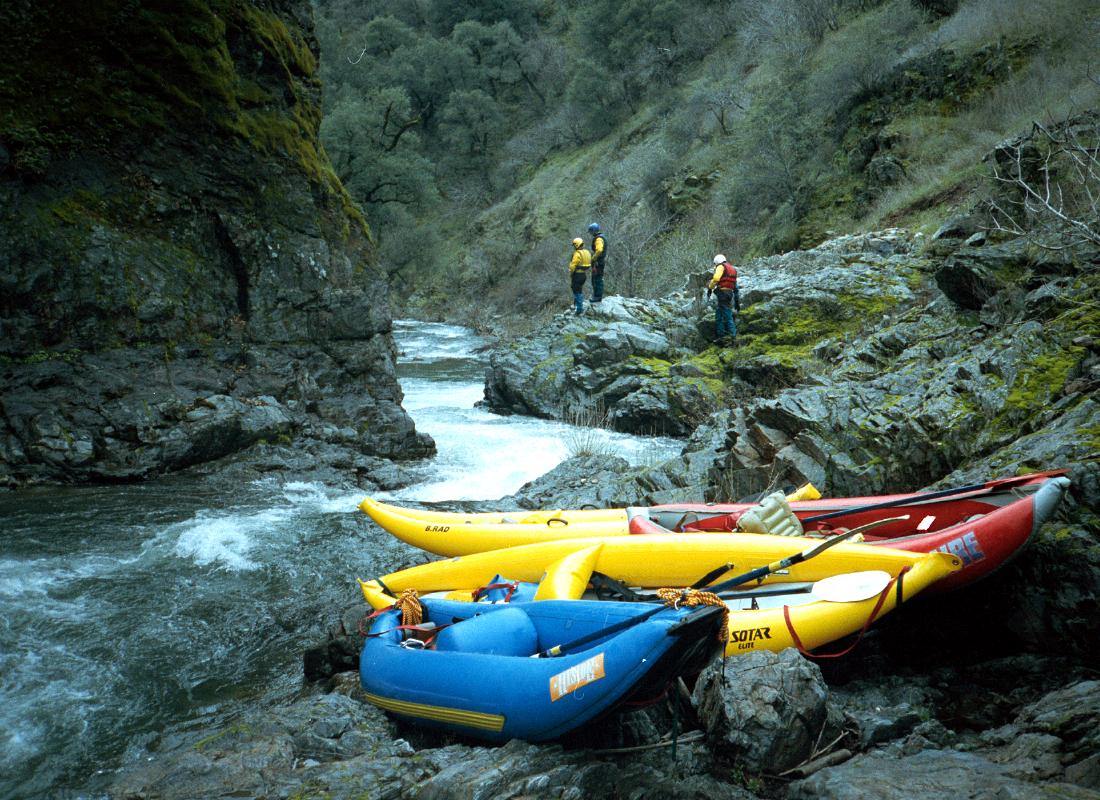
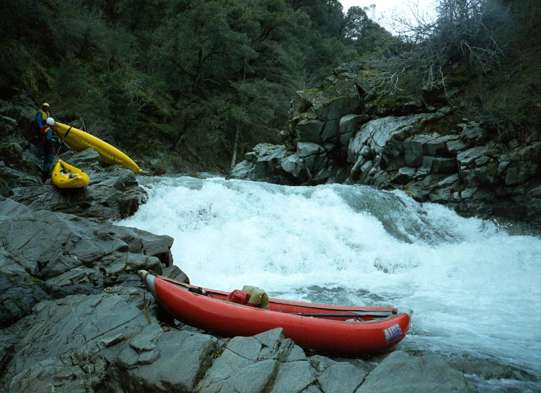
This was a real scouting- and portage-fest at high water, which resulted in lots of silent whining, at least one torn drysuit, and some mild cases of poison oak rash. Five or six class V drops were either run or portaged. (After the initial steep section, the creek flattens out for a while, and there are good views of a waterfall high on the left. Shortly thereafter gradient increases again, and remains steep until Jerusalem Creek.)
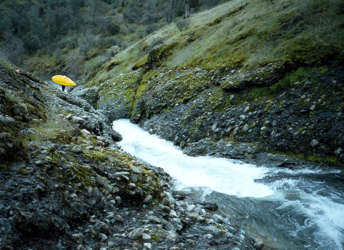
When I hiked the canyon at summer trickle, I thought the steep section above the Jerusalem Creek confluence might entail a 30 yard portage. The thundering, unrunnable, maelstrom created by the high water within that narrow canyon now resulted in a difficult portage of 150 yards on river right, on a precarious cliff high above the creek. (Sorry, no photos of this class VI segment.) Jerusalem Creek added another 100 cfs to the current. We all did a horrible portage on river left to avoid a steep drop with an unrunnable reversal. The 20' high, Niagara Falls-type waterfall was too dangerous to run at this flood level due to a killer reversal at the bottom. Sigh. There is an easy portage on the right. Running this clean waterfall would have been a high point of the run at a sane water level. Half of this flow would have made this upper portion of the run a lot safer and enjoyable; much like a typical Costa Rica run with high canyon walls, small waterfalls entering the creek, and lush vegetation.
The final big drop of this upper portion consists of a long super slide-type rapid that can be seen from high above on Platina Road. Lower flows might make this rocky drop unrunnable. As the creek turns left with the highway in sight, scrape down the right channel past a long island to avoid having to make a death ferry above the waterfall. The lower, sometimes run, portion of this stretch starts below a narrow, twisting, unrunnable, waterfall, which recently claimed the life of a youthful summer swimmer. This drop can be seen from where Platina Road comes closest to the creek. The usual access to this lower segment is accomplished by hiking across country from the Platina Road down to the creek (read: trespassing, which is not encouraged!).
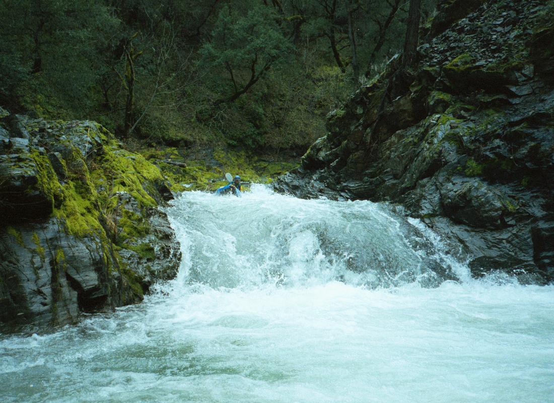
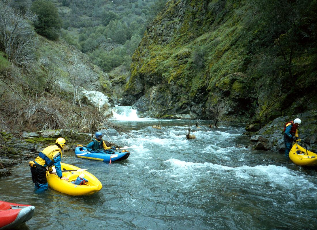
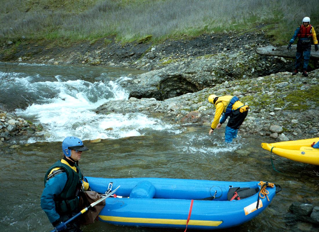
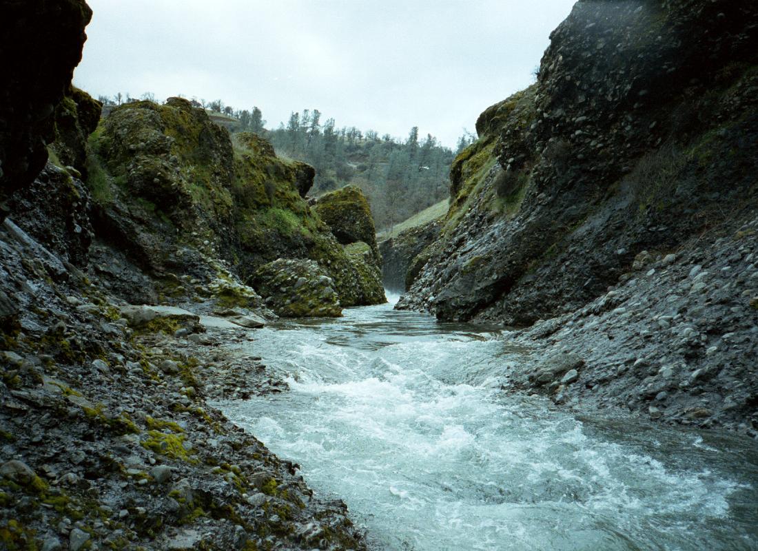
Usually kind of scrapey, this occasionally-run section was pure joy at these high flows, with lots and lots of fun class III+ and areas of continuous holes and waves. Only one downed tree survived the floods and blocked the run, a lone gray pine below the big slide rapid. There are always two rapids worth looking at in this lower segment. The first is the site of a blown-out rock diversion dam for a ditch on river right. Look for the boulders and ditch intake and scout near the intake. The second, most difficult drop involves sliding down a few big ledges with a sprinkling of boulders in a rather open curve in the stream. Scout on the dipping sandstone outcrop on river left. The deeded public highway easement at the Platina Road bridge is 200' wide, so we easily stayed within the fence lines at the take-out. The take-out is the infamous A16 bridge near Ono with constitutionally uninformed landowner (see the North Fork Cottonwood Creek writeup). To reach put-in, take Rainbow Lake Road northwest from the town of Ono, and turn left onto Sunny Hill Road before crossing Ducket Creek. The BLM has found this section of the North Fork Cottonwood Creek to be eligible for Wild and Scenic River designation.
|
Creeks NavigationHomeRecommended Runs Map of Rivers Alphabetic Index Alphabetic Table Text Search
Sponsored Links
|