| |
| Stretch: |
North Fork at Highway 20 to Bear Creek |
| Difficulty: |
Class II+ (one or two class III- rapids) |
| Distance: |
18.7 miles, 1 long day, or camp |
| Flows: |
small raft and kayak minimum 450 at confluence, IK minimum 400 cfs
|
| Gauge: |
start on North Fork
(USGS site)
plus Main at mile 2
(USGS site)
|
| Gradient: |
20 fpm average |
| Put-in: |
BLM parking lot near highway 20, 1000' |
| Take-out: |
Yolo County access, near Colusa county line, 630' |
| Shuttle: |
20 miles (30 minutes) one-way |
| Maps: |
Delorme N Cal, AAA Sonoma and Mendocino,
Topo
|
| Season: |
Spring and early summer, dam release |
| Agency: |
private, mostly BLM |
| Notes: |
© 2008, 2013, 2016, 2024 Bill Tuthill,
CreeksYahoo
|
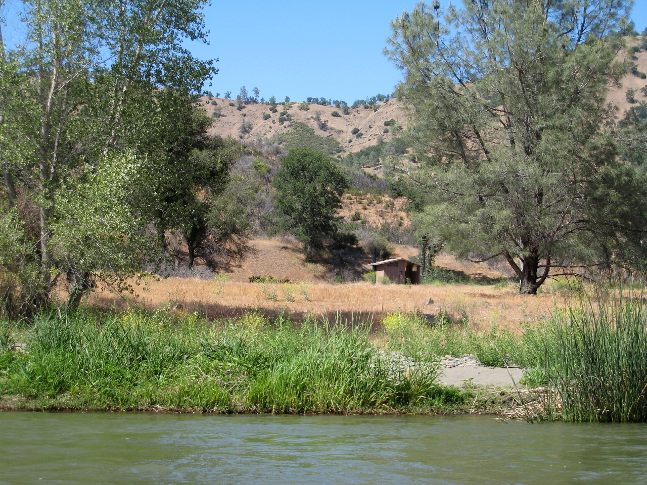
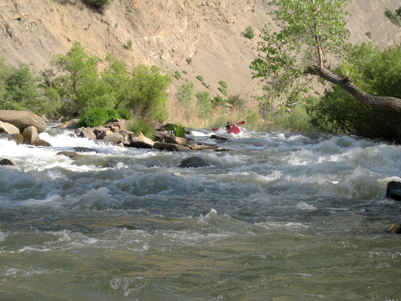
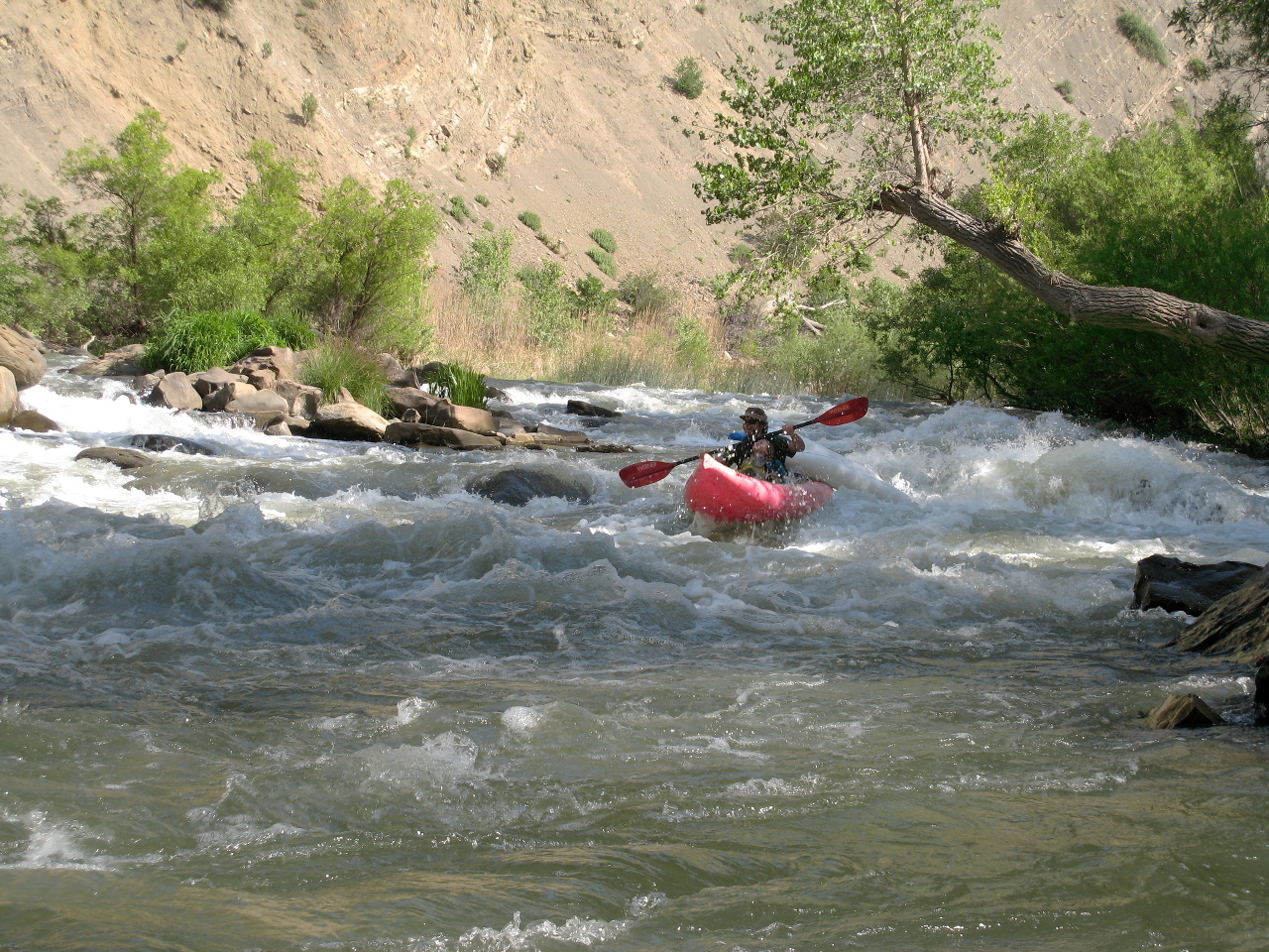
This used to be a favorite rainy-season run for class II-III rafters,
largely for bird watching and pleasant scenery.
After Indian Valley reservoir (upstream on the north fork) was enlarged
and started making water deliveries to farmers in the Capay valley,
boaters realized that upper Cache is runnable into mid summer.
This stretch is now beloved by many, although seldom crowded,
especially compared to the section just downstream.
It is quite an adventure, with float time around 6 hours.
New!
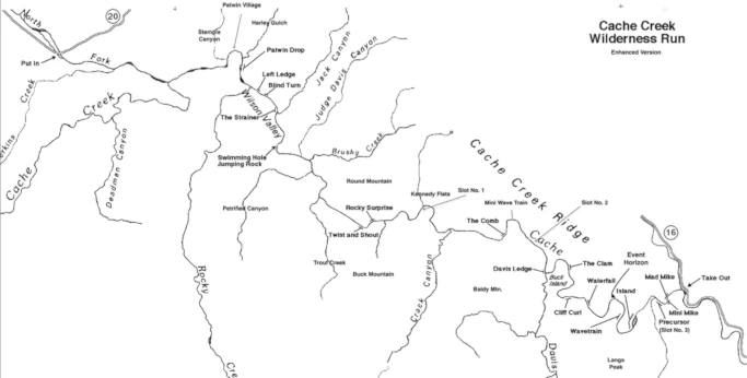
Map with link to printable PDF below mile-by-mile description.
Thanks to Herb Howe for drawing the map, and Ken Stanton for updating it.
Raft and kayak minimum flows are given for the confluence,
where after 2 miles the north fork meets the main.
Flow ratio varies from year to year,
but usually totals > 450 cfs during irrigation season.
You need > 85 cfs on the north fork to avoid boat dragging,
but runs have been made with less.
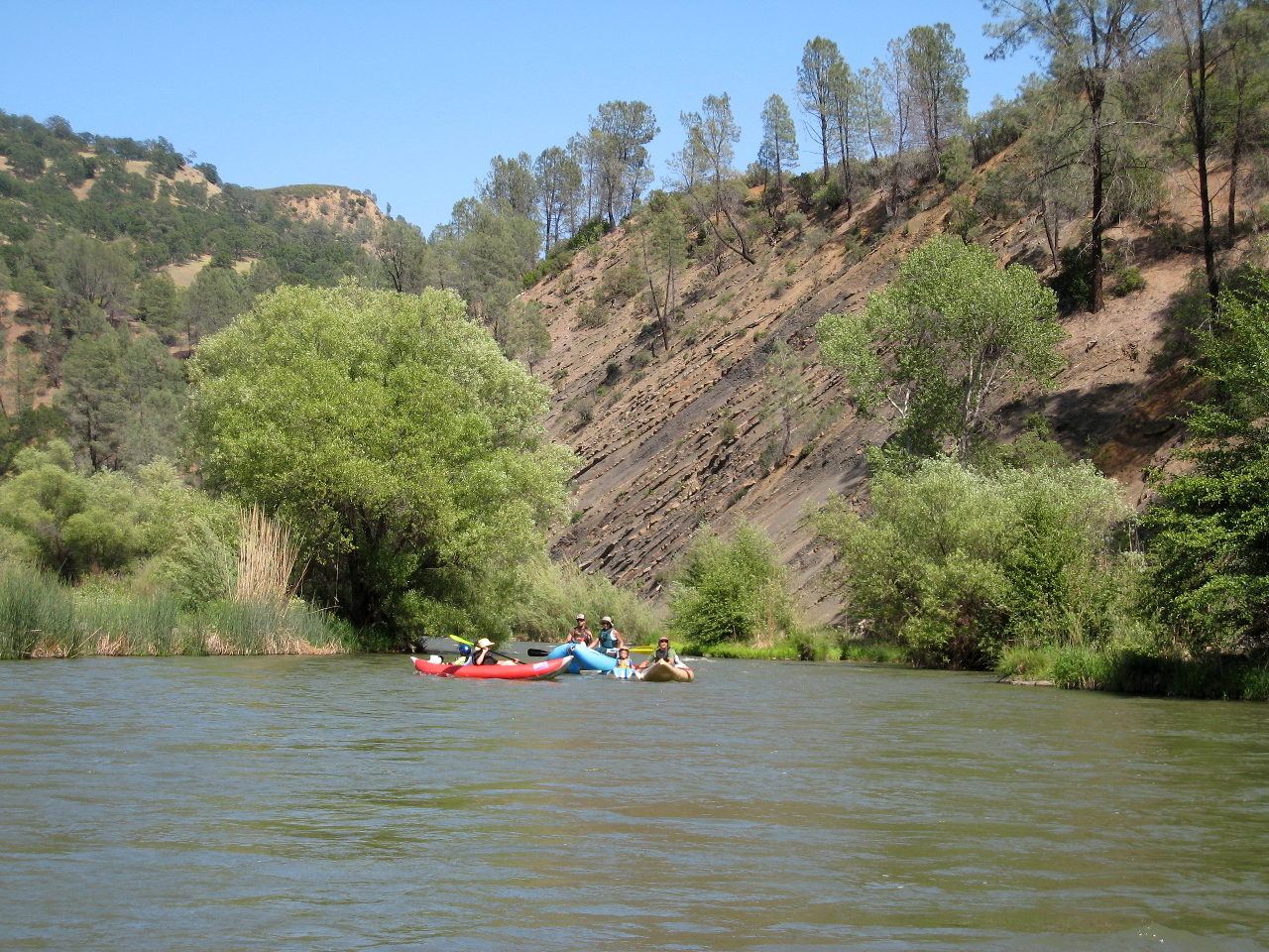
At 650 cfs combined, current moves around 3 MPH.
Good campsites (and blackberries in season) are available,
though many camps were affected by 2015 Rocky wildfire.
Vegetation has grown back quite well in the last decade.
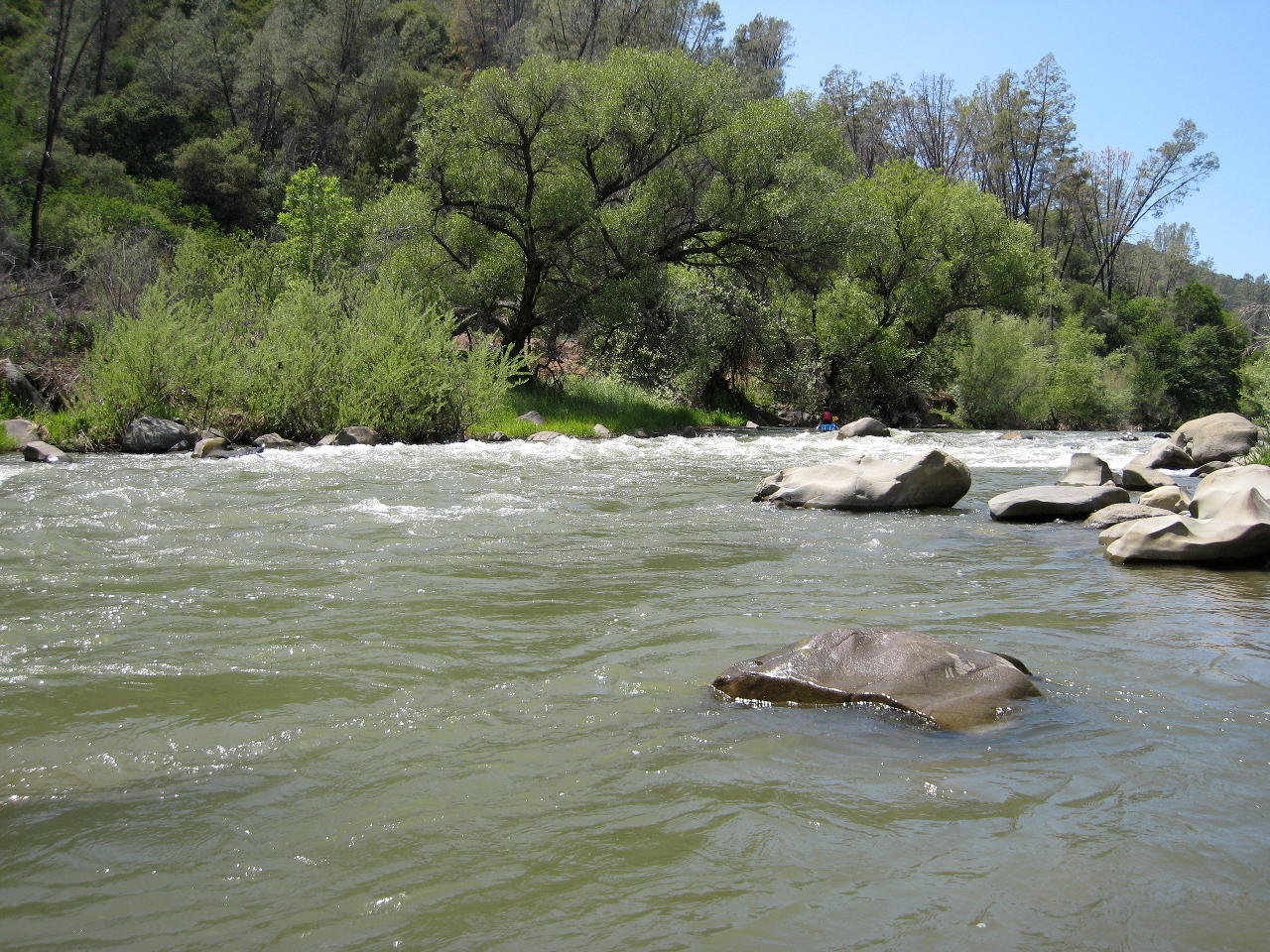
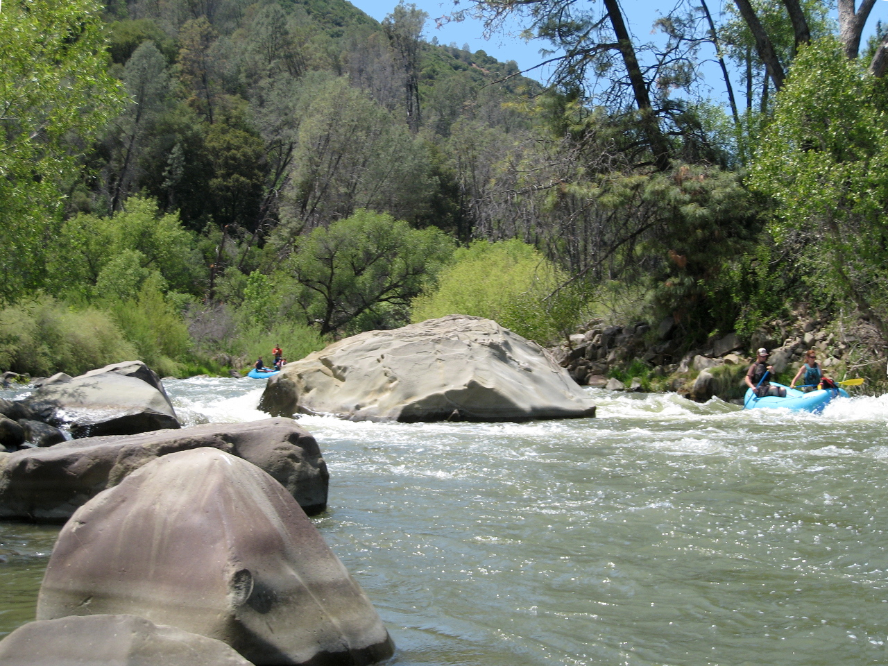
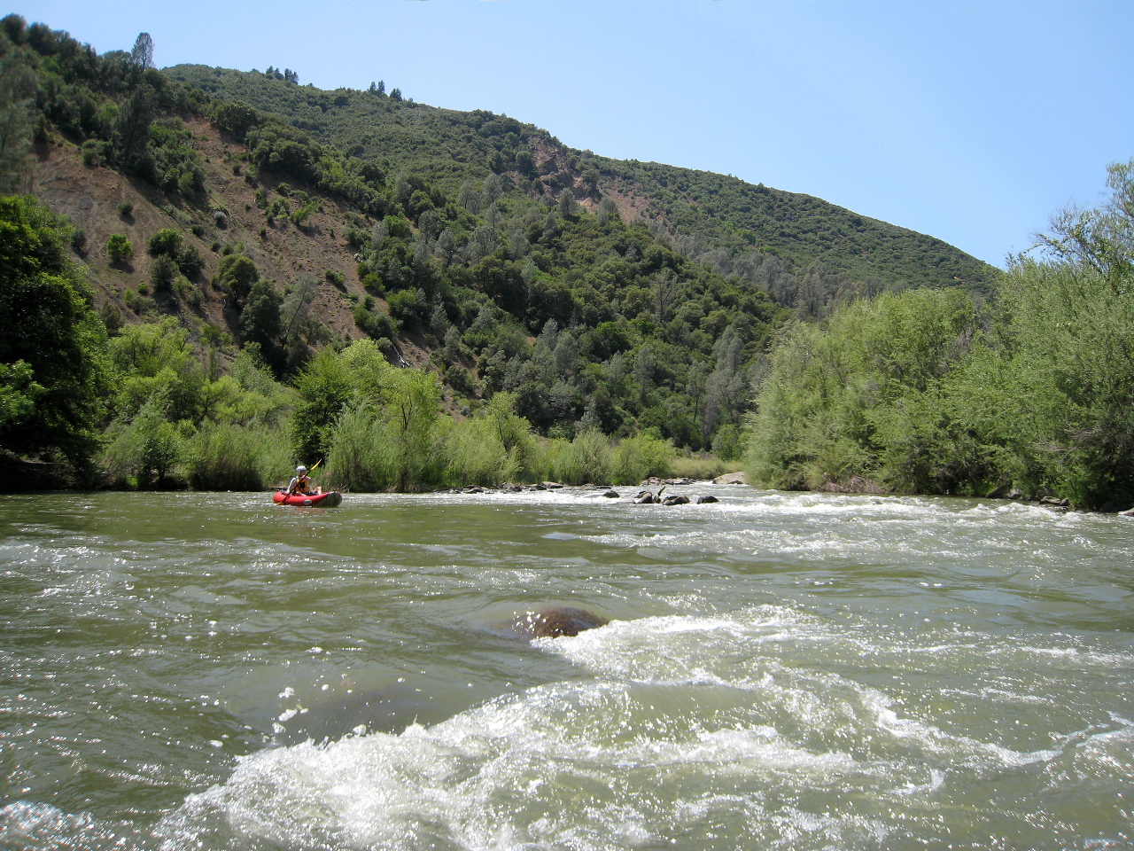
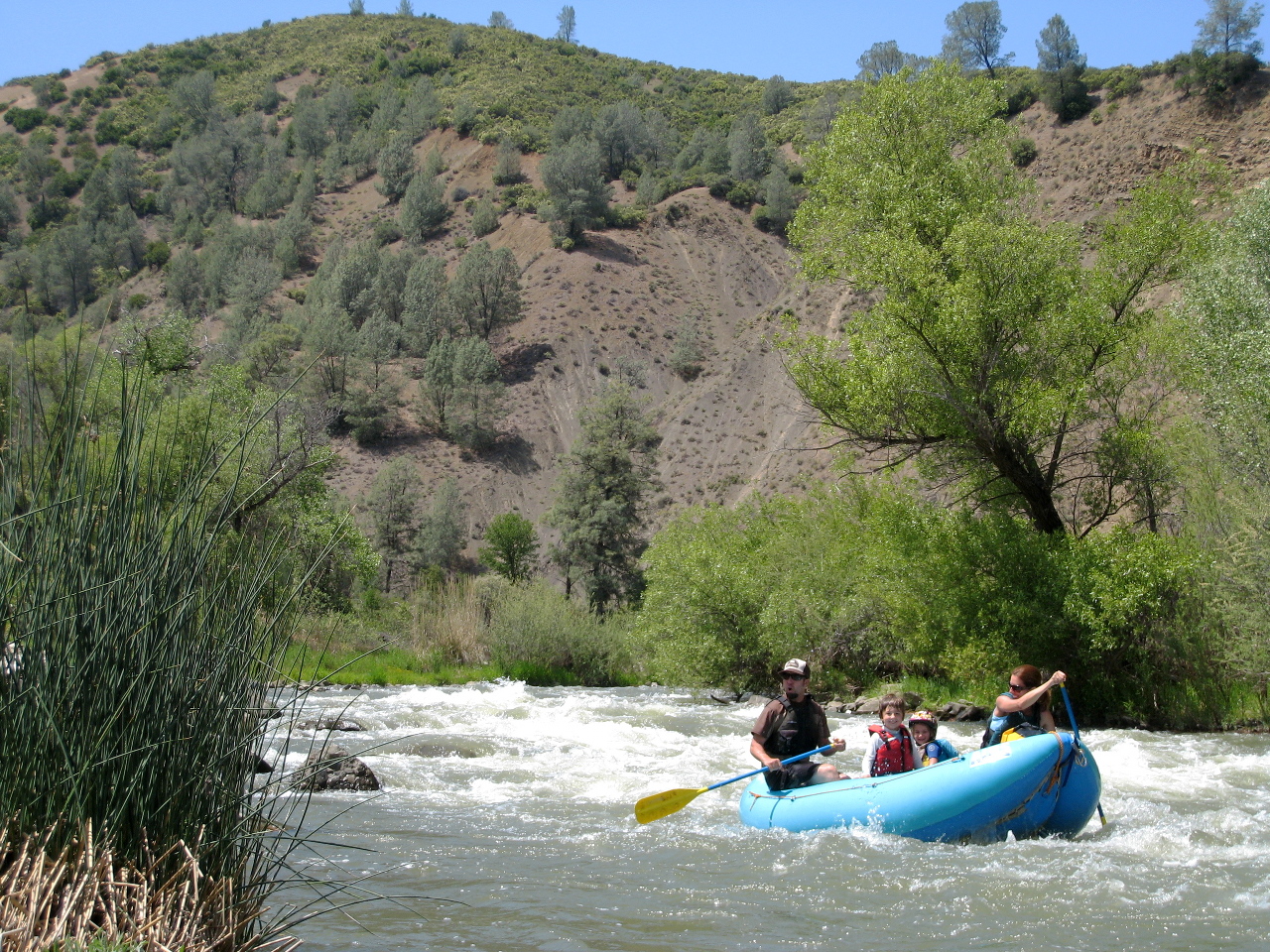
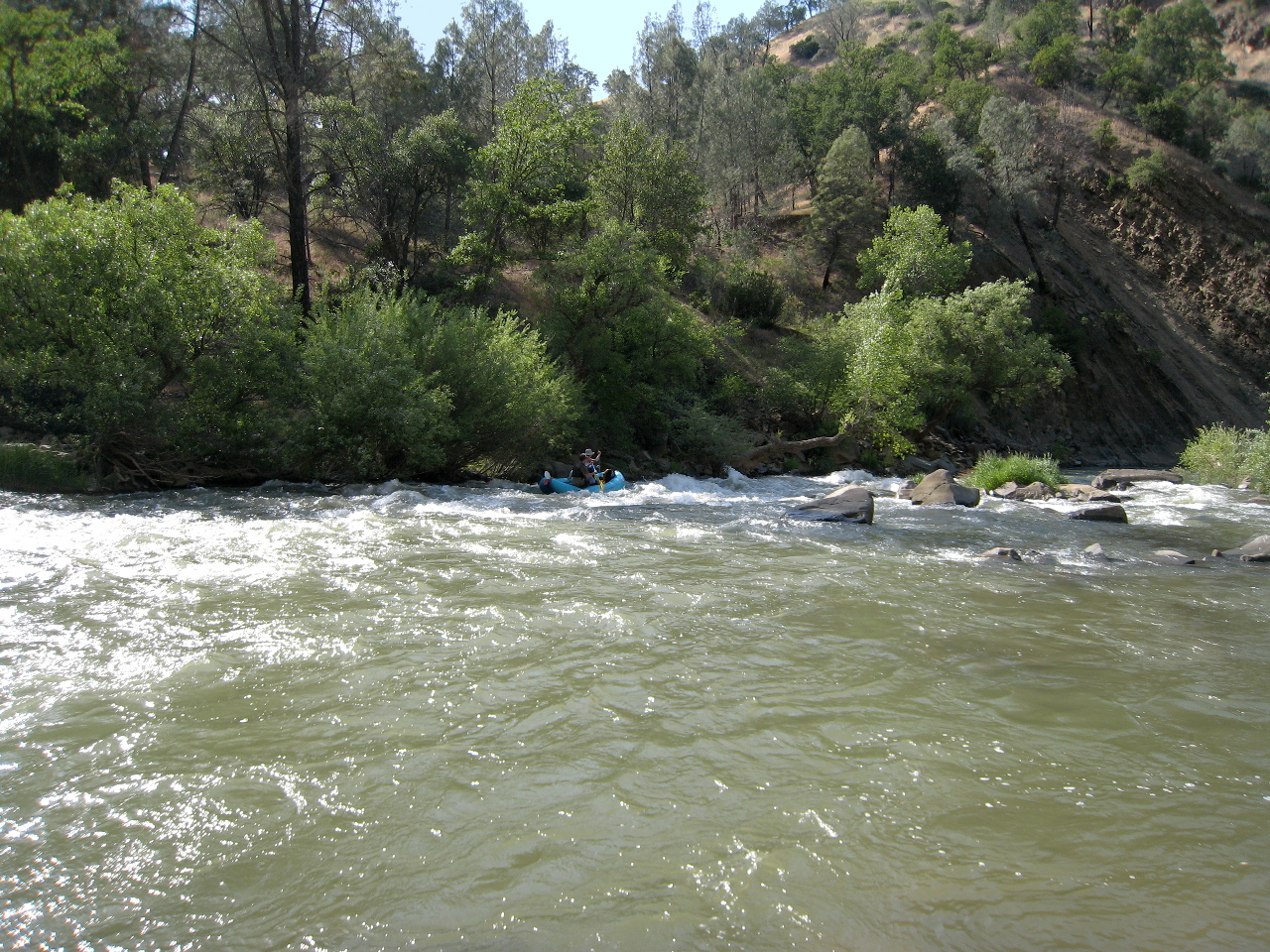
This section contains many rapids, most of them not difficult,
however brush hazards are considerable at high water,
and a concern even at low flows.
At flows above 1000 on the north fork,
watch out for a bridge about one mile down, near a residence on the left.
In 2023-2024, the right side foundation collapsed a bit.
Pull over to either shore as soon as you see the bridge,
and make sure you have adequate clearance under the bridge.
If not, you will have to portage. Within sight of the bridge,
there is an eddy on the left then a portage trail on the right.
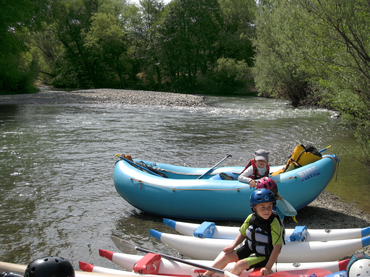
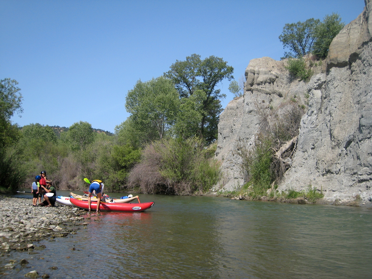
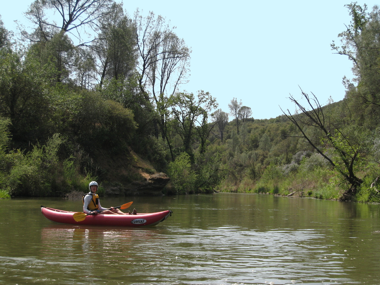
The pictures below were taken pre wildfire on a mostly north fork release
with combined flow around 450 cfs.
When flows at Rumsey exceed 3500 cfs, this run takes about 3.5 hours,
so you can combine it with the lower run.
At low flows, this 18.7 mile run requires a full day in itself.
Carry emergency gear such as lighter and rescue blanket;
hiking out is nearly impossible.
-
mile
0
- From highway 20, drive downstream on a dirt road to a parking lot
with information kiosk and toilet facilities. Carry your boats
across the flood plain to a gravel beach, obscured by willow trees,
near the river.
- .1
- Slalom, class I-II
Immediately below put-in, swift water creates many S turns
against willow-lined banks. After Perkins Creek enters on the right
in a wide alluvial fan around mile .3, the creek opens up a bit.
Watch for strainers.
-
- .9
- Low bridge, no problem at typical reservoir releases,
but a significant hazard at flood stage.
- 2.1
- Confluence with main Cache Creek, which enters on the right.
After a rainstorm, the main stem adds considerably to the flow.
In dry weather, even if the main stem carries negligible flow,
water gets more turbid after the confluence,
because Clear Lake is not clear.
About 3 miles upstream of here on the main stem is The Jams,
a class V or VI rapid.
-
- 3.2
- Stemple Creek enters on the left, before a horseshoe bend.
Patwin Village shows evidence of native American habitation.
- 3.6
- Harley Creek enters on the left, after the horseshoe bend.
- 4.2
- Rocky Creek enters on the right, at a left bend with a big alluvial fan.
In summer the water gets warm from blazing sun. Start of Wilson Valley.
- 4.9
- Jack Canyon enters on the left, .7 mile from the end of Wilson Valley.
- 6.2
- Judge Davis Canyon enters on the left.
- 6.5
- Brushy Creek enters on the left.
- 6.7
- Petrified Canyon enters on the right.
- 7.3
- Trout Creek enters on the right, in a big alluvial fan.
There are two nice waterfalls shortly upstream, well worth visiting.
After a bend, Cache Creek flows straight southeast for about a mile.
- 8.2
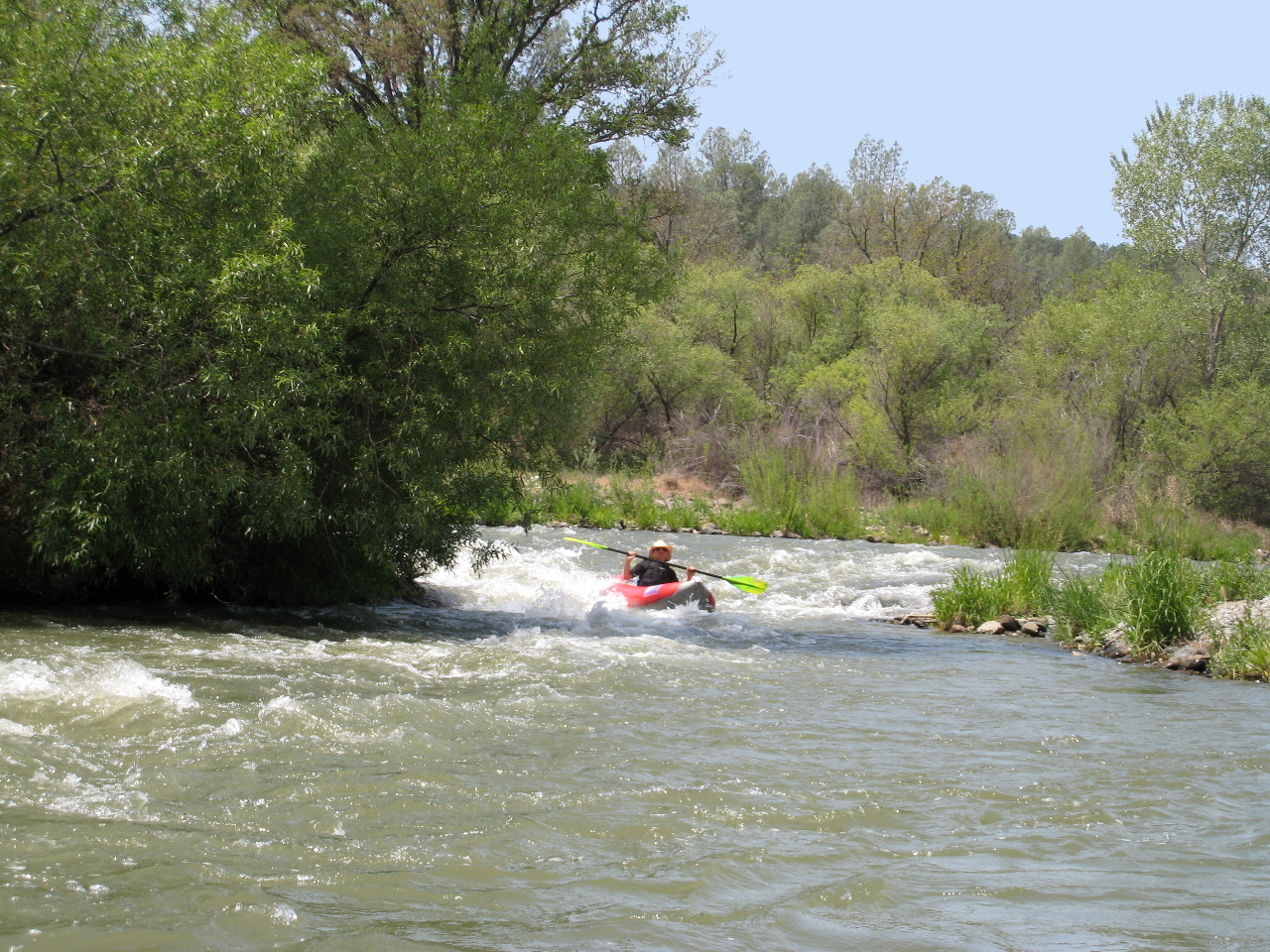
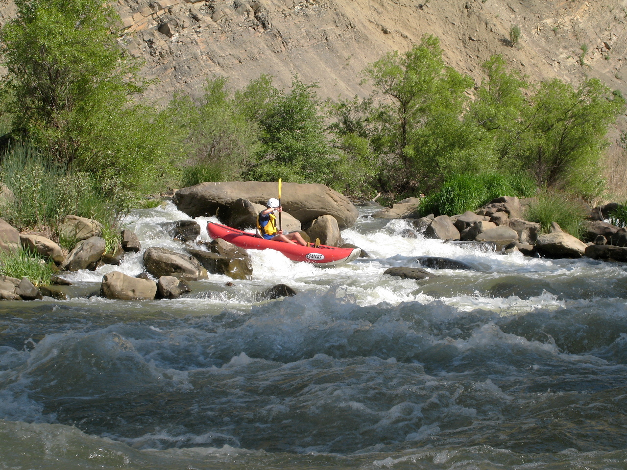
- Twist and Shout, class II+, harder at high flows
Recognition: the river curves left, and you see a big rock in the middle.
The easiest route is to its left, although you can go right.
A small creek enters on the right during the rapid.
At low flows this is a long boulder garden, technical for rafts,
with several distinct drops, followed by more after a distance.
The biggest waves are above and just below the big rock.
At high flows the big rock creates two pour-overs on either side,
both usually runnable, and this becomes a long class III rapid.
-
- 8.6
- Rocky Surprise, another rapid or a continuation at high flow.
-
- 9
- Start of Kennedy Flats, where Cache Creek makes two horseshoe bends.
Another fun rapid is at mile 9.2, near a large gravel bar on the right.
Camping was good in this area, although many shade trees have burned down.
A decent camp with “Friend of the River” plaque
on a cottonwood tree is at 38°56'43" N 122°25'22" W
near the halfway point of your trip.
- 10.5
- Crack Canyon enters on the right, in another horseshoe bend,
marking the end of Kennedy Flats.
- 11.5
- Road visible on left bank, announcing semi-civilization ahead.
This dirt road eventually reaches highway 20 near its intersection
with highway 16.
- 11.8
- The river turns sharp right and continues curving less sharply right.
A rough dirt road is occasionally visible on the right bank.
- 13.1
- Davis Canyon enters on the right. You can see Buck Island ahead
and another abandoned dirt road on the left bank.
Although it does not appear so from the river, water would have to
rise only about 40 feet for Buck Island to become an actual island.
After the river bends left then right around another horseshoe bend,
you can see the dirt road to Buck Island campground and parts upstream.
Pre wildfire this was a beautiful spot, and it is still a good camp.
Several large oak trees and two vault toilets did not burn down.
Now that the new bridge replaced the condemned low-water bridge,
vehicles can reach this area again.
- 14.3
- A dirt road connects Buck Island campground to the river.
This was the standard put-in for boaters on long commercial trips,
and might be again someday.
Downstream, as you leave the dirt roads of Buck Island behind,
Cache Creek begins a disorienting series of horseshoe bends with
few landmarks, although it seems that you make distance quickly.
-
- 17.1
- Island, main channel on the right. Narrow left channel might go.
- 18.3
- Mad Mike, class III-
A steep drop on river left with a boulder fence on the right.
Recognition: the creek bends left at a steep barren brown cliff,
and pushes left again toward a big rock and dark forested wall.
It looks more difficult than it is, although the waves are big.
At most flows the easiest route is slightly right of center.
-
-
- 18.7
- Take out at the Bear Creek confluence, or continue downstream to
one of many access points, such as the large parking lot access
shortly downstream of the Yolo-Colusa county line.
To continue, see the regular Cache Creek writeup.
For quiet-water paddling on nearby Clear Lake, see
Konocti Water Trails.
Shuttle Directions
To access all runs on Cache Creek, take I-80 to Vacaville, then I-505 north,
or if coming from the north, I-5 to Dunnigan, then I-505 south.
Boaters arriving from the west can take highway 20 to 16.
About 11 miles after crossing Putah Creek, take the Woodland-Esparto exit
and turn west onto highway 16. Stay on this bendy road thru Esparto, past
the Brooks casino, a ways to Guinda, then to the small town of Rumsey.
To reach take-out, continue upstream 6 miles on highway 16 to Yolo County Park.
Shortly upstream of the main park entrance are several turn-out areas
with plenty of parking, and good access down to the creek.
Parking at the Bear Creek confluence is tight, and access is poor except
for outfitters, who have a key to the locked gate.
To reach put-in, continue 7 miles upstream along Bear Creek on highway 16
to its junction with highway 20. Turn left (west) and drive 13 miles to
a bridge over the north fork of Cache Creek. Turn left on a dirt road.
A fine BLM river access area is a short distance downstream.
Before Memorial Day, it is easy to find a site at Yolo County's
Cache Creek Regional Park campground, which is quite nice,
with reasonable fees and available hot showers.
If you want to finish in one day, camping helps you get an early start.
|
|
Creeks Navigation
Home
Recommended Runs
Map of Rivers
Alphabetic Index
Alphabetic Table
Text Search
Sponsored Links
|