| |
| Stretch: |
Headwaters at The Basin to Middle Fork Eel Confluence |
| Difficulty: |
Class IV+ with 1 portage (plus logs) |
| Distance: |
24 miles, 2 days |
| Flows: |
kayak optimum 1000 cfs at take-out
|
| Gauge: |
estimate 40% of the Eel
(DOS) |
| Gradient: |
80 fpm average
(40 80 90 70 120 120 90 110 140 100 90 100 80 80 80 90 80 90 70 60 40 50 50 10) |
| Put-in: |
Estelle Creek near Middle Creek confluence, 3390' |
| Take-out: |
Near confluence with Middle Fork Eel, 1460' |
| Shuttle: |
100 miles (5 hours) one-way |
| Maps: |
USFS Mendocino NF, AAA Sonoma and Mendocino,
Topo
|
| Season: |
April into June, rain and snowmelt |
| Agency: |
USFS |
| Notes: |
© 1998 Bill Tuthill,
CreeksYahoo |
Andy Hertz sent me this description after what he thought was a first
descent of upper Black Butte. Alas, no dice. We later discovered that
kayakers Kenny King, Eric Jensvold, and Bill Vogler started at mile 10
in 1992, as reported in the Sierra Club's Paddlers News Bulletin.
Mike Doyle e-mailed that he guided a raft starting at mile 17 circa 1987.
Finally we heard that the Black Butte was run in 3 days in 1974 from the
very highest road crossing by the Bauer brothers, who reported strenuous
portaging in the upper miles in the American Whitewater Journal.
The Black Butte is an all-time classic! We all agreed that we had never
experienced a better combination of fantastic rapids, beautiful scenery,
abundant wildlife, and isolation from humanity. Along the way we saw a
bear, otters, golden eagles, deer, and some bunnies on the drive in.
For more than twenty miles along the river corridor there were literally
no traces left by mankind. Pure wilderness at its best. I can hardly say
enough about the quality of the rapids - mile after mile of exhilarating
class III-IV+.
This run is superb in every sense, and one that emphatically deserves a spot
on your annual to-do list. Although the shuttle is long in snowy years,
it could be shortened significantly if 5006' Mendocino Pass were open,
although by then the river might be too low. A good strategy might be
to do this run on declining flows after a minor spring rainstorm.
- mile
0
- Put in where road 311 fords Estelle Creek. Much of this area is
private property. Expect skimpy flows for the first mile. If it's
not skimpy, the lower river will probably be too high.
-
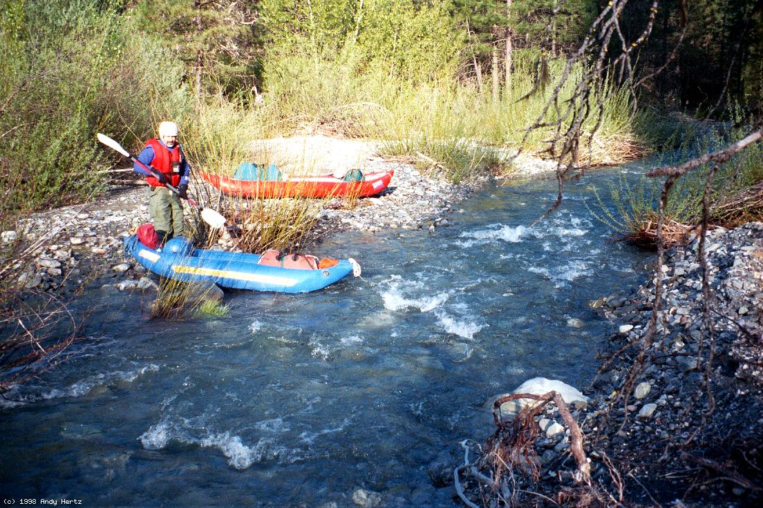
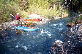 Boris waits for slowpokes at put-in
- 1
- Spanish Creek comes in on the right, approximately quadrupling
the flow. If it's still skimpy, the flow is probably too low.
Rapids are mostly class II.
-
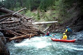 Log jams often force you out of your boat
- 3.9
- Skidmore Creek enters on the left. After a while, the gradient
steepens and rapids become class III-IV. The first class IV,
beyond an overhead log (1998), is not runnable at low flows.
-
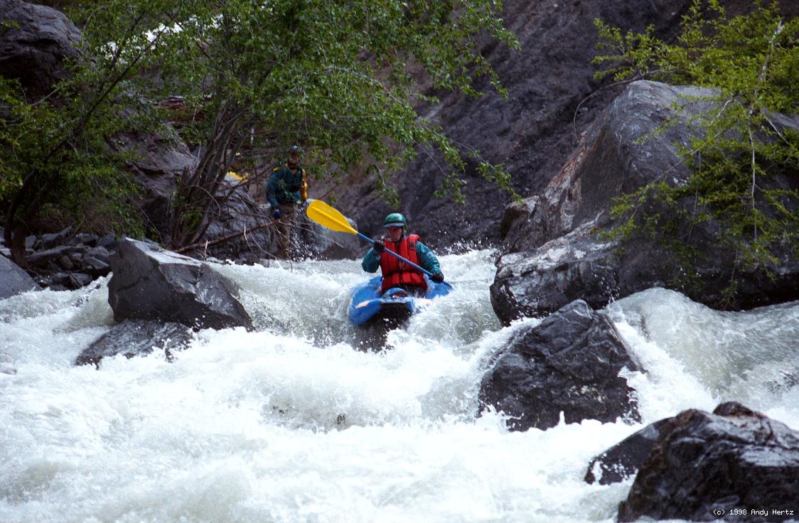
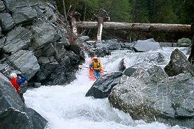 Darren in the first Class IV rapid
- 4.6
- Tree Right, possible portage at high flows, owing to tree.
-
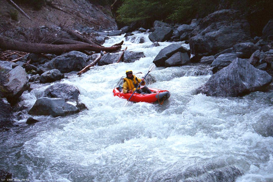
- 5.1
- Plug Rock, long boulder slalom.
-
- Rapids ease a bit; the steep gradient creates many fun drops.
-
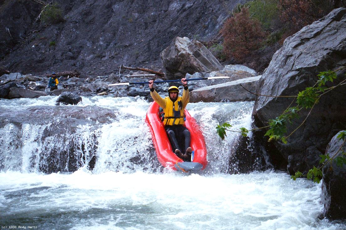
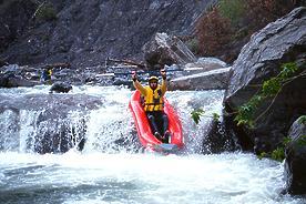 Camera Falls seems best run on the left
- 6.5
- Buckhorn Creek enters on the left.
- 7.2
- Baldy Creek enters on the left. Gradient steepens ahead, but
without creating any unrunnable rapids.
-
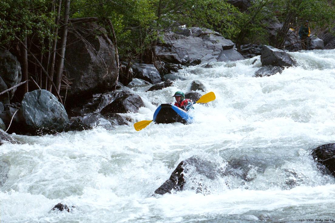
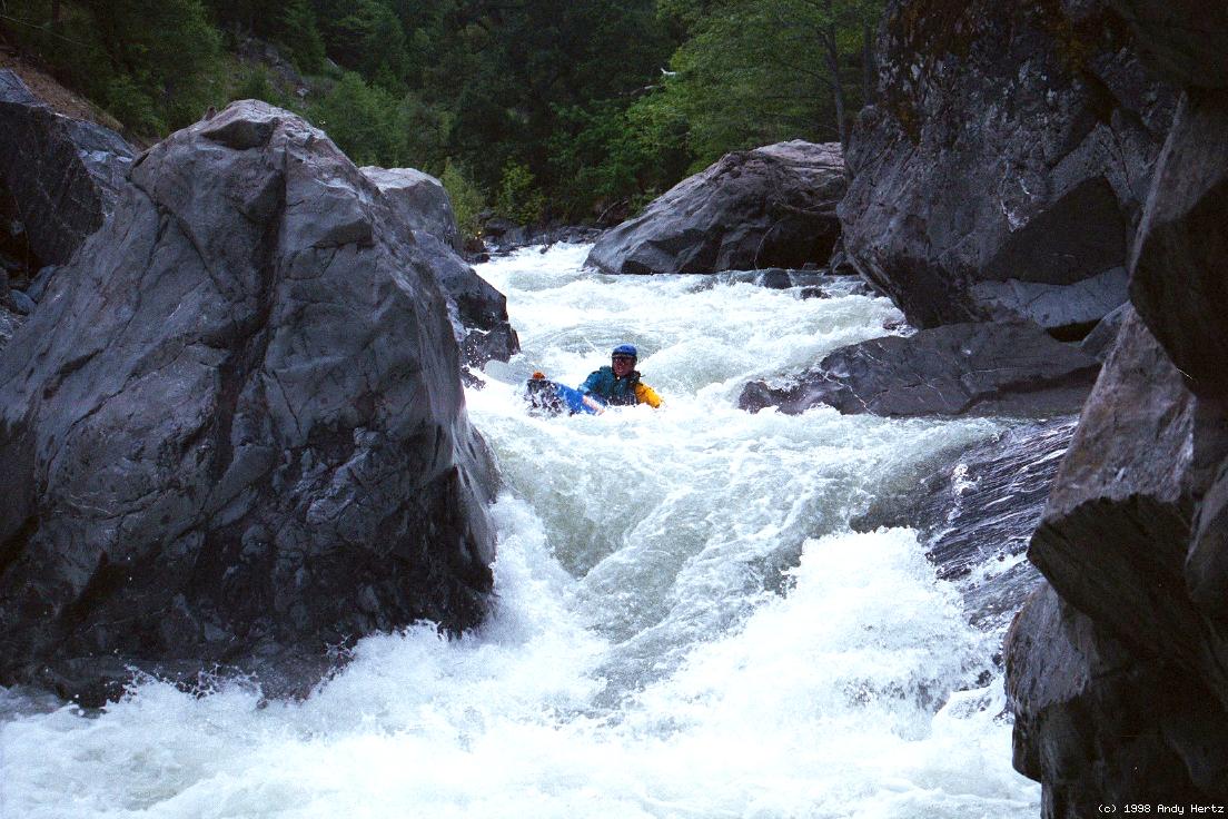
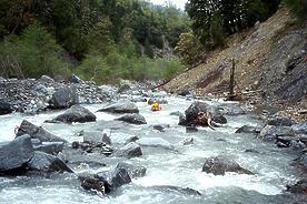 Typical steep boulder dodging action
- 9.1
- Cold Creek enters on the right, adding significantly to the flow.
Rapids become bigger but less technical.
- 9.5
- Salmon Creek enters on the left. Rapids ease up a bit, and good
campsites abound.
- 10.7
- Dingman Creek enters on the left.
- 11.7
- Butte Creek enters on the right.
- 12.3
- Billy Pike Creek enters on the left.
- 12.4?
- Fifteen Minute Scout, class IV+
-
- 12.5
- Atchison Creek enters on the right
- 13?
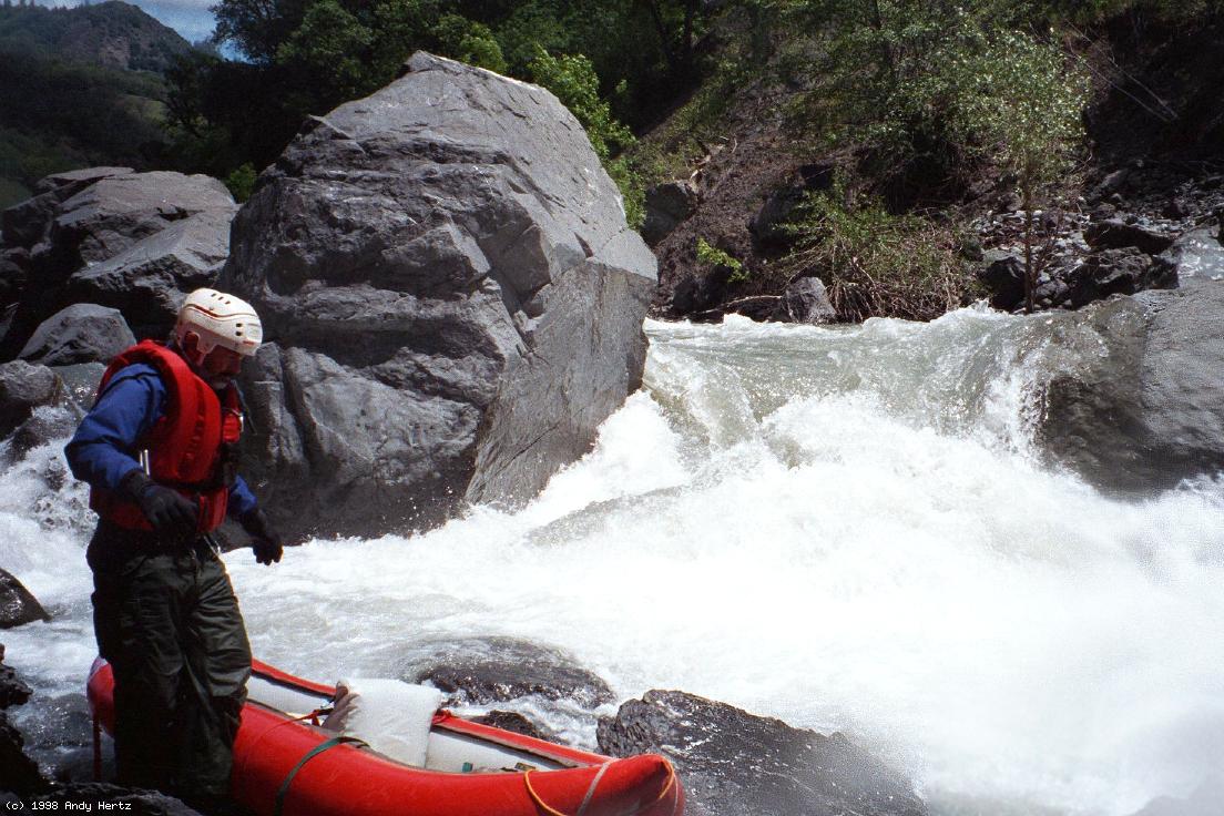
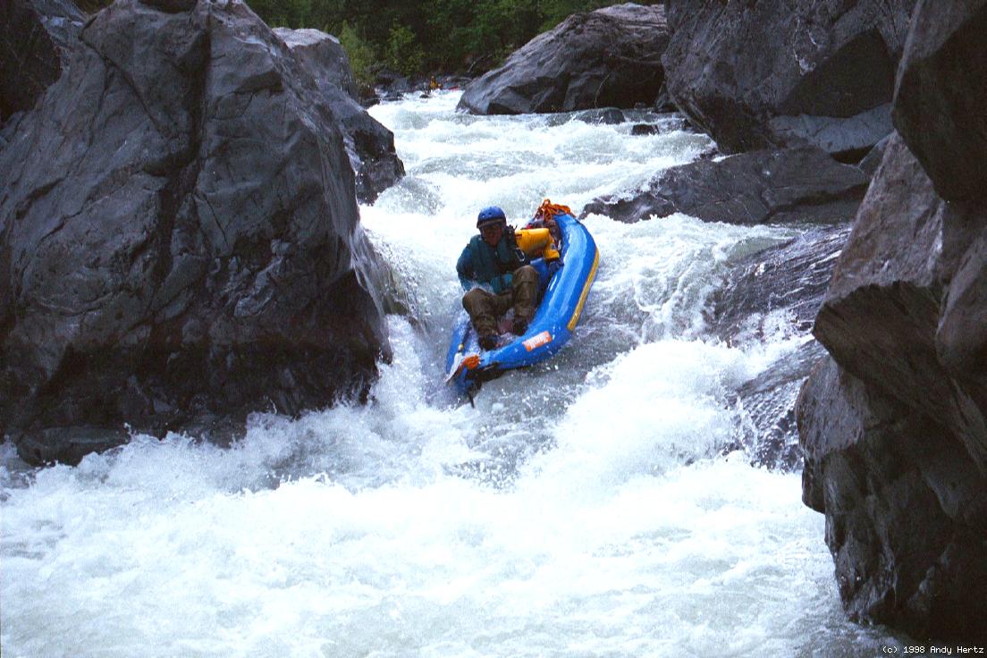
- Top Portage, class IV+
You can take the teeth out of this one by portaging the first section
and doing just the long class IV+ runout. (Andy's fine pictures of
this rapid were ruined by a water droplet on his Pentax WR-90 lens.)
- 14.4
- Blue Slide Creek enters on the right.
- 15.1
- White Hawk Creek enters on the right.
- 15.9
- Mississippi Creek enters on the left.
- 18.1
- Sallady Creek enters on the left.
- 19.5
- Billy Williams Creek enters on the left.
- 20.1
- Jumpoff Creek enters on the right with a big gravel contribution.
- 20.7
- Nebo Creek enters on the right.
- 21.9
- Shields Creek enters on the left.
- 23?
- Double Dynamite, class V+, probable portage on right
A suspiciously long flat section lulls you into thinking it's all over,
but it's not. GPS coordinates north 39°48.3' west 123°3.7'
-
- 23.1
- Van Horn Creek enters on the left.
- 24
- Take out at on the left underneath the Etsel Ridge highway bridge,
which crosses to the USFS campground on the right bank.
To reach put-in, take Potter Valley Road north from Highway 20, and follow
signs to Pillsbury Reservoir. Drive around the north side of the reservoir,
then take M1 (Hull Mtn. Road) east. After this road crosses Squaw Valley
Creek, stay straight as the road becomes M6, which climbs and then descends
into the upper main Eel at Horse Creek. Keep going northward as the road
climbs into Low Gap. Although 311 goes straight ahead from Low Gap, it is
blocked by a landslide. Turn left, continue uphill, then turn sharp right
and follow signs to The Basin, rather than continuing east on M6. Descend
to road 311, turn left, and continue downhill to the ford of Estelll Creek.
To reach take-out, return to Highway 20 and 101, proceed north to Longvale,
and turn west on highway 162 to Covelo. After turning sharp right in Covelo,
this becomes Mendocino Pass Road and then FH7 as it descends and follows the
Middle Fork Eel to the Black Butte USFS campground.
|
|
Creeks Navigation
Home
Recommended Runs
Map of Rivers
Alphabetic Index
Alphabetic Table
Text Search
Sponsored Links
|
 Boris waits for slowpokes at put-in
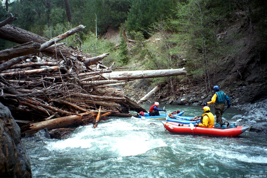 Log jams often force you out of your boat
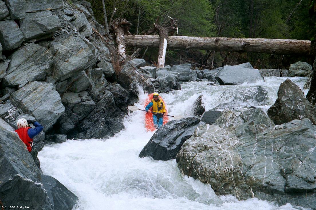 Darren in the first Class IV rapid
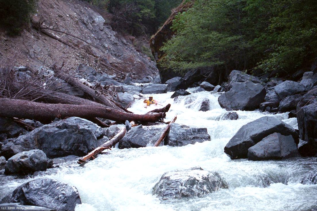
 Camera Falls seems best run on the left
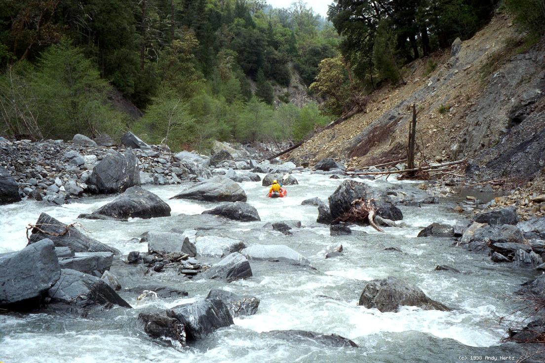 Typical steep boulder dodging action