| |
| Stretch: |
Euchre Bar trail to Iowa Hill Road |
| Difficulty: |
class IV+ with 3 class V rapids, harder above 1050 cfs |
| Distance: |
14.5 miles, 1 or 2 days |
| Flows: |
rafts (500) 700 - 2000 cfs, kayaks 600 - 2500, IK minimum 350
|
| Gauge: |
flow measured way downstream
(NFD) |
| Gradient: |
54 fpm average, 120 fpm in mile 4, 100 fpm in mile 6 |
| Put-in: |
down a 2 mile trail to Euchre Bar, 1900' |
| Take-out: |
USFS campground along Iowa Hill Road, 1110' |
| Shuttle: |
19 miles (30 minutes) one-way, some on dirt road |
| Maps: |
USFS Tahoe NF, AAA Tahoe Region,
Topo
|
| Season: |
spring, from snowmelt |
| Agency: |
USFS,
guided Whitewater Rafting |
| Notes: |
© 1999 Bill Tuthill,
CreeksYahoo |
Giant Gap is a total classic, both for its whitewater,
which is intense at times and relaxing at other times,
and for its dramatic canyon scenery.
The view of Giant Gap from your trailhead is awe inspiring,
and once you boat into the Gap, there is no exit except by river.
Below 600 cfs this is more of a class IV run than a class V run,
although two or three rapids remain class V even at low water.
Many class IV rapids require bank scouting to pick a good route,
unless you are familiar with the best routes,
but even then the rapids often change from year to year.
There is a pleasant campsite on a wide boulder bar about a third of the way
down the run, but camping gear makes the hike down to put-in much tougher.
Most people do this run in one long day,
finishing just before dark or shortly thereafter.
Camping at the trailhead and starting your hike down before dawn
is an excellent precaution against finishing in the dark.
This run is not exceptionally hazardous.
There are probably fewer deathtraps per mile on this stretch
than on the Chamberlain Falls section just downstream.
In 1985 hardshell kayaker Mark Allen died on this run,
but it was in the easier class II-III section after the Gap,
from broaching on a rock without any nearby companions to rescue him.
- mile
- 0
- Put in at the limpid green pool below the Euchre Bar pack bridge.
- .1
- Class III rapids begin immediately, and continue into a small gorge
where the river has cut a narrow channel. Frequent waterfalls
provide a scenic backdrop, but the rapids are too continuous for
you to pay much attention.
- 1.2
- The canyon opens into Green Valley and the rapids taper off to
class II. Several hiking trails reach the right bank here,
including one from your trailhead, but the trails are difficult
to spot from river level.
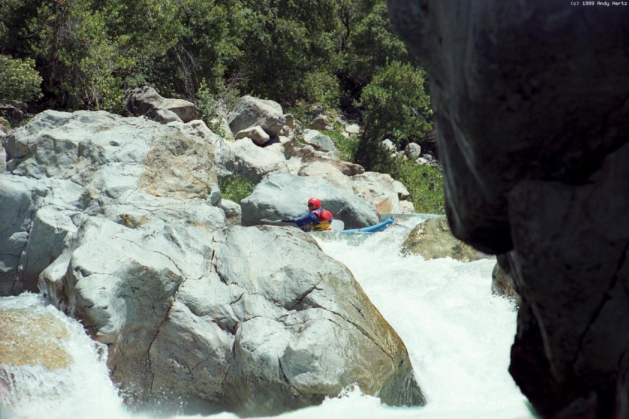
- 2.4
- Giant Gap begins, marked by a rapid where most of the current
piles into a huge midstream boulder, often with a tree stuck there
to make things more exciting.
- 2.6
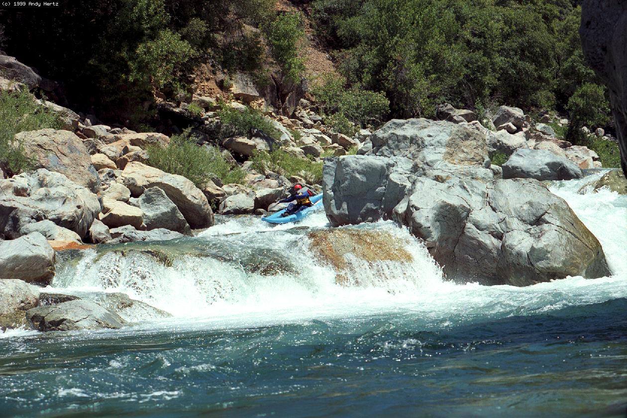
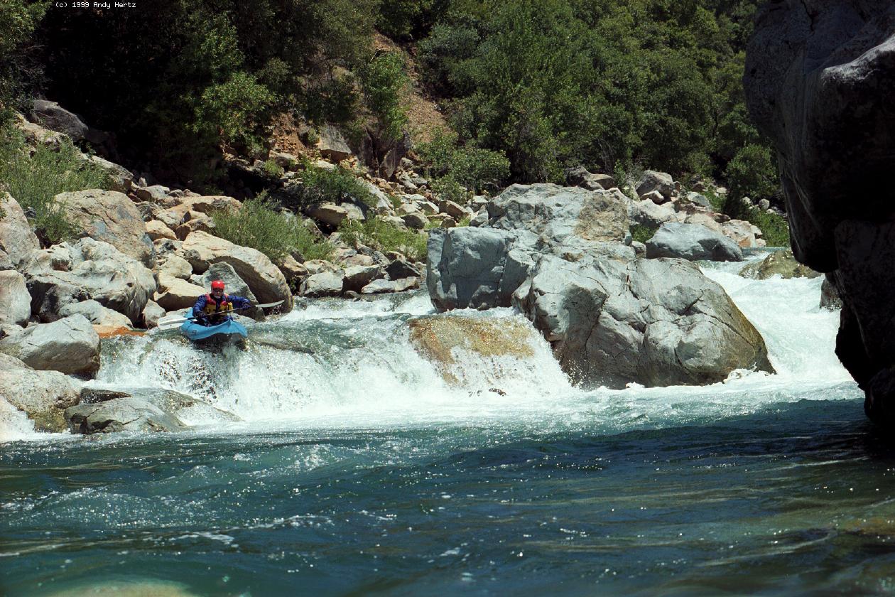
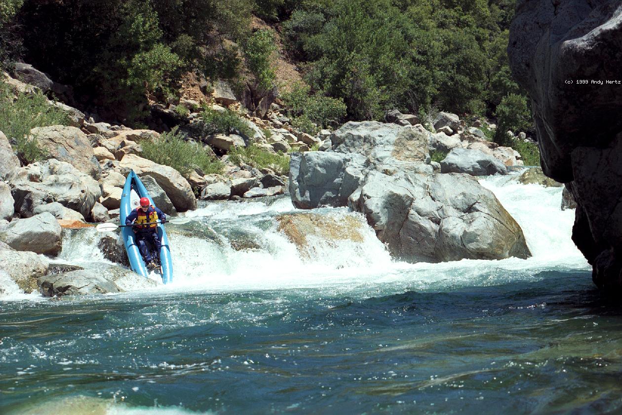
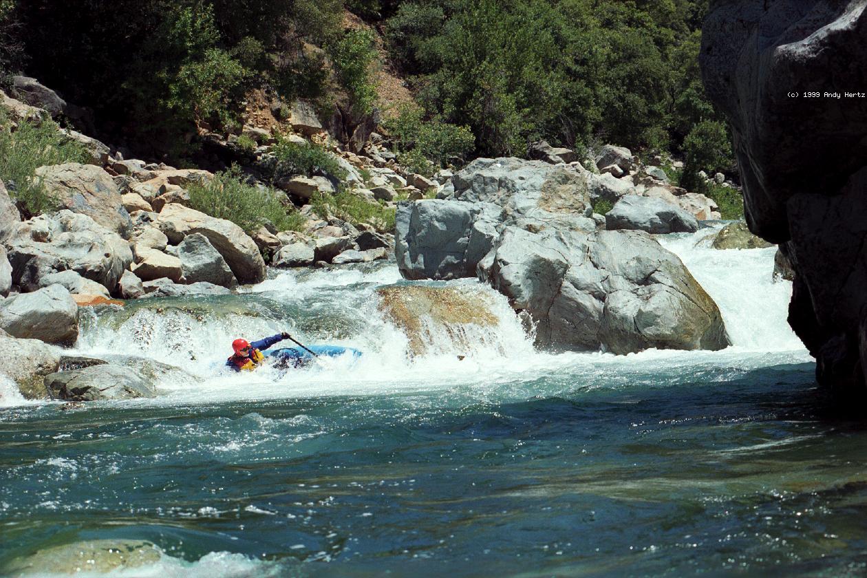
- Grater, class IV
Rafters should scout right because the widest channel is over there.
Kayakers can often negotiate the narrow passages among boulders
towards the center, where the drops are less steep and turbulent.
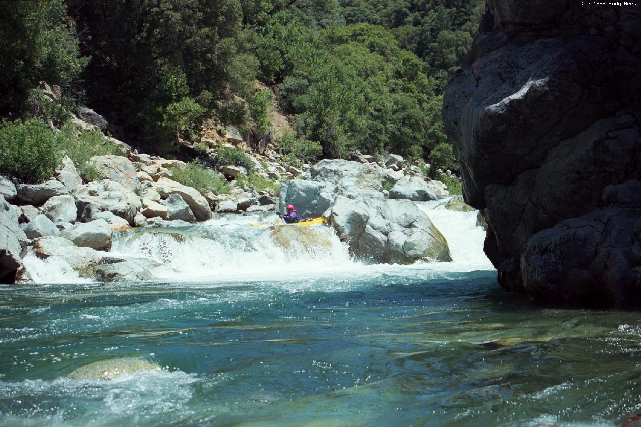
- 3.1
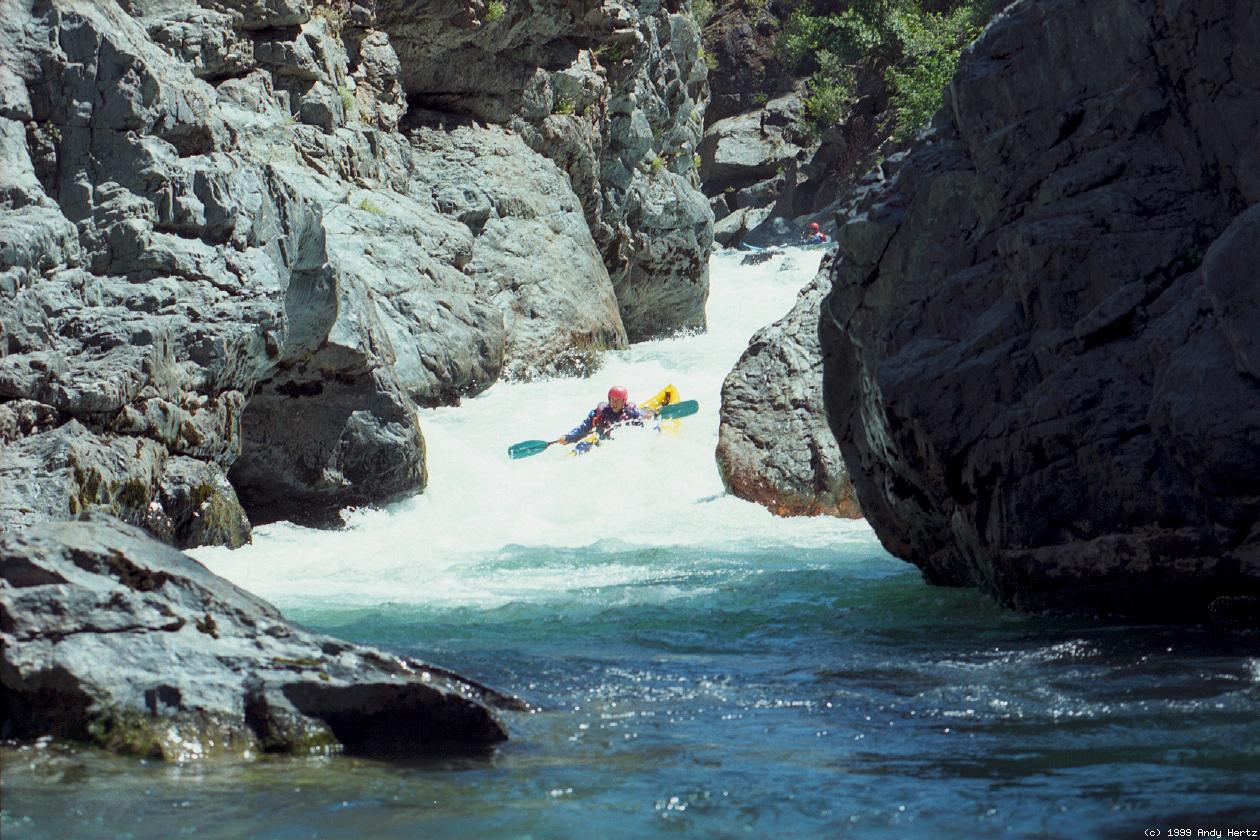
- Nutcracker, class V, scout center
The river drops over a rock fence and into a narrow turbulent chute
flanked by a big boulder on the left and a cliff on the right. Not
as technically difficult as it looks. Easy portage on the left.
-
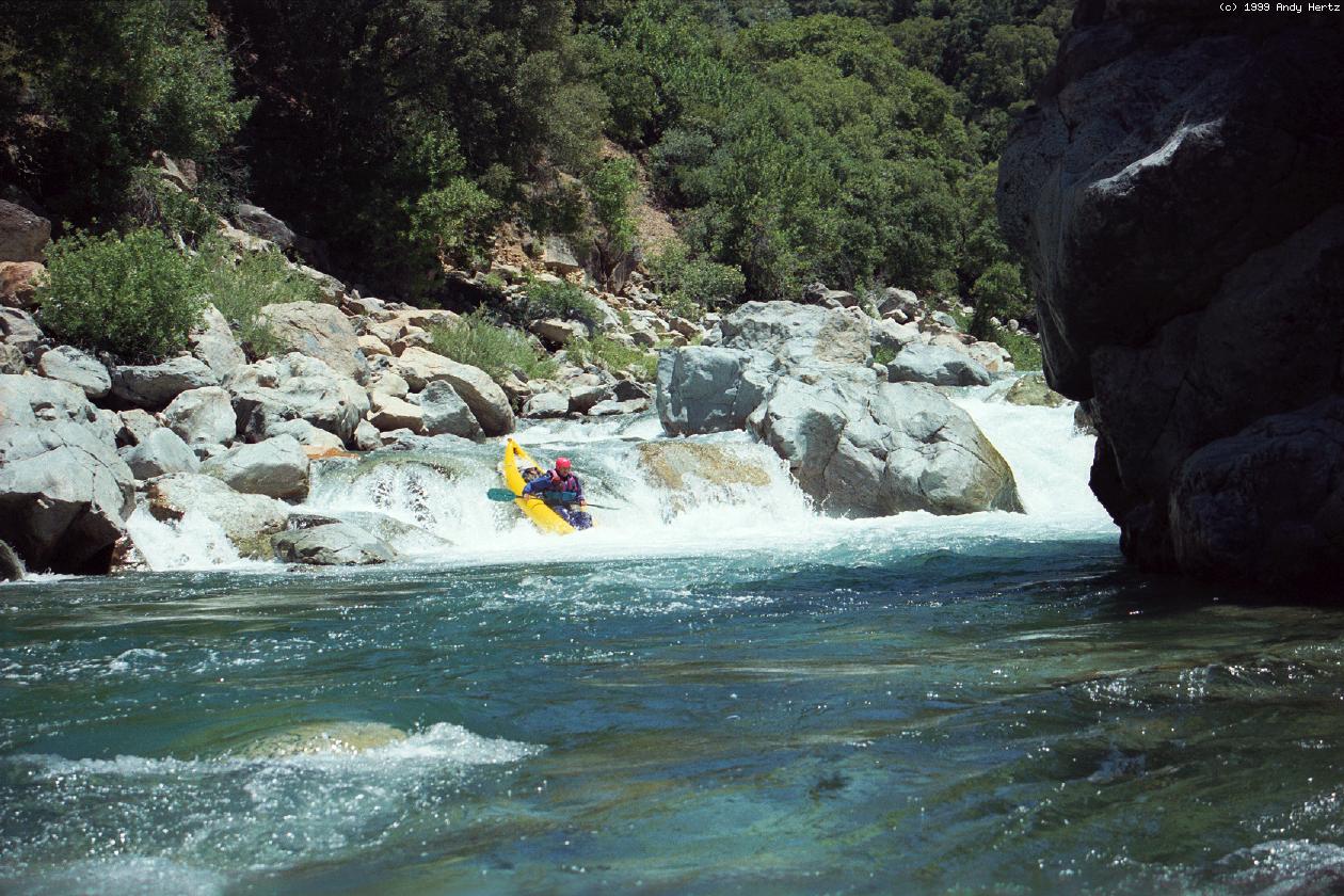
- 3.5
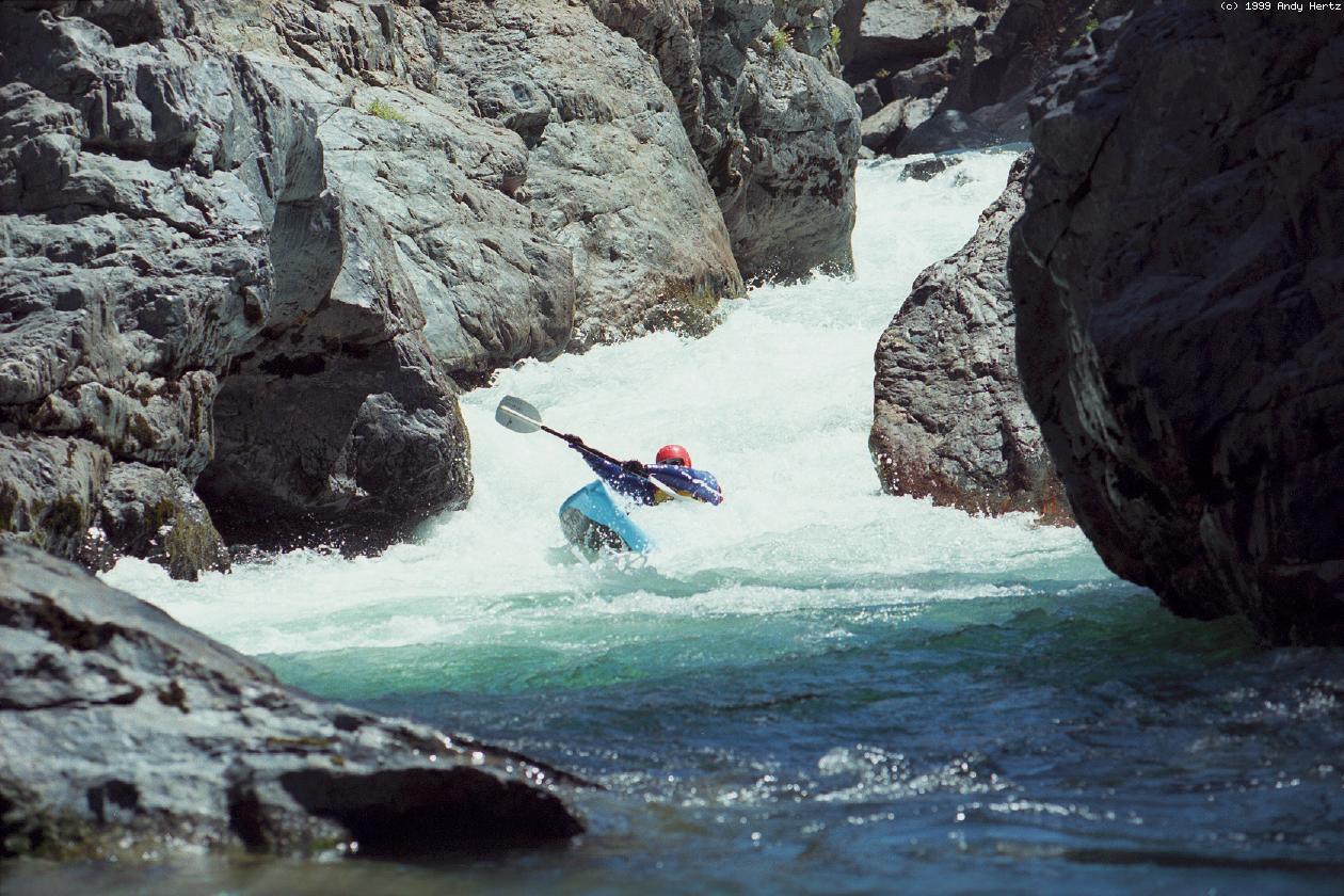
- Locomotive Falls, class IV-V, scout right
The entire river drops over a 5' or 6' falls into a reversal that
can be very sticky. At low flows you can wade over an underwater
gravel bar to get a look at the falls, and even line your boat over
the falls from a rock on the right. At higher flows this rapid is
extremely difficult to scout and almost impossible to portage.
-
- 4.5
- Large gravel bar on river right makes a good camp or lunch stop.
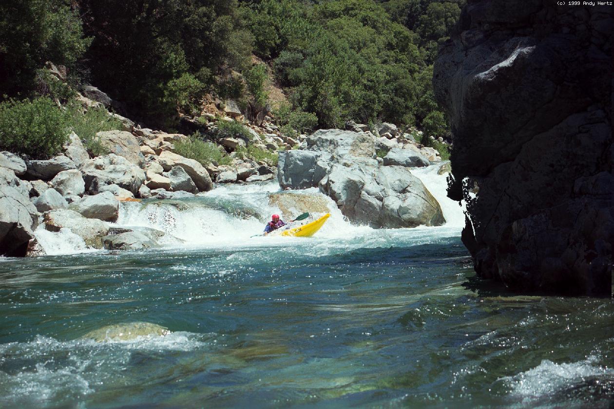
- 5.1
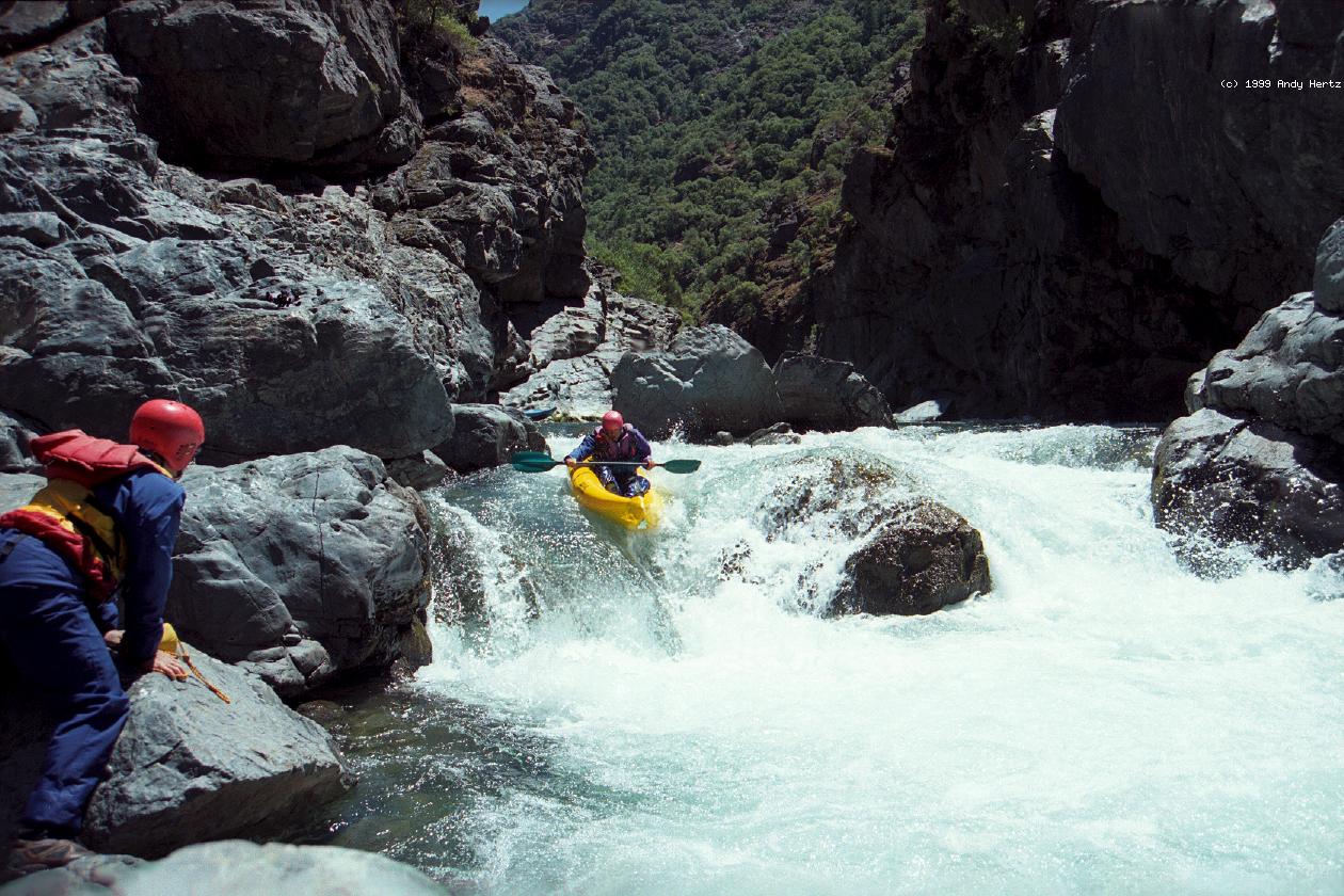
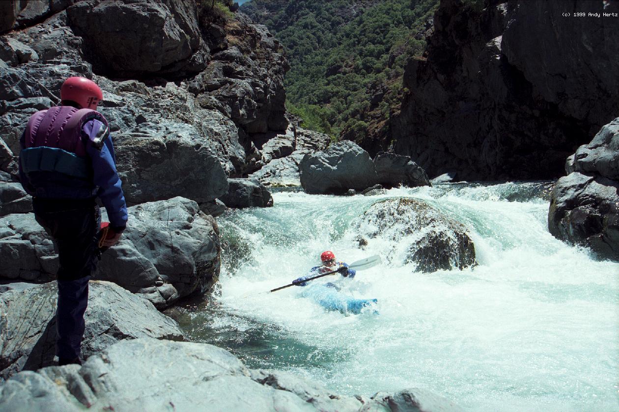
- Dominator, class V, scout right
Many entry routes, not the same ones at all flows, make this rapid
difficult to anticipate. All routes lead to a huge drop at the end,
which is cleanest on the far right, but has been run, sometimes
unintentionally, to the left of the final plug rock. Moderate
portage over boulders on the right bank.
-
- Mumu shows that it's easy to get surfed off-course in this rapid.
-
- 5.5
- Canyon Creek enters thru a narrow cleft on the right, after dropping
over several scenic waterfalls just upstream.
- 6.0
- Pickering Bar on the left bank. A trail leads out of the canyon
from the right bank. Shortly below, the rapids taper off from
class IV to mostly class III.
- 7.0
- Tommy Cain Ravine on the right, with a trail leading out of the canyon.
- 14.1
- Pinball, class IV+, scout left
A long slalom over major drops with curling waves that can easily
flip a kayak. The rapid is difficult enough, and comes at the end
of the trip when you are tired and not ready to concentrate. There
are several mandatory left-right-left moves.
- 14.4
- Take out on the left bank at the USFS campground above the
Iowa Hill road bridge.
Shuttle Directions
To reach take-out, exit I-80 at the Colfax exit.
On the south side of the freeway,
follow Canyon Way west for about a quarter mile.
Turn left onto Iowa Hill Road, and descend to the river.
The USFS campground is on the far side of the bridge.
To reach put-in from there, return to I-80
and drive uphill to the Alta exit.
On the south side of the freeway,
follow signs towards Casa Loma.
After one mile turn right at a sign for Eucre Bar Trail.
This road crosses the railroad tracks after .5 mile,
and again after another .8 mile, changing to dirt now and again.
Be careful, this is an active railroad line.
After another .6 mile the dirt road forks.
Take the left fork, which leads to the Euchre Bar trailhead and outhouses.
To find nearby food and lodging, type Colfax into the box and click Search.
|
|
Creeks Navigation
Home
Recommended Runs
Map of Rivers
Alphabetic Index
Alphabetic Table
Text Search
Sponsored Links
|