| |
| Stretch: |
Big Slide campground to near Trinity confluence |
| Difficulty: |
class IV+ (1 class V-) with 2 portages, harder at higher flows |
| Distance: |
17.1 miles, 1 or 2 days |
| Flows: |
rafts 800 - 3000, kayaks 700 - 2000, IK minimum 600
|
| Gauge: |
measured near put-in at Hyampom
(USGS site)
|
| Gradient: |
37 fpm average, 56 fpm to Underwood Creek |
| Put-in: |
gravel bar below Big Slide campground, 1200' |
| Take-out: |
washed-out bridge 8 miles above confluence, 570' |
| Shuttle: |
50 miles (over 2 hours) one-way, some on dirt |
| Maps: |
USFS Six Rivers NF, AAA Northern California,
Topo
|
| Season: |
spring, from snowmelt |
| Agency: |
USFS, some private |
| Notes: |
© 2001 Bill Tuthill,
CreeksYahoo |
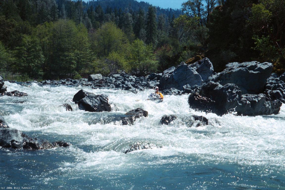
This classic run on the South Fork Trinity offers superb wilderness scenery,
excellent although not sustained rapids, and great water quality.
The only drawbacks are the long shuttle and one difficult portage.
Holbek says “this beautiful and challenging run is probably the best on
the south fork of the Trinity,” implying it also has the longest season.
In his classic book West Coast River Touring,
Dick Schwind said he didn't consider the first few miles navigable,
and recommended putting in at Underwood Creek.
However, except for the portages, that is the best section!
The South Fork Trinity continues running from snowmelt for quite a while.
Even in drought years it might be at a good level into mid spring,
after Antelope Creek and Deer Creek have petered out.
Kayakers often prefer high flows, but on our trip at 700 cfs
one hardshell kayaker accompanied us and had a great time.
Holbek's minimum 700 cfs is more than enough water to avoid scraping.
I suspect the true minimum is quite a bit less than 600 cfs.
- mile
0
- Put in along the beautiful gravel bar, most easily reached
from the far end of the campground.
- .2
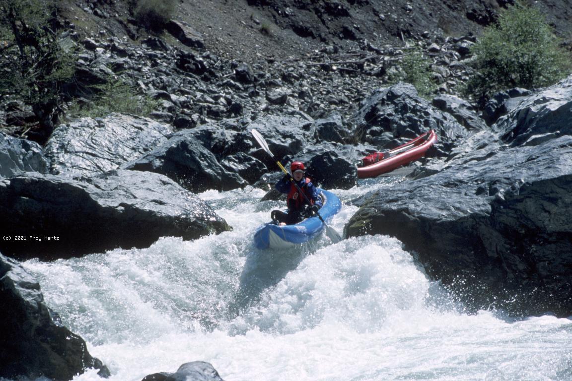
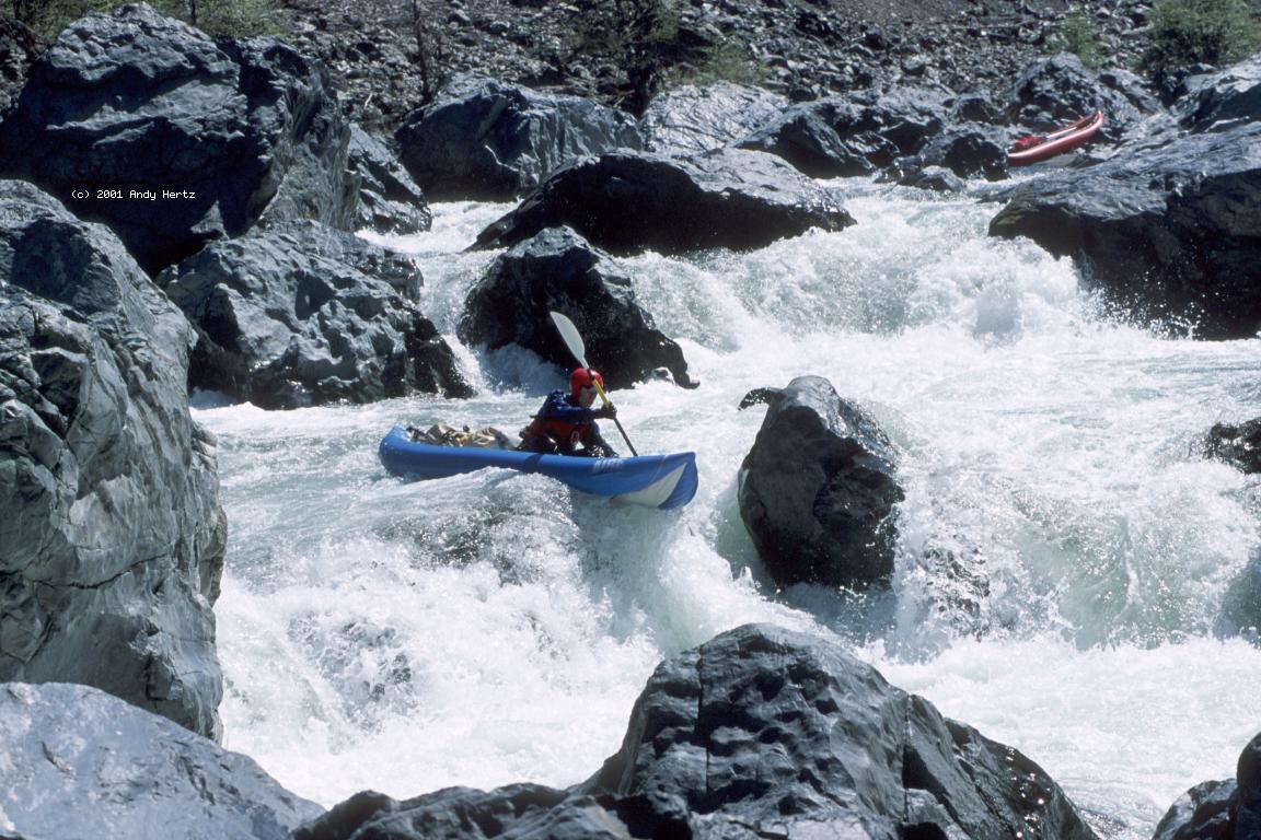
- Hazard! Big Slide Falls, class VI, portage left or line right
This mess, the result of a landslide from the mountain on the right,
probably changes every few years. Depending on the configuration of
boulders, you may either portage on the left or line on the right.
The road is perched high on the left bank, offering no assistance.
-
- In spring 2003, Boris Trgovcich sent this updated description:
The first part of the rapid is a mandatory portage. There is just
no way to get through all the boulders at normal flows. However,
the rest of the rapid is a long runnable class IV+ stretch that ends
with 5-6 foot drop on the river right.
Above the last drop is a small eddy on the right which is tempting
to catch, however, if you miss it you'll end up in a hole under a rock:
really scary looking and it is not at all obvious. At higher flows
it would be really easy to get sucked into there if you did not know
about it. A real death trap.
- .5
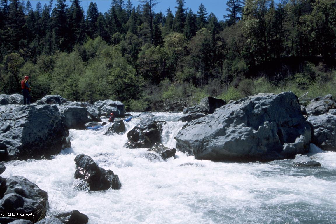
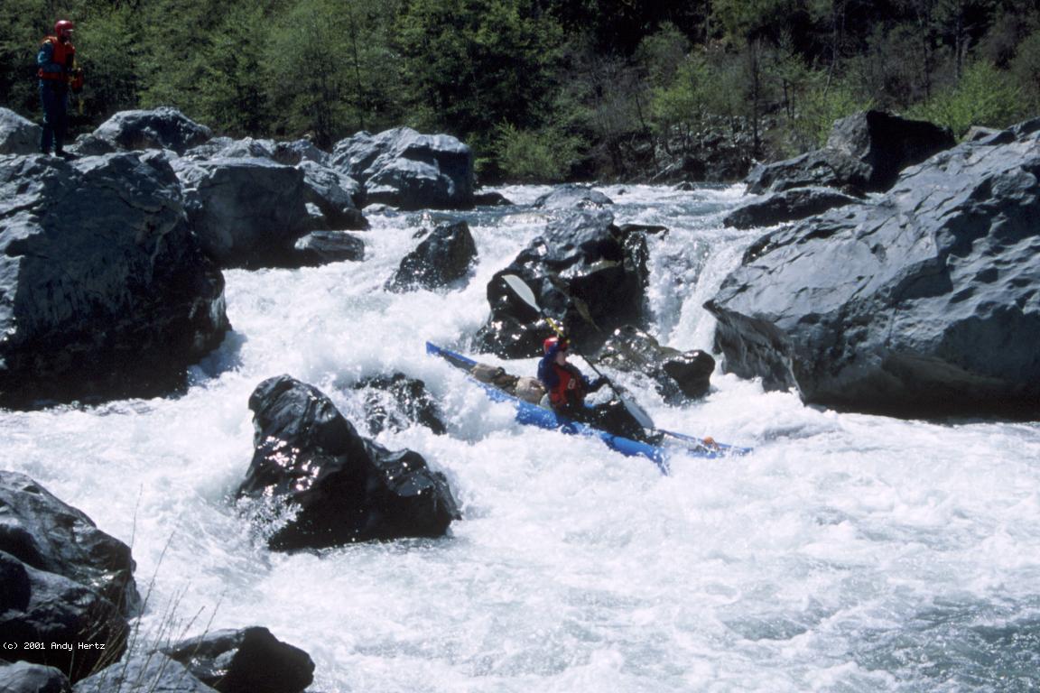
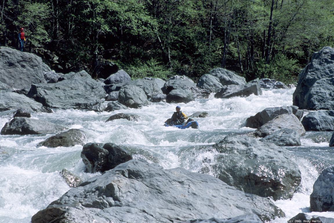
- Fun class III-IV rapids begin in a scenic gorge. Most are
relatively steep drops over and around boulder piles.
- 2.1
- Entrapment Falls, class V or V+, line left?
In our party, people who scouted from the right immediately decided
to portage (moderate on that side). People who scouted from the left
either decided to run the rapid or lined it with minimum difficulty.
That's because most of the entrapment horrors are on the right side
(spring 2001).
-
- Fun class III-IV rapids continue below.
- 3.6
- Powerline Falls, class IV+, scout right
With powerlines close ahead, the river spreads out and drops
over a steep boulder pile. The best route seems to be an S-turn
on the right, with a high-water sneak route even further right.
-
- 4.1
- Power lines pass overhead.
- 5
- Underwood Creek enters on the right, just above a footbridge
across the river. This makes an alternate put-in, but why bother?
You can reach the footbridge by driving past Big Slide campground
uphill then down again; after driving underneath the power lines,
take the 2nd right onto Gates Road.
- Rapids taper off to mostly class II-III,
however Boris Trgovcich (spring 2003) reports the following:
After about 1.5 hours of floating past the Mule bridge,
an innocent looking class II leading into a class III had a log
all the way across at the very bottom. We could not see it
from the river and even from the shore it was not easy to spot.
It is wedged between a van-sized wrap-boulder in the middle
and the left wall. There was no passage to the right of the boulder
at our flow. Once you are in the current, it is impossible to
pull out except for a microeddy that a hardshell may be able to catch
almost on top of the log against the left wall. A dangerous spot.
-
- 6.4
- Grouse Creek enters on the left, marking a big rapid ahead.
- 6.7
- Grouse Creek Falls, class V-, scout left
The river drops steeply over several boulder ledges, then piles
into a big hole. This would be just class IV+ if not followed by
another steep drop at a left-hand bend, with little recovery time.
-
- 7
- A nice wilderness section follows, with occasional III+ rapids.
Campsites are rare at first in the gorge, then become easier to find.
- 11
- Coon Creek enters on the right, soon followed by Surprise Creek.
A cable crosses the river to a lone house on the left bank.
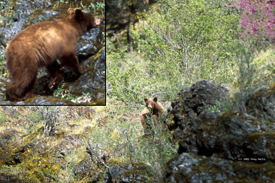
This is where commercial “Three Bears” rafting trips begin.
The canyon starts to open up a bit.
-
- 14.9
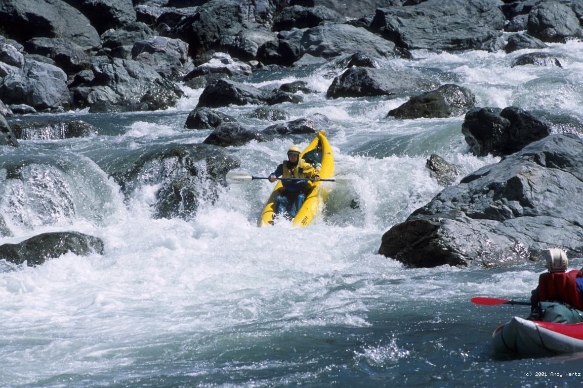
- Poppa Bear, class IV, involves maneuvering around big rocks;
scout either side.
- 15.1
- Mama Bear, class IV+, a slalom ended by some narrow rocky chutes;
scout either side or possibly from mid-river boulders.
- 15.5
- Baby Bear, class IV-, a wrap rock at lower flows.
- 17.1
- Fun class II-III rapids continue to the washed out bridge
where you (hopefully) parked your shuttle vehicle. Below this
the rapids taper off quickly to class I-II for 8 miles to the
confluence with the main Trinity.
There is an easier wilderness run with a shorter season on the
South Fork Trinity above Hyampom.
There are tougher semi-wilderness runs with shorter seasons on
upper Hayfork Creek near Hayfork and
lower Hayfork Creek just above the confluence
at Hyampom.
To reach take-out, take highway 299 west from Redding.
After passing thru Burnt Ranch and Hawkins Bar,
and just before crossing the South Fork Trinity,
turn left onto South Fork Road
(if coming thru Willow Creek, turn right).
Drive exactly 6.9 miles and watch closely for a V intersection
with a dirt road on the right, marked as two private farms or ranches (2001).
This intersection is hard to find in the dark.
Turn onto this dirt road and proceed past the private driveways,
curving left and then going downhill to the river.
If the gate near the river is locked, park just uphill.
South Fork Road continues upriver for quite a distance,
providing access for hikers and a put-in for commercial rafting trips.
To reach put-in from there, return to highway 299.
Turn right and drive east to the town of Burnt Ranch.
On the far side of town,
turn right onto Underwood Mountain Road and drive uphill generally south.
It seems like there ought to be a connection between
South Fork Road and Underwood Mountain Road, but there is none
(Hennessey Road is not a time saver).
You might want to follow your progress on a map!
Underwood Mountain Road is paved all the way.
It might be covered by snow near the top, and is not plowed,
but snow melts relatively quickly after storms.
After descending quite a ways you encounter Corral Bottom Road,
not marked (2001).
Turn right and proceed downhill on this road, which,
after traversing a burned area, reaches Hyampom.
Turn left and cross Hayfork Creek on a small bridge,
and the South Trinity on a high bridge.
Turn right and drive north for several miles to Big Slide Campground,
where the wide Hyampom valley starts becoming a deep canyon.
|
|
Creeks Navigation
Home
Recommended Runs
Map of Rivers
Alphabetic Index
Alphabetic Table
Text Search
Sponsored Links
|