|
Trinity River above Clair Engle reservoir |
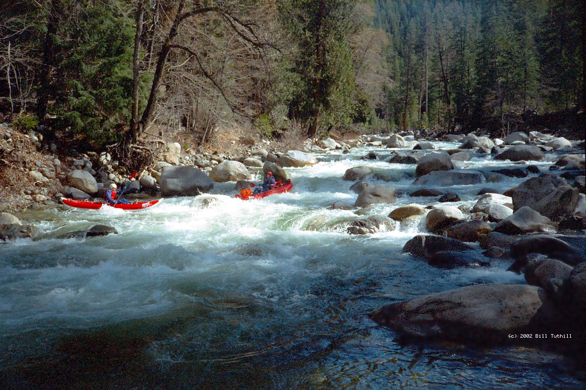
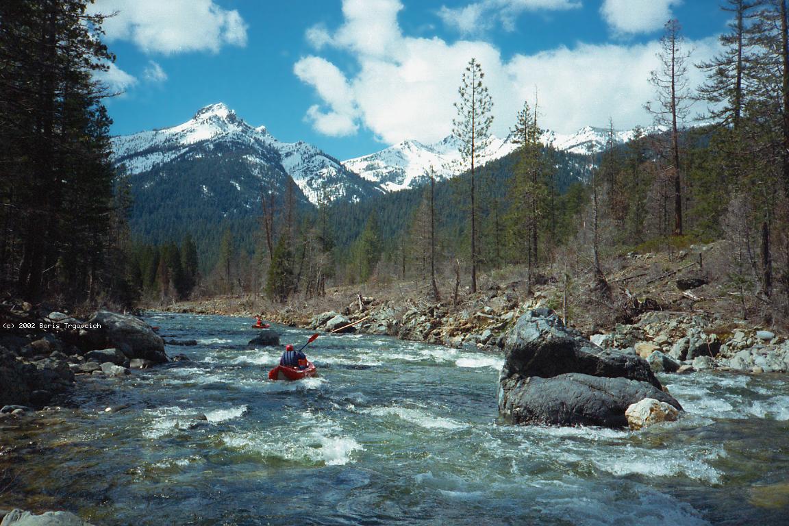
This is another of those great runs that hasn't been in any guidebook since 1974. Dick Schwind's book rates this section class III (with two class IV rapids) and says optimum flow is 450 cfs, runnable at 410 cfs. Holy smokes this is a classic run! We had about 500 cfs and it was great fun with continuous class II-III all the way, beautiful views of snow-capped mountains in all directions, and one class IV- rapid. Although hardshell kayakers complain about boniness at 400 cfs, I'd say this is one of the finest class III runs in California, so I'm surprised it's not in any current guidebook. Perhaps the season is too short, driving distances too long, or modern guidebook writers too class-V oriented. Class V boaters could combine this run with the East Fork Trinity. Class IV boaters could combine this run with Coffee Creek or Canyon Creek. Class III boaters could combine this with Clear Creek from Stop Rock to Whiskeytown reservoir. Flows looked thin from the road, but that turned out to be a false impression owing to water clarity. We put in near Tangle Blue creek, where highway 3 turns left and climbs away from the main Trinity. Schwind says rapids are shallow and recommends putting in at the first highway bridge below, but we did not find shallowness substantially different above or below that point. We could have put in even higher by following Parks Creek Road 17 further up the Trinity above highway 3. However, James Mitchell reports that there is a class IV-V rapid, Crawdad Hole, in this otherwise read-and-run section. Schwind breaks this section up into two parts: 6.3 miles of class III+ to Eagle Creek, and 7.3 miles of class III- from there to the reservoir. This seems to be mostly because of two class IV rapids on the upper run, one of which has disappeared. He bases everything on bridge crossings, of which there were 6, now 7 including a new side-road, or 8 including the bridge over Coffee Creek. He rates scenery A for the upper run and AA for the lower run. Despite the highway, I'd rate both sections AA. A 2-part class IV- rapid still exists above Bear Creek, near mile 2.5. The first part begins at a right turn thru big boulders, and the second part is a more-difficult boulder slalom in a straight section below. Ramshorn Creek enters on the left near mile 5.9, and Eagle Creek on the right around mile 6. The river flows very fast near mile 7 under a non-highway-3 bridge. Perhaps this was once Schwind's class IV just above part one take-out. Nowadays the rapids don't get much easier below there, continuing nicely to the Trinity River campground around mile 11, where we took out. It looks like the river slows down below there. You could go about 5 more miles to the road 106 bridge at the head of Clair Engle reservoir, but the take-out there is difficult.
To reach take-out, drive west from Redding on highway 299 about 50 miles up and over the summit to the Lewiston turnoff. Turn north and proceed thru the town of Lewiston to highway 3, which originates in Weaverville. Turn north and drive along the shores of the Clair Engle reservoir, across Coffee Creek, past the ranger station, and over one more bridge. The Trinity River campground, open in late winter, is on your left between highway 3 and the river. To reach put-in, continue north on highway 3 to Tangle Blue Creek. There is a loop dirt road that approaches the river near the confluence of Tangle Blue Creek. If flows look propitious you might want to turn right from highway 3 onto road 17 and continue upriver to your choice of put-in. I have never heard of anyone running this upper section.
|
Creeks NavigationHomeRecommended Runs Map of Rivers Alphabetic Index Alphabetic Table Text Search
Sponsored Links
|