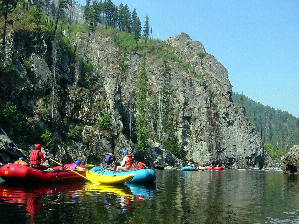
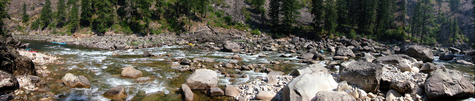
| |
| Stretch: |
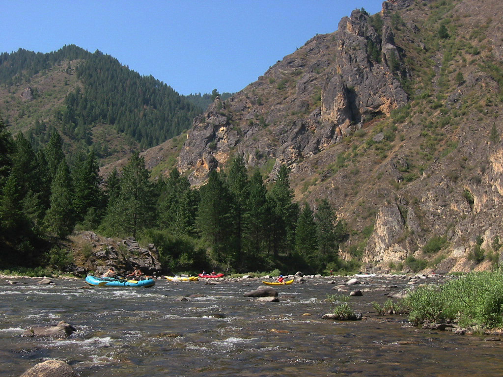
Paradise campground to Selway Falls |
| Difficulty: |
At low flows, class III with several class IV rapids |
| Distance: |
47.7 miles, 5 or more days |
| Flows: |
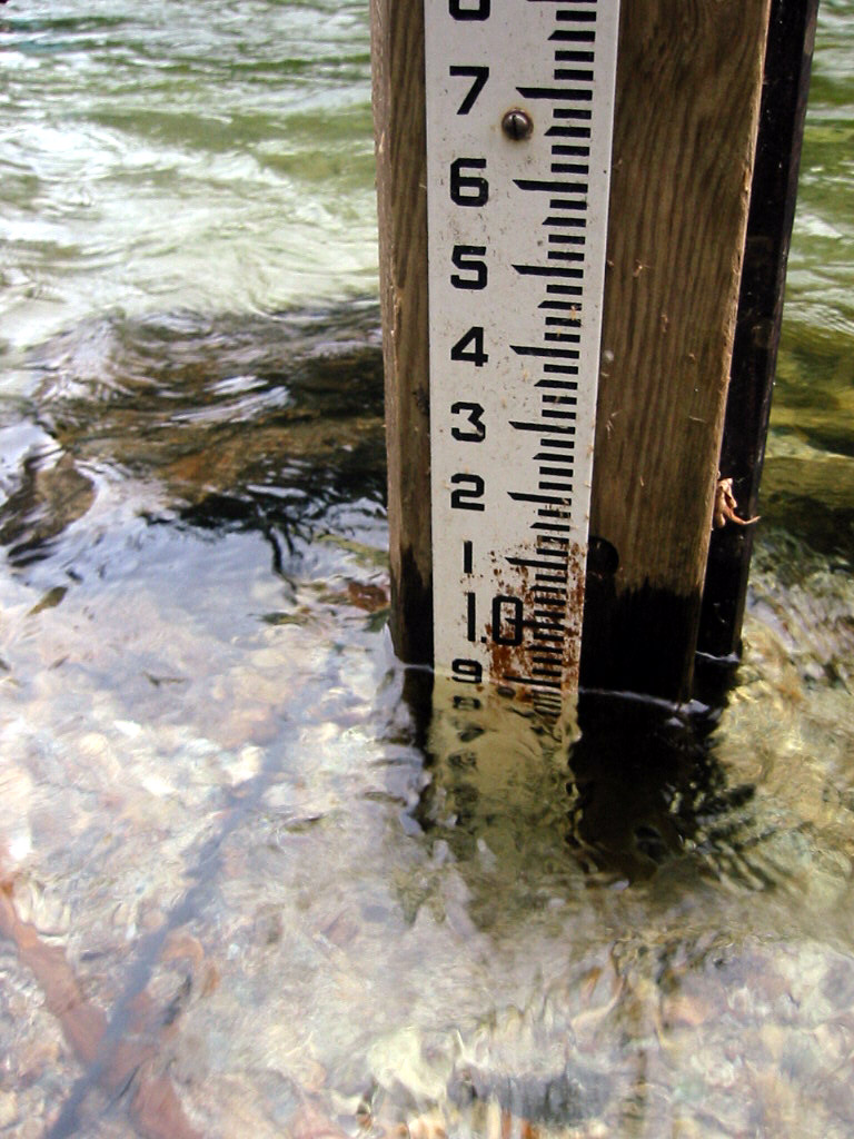
put-in minimum: rafts .9', kayaks .5', IK .1'
|
| Gauge: |
1000 - 10000 cfs measured below take-out near Lowell
(USGS
site) |
| Gradient: |
28 fpm overall, steeper after Moose Creek |
| Put-in: |
just below confluence with White Cap Creek, 3050' |
| Take-out: |
boat access below Race Creek campground, 1325' |
| Shuttle: |
275 miles (6.5 hours) one-way |
| Maps: |
USFS Floating the Wild Selway, AAA Idaho |
| Season: |
early summer, from snowmelt and springs |
| Agency: |
USDA-USFS |
| Notes: |
© 2005 Bill Tuthill,
CreeksYahoo,
Photos © 2003 Jennifer Bamesberger |
This section of the Selway requires a USFS permit,
and they are among the most difficult permits to obtain in the USA.
Generally your chances are better in mid to late July.
The permit season currently ends on July 31st,
but flows are usually too low for rafts by then.
This guide is written for low-water conditions,
around one foot on the Paradise gauge, because that's how we floated it.
The Selway has many great campsites, but not until after mile 10.
Running Creek ranch at mile 6.5 has a high horse population,
so there are lots of horseflies in early campsites until the first bridge
where horses cross from river right to the ranch on river left.
After that point, it is possible to camp every night with access to
a sandy beach, forested tent sites, and a good swimming hole.
This
USDA webpage contains links to monthly percent-of-normal snowpack (BASN),
and daily snowpack water-content data (BASS) that you can correlate.
To help you coordinate with the USFS map and inventory of campsites,
mileage is given in trip distance and/or river miles above
the Lochsa River confluence.
- mile
- 0 / 164.2
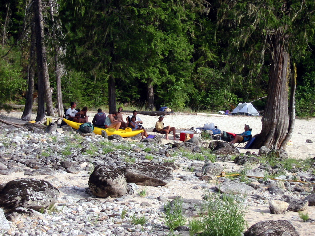
- Put in at the Paradise launch site, just below the confluence
with White Cap Creek, where a wooden boat ramp helps you lower
big boats to the river. Upstream about half a mile on the creek
is a nice campsite, and further, a USFS guard station.
-
- 0.2? / 164?
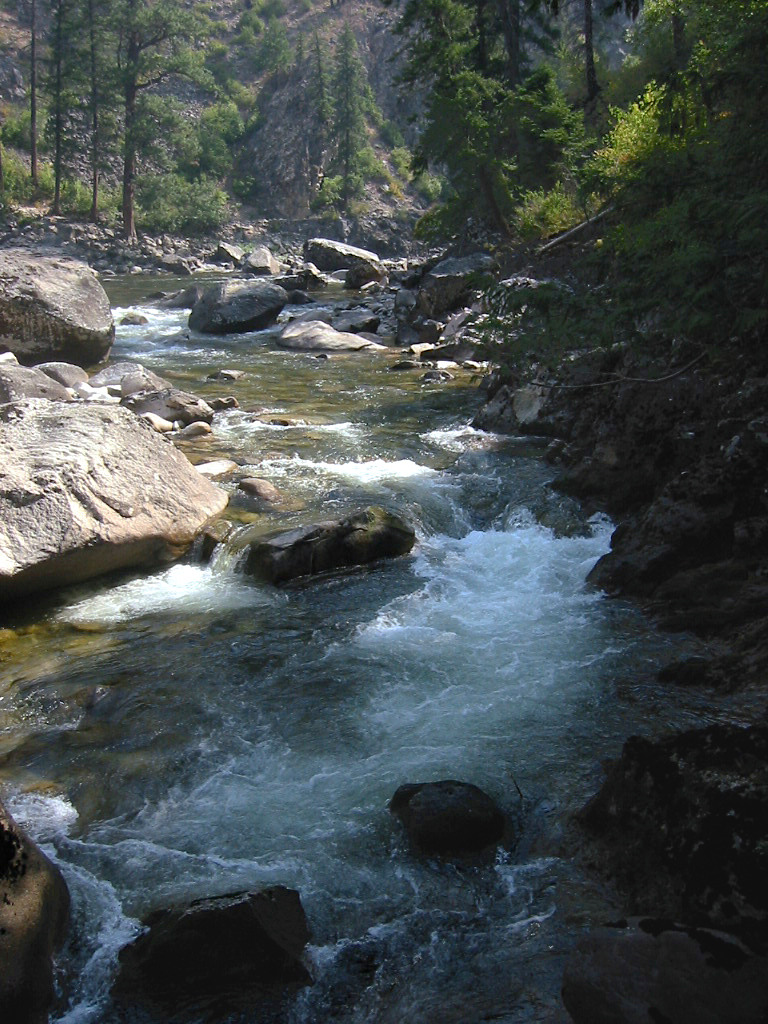
- Some rocky rapids shortly below put-in are tight for rafts.
- 2.1 / 162.1
- Bad Luck Bar, large high-water camp on the left. Somewhat
misnamed: Bad Luck Creek comes in on the right .3 mile downstream.
- 3.5 / 160.7
- Slalom Slide, class III
A boulder bar where the main channel starts on the left and
flows diagonally right around a rocky slope.
- 4.2 / 160.0
- Galloping Gertie, class III+
This is a tough one at low water. The apparent boat-scout
route is down the left side, which works fine for kayaks,
but rafts wider than a meter(?) will get wedged tight there.
At low flows, rafts must enter right and get dragged over
boulders on that side (not as hard as it sounds).
- 4.4 / 159.8
- Washer Woman, class III
The apparent boat-scout route is in the center, which might
work for rafts with a little tugging, but bumping down the
right side and working center might work better.
- 4.6 / 159.6
- Waldo Bar, large high-water camp on the right, with few trees.
- 4.7 / 159.5
- Cougar Bluff, class III
Big wave train along a cliff on the left-hand side.
- 5.0 / 159.2
- Driftwood Bar, medium-size moderate-flow camp on the left.
- 5.5 / 158.7
- Holy Smokes, class III-
Might only be class II+ at low water.
- 6.6 / 157.6
- Trail bridge crosses the river, leading to Running Creek ranch
/ private) on river left. Large moderate-flow camp on the left
just before the bridge, sometimes infested with horseflies.
- 6.7 / 157.4
- Running Creek Flat, large wooded high-water camp, is much more
pristine but lacks sandy beach, though you can hike to a good
swimming hole (see below).
- 6.9 / 157.2
- Running Creek Creek enters on the left. Around the corner is a
nice swimming hole reachable by trail from Running Creek camp.
- 8.7 / 155.5
- Archer, large high-water camp on the left, has a nice sandy beach
and nearby forest with wildflowers, but lacks a swimming hole.
North Star ranch (private) is across the river but seems unobtrusive.
- 9.3 / 154.9
- Ping Pong Alley, class II-III
Marked on the USFS map as just a class II, but at low flows it
becomes very difficult for rafts. Kayaks can squeeze down
the left side, but the best plan for rafts might be dragging them
over the low boulder bar on the right, then back into the center.
-
- 10.8 / 153.4
- Goat Creek enters on the left. Good place to stop for lunch.
Fine small high-water camp: relatively few tent sites on a steep hill.
- 11.1? / 153.1?
- Pom Beach, an excellent but small low-water campsite on the right.
Mileage approximate; not marked on the USFS campsite inventory.
- 11.5 / 152.7
- Goat Creek rapid, class III or IV
Major rapid among large boulders. Easy partial-scout on the right.
Guidebooks say to watch for logs in early season.
- 11.8 / 152.4
- Little Goat Creek, excellent large moderate-flow camp on the left.
It's in the middle of a rapid, so landing rafts can be difficult.
Wooded tent sites at the top, followed by a sandy beach below.
Just downstream is a nice swimming hole.
-
- 13.7 / 150.5
- Shearer USFS guard station on the left bank, before the river
bends left. A public airstrip is just upstream.
- 14.5 / 149.7
- Ditch Creek on the left, followed by Selway Lodge (private).
Pack bridge where trail crosses from left to right. Nearby:
Cougar Flats, large high-water camp on the right.
- 14.9 / 149.3
- Selway Lodge Bridge rapid, class II+
Just upstream of the bridge where the pack trail crosses from
left to right bank. Apparently not remarkable at higher flows,
but at low flows rafts tend to get stuck on exposed rocks.
- 15.6 / 148.6
- White Trail Flats, nice large high-water camp on the right,
on a long wooded bench.
Mills Camp, large high-water camp, .2 mile downstream on the left.
- 16.0 / 148.2
- Bear Creek, a large tributary, enters on the right.
Excellent but small low-water camp near the mouth of the creek.
About .2 mile below is Bear Creek rapid, class II.
- 16.5 / 147.7
- A wild island splits the river; more water goes left (2003).
About .2 mile below is Unnamed, large high-water camp on the left.
About .3 mile below that is Big Cedar, medium-sized low-water
camp on the right.
- 17.8 / 146.4
- Black Sands, a wonderful large moderate-water camp on the left.
You can land on rocks above a class II- rapid, or in a small eddy
below the rapid. The black and white sandy area is up higher,
below several wooded tent sites, and gives way to cobble near the
river. A good swimming hole is a short hike downstream, and a
large cave is slightly further on the left bank. Rodeo rapid,
marked on the USFS map as class II, is probably below this camp,
but at low flows does not seem significant.
- 18.5 / 145.6
- Shortly below Pettibone Creek is Dead Elk camp, a beautiful
medium-sized low-water site on the right, with big sandy beach
leading down to a swimming hole. Perhaps named to make it seem
less attractive. Soon followed by Pettibone rapid, class II.
- 20.8 / 143.4
- Rattlesnake Bar, medium-sized high-water camp on the right.
Nice campsite, but no swimming hole.
- 27.7 / 141.5
- Magpie Creek comes in on the left, followed by a class II rapid.
- 23.3 / 140.9
- Ham Rapid, class IV-
Above Ham is False Ham, a class III- rapid, then a short stretch
of quiet water. At higher flows you should scout Ham on the left,
but at low and medium flows the view is better on the right. This
long rapid contains two major drops divided by midstream boulders.
Maybe it's not quite class IV at lower flows.
- 23.9 / 140.3
- Roots camp, a small moderate-flow site on the left.
- 24.1 / 140.1
- Hell Creek comes in on the right, marking the start of a busy
section of nearly continuous class II+ rapids, definitely more
than marked on the USFS map.
-
- 25.9 / 138.3
- Suspension bridge ahead, where trails cross from Tony Point to
the Moose Creek ranger station and public airstrip. It is a
mile-long hike to the ranger station, uphill then level along
the airfield, past a grove of old-growth western red cedar.
- Tony Point Bridge camp, a good medium-sized high-water camp,
is on the right just above the bridge. An emergency camp, used
in spring when groups are stacked up above Moose Creek waiting
for flows to recede, is on the left just below the bridge.
- 26.0 / 138.2
- Tony Point rapid, class II+
This is relatively easy for kayaks, but at low water rafts must
plan their route. It helps to scout from above on the bridge.
- 26.1 / 138.1
- Tony Point camp, an excellent medium-sized high-water camp,
with many wooded tent sites up higher, a sandy beach, and a
relatively shallow swimming hole. You can ferry across the
river and hike downstream, or over a spit of land, to see
the confluence with Moose Creek.
- 26.2 / 138.0
- Confluence with Moose Creek, which almost doubles the flow.
The gradient steepens shortly ahead, and rapids go by in a blur.
No large campsites for almost seven miles downstream.
With added flow, this stretch is sometimes called Moose Juice.
- 26.5 / 137.7
- Divide Creek comes in on the right, followed by a class II rapid.
Below(?) is a medium-sized moderate-water camp on the left.
- 27.2 / 137.0
- Double Drop, class III-IV
Just past Jake Creek, after a left bend, are two sizeable drops.
At low water both can be run on the right, but at higher flows
boaters often ferry left to avoid a big hole in the second drop.
You can scout this rapid from the trail on the right bank.
-
- 27.9 / 136.3
- Wa-Poots, class III
After a right bend, an unnamed class II, a left bend, and a
straight-away, the river turns sharp right into Wa-Poots.
At lower flows it is a steep chute in bedrock. At higher flows
boats are pushed towards a big boulder on the right.
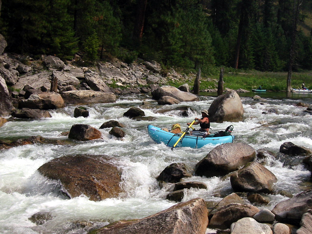
- 28.2 / 136.0
- Ladle, Class IV+, toughest rapid on this run at any flow.
So named because it is wide at the top and narrow at the bottom,
like the bowl and handle of a ladle.
Scout left if you have a narrow boat and plan to run the sneak route.
Scout right if you plan to run the main rapid or have a wide boat.
-
- Kayaks and canoes can avoid the worst of this rapid by taking
the sneak route along shore on extreme left. At low flows, this
route starts at the second door from the left. It is also possible
for such boats to run more complicated routes in the center.
Wide boats generally have to enter on the right and work center
to avoid wrap rocks on the bottom right. At higher flows, when
wrap rocks are out-of-play, most boaters elect to run Ladle
down the far right side.
-
- 28.5 / 135.7
- Little Niagara, class III-IV
Just a class III drop at low flows, but at higher flows the
sheer rock wall on the right and the bedrock drop-off on the left
funnel the river into some big hydraulics.
- 28.8 / 135.4
- Puzzle Creek, class III
This might the one where the best route is to enter left, work right,
then shoot a waterfalls (over one meter high) just right of center.
I had no problem there, but remember thinking it was somewhat steep
to be rated class III. The Cross/Cassady/Calhoun guidebook says
a big hole develops at high flows in the bottom center.
- 29.0 / 135.2
- No Slouch, class III
Can't remember it. The Cross/Cassady/Calhoun guidebook says
most boaters run left at moderate and high flows.
- 29.5 / 134.7
- Miranda Jane, class III
After Halfway Creek enters on the right comes a class II rapid,
then this one. Can't remember it, either.
- 29.8 / 134.4
- Upper and Lower Cedar Flats are on the USFS campsite inventory.
Neither large nor suitable for high-water, they seem totally unused.
- 31.5 / 132.7
- Osprey, class III
A steep drop among boulders, easier than it ought to be
considering the height of its drop. The river slows down
after this. We never determined which rapid was Meeker,
a class III marked on the USFS map about half a mile upstream.
- 31.6 / 132.6
- Meeker Creek enters on the right. A good moderate-flow camp
sits at the mouth of the creek. The USFS campsite inventory
has it marked small: the kitchen area is small, but there are
possible tent sites uphill in a field downstream of the creek.
- 31.6 / 131.4
- Tango Creek enters on the right, not carrying much water.
The USFS campsite inventory lists a medium-sized high-water camp.
- 31.6 / 131.3
- Tango Bar, an excellent large moderate-flow camp on the left,
at what looks like a stranded meander (except at flood stage).
Big sandy beach, good swimming hole just downstream, and
semi-wooded tent sites up higher.
- 33.5 / 130.7
- Marten Creek enters on the left. The USFS campsite inventory
lists Trapper Camp, a moderate-sized low-water site on the left
.2 mile upstream.
- 34.6 / 129.6
- Pack bridge connecting various trails. Just downstream is a
very unusual sight, as Three Links Creek enters on the right
and Mink Creek enters on the left directly across the river.
Downstream .4 mile is Three Links, marked on the USFS map as
class III, but unmemorable.
- 36.2 / 128.0
- Dry Bar, a beautiful medium-sized moderate-flow camp on the right.
The USFS campsite inventory also lists Boulder Bar .3 mile upstream
on the right, same size and usability.
- 37.4 / 126.8
- Upper Pinchot, a nice medium-sized moderate-flow camp on the right.
- 37.6 / 126.6
- Lower Pinchot, a large high-water camp on the right.
- 37.7 / 126.5
- Wolf Creek, class IV
At high water this can also be run on the left, but at low flows
all boats are forced to go right. You can scout either from
the trail high on the right bank, or from the rocky center island.
In the right channel, rafts must enter left of center, ferry right,
then (optionally) left again to cheat the biggest drop. After
that, hang on for the turbulent final drop. Kayaks can choose
a less risky route starting on the far right, then converging
where rafts finish ferrying right.
-
- 39.2 / 125.0
- Ballinger, a moderate-sized high-water camp on the right,
at the mouth of Ballinger Creek.
- 40.4 / 123.8
- Tee Kem Falls, AKA Jim's Creek Falls, class III
Most easily run on the far right, but watch for a big rock below.
At low water this seems class III+ especially in small boats.
Just downstream on the left (easy to miss) is Tee Kem Camp,
an excellent medium-sized moderate-flow camp with wooded tent sites,
sandy beach, and good swimming hole.
-
- 40.8 / 123.4
- Cupboard, a medium-sized moderate-flow camp on the right,
near the mouth of Cupboard Creek. Class III rapid marked on
the USFS map, could be easier at low flows.
- 42.4 / 121.5
- Trapper Camp on the lefta Not listed on the USFS campsite inventory.
Similar to Tee Kem camp: not quite as nice, but a good alternative
if Tee Kem and Renshaw are occupied.
- 42.5 / 121.4
- Renshaw, class III
A stiff drop along the left bank into a cliff.
Just below is a good campsite on the right with sandy beach, shade,
and swimming hole, also not listed on the USFS campsite inventory.
- 44.9 / 119.3
- Boundary of Selway-Bitterroot Wilderness area.
- 46.7 / 115.5
- Race Creek campground on the right, accessible by vehicle.
- 47.7 / 116.5
- Take out at the designated boat access ramp, unpaved in 2003.
Hazard! Do not proceed downstream. Selway Falls, class VI,
maybe only class V+ at low water, is less than half a mile downriver.
Shuttle service is readily available in Darby Montana
from Booksmith 406-821-3167 and other sources.
Gail New 406-821-4513 in Conner Montana also provides shuttles.
To reach Darby MT where you pick up shuttle driver,
take highway 93 north from Twin Falls ID.
It seems shorter to stay on 93 via Arco past Craters of the Moon,
rather than to onto highway 75 thru Sun Valley.
After Challis and Salmon ID, continue north on 93,
uphill past a ski area, over a pass in the Sawtooth range.
Darby is a small town south of Hamilton.
To reach return home after take-out,
follow the dirt road downstream, stopping to look at Selway Falls.
At the town of Lowell, turn west on highway 12,
then take highway 13 as a shortcut to highway 95 south.
If you want to drive past the class V rapids of the North Fork Payette,
towards Boise onto highway 55 near McCall.
|
|
Creeks Navigation
Home
Recommended Runs
Map of Rivers
Alphabetic Index
Alphabetic Table
Text Search
Sponsored Links
|