| |
| Stretch: |
Dunsmuir to Shasta Reservoir |
| Difficulty: |
class III+ with one class V |
| Distance: |
up to 32 miles, 2 days |
| Flows: |
rafts and kayaks 600 - 6000, IK minimum 500
|
| Gauge: |
flow into Shasta reservoir at Delta
(DLT) |
| Gradient: |
43 fpm average |
| Put-in: |
under Dunsmuir's I-5 bridges or upstream, 2360' |
| Take-out: |
bridge at Dog Creek or upstream, 1080' |
| Shuttle: |
24 miles (30 minutes) one-way |
| Maps: |
Shasta NF, AAA Northern California,
Topo
|
| Season: |
spring, from snowmelt and dam release |
| Agency: |
private, BLM,
guided Whitewater Rafting |
| Notes: |
© 2011-2017 Bill Tuthill,
CreeksYahoo |
The Sacramento river below Dunsmuir has some great scenery and whitewater
that boaters can enjoy every year as a weekend trip,
or combine with nearby rivers for a longer vacation.
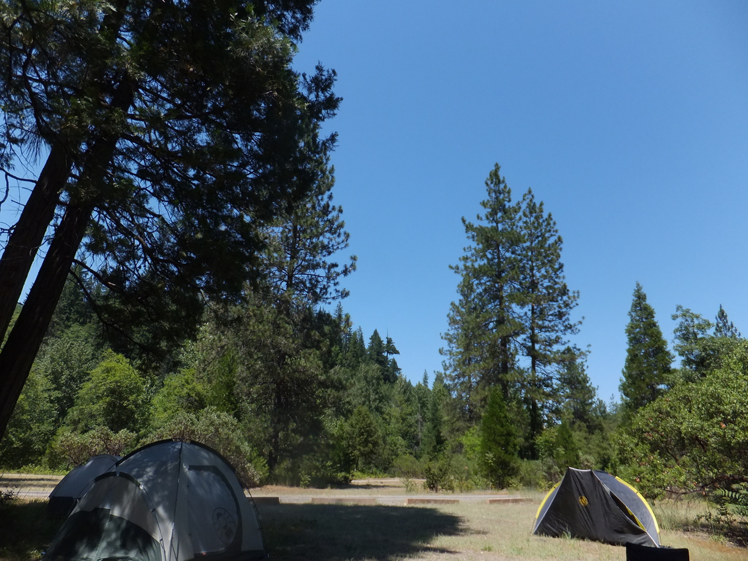
Sims Flat campground makes a good base of operations,
being in-between two recommended runs and
shortly below the class V- rapid at Mears Creek.
Dunsmuir offers an assortment of good restaurants, stores,
fishing shops, and an excellent brew-pub opened in 2009.
The Dunsmuir Brewery Works
has live music on weekend evenings.
The lower recommended run from Sims Flat to Pollard Flat
is commercially rafted, and very popular among the big-boat crowd.
With many sidestreams contributing water, it has a longer season than the upper run.
Floats of this stretch as low as 400 cfs have been reported.
The whitewater feels a lot like the Tuolumne, but without the class IV punch.
A railroad and an interstate highway follow the river.
Trains appear frequently, but the highway is seldom visible and rarely audible.
The upper recommended run is infrequently boated,
perhaps because the Cassady/Calhoun guidebook falsely dismissed it as
“less scenic [past Dunsmuir as] water quality declines.”
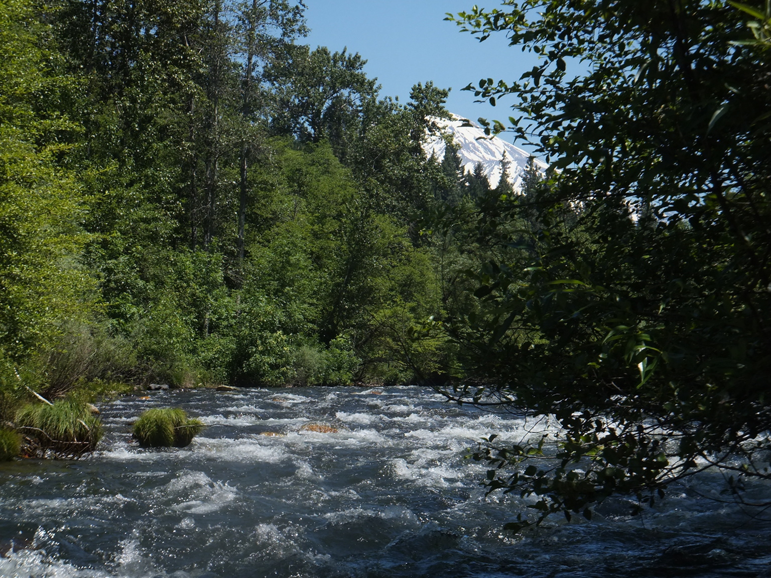
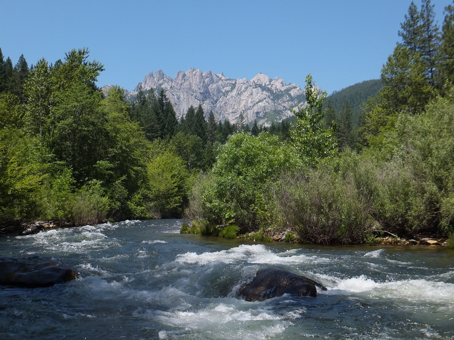
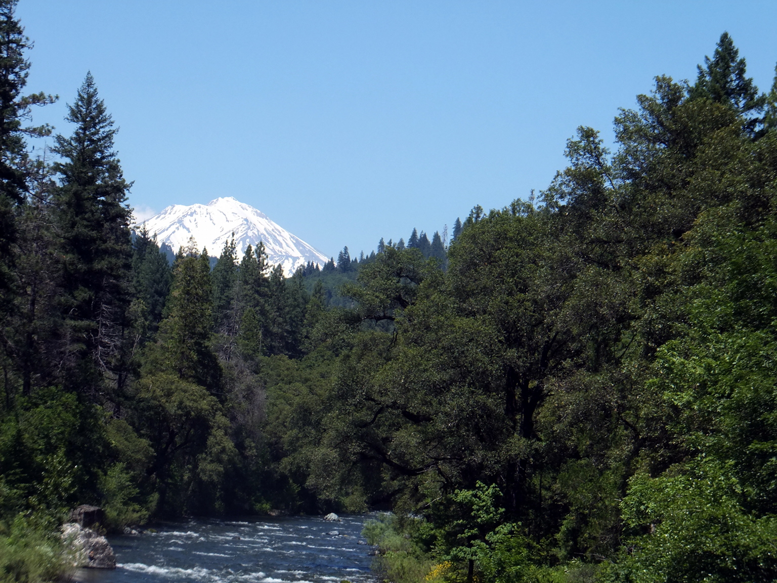
In fact the stretch past Dunsmuir is more scenic than downstream,
if you have time to look up from the whitewater
at intimate views of Mount Shasta and Castle Crags.
The Dunsmuir Chamber of Commerce claims they have
“the best water on earth” so water quality can't be too bad.
My kayak buddies and I really like the upper run,
but it seems less popular with rafters.
The mile-by-mile starts in Dunsmuir and resets at Sims Flat
(with continuing mileage in parentheses).
- -1.6
- To make a longer day, you can put in at the end of Prospect Avenue
and Pinewood Road, the furthest upstream river access in Dunsmuir.
With sufficient flow, expect frequent class III rapids with a
boulder-strewn III+ at the .5 mile mark just before Cave Avenue bridge.
Class IV boaters can start upstream at Cantara Loop or below Box Canyon Dam
for a busy day on the classic Mossbrae Falls run.
- 0
- Put in at Tauhindauli Park on river left, just upstream of
the Dunsmuir Avenue and I-5 highway bridges.
The park was named after Laktcharas “Grant” Tauhindauli,
a Wintu Indian who was born and worked at Upper Soda Springs resort,
a pre-railroad hotel and stagecoach stop north of the present-day park.
- .4
- Rapids are continuous class II-III around a right corner
to the Sacramento Avenue bridge, past beautiful downtown Dunsmuir.
- 1.2
- More houses are visible on the left after the Bush Street bridge.
When feasible, look upstream for views of Mount Shasta.
- 1.7
- The river channel becomes less narrow as it passes under Bridge Street,
but rapids remain continuous.
- 3.3
- Bridge at South First Street. The Dunsmuir waste water treatment plant
is downstream on the left, but we did not notice any bad smell.
-
- 4.4
- Good views of Castle Crags on river right, often obscured by trees.
Road with turn-around approaches on river left.
Shortly below, the river flows past a white-rock railroad embankment.
- 5.7
- Soda Creek Road crosses on a sturdy bridge.
- 6.1
- Nice lunch beach on a partially shaded gravel bar on river right,
at a left bend. You can walk up to the railroad tracks then downriver
if you want to scout the next rapid.
- 6.2
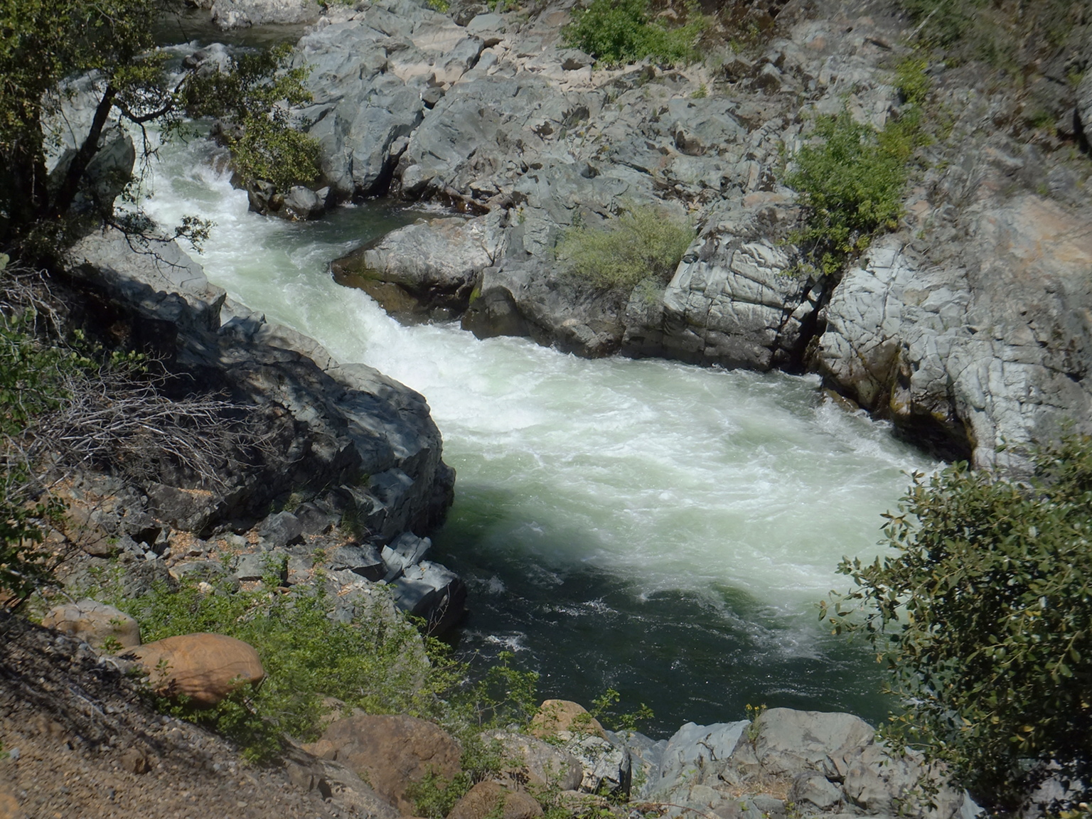
- Ledges, class IV on the left side, class III+ on the right side.
You can ferry from side to side for interesting scout-and-drop routes.
Lesser rapids continue below for a considerable distance.
- 6.6
- Island, class III.
Most water goes right and drops thru big hydraulics at a left bend.
A hiking trail becomes visible on river left as smaller rapids continue.
- 7.4
- Footbridge where patrons of a former hotel crossed to a mineral spring,
and where current-day campers can cross from Castle Crags campground
to Riverside campground. An excellent takeout is .1 mile below at the
site of a spring that supplied mineral water far and wide in the 1800s
(fee area, part of Castle Crags state park).
- 7.7
- Vehicle bridge connecting riverside campground to Castle Crags state park.
- 8.1
- Castle Creek enters on the right. Town of Castella is situated below.
Shade Avenue bridge, access status unknown, is at the far end of town.
- 9.5
- Falls Avenue bridge, accessible from an I-5 exit and Sweetbriar Avenue.
River access on river right just above the bridge, up a narrow trail.
This is the last easy take-out above Mears Creek Falls.
- 11.3
- Difficult take-out at the Conant exit, up and over the railroad tracks.
- 12.7
- Flume Creek enters on the left, although without much water,
and the flume is obscured by trees. Rapids intensify shortly below.
- 13.7
- Railroad bridge crosses the river and the tracks enter a tunnel.
At river mile 14.1 they emerge and cross the river on another bridge.
Stay alert for an upcoming scout/portage .5 mile downstream.
-
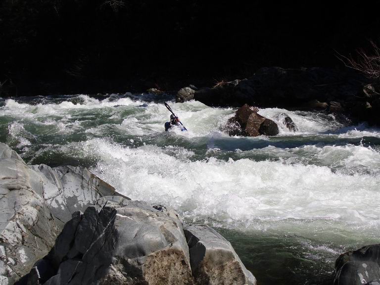
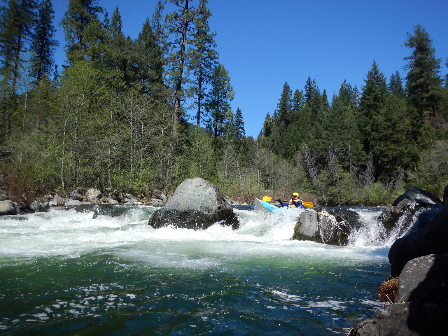
- 14.6
- Triple Drop, AKA Mears Creek Falls, class V-, harder at high flows.
Recognition: a dead pine tree on the left bank upstream (still standing 2012).
This is a steep three-part drop thru a narrow cleft in the bedrock.
The first drop is not as bad as the second and third, which are undercut.
Scout and possibly portage on the left (relatively easy, with seal launch).
You can also portage on the right along the railroad tracks,
which are up a steep embankment where trees obscure your view.
If you blunder into this rapid, try to make it to the left bank
so you can scout the second and third drops, which are closely spaced.
-
- Mears Creek enters on river right .2 mile below the top of the falls,
offering a short creek run for local boaters.
- 0 (15.3)
- Vehicle bridge to Sims Flat campground.
A footbridge built during the Great Depression is just downstream.
This bridge, and some stone steps, are all that's left of a CCC encampment.
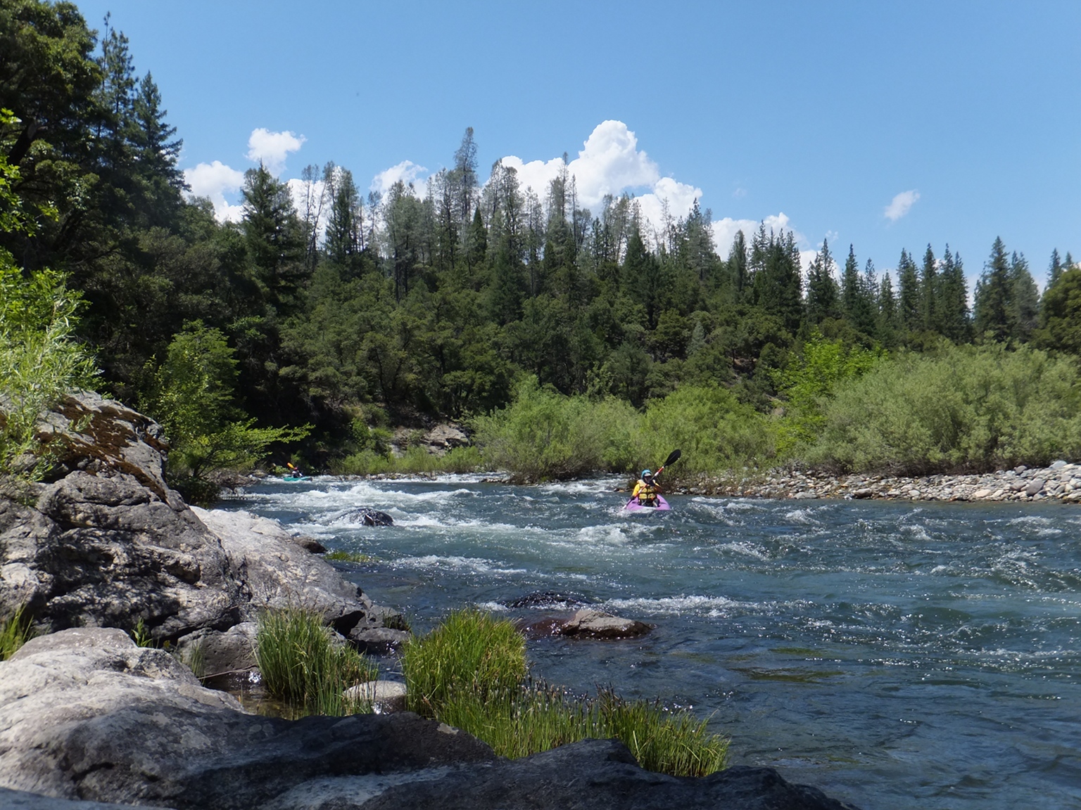
Excellent raft access on river right, and kayak access on river left.
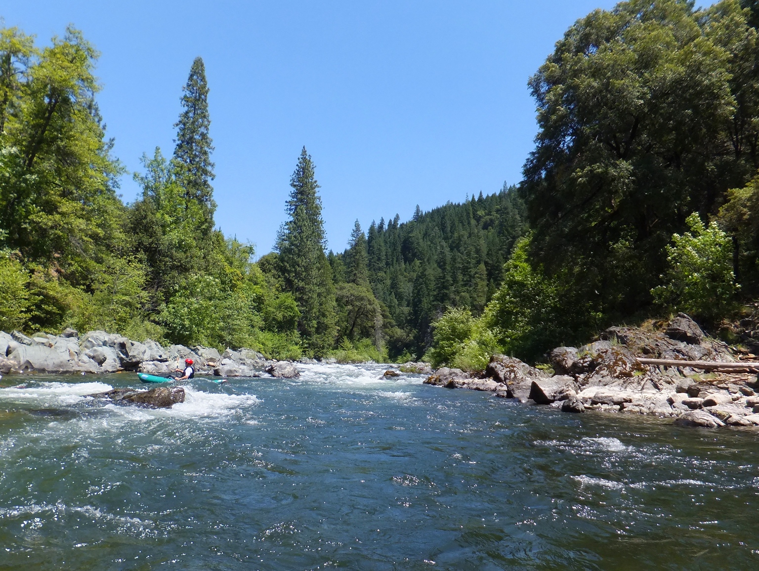
The next 14 miles go quickly and contain many good rapids,
some of which can change from year to year.
-
- .2 (15.5)
- Tree-lined drop in the right channel below Sims Flat campground.
Hazel Creek enters on the left shortly below.
- .7 (16)
- Long rapid in a straight-away, then curving right.
- 1.8 (17.1)
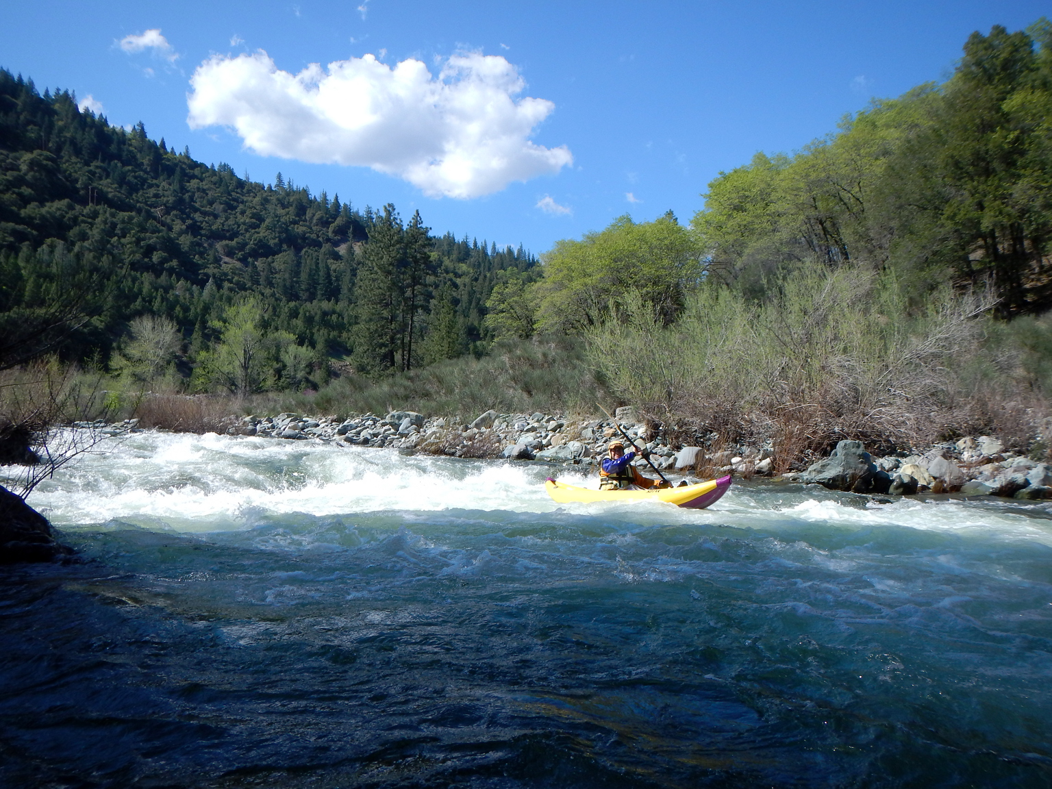
- Shotgun, class III+. After a left horseshoe bend comes
this steep boulder bar drop with big holes against the left bank.
Pavel Solin video part 1.
Shotgun Creek enters below on the right in a straight-away.
At the end is a hard-to-escape eddy on the left.
-
- 2.0 (17.3)
- Rock Fence, class III+, a riverwide ledge with boulders of varying height.
Pavel Solin video part 7.
- 2.5 (17.8)
- Right Elbow, AKA Screaming Right Turn, class III+
A boulder drop and sudden right turn into large holes.
The river bends right around a rocky peak before this deceptive rapid.
The lead-in looks like an easy boulder drop, but it feeds you towards
large holes below, especially on the left side.
Pavel Solin video part 2.
-
- 2.8 (18.1)
- The river bends away from the railroad and drops into a large pool
with superb-looking beach campsite on the left (private land, however).
- 3.1 (18.4)
- Bridge as railroad crosses from right to left bank.
More rapids downstream, some with large constriction waves or holes.
- 4.2 (19.5)
- After a right bend, this typical drop in a straight-away along a boulder bar
on the left contains a large (flipper) hole on the right near the end.
- 4.6 (19.9)
- Railroad goes into a tunnel on river left.
Tracks emerge from the tunnel .3 mile later and cross the river on a bridge.
-
- 5.6 (20.9)
- Mini Gorge, class III+. After a right curve is a pool with fast water ahead.
The right side looks more turbulent than the left.
A boulder below splits the flow below, creating an horizon line.
At most flows the easier line is to stay left of that boulder.
Pavel Solin video part 3.
- 5.7 (21.0)
- Shortly after Mini Gorge is a long straight section along the railroad tracks,
with big waves especially at higher flows.
Pavel Solin video part 4.
- 6.1 (21.4)
- Interstate highway crosses high overhead. After a .4 mile horseshoe bend,
the highway crosses overhead again. The railroad remains on river right.
- 6.5 (21.8)
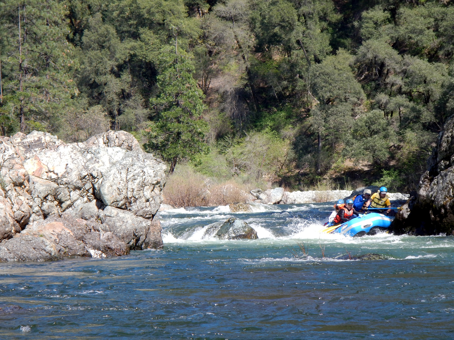
- I-5 Hole, class III+ or IV, directly underneath the second highway bridge.
The right side becomes a large hole at medium flows,
and the center turns into into a monster hole at higher flows;
approach and finish on the left to avoid the hole.
A route may be available on far right; scouting advised.
At low flows rocks are exposed on the left and skirting the hole is preferable.
Pavel Solin video part 6.
-
- 6.8 (22.1)
- Micro Gorge, class III, like the Mini Gorge upstream but not as constricted.
Pavel Solin video part 5.
- 7.3 (22.6)
- Ranch bridge, oddly not yet washed away.
Before the next bridge is a rocky rapid with large holes as flow increases.
- 7.5 (22.8)
- North Salt Creek Road bridge, with a log still stuck in the side (2012).
- 8.2 (23.5)
- A landslide occurred on the left bank in 2014 or before, resulting in a
difficult-looking washboard rapid with a huge boulder bar on the right (2017).
- 8.6 (23.9)
- Bridge as railroad crosses from right to left bank.
Pollard Flat take-out, with cement stairs and pleasantly shaded picnic tables,
is on the right just below. Downstream, rapids are spaced further apart.
- 9.1 (24.4)
- Bridge as railroad crosses back to the right bank.
- 11 (26.3)
- Slate Creek enters on the right, near the hamlet of Lamoine.
Slate Creek offers a good rainy-season class V run.
Whitlow Creek enters on the left .3 mile below.
- 13 (28.3)
- McCardle Gulch on the left, then Mosquito Creek enters on the right.
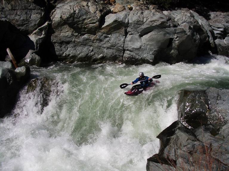
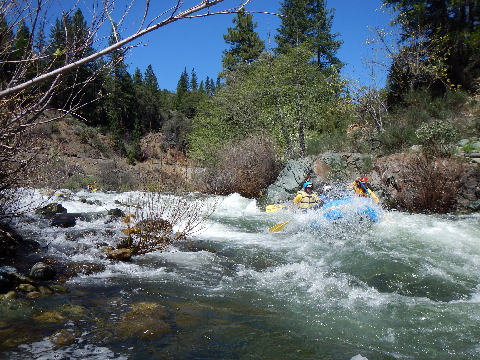
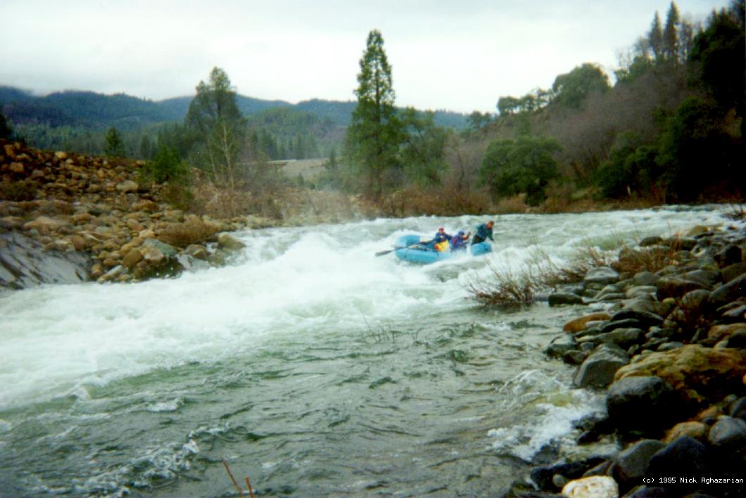
- 14.3 (29.6)
- Whitehorse Rapid (shown here) used to be shortly above take-out
but the gravel bar on the left that created it washed away perhaps in 2007.
-
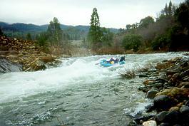 Margrit Petrofsky rowing with Joe and Nick paddling Margrit Petrofsky rowing with Joe and Nick paddling
- 14.9 (30.2)
- Dog Creek comes in on the right, at Fenders Ferry Road bridge.
This is the last good take-out before the reservoir.
The Delta gauging station is downstream on the left.
Shasta Reservoir begins not far below. When the reservoir is low
you could take out at Antlers, but this is not recommended.
-
Downstream of the reservoir, the Sacramento offers
a surprisingly scenic all-year class I-II run.
Shuttle Directions
To reach put-in, exit I-5 at the middle Dunsmuir exit,
south of where I-5 crosses the river.
Turn left on Dunsmuir Avenue, which heads north and crosses the river.
Take the first left on Stagecoach Road, then another left on Upper Soda Road.
Follow the signs to Tauhindauli Park, where parking is plentiful.
To reach the first take-out, exit I-5 at Castle Crags state park, head east,
cross the river on a bridge, and park at Riverside Campground (fee area),
or outside the park entrance if you don't mind the walk.
To reach the take-out at Falls Avenue bridge, exit I-5 at Sweetbriar Avenue.
Drive north to where the road bends right and crosses the river.
Space is tight, so you should park before the bridge.
To reach Sims Flat access and campground, exit I-5 at Sims Road.
Cross to the southeast and continue downhill on Sims Road
for about half a mile, where it cross the river on a bridge.
Turn right into the campground, which is along the river.
To reach the excellent Pollard Flat take-out,
take the Pollard Camp / North Salt Creek Road exit off I-5.
The river access road is immediately southeast (downhill) from there.
To reach the Dog Creek take-out at Fenders Ferry bridge, exit I-5 at Delta,
turn to the southwest (uphill) side of the freeway, counter-intuitively!
Curve right, then turn sharp left (downstream) onto Fenders Ferry Road,
which winds down along Dog Creek to an old bridge across the river.
To find nearby food and lodging, type Dunsmuir into the box and click Search.
|
|
Creeks Navigation
Home
Recommended Runs
Map of Rivers
Alphabetic Index
Alphabetic Table
Text Search
Sponsored Links
|


 Margrit Petrofsky rowing with Joe and Nick paddling