| |
| Stretch: |
Bair Road bridge to Orick |
| Difficulty: |
Class II, then IV (one portage), then class I |
| Distance: |
37 miles, 3 or 4 days |
| Flows: |
put-in minimum: rafts 350, kayaks 250, IK 150 cfs |
| Gauge: |
put-in measured at O'Kane
(OKN)
take-out at Orick
(ORK)
|
| Gradient: |
23 fpm, then 10 fpm |
| Put-in: |
Bair Road bridge near Blue Lake, 700' |
| Take-out: |
Highway 101 bridge in Orick, 25' |
| Shuttle: |
48 miles (1.5 hours) one-way |
| Maps: |
USFS Six Rivers NF, AAA Northern California,
Topo
|
| Season: |
March thru May, rain and snowmelt |
| Agency: |
private, National Park |
| Notes: |
© 1997, 2001, 2008, 2023 Bill Tuthill,
CreeksYahoo |
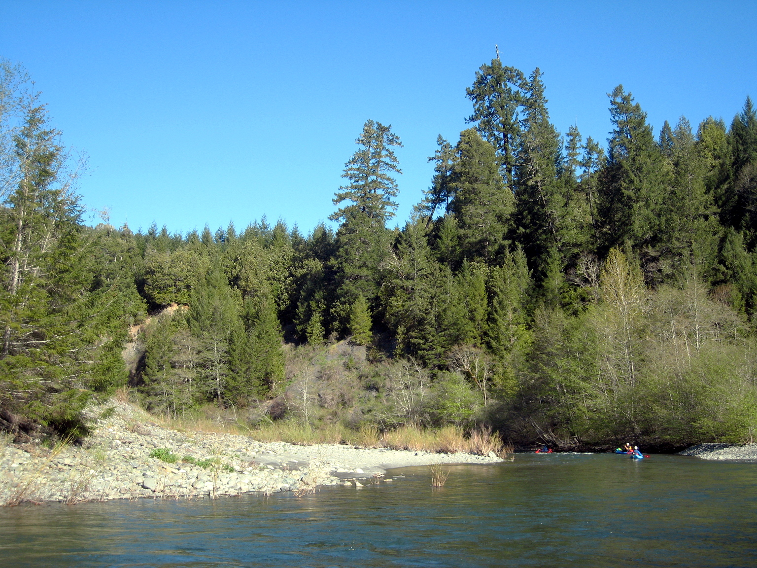
This seldom-run run is seldom run.
Campsites and portage trails seem underused.
Boaters rarely encounter any people in the upper section,
although in late spring, after steelhead spawning season,
hikers along the river are a common sight,
especially in Redwood National Park near Tall Trees grove.
Although considered a classic run, Redwood Creek has three problems:
it is a long drive from population centers,
there is a difficult portage at Rocky Gap,
and it might be too narrow for rafts.
If you live in Eureka, the first problem is not a problem.
The portage keeps class II-III boaters off the river, and the long stretches
of mellow but scenic class I-II keep class IV-V boaters off the river.
This makes for superb solitude in forested parkland that is stunningly beautiful
in sunny weather, which might occur in April and possibly March.
As an overnight wilderness trip suitable for intermediate kayakers
(with supervision) Redwood Creek is one of the best in California.
My friends find this run to be much more fun and scenic than the
guidebooks made us expect, especially Chuck Stanley's negative description.
We always see deer, bald eagles, steelhead, and often bears, otters, and elk.
Though few in number, excellent campsites do exist.
At low flows water quality is good; higher flows greatly increase turbidity.
Old guidebooks described a put-in on private property at Stover Ranch,
but phoning them has been useless for decades.
Though it is a public right-of-way,
Bair Road bridge used to be lovingly lined with barbed wire,
which was removed for unknown reasons.
This is your best put-in alternative,
though it lengthens the traditional run by 10 miles.
Landowners in Redwood Valley (who own ranches near put-in) do all they can
to prevent river access. Past the Bair Road bridge is a sign saying
“No Redwood Creek Access.”
It is best to have a shuttle driver and not leave vehicles near the bridge.
For a longer trip, you could put in at highway 299,
but access is difficult due to the high highway bridge.
This would involve 6.4 miles of reportedly class II from 299 to Bair Road.
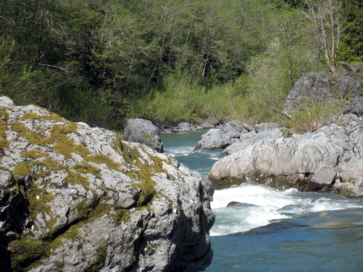
It is difficult to measure your progress on Redwood Creek,
because lovely sidestreams cascade into the creek frequently.
Named streams are not significantly bigger than unnamed streams.
Campsites are rare, thus noted in the mile-by-mile.
National Park regulations apply to camping within park boundaries,
although until you reach trails, encountering a ranger is unlikely.
Helicopter rescue in the class IV stretch is difficult or impossible, so be careful.
- 0
- Bair road bridge.
Carry boats down a poison-oak impinged trail downstream on river left.
You can get gear ready on a sandy beach underneath the bridge.
- 1.0
- Moon Creek on right. The road is near until mile 5.
- 2.0
- Toss-up Creek on left.
- 2.7
- Molasses Creek on right.
- 3.1
- Mill Creek on right.
- 3.4
- Pedestrian bridge and utility service to roadless house on left bank.
- 4.8
- Beaver Creek on right, with houses on Beaver Flat.
After this Redwood Creek traces two large horseshoe bends
away from civilization, though without any large campsites.
- 6.8
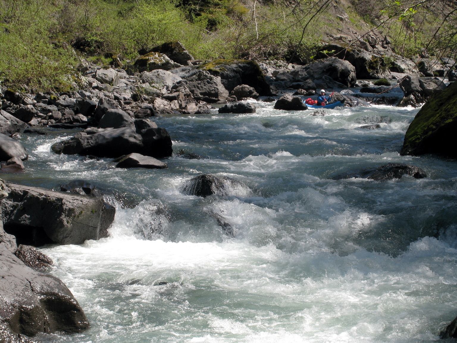
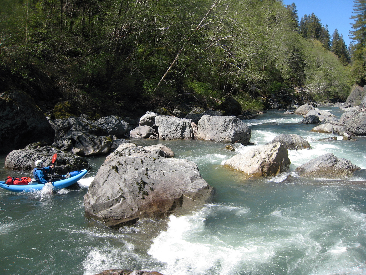
- Roaring Gulch (creek) enters on right, between the horseshoe bends.
Downstream, two rapids verge on class 3 depending on flow and wood debris.
- 9.2
- Lawns and houses on Cookson Drive, the last habitation before Stover ranch.
- 10
- Stover Creek enters on right. Stover ranch buildings soon visible,
the last habitation.
- 11
- Lacks Creek enters on right, in a wide valley.
Shortly downstream are some more rapids that verge on class 3.
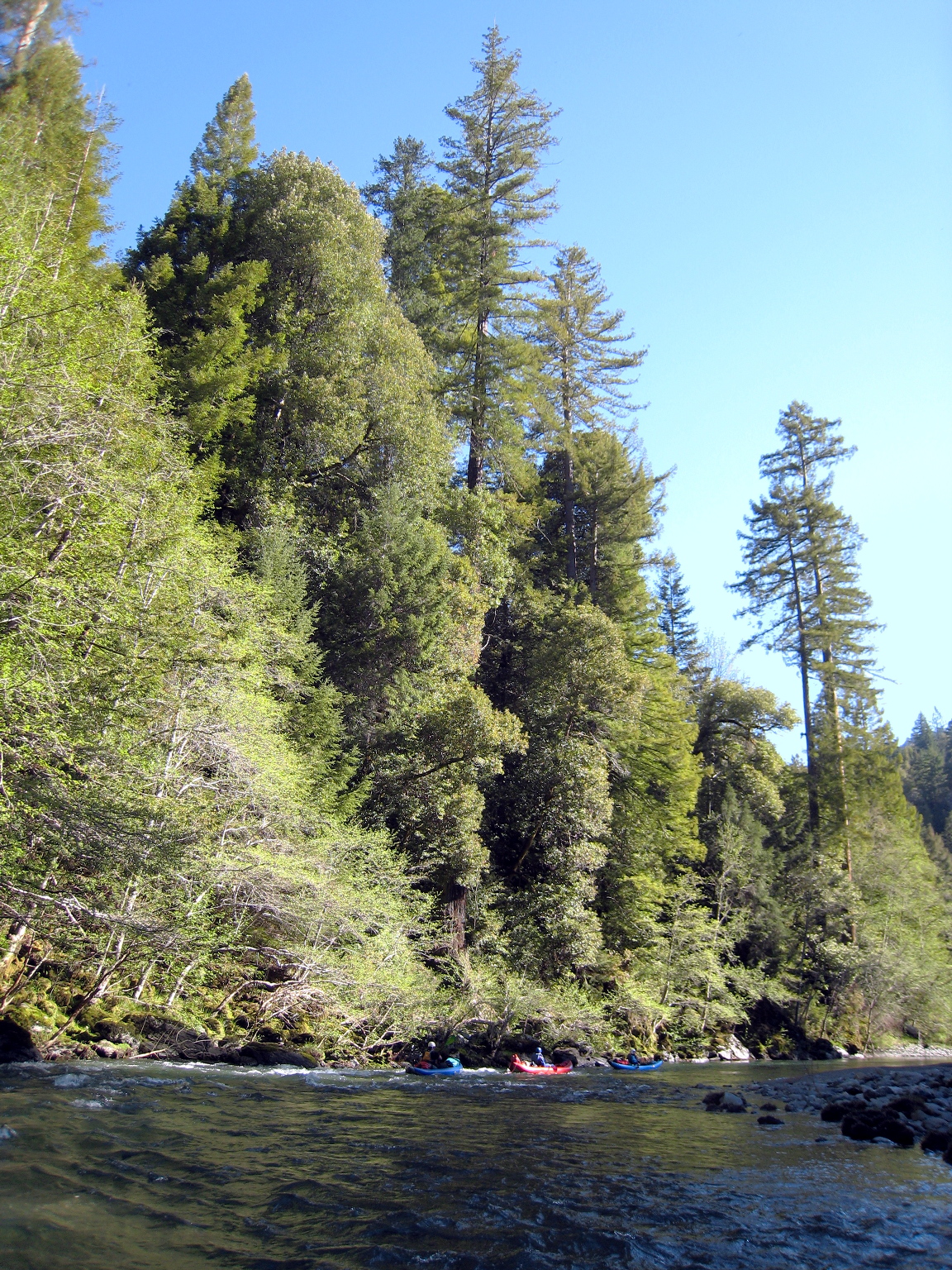
Downstream, the river flows through mixed Douglas fir
and second growth redwood, apparently owned and managed by Simpson Lumber.
- 13.3
- Garrett Creek enters on right.
- 14.7
- Old logging road, just before Panther Creek enters on left.
This is a possible campsite if it's getting late in the day.
The right side is not as steep as the left side.
About 20 years ago this spot had an amazing log bridge cut from two halves
of a huge redwood tree, probably removed for safety and profit.
- 15.7
- Large gravel bar on left, after a sharp right turn at an unnamed creek.
The lower portion has some small gravel and perhaps sand in some years.
Large groups often camp here when they run out of daylight.
- 17.0
- Coyote Creek on right. Boundary of Redwood National Park.
For miles below, there is much evidence of clearcutting.
Vegetation has grown since the late 1960s,
so this area is now covered with alders and small redwood trees.
Alders seem to be reaching their maximum lifespan;
they disintegrate frequently without provocation.
-
As Cassady/Calhoun wrote in their guidebook,
“Many [magnificent giant redwoods] fell during a race between
timber companies and conservationists – a race that continued
beyond 1968 when the federal government included 12000 acres of
Redwood Creek's lower watershed in Redwood National Park, but
left upstream trees open to exploitation. The protected area
was nearly doubled in size 10 years later, but by then loggers had
cleared giants from both banks for many miles below Coyote Creek...
The dozen or so miles of virgin redwoods that remain along the
lower river are among the most spectacular sights in this guidebook.”
-
Actually the left bank was more heavily logged than the right bank,
even in the earlier designated portion of Redwood National Park.
This was probably due to a network of logging roads close to highway 101.
Most of the original tall trees are on the right bank,
although some remain on the left.
- 18.1
- Devils Creek on left.
- 19.8
- Copper Creek on right.
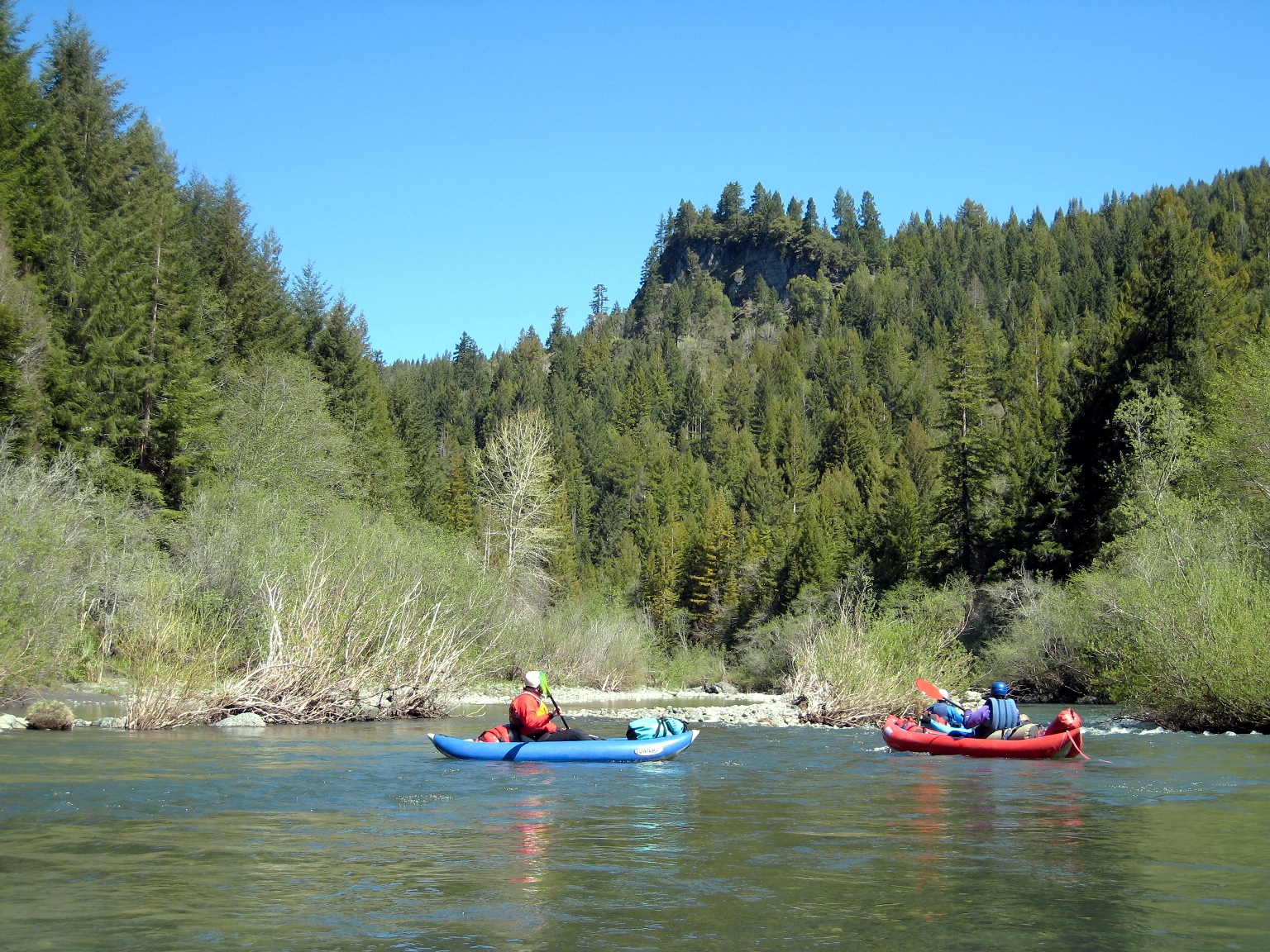
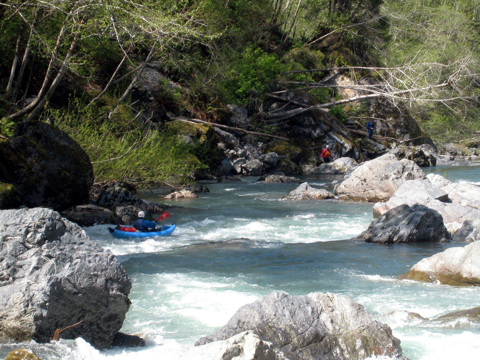
A rocky promontory is visible high on the right bank, indicating
a Class III rapid .6 mile ahead, followed by a fine campsite.
- 20.3
- Fine campsite on the left bank. Grass-covered flat spot above
a mixed cobble and sand beach. Class III rapid audible upstream.
The next three miles could take many hours to run depending on
what you do at Rocky Gap, so stay here if darkness is approaching.
- 20.4
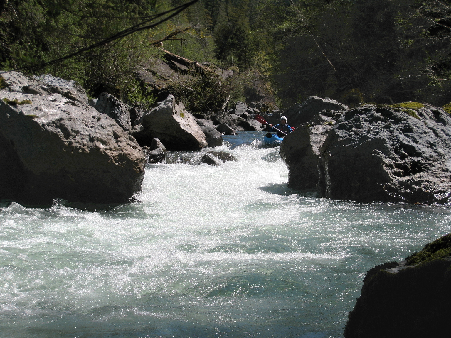
- Around the corner past the rock outcropping,
rapids become more frequent, with stretches of easy water between.
From above, some rapids look class IV because large boulders obscure
your view, but they are generally straightforward unless clogged by wood.
- 22.1
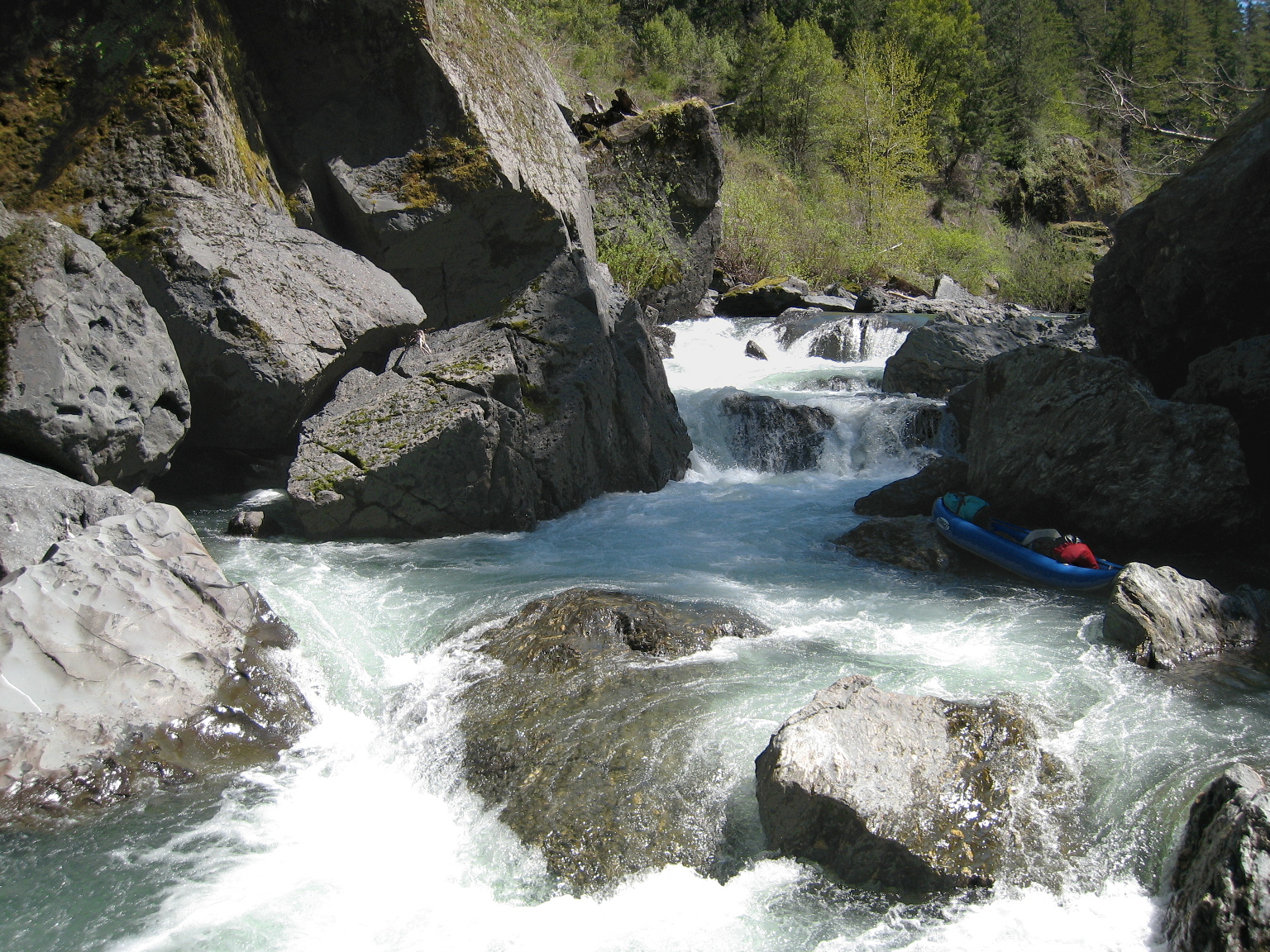
- False Rocky Gap, class IV.
From the top it looks a heck of a lot like the genuine Rocky Gap
downstream: the right bank is eroded, and a square rock outcropping
juts up from the right shore below. False Rocky Gap turns out to be
a fun boulder garden punctuated by a narrow one meter falls/hole,
followed by a steep narrow chute.
- After a short distance comes the class III lead-in to Rocky Gap.
First-time boaters are encouraged to scout on the right,
where it is relatively open and unobstructed by trees.
However you must then cross the river and eddy out on the left.
In large parties, stop well upstream and allow one boat at a time
to negotiate the small eddies above the lip of the falls.
- 22.4
- Rocky Gap, class V to unrunnable.
Rocky Gap changes from year to year. It is sometimes runnable
but risky because of remoteness and difficulty of rescue.
Currently (2023) Rocky Gap is a three-tier drop on the left side
with undercuts and sieves, and underwater logjam on the right.
The first drop is more than a meter high, the second is about a meter,
and the third drop is less.
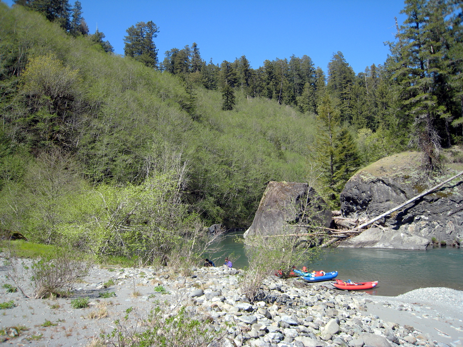
- You could portage on the right by climbing some high cliffs
among poison oak, but the left side has a muddy portage trail,
starting two eddies above the lip of the falls.
At low flows, the easy portage or boat line is on the left.
If the upper drops are clear of logs, you can push your boat out
on a throw rope and pull it back in before the third drop.
Then you must currently (2023) do a seal launch on far left,
threatened by current flowing into the undercut left wall,
and paddle hard towards the third drop.
- 22.5
- Class IV- below Rocky Gap, prefaced by a gravel bar drop.
Large boulders block your view, presenting a choice of three or four
viable routes. Below the boulder fence, exit is on far left,
so routes on the right give you more time to maneuver,
especially if the exit still contains an overhead log. (2023)
- 22.9
- Last class III-IV, where the flow goes sharp right with wrap rock below.
- 23.3
- Mossy bench high above the left bank, once used as a logging camp.
At least one obvious landing leads through willows up to the camp.
Very good campsite with afternoon shade and morning sun.
- Below here, the river is 1-2 feet deep in most places,
flowing quickly over sand and gravel bars.
Most eroded sand is gray, lending the bottom an unusual color.
Soon the creek bed widens and becomes a river, if not so named.
- 25.8
- Tall Trees Grove trail on the right bank promontory, with the
(formerly) tallest tree in the world that hasn't been cut down yet,
and many other redwoods equally impressive and large in diameter.
Topo maps mark this as the site of the Howard Libbey Tree,
which lost its tallest-tree status probably after a storm in 1989.
It was then supplanted by the 370' Stratosphere Giant
of Humboldt Redwoods State Park.
In summer 2006, three taller trees were discovered in Redwood National Park,
the tallest of which is the 378' Hyperion tree,
followed by the 376' Helios and 371' Icarus tree.
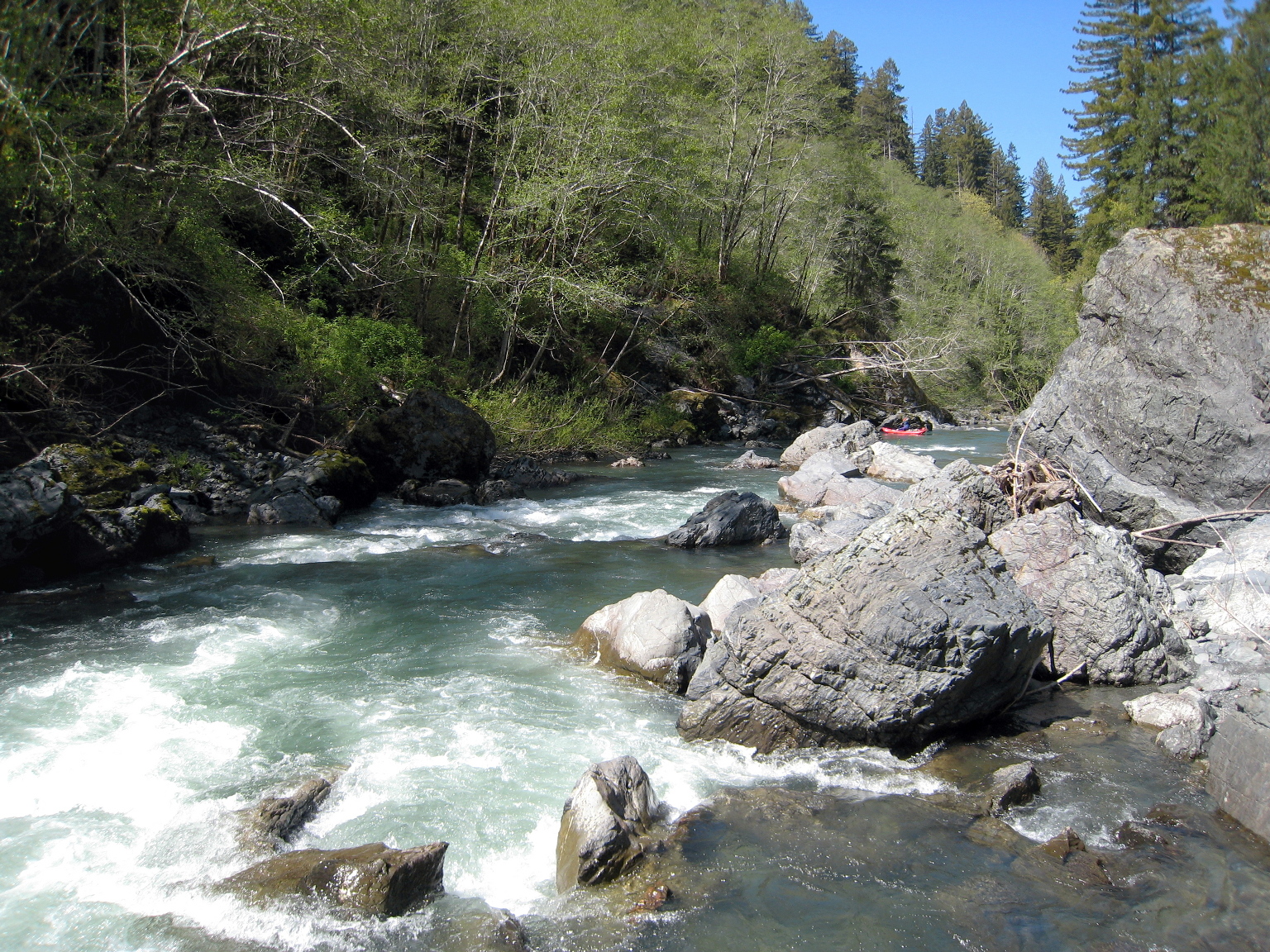
- Around the corner from Tall Trees grove is a very large gravel bar campsite,
increasingly sandy as you proceed downstream.
It is about 11 miles from this campsite to take-out.
Many gravel bars downstream are available for camping
if you want shorten your final day.
- 28.6
- Fortyfour Creek on left.
- 29.7
- Bond Creek on left.
- 32.6
- Elam Creek on left.
- 33.8
- McArthur Creek on left.
- 36.2
- If you parked a vehicle at Orick Rodeo grounds,
you can take out here on river left by climbing over the levee.
- 37.0
- Highway 101 bridge in Orick.
I have never found a trail down to the river from the parking lot
of Redwood Creek trailhead off Bald Hills Road, although one might exist.
High clearance vehicles might be able drive down to riverside gravel bars
from Bald Hills Road opposite Prairie Creek Camp Road.
If you have a shuttle driver, you can back your vehicle
into a small spot at the top of a trail up to the NE corner of the 101 bridge.
If you must leave a vehicle at take-out, Orick Rodeo grounds (on river left)
provides secure parking for $5 per vehicle per night; call to confirm.
Alternatively, you can continue on to the ocean.
The feeling of seeing the ocean ahead is incomparable,
although the Carmel and Big Sur rivers have prettier estuaries.
Sara Gallagher wrote an excellent trip report with photos
of their packrafts(!) and kayaks, posted on American Whitewater:
Redwood Creek, February 2023, 650 at Orick.
|
|
Creeks Navigation
Home
Recommended Runs
Map of Rivers
Alphabetic Index
Alphabetic Table
Text Search
Sponsored Links
|