| |
| Stretch: |
Pit #5 dam to Iron Canyon powerhouse |
| Difficulty: |
Class IV (with short portage), harder at higher flows |
| Distance: |
10 miles, 1 day |
| Flows: |
rafts and kayaks 800 - 4000 cfs, IK minimum 380
|
| Gauge: |
at Big Bend
(CDEC PRB)
and check AW site for release dates
|
| Gradient: |
56 fpm average, upper half 80 fpm |
| Put-in: |
PG&E Madesi access below Pit #5 Dam, 2000' |
| Take-out: |
PG&E access at Iron Canyon powerhouse, 1440' |
| Shuttle: |
8.9 miles (23 minutes) one-way |
| Maps: |
AAA Northern California,
Topo
|
| Season: |
all year long, with scheduled fall releases |
| Agency: |
PG&E, private, BLM |
| Notes: |
© 2015 Bill Tuthill,
CreeksYahoo,
Photos © 2014 Jeff Wasielewski |
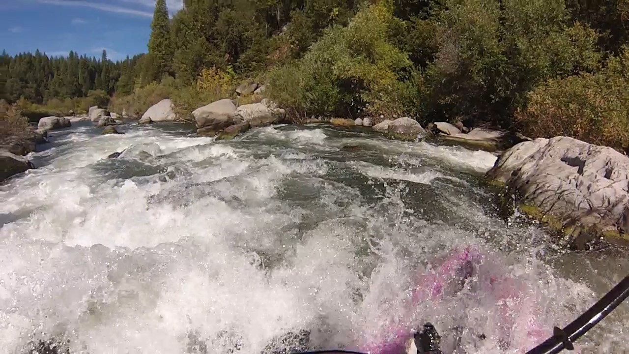
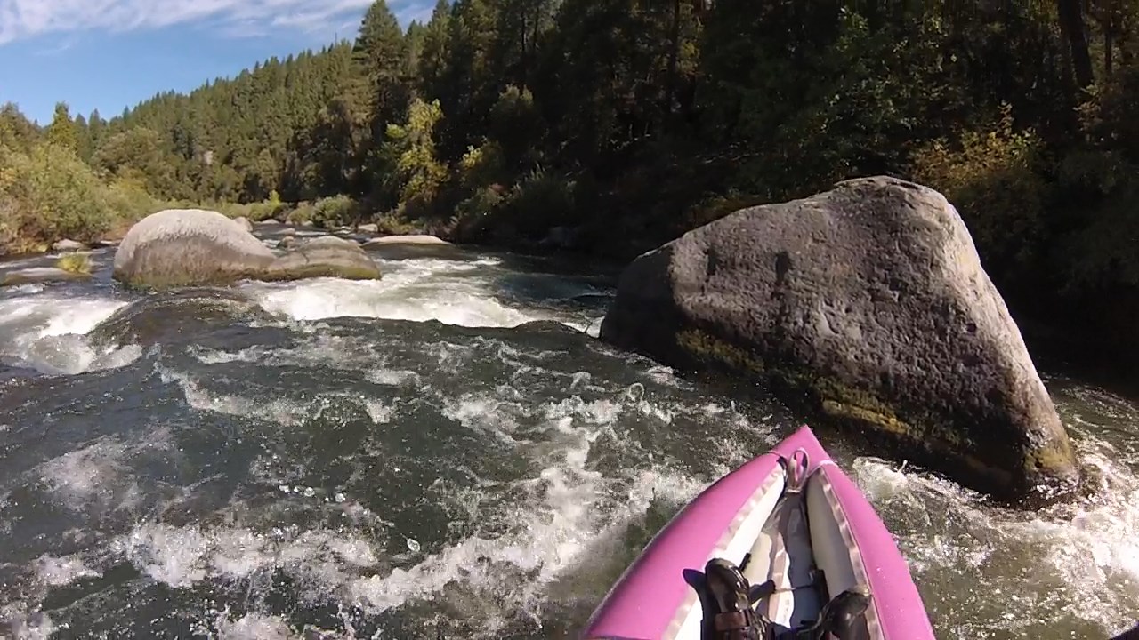
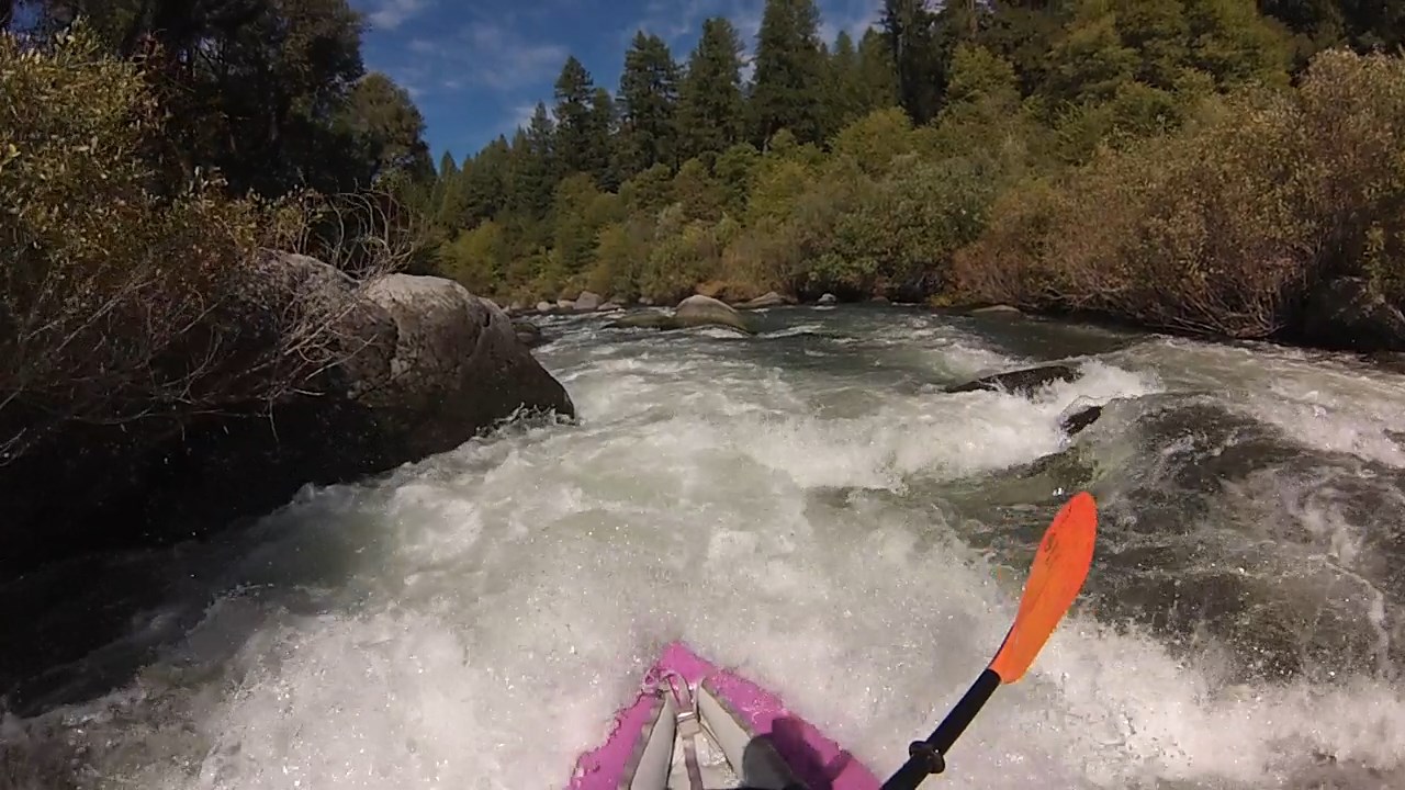
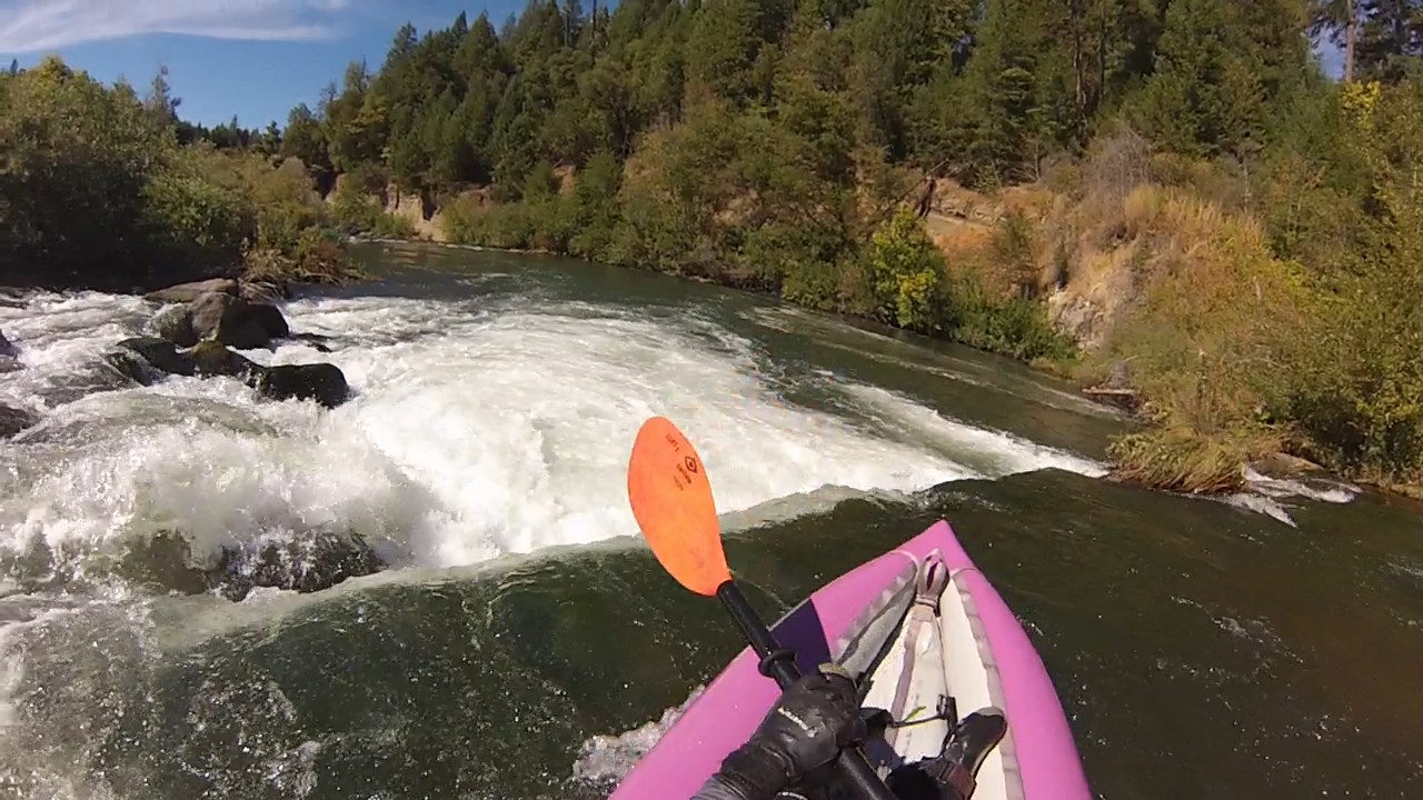
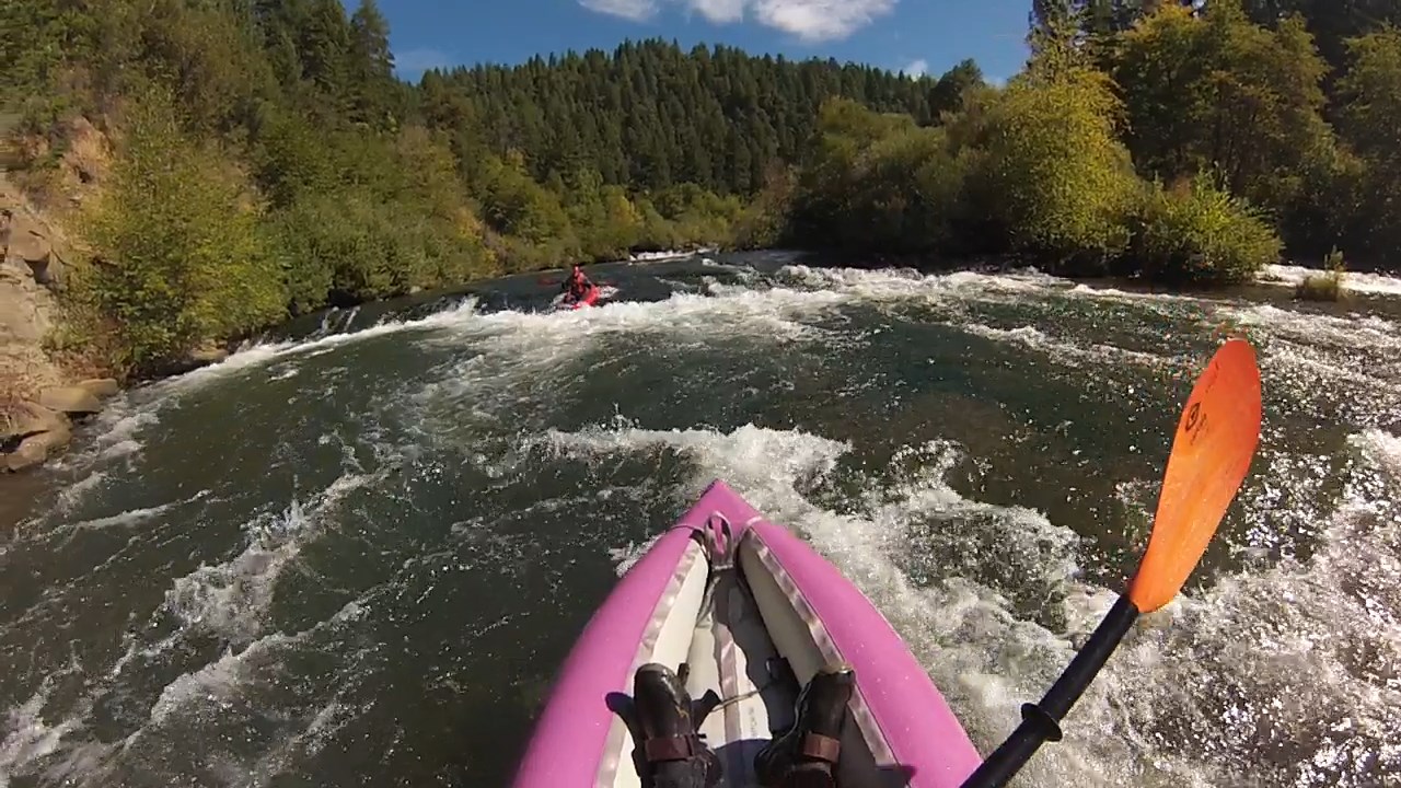
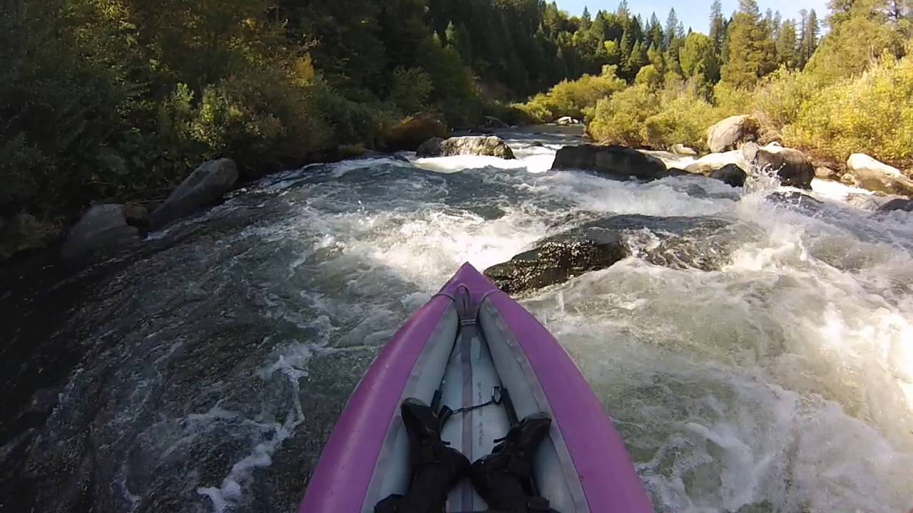
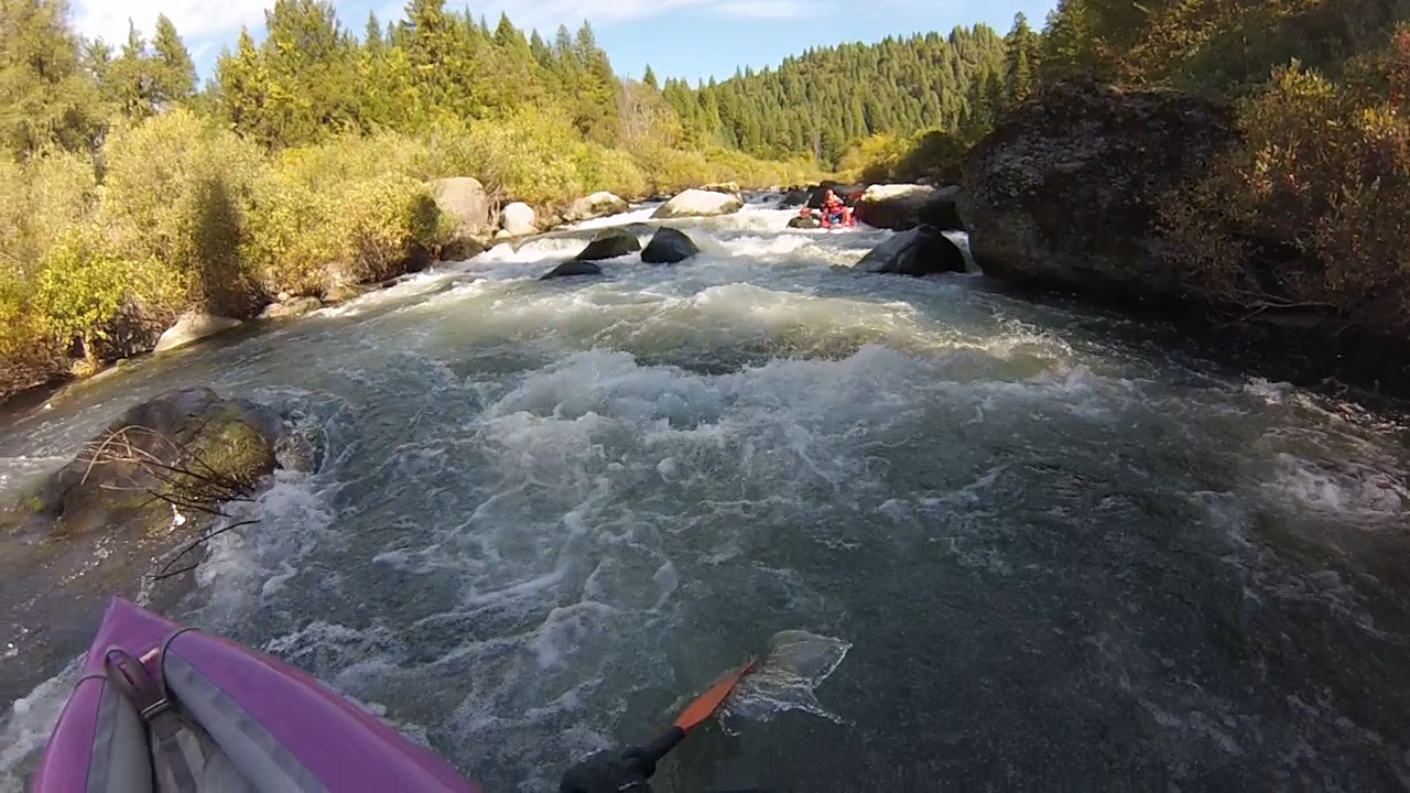
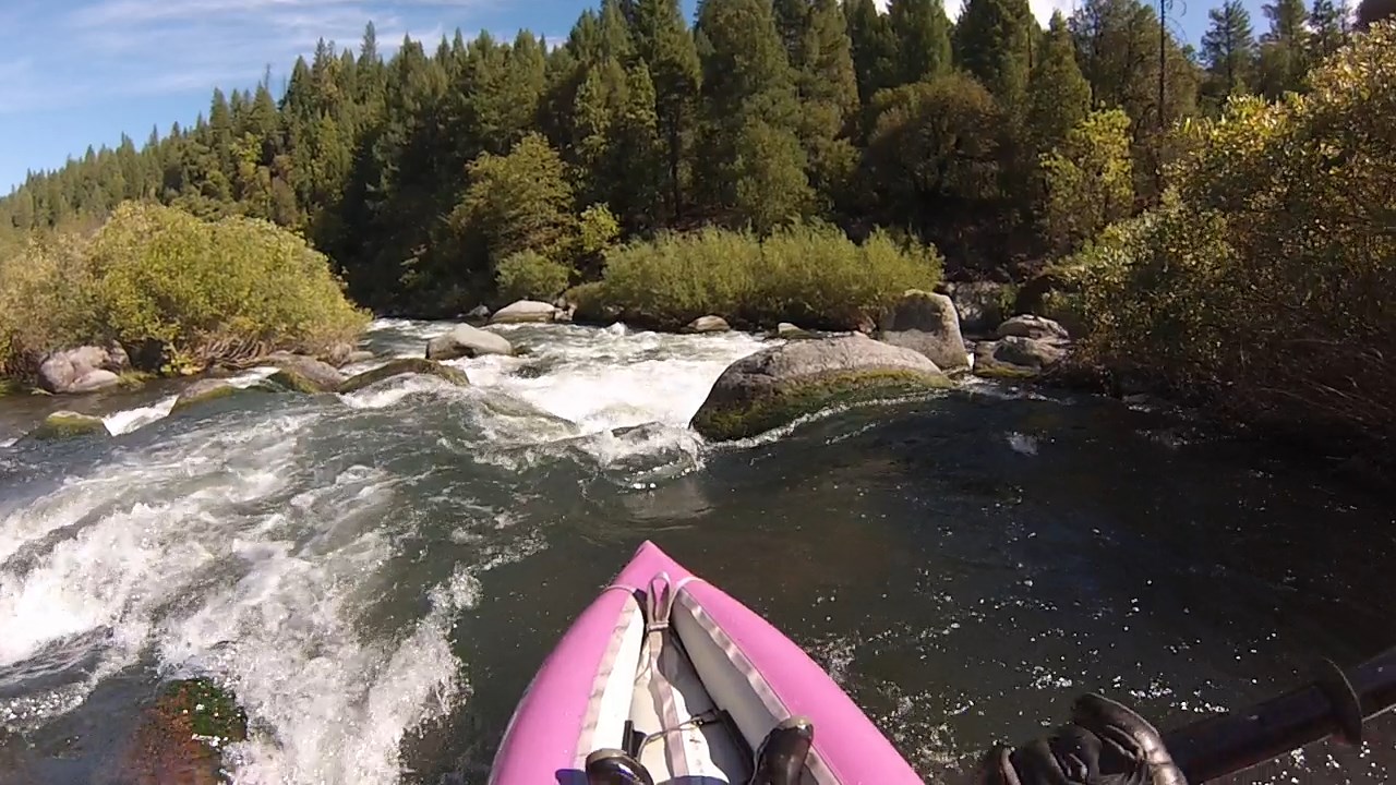
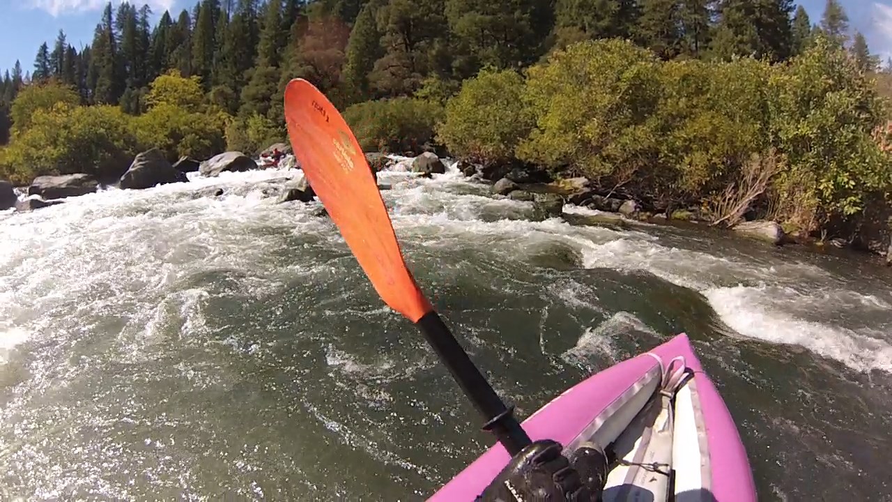
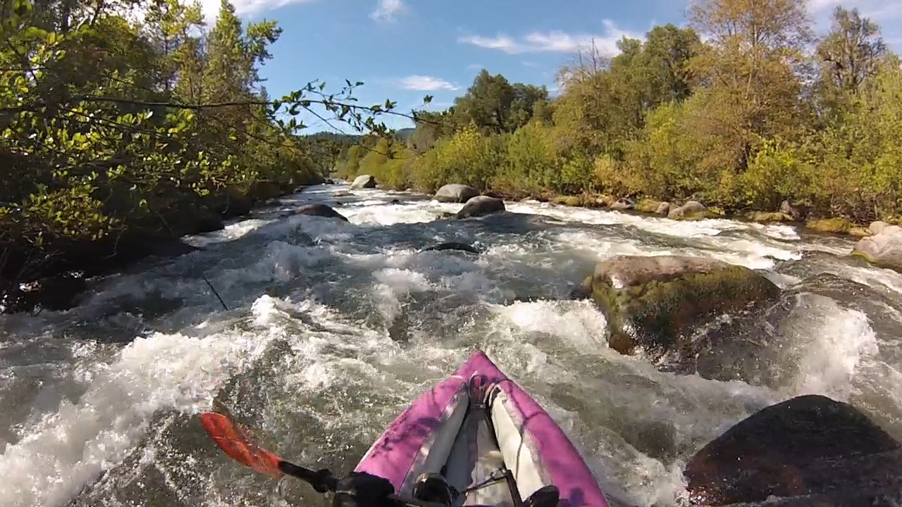
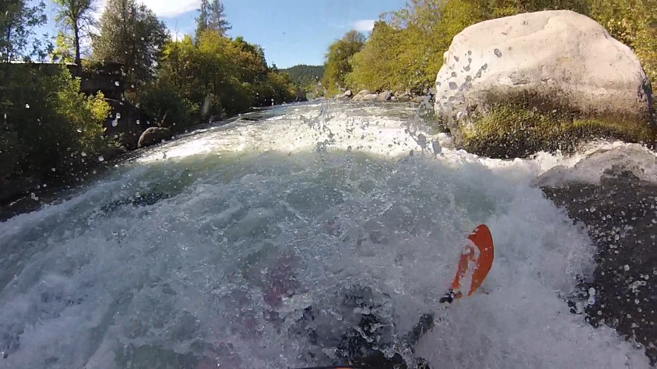
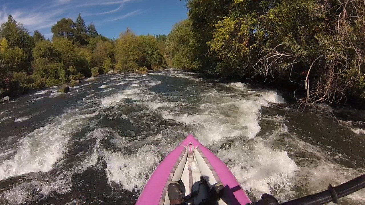
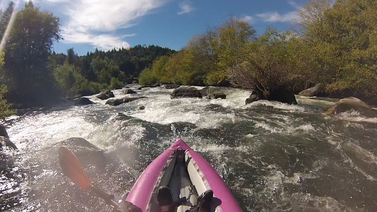
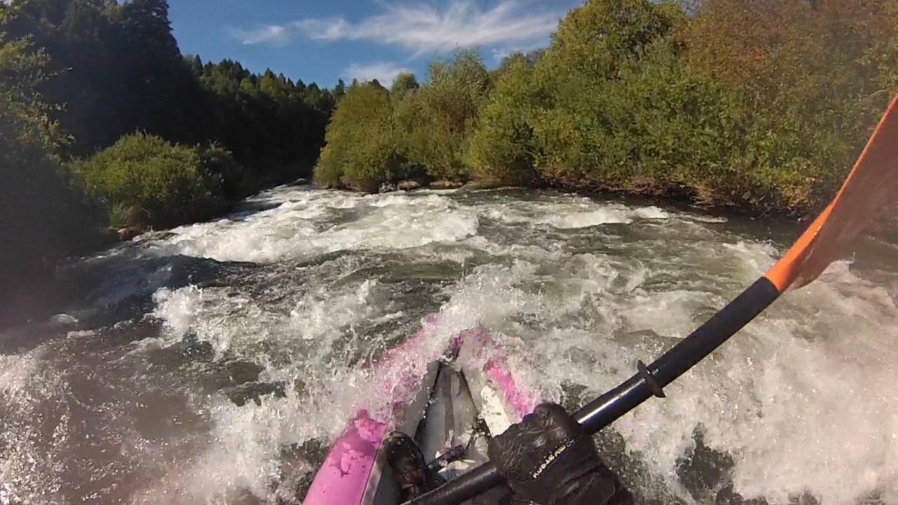
In a self-bailing inflatable kayak (IK) this may be the best class IV run in California.
Unlike the Tuolumne, the shuttle is quick and the take-out is easy.
Unlike the North Fork American, Pit #5 is runnable every day of the year
with nearly constant flow, even after hydropower diversion.
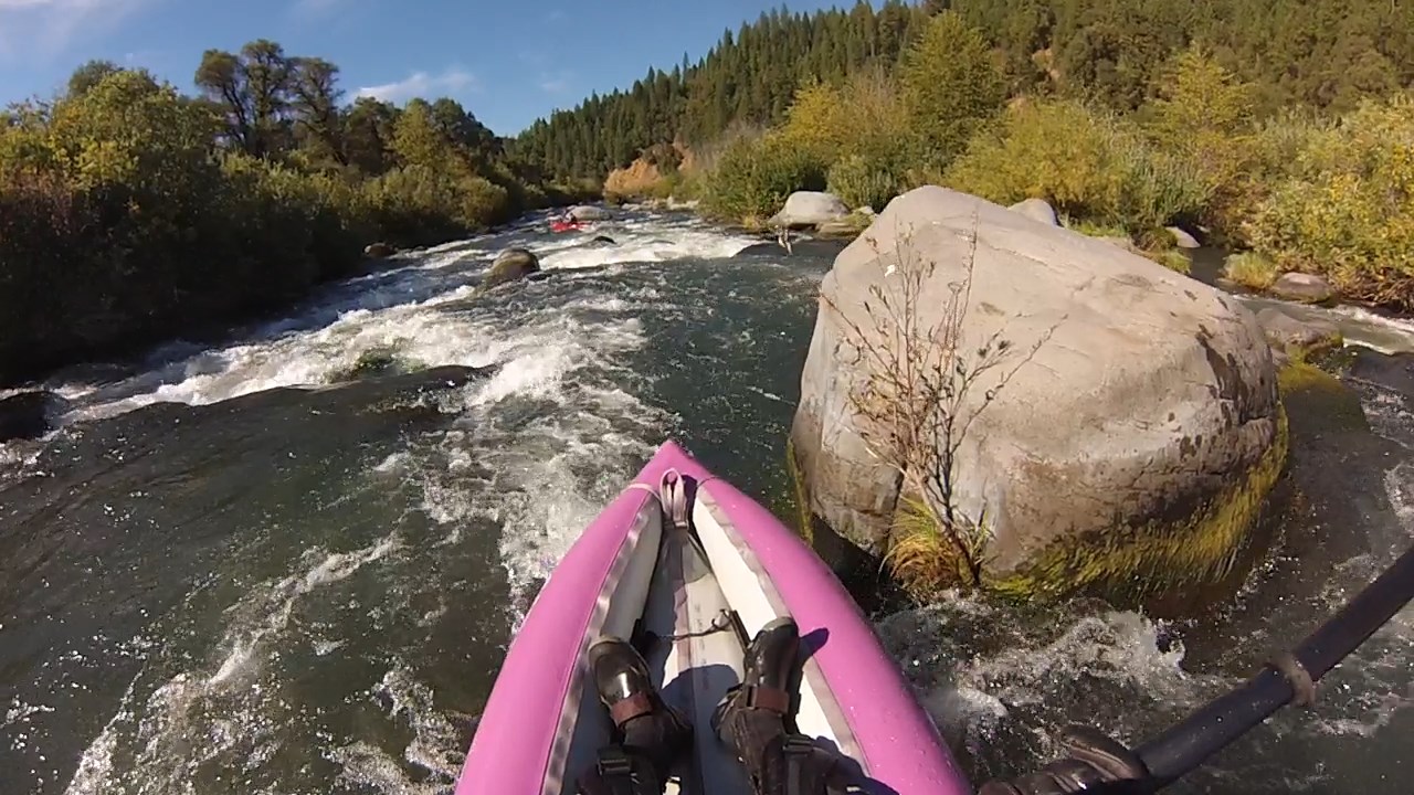
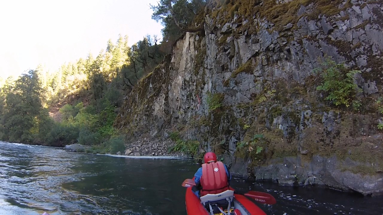
Its steep boulder drops and forested hillsides are scenic if not spectacular.
After a brushy rapid and a short portage,
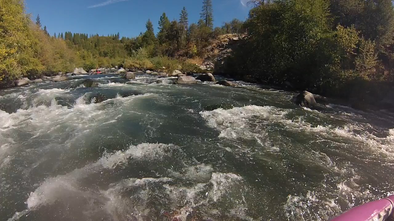
you are rewarded with 4 miles of constant class III-IV boogie water,
a hot springs for your lunch stop, then 4 miles of easier water to take-out.
If you prefer, you can run laps on the first 4 miles, missing the hot springs.
Most whitewater boaters (kayakers and rafters) will probably want to wait
for scheduled releases (1200-1500 cfs) in August and September.
Thanks American Whitewater activists!
Existing flow information says 500 cfs is too low, which is untrue for IKs,
but below 500 cfs, slots are too narrow for rafts, and pin spots are prevalent.
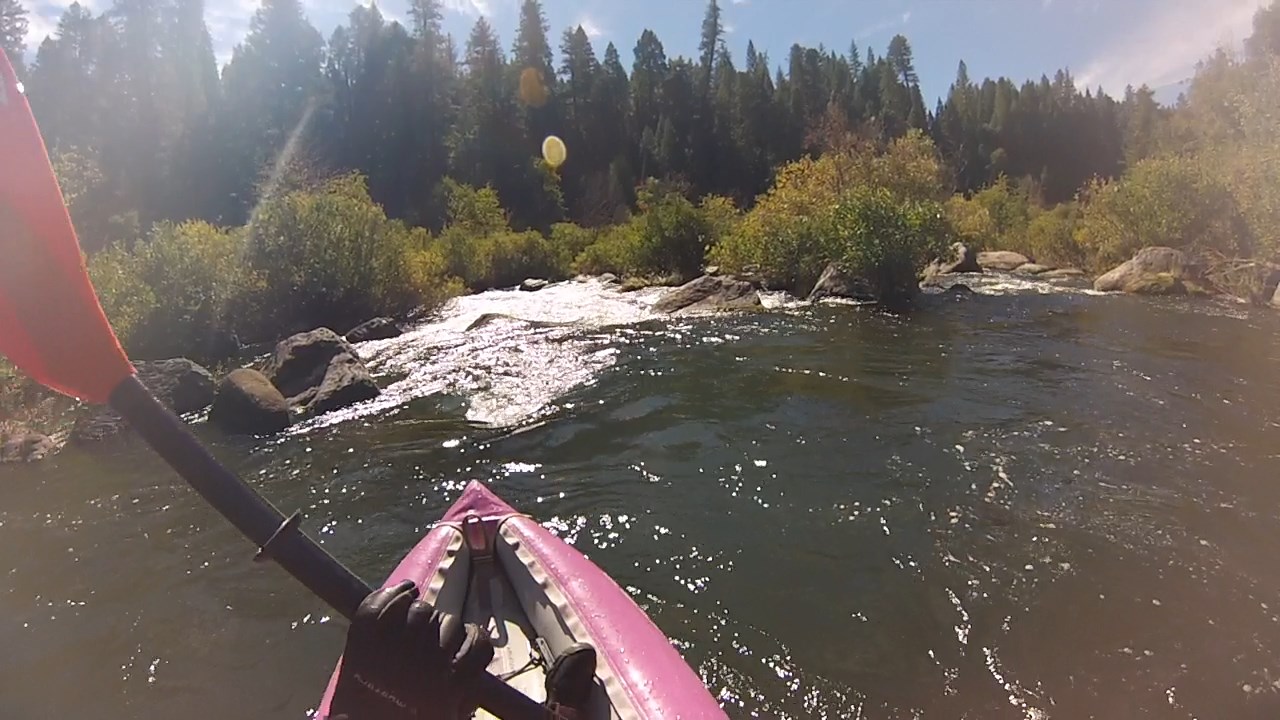
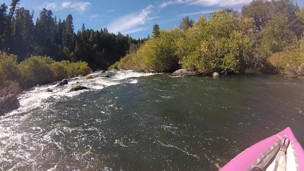
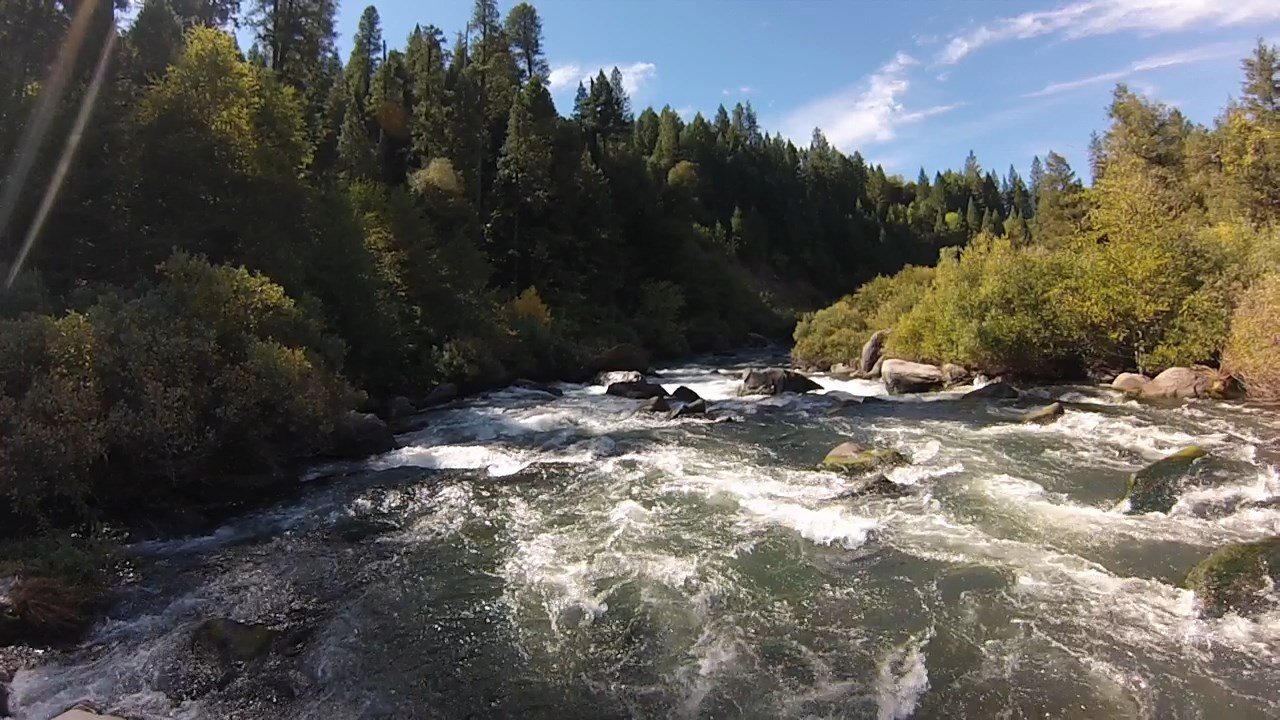
Photos on this page are screen captures from GoPro video taken at 380 to 400 cfs.
Additional writeups and photos are available on the
AW website
and at A Wet State.
- 0
- Put in at Madesi River access with paved parking and vault toilet.
Just upstream of a fishing and viewing platform is a narrow put-in spot.
You can find several campsites away from the river near a large parking area.
- .1
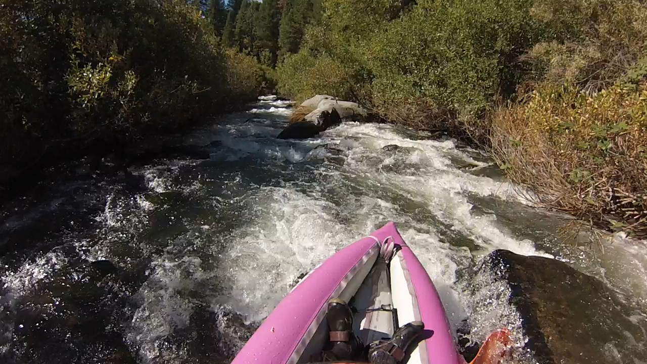
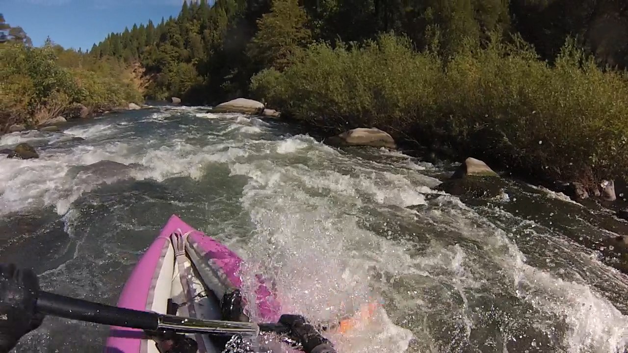
- African Queen, brushy class III-IV, has at least four braided channels,
with the center channel being the traditional route, pruned in 2015.
-
- .3
- Class II rapid before a right bend.
Eddy out on the left and get ready to portage the next drop.
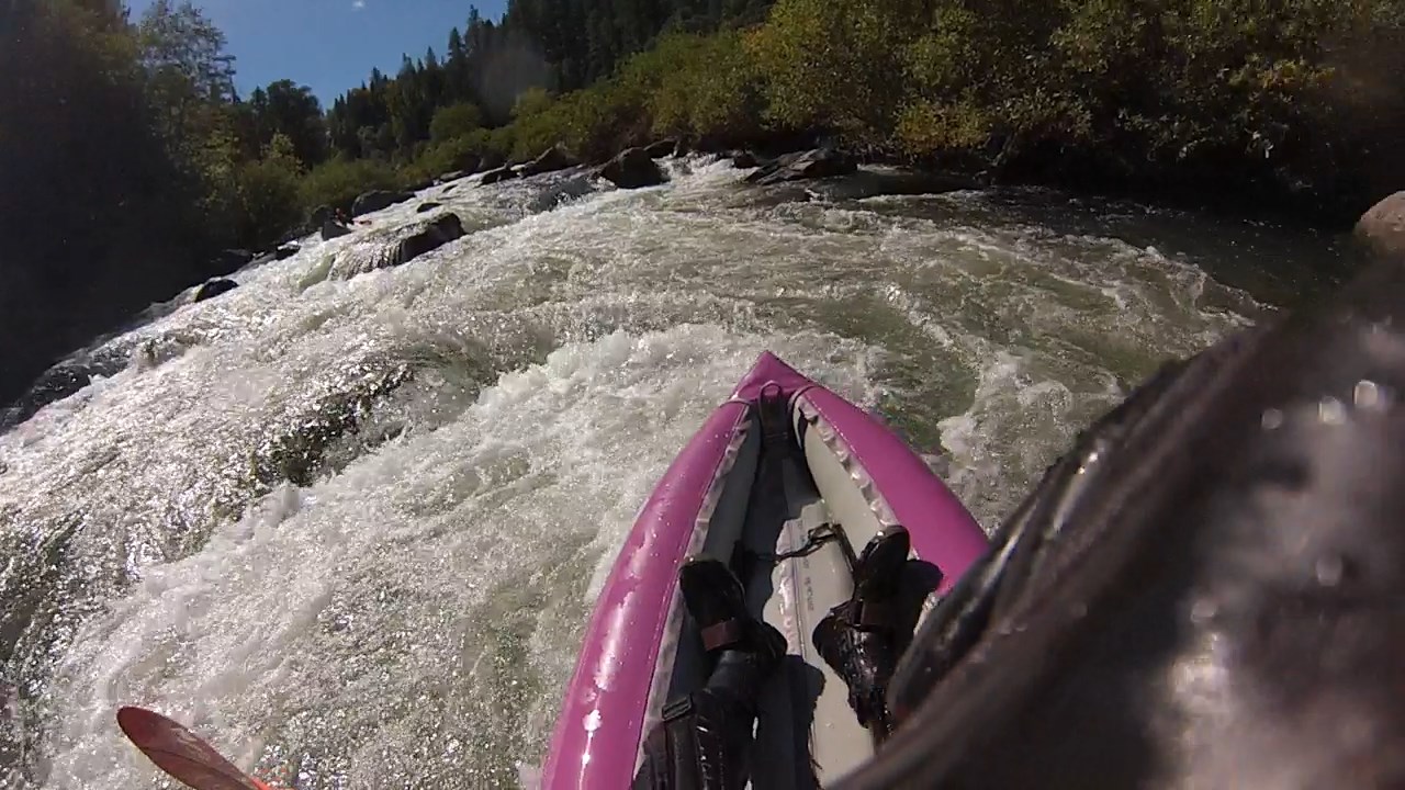
- .4
- Sneak Peek, class V. If you portage the first drop starting with a flat rock
on river left, thru a gap in the boulders, then drop into an eddy
behind a large rock, the remainder of this rapid is class IV+.
The top drop is runnable by entering left, moving sharp right,
then left again towards the re-entry eddy shown in the portage picture.
-
-
- .6
- Split Decision. At low flows the best route is down steps on the far right,
then crossing into the left channel behind a large rock, or soon after.
At higher flows you can go either way, hence the name.
-
- 1.0
- Left OK, class III. After a straight section with many fun rapids,
the river bends left. At the entry this rapid looks like the next one,
where you might not want to go left.
- 1.1
- Upper Ledge, class III+.
Rocks and a vegetated island obscure the ledge lurking at the bottom of this rapid.
The easiest route is to find the right channel, get forced left by rocks, then
and ferry right for a clean drop avoiding the rooster-tail.
-
- 1.2
- Spin City, the lower ledge. Not as high, so a good place to surf.
-
- 1.3
- Upper Spillway, class IV, one of the steepest drops on this run.
The spillway from Tunnel Reservoir enters unobtrusively on the left
(no concrete is visible, it looks like a landslide).
-
-
- 1.5
- Lower Spillway, class III, milder but long rocky drop,
left of an island that appears at higher flows.
- 1.6
- Cut Right of Hump, class IV. The river turns sharp right into a steep drop.
Below the cut, a large and steep boulder field suddenly appears.
-
-
-
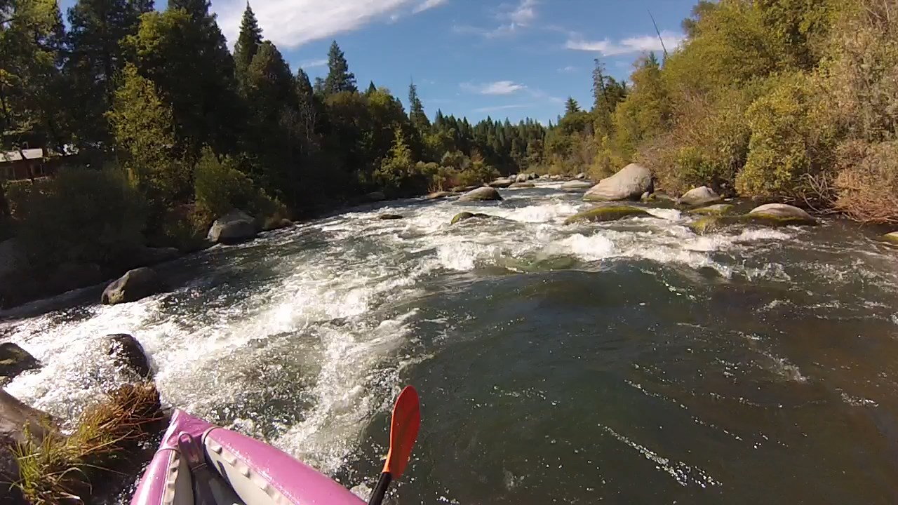
- 1.7
- Scenic alert, Kinner Falls on the right bank.
Just below is Kinner Rapid, class III. The best low water route is far left.
A long straight-away with fun rapids follows.
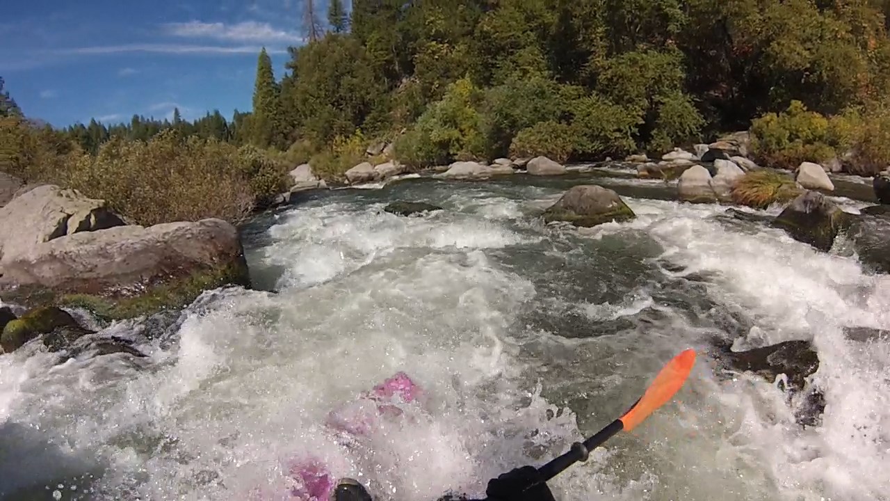
- 2.3
- Powerline, class IV.
The rapid begins at a left bend, going mostly left of an island.
After a short lull the rapid drop steeply thru large boulders,
with a deep water channel on far left. Power lines are overhead below.
-
- 2.5
- A few houses appear on the left bank.
Then the river splits around an island, with most water going left.
-
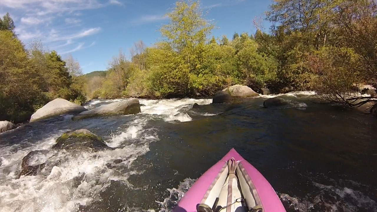
- 3.7
- Bridge Rapid, class IV-.
A steep boulder-infested drop within sight of the Big Bend bridge.
-
- 4.0
- Public river access on the right bank.
- 4.2
- Bad Alder, class III+. Starts quietly at a right bend,
then picks up speed as most water drops steeply into the right channel.
At low flows you must slalom around rocks in the middle
to avoid the overhanging alder trees on the right bank.
At high flows half the water goes into overhanging branches,
but it is easier to stay left because rocks are covered.
-
- 4.5
- Hot Springs Rapid, class III+. Starts at an island where
the right channel turns left and drops steeply as it joins more flow.
A very long slalom follows with some brush among large boulders.
At low flows, a good option is to start right,
perhaps just left of a tree growing out of a rock, then work left.
-
- 4.8
- Big Bend hot springs pour out of the left wall. Private resort above.
Below the hot springs is a steep rapid moving right, followed by
a small drop, then a long rapid called Osprey in the AW writeup.
-
- 5.4
- Wide gravel bar along a minor rapid, with hot springs on the left hillside.
This is a good lunch stop, because only class II-III rapids remain.
- 5.6
- Kosk Creek enters on the right. Beforehand is a significant rapid
below the gravel bar hot springs, and another significant rapid
immediately below Kosk Creek.
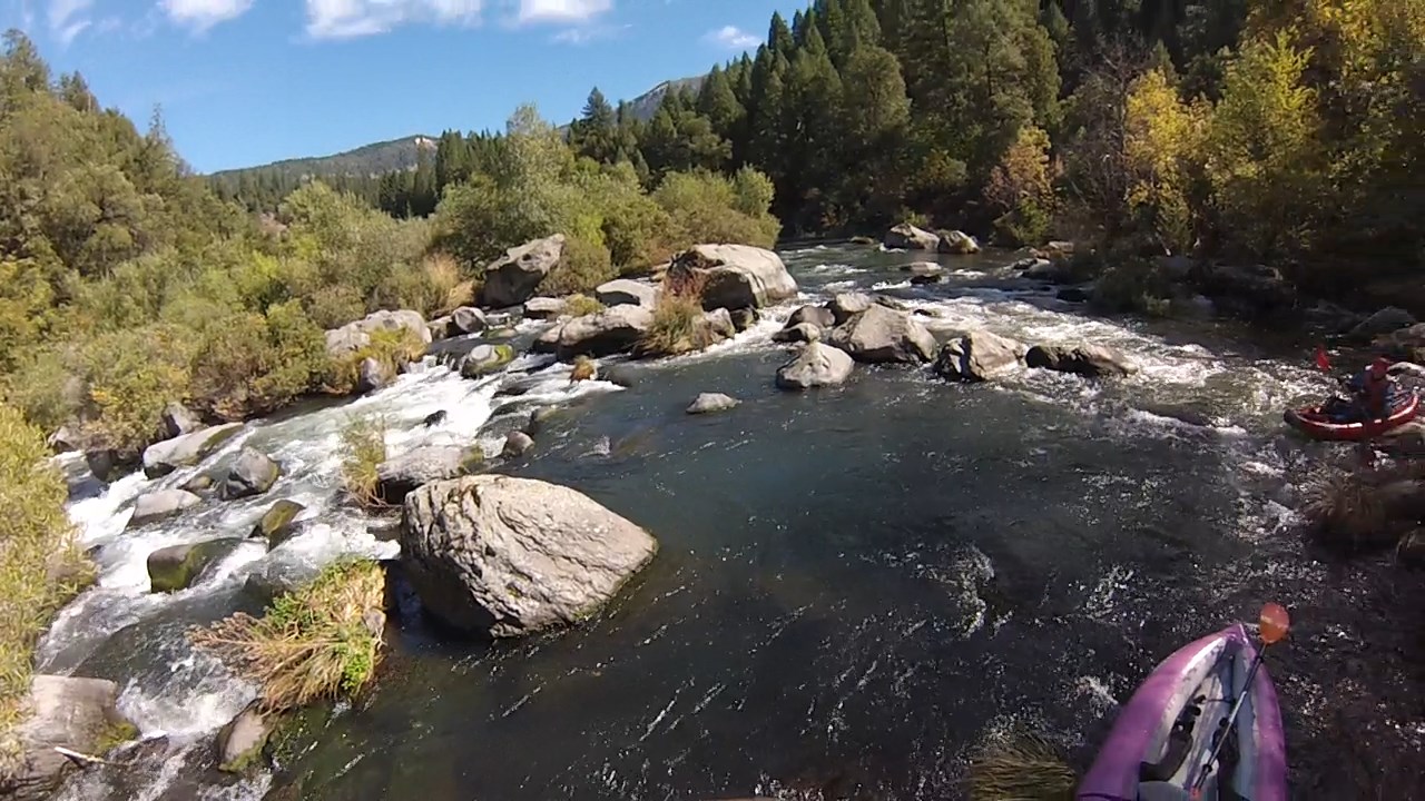
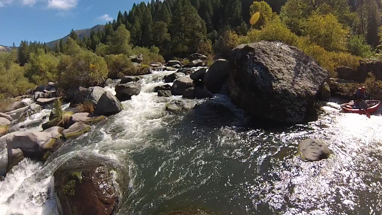
- 7.3
- Power line overhead. One of the bigger rapids on the lower run ends here.
Fun rapids continue all the way to take-out, spaced further apart.
-
- 10
- PG&E access area with vault toilet and gravel boat ramp,
across from James B. Black Powerhouse,
whose water comes from the McCloud river via Iron Canyon reservoir.
Locked gate access to the Pit #5 Powerhouse .5 mile downstream.
|