| |
| Stretch: |
Highway 95 to Birch Creek or Leslie Gulch |
| Difficulty: |
Class II with some Class III |
| Distance: |
49 or 67 miles, 4 to 5 days |
| Flows: |
rafts and kayaks 800 - 5000 cfs, IK minimum 600 |
| Gauge: |
measured shortly downstream of Rome
(USGS site)
|
| Gradient: |
fairly continuous 13 fpm not including reservoir |
| Put-in: |
BLM access just upstream of highway 95, 3360' |
| Take-out: |
Birch Creek ranch or Leslie Gulch on reservoir, 2670' |
| Shuttle: |
75 miles (2 hours) one-way |
| Maps: |
BLM Owyhee Bruneau map, AAA Oregon
(Topo)
|
| Season: |
March maybe into June, from snowmelt |
| Agency: |
BLM (self-registration), private |
| Notes: |
© 2011 Bill Tuthill, Photos © 2006 Martin Wong |
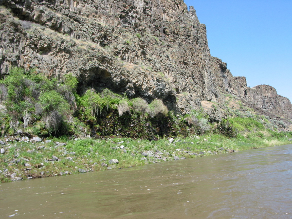
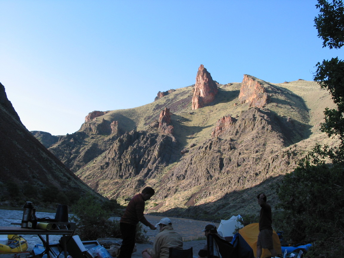
The lower Owyhee is one of the most beautiful places I have visited
that is not designated as a National Park or Monument.
The Jarbidge and Bruneau rivers, also not designated,
are perhaps more spectacular, but less varied in scenery.
Another big advantage of the lower Owyhee is ease of boating.
The rapids are not difficult, particularly at moderately high flows.
Campsites with sandy beaches and easy kitchen access abound,
and several good hotsprings are situated along the river.
During years with average or above-average snowpack,
the Owyhee runs for at least several weeks when temperatures rise,
perhaps on several occasions if late-season storms occur. Unfortunately
it is difficult to plan a trip more than a few weeks in advance
because weather in the high desert is extremely variable year to year.
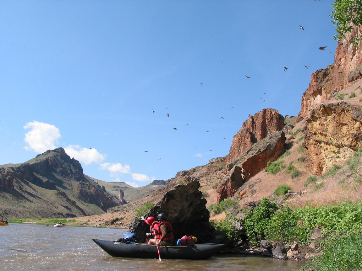
Photos below were taken with flows around 3000 cfs.
Isolation and rattlesnakes are the principal hazards.
When you hike, keep an eye on the ground ahead.
It is possible to walk out of the canyon in many places,
but help (humans in any form) might be a long distance away.
Temperatures vary unpredictably during the boating season,
so be prepared with summer and winter clothing.
- mile 0
- Put in at the small BLM campground about .2 mile upstream (south)
of highway 95. A dirt road leads down to the river, so you can
unload rafts directly from trailer. Sign in at the BLM kiosk.
No good put-in exists downstream, despite what old guidebooks say.
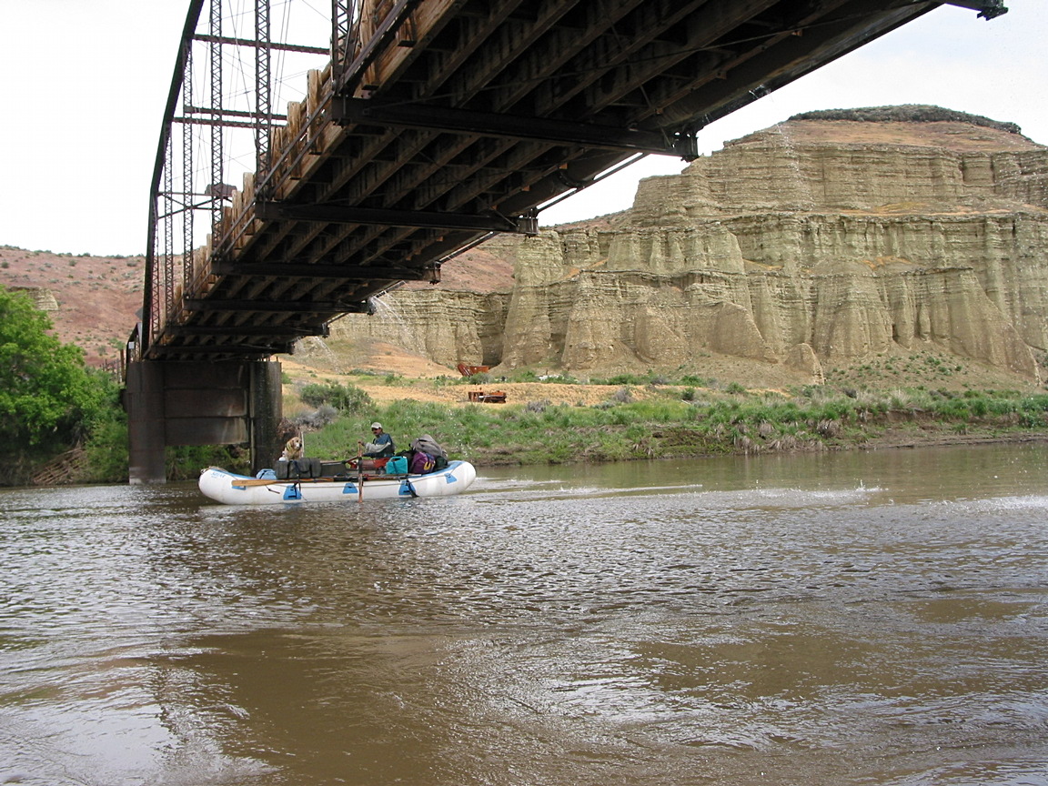
- 2.8
- Truss bridge where private road crosses to an old stagecoach stop
and ranch land. The gauging station is shortly upstream.
-
- 6
- Crooked Creek enters on the left, after the canyon deepens.
Highway 95 crosses this creek in a big valley many miles east of Rome.
-
- 11
- Three straightforward class II-III rapids about a mile apart:
Long Sweetwater, [so-called] Upset, and Bulls Eye.
-
- 17
- Weeping Wall springs, a good place to fill water bottles.
-
- 21
- Two rapids within half a mile, Read-it-and-Weep, then Artillery.
The first is tricky at low flows, but is not prominent otherwise.
- 21.5
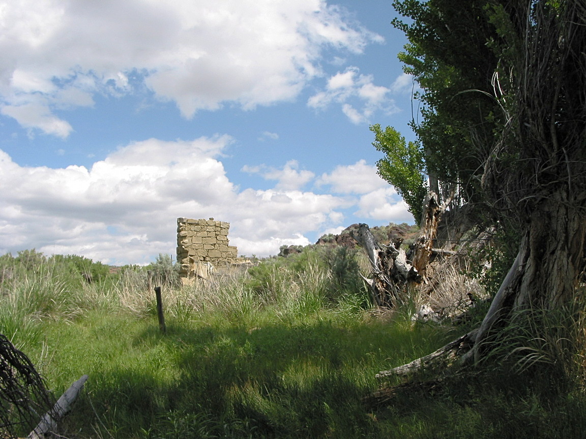
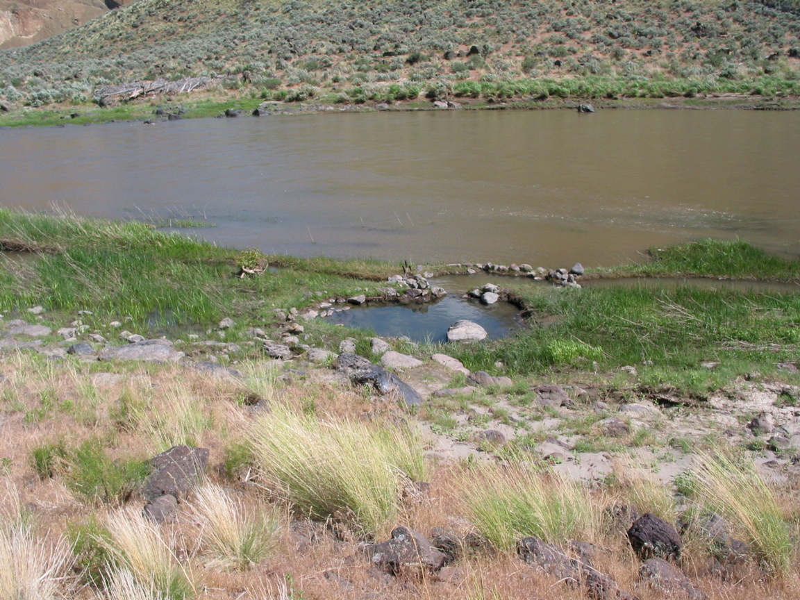
- A hotspring is marked on maps. Near river level it is muddy
and unusable, but perhaps we did not find the best pool.
The so-called Rustler's Cabin is up the hill just downstream.
A picture in John Garren's 1973 guidebook Oregon River Tours
shows the cabin still with a roof, which has since collapsed.
-
- 24
- Campsites on both sides of the river. The left campsite is bigger.
Shortly upstream is a very nice hotspring.
-
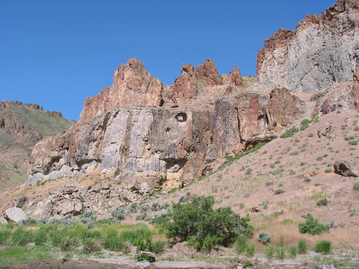
- 24.5
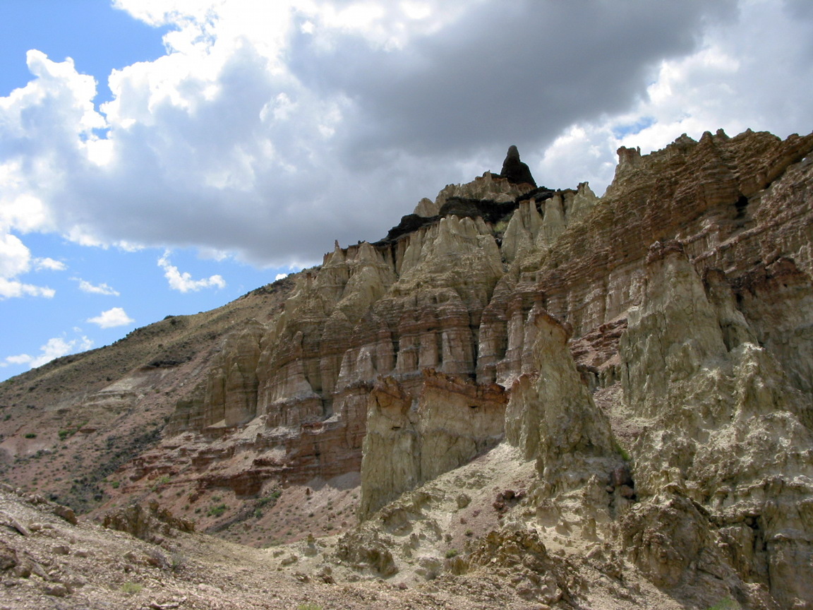
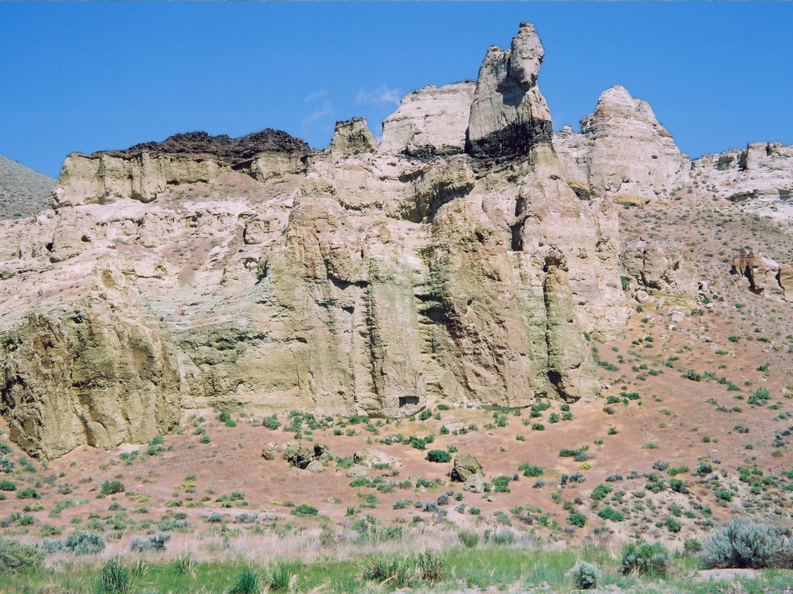
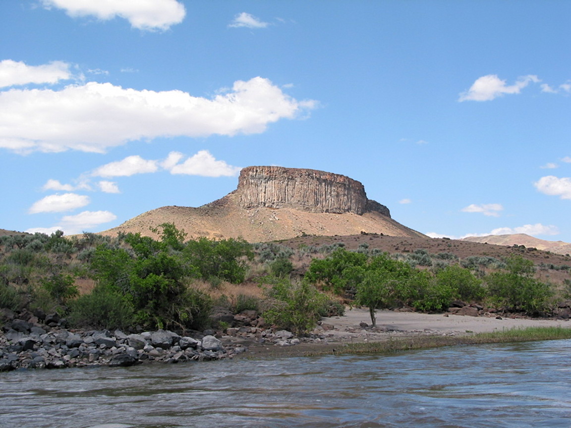
- Pruitt's Castle, a beautiful rhyolite fortress, on river left.
Several good campsites in the next two miles offer hiking opportunities.
-
- 26
- Lambert Rocks, a striking dome formation, on river left.
-
- 27.8
- Bogus Creek enters on the right, creating Bogus Falls with recent rain.
- 28.2
- Bull Creek enters on the left, creating Dog Leg rapid, harder at low flows.
- 30.3
- Whistling Bird rapid, class III,
where a huge rock broken from the right-side cliff creates a tight squeeze
at low flows against the left-side boulder bar.
At higher flows it is easy to cheat left.
-
- 31.5
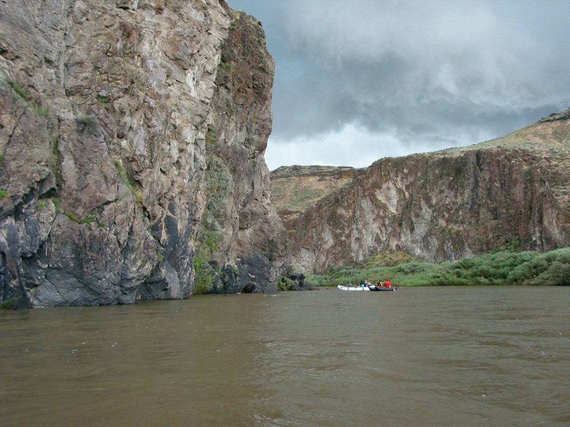
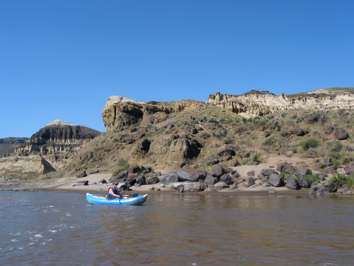
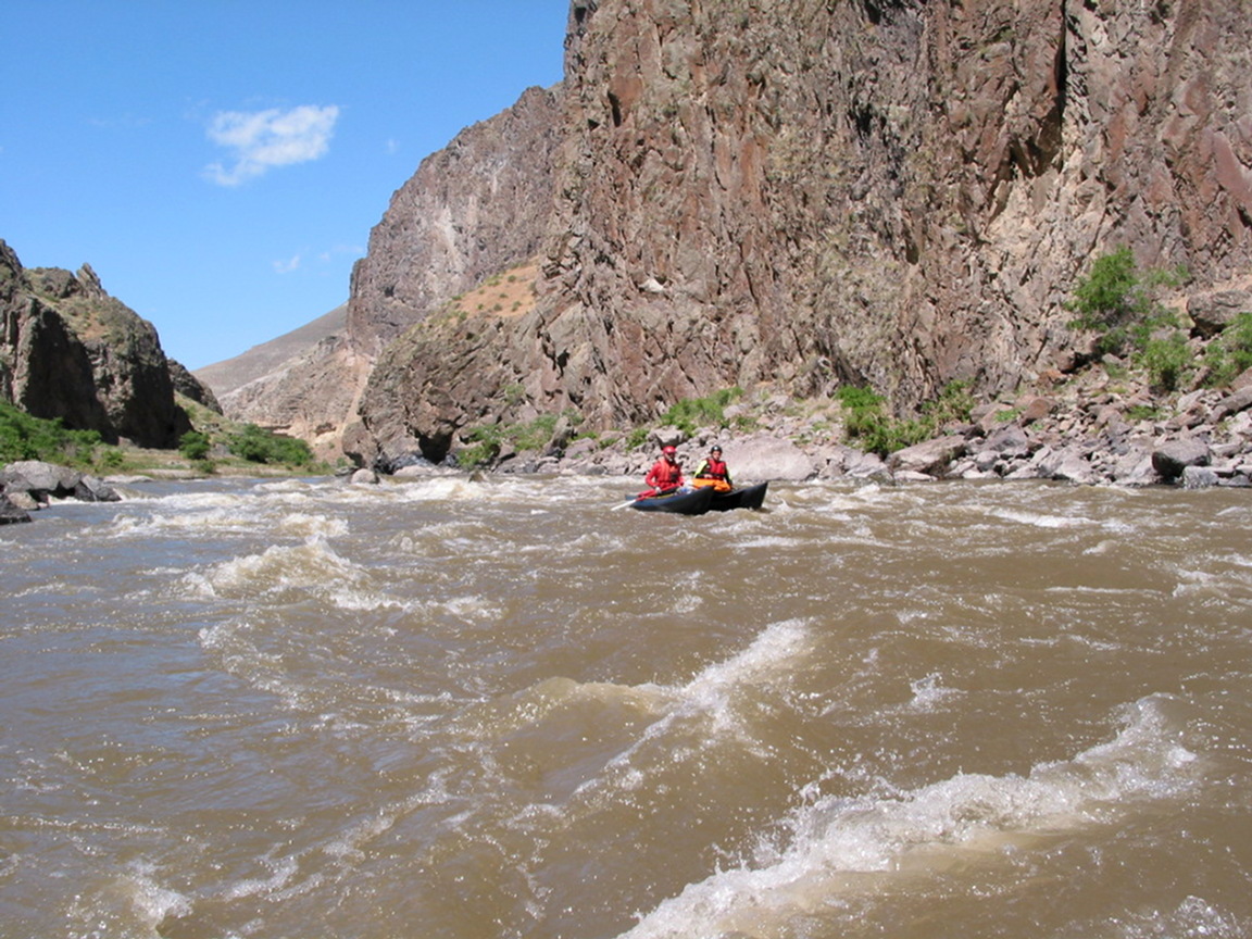
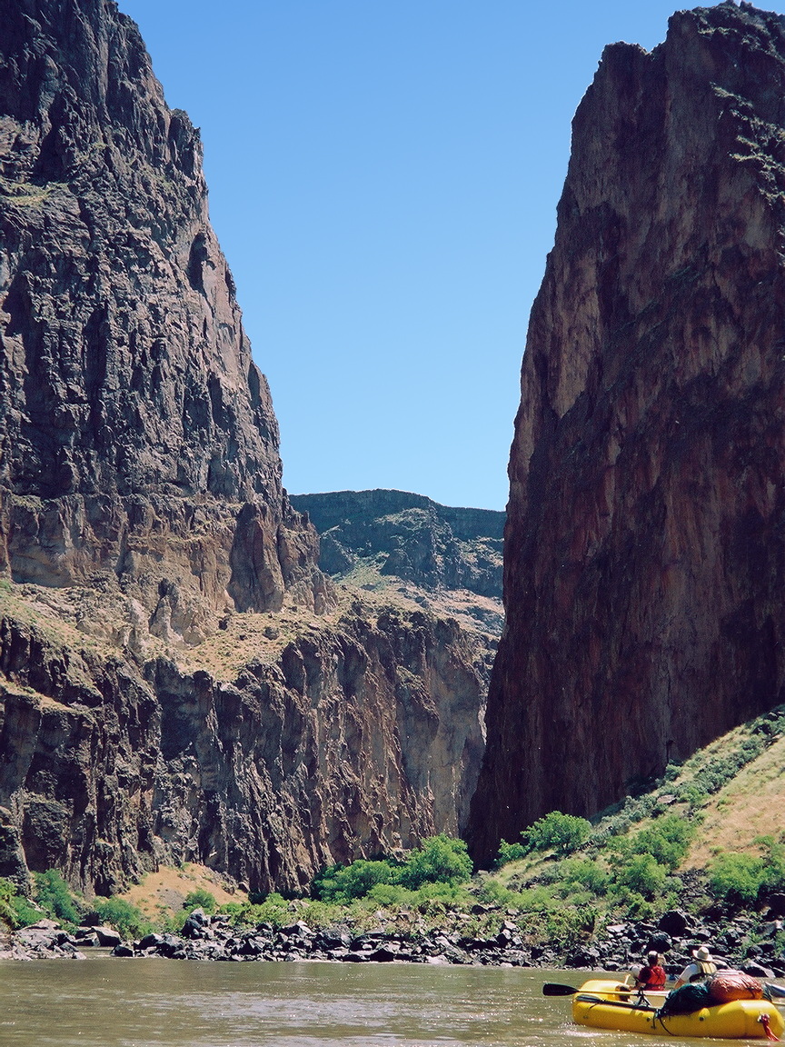
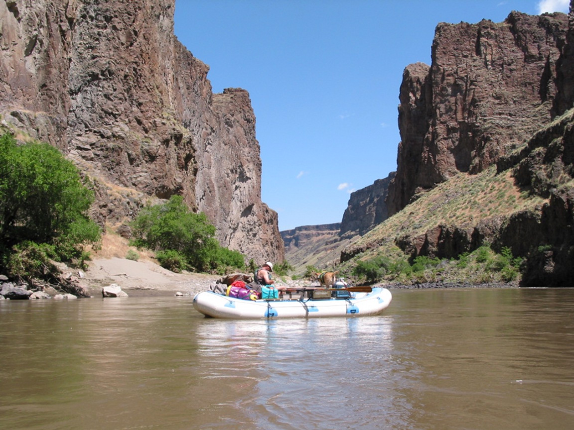
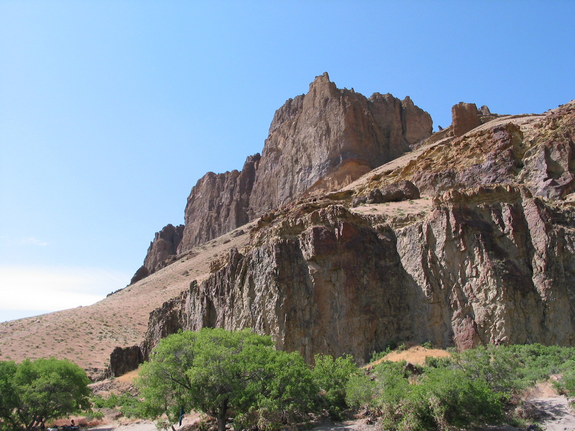
- The cliffs close in as the river enters Green Dragon Canyon.
The most concentrated whitewater on the lower Owyhee lies ahead.
-
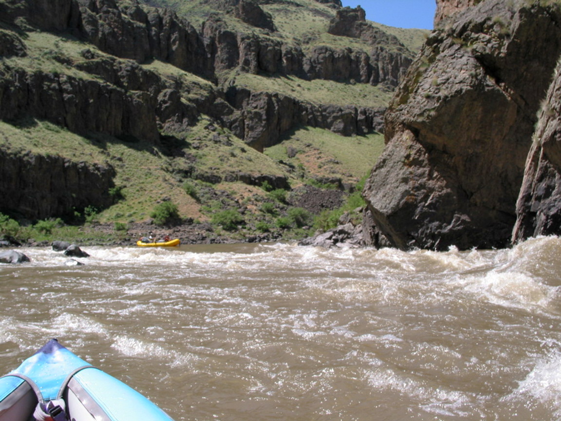
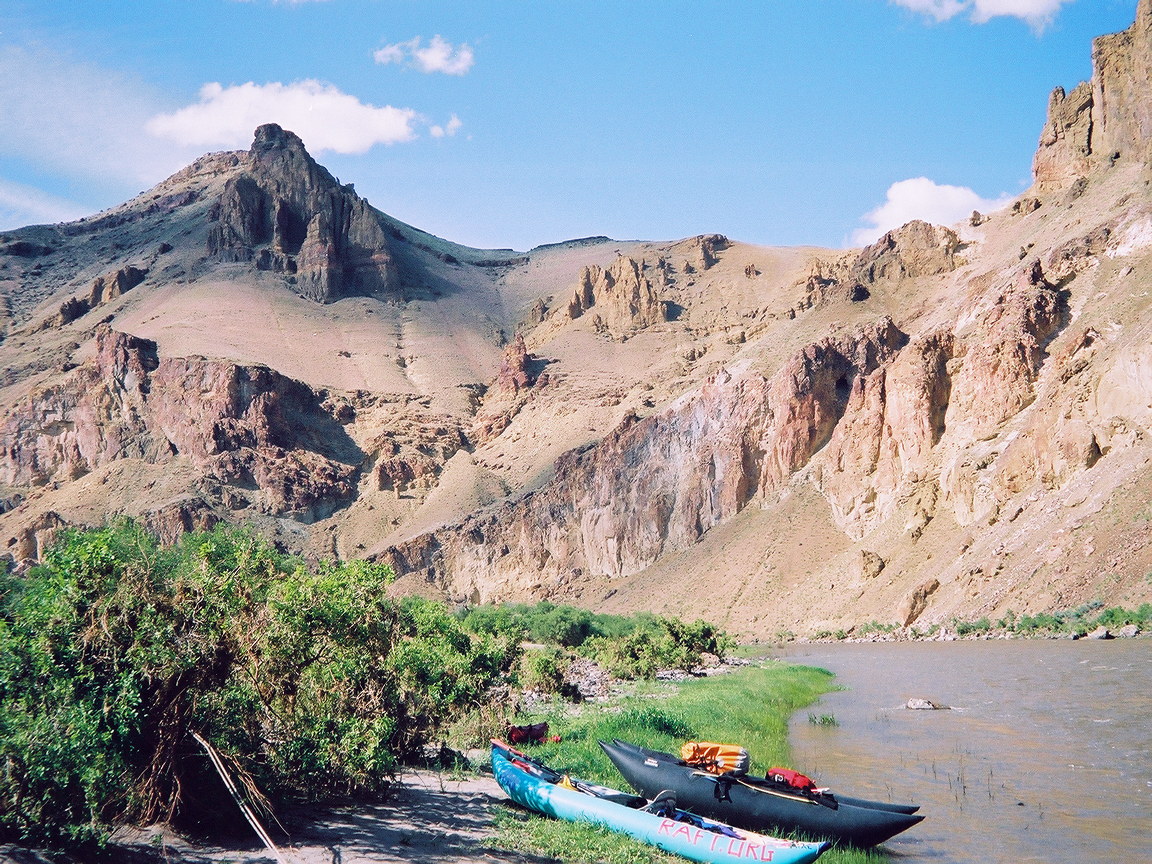
- 32.6
- Squeeze rapid, class III, bigger at higher flows.
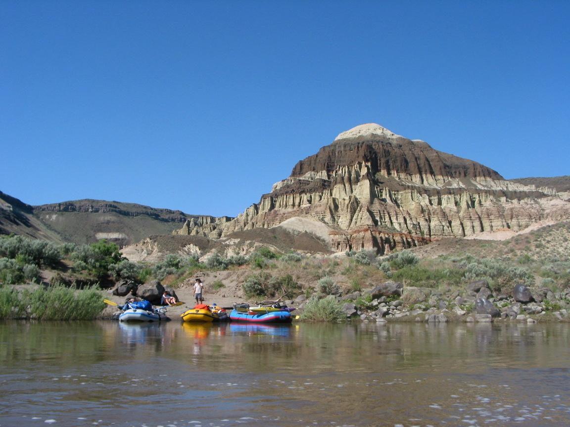
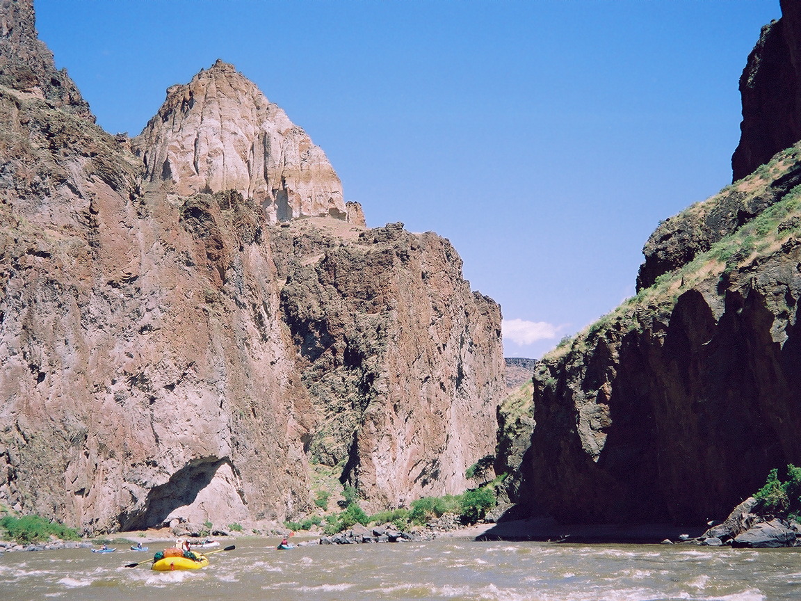
As the river bends left, a pyramid formation becomes visible.
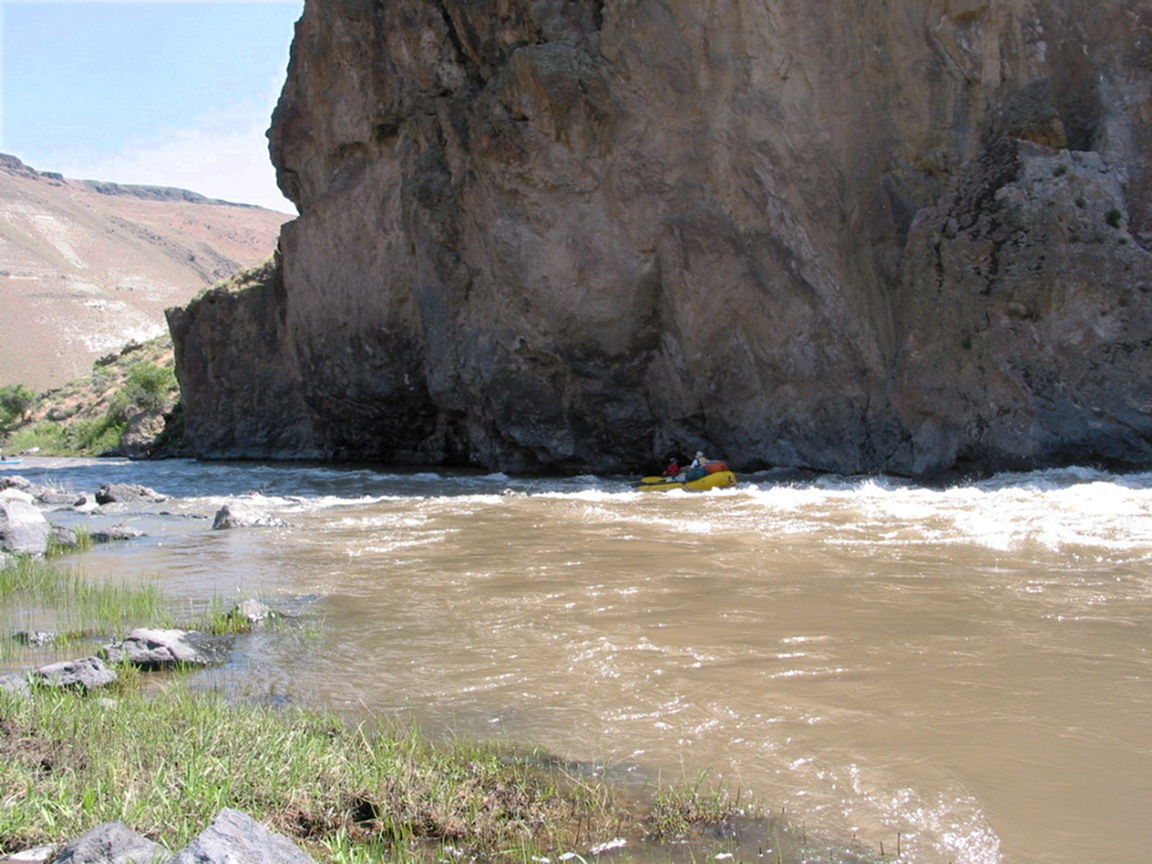
- 32.8
- Montgomery rapid, class III+
The river piles into a cliff on the left, first hitting a guard rock.
Moving right requires power at higher flows due to the strong current,
and finesse at lower flows due to the rock-dodging required.
There is a good low-water picture of this rapid on the cover of
the Oregon guidebook Soggy Sneakers third edition, 1994.
-
- 34
- Several good but shady campsites before the end of Green Dragon canyon.
- 37
- After the canyon open up, Jackson Creek enters on the left. Very good campsite.
- 38.3
- Nuisance rapid, a boulder maze at lower flows, not significant at higher flows.
The 2010-era BLM map Owyhee & Bruneau River Systems Boating Guide
has a picture of Nuisance rapid on page 4.
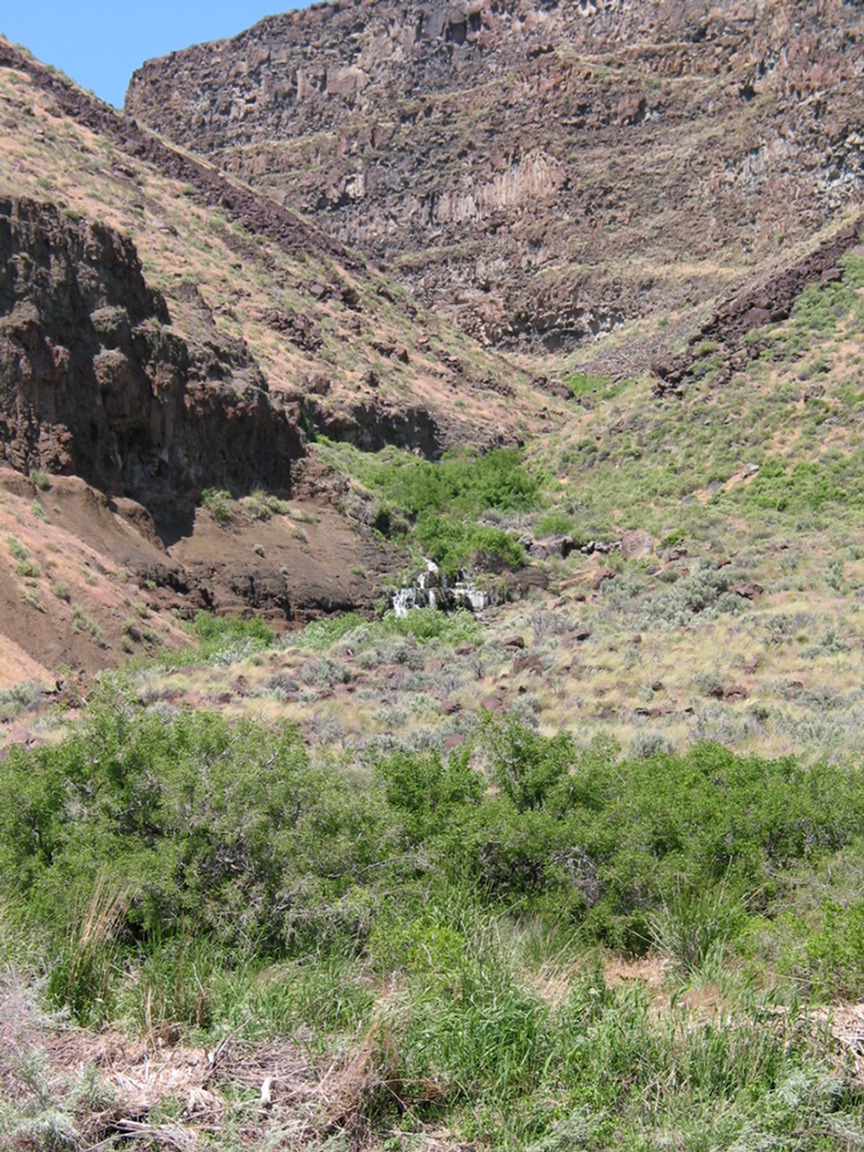
Rinehart Falls, fed by perennial springs, soon becomes visible on the left.
- 38.8
- Morcum Dam rapid, an old diversion dam for Hole in the Ground ranch,
very rocky at lower flows, not significant at higher flows.
-
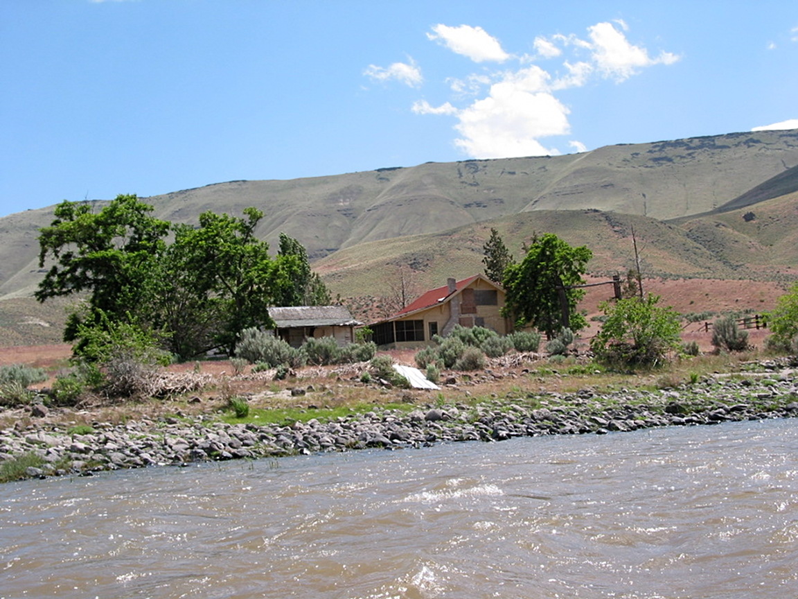
- 40
- Ranch house on the right.
Hole in the Ground is vast and amazing to see,
although it does not make good photos.
-
- 42.8
- Devil's Tower campsite, about a mile upstream of the hotspring.
- 43.7
- Hotspring on the left bank.
The BLM guide says not to moor boats here.
Three good to excellent campsites are downstream,
the first only .3 mile from the hotspring.
-
- 44
- A cabin (foundation) is marked at Greeley Bar, but we did not see it.
-
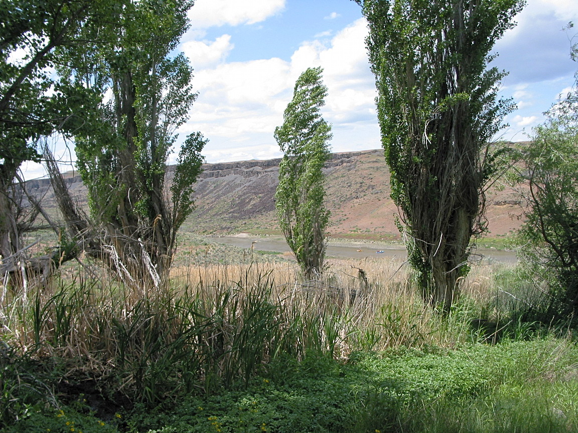
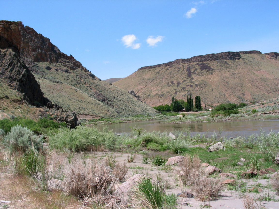
- 46
- More good scenery as the river cuts thru Owyhee Breaks.
-
- 48.2
- Birch Creek historic ranch on the right.
-
- 49
- Birch Creek BLM take-out on the right bank. A campground is adjacent.
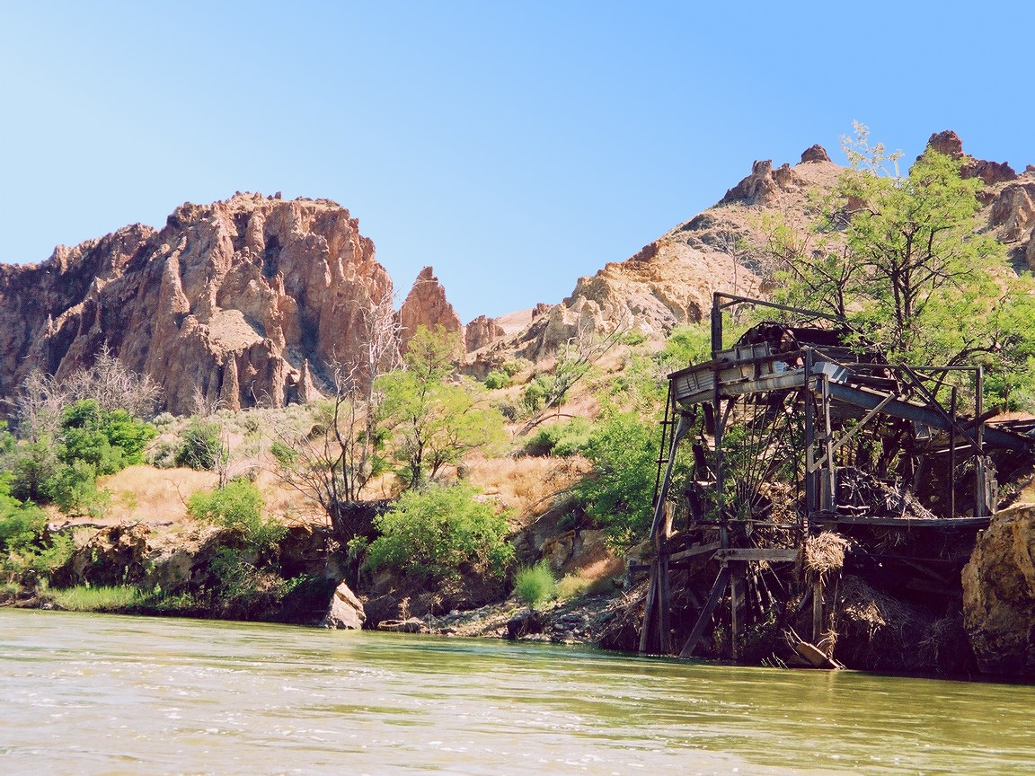
- 54.3
- Another waterwheel below a large island, at historic Island Ranch.
- 55
- Motors allowed below this point, high water mark of the reservoir.
Pinnacle Rock on the left.
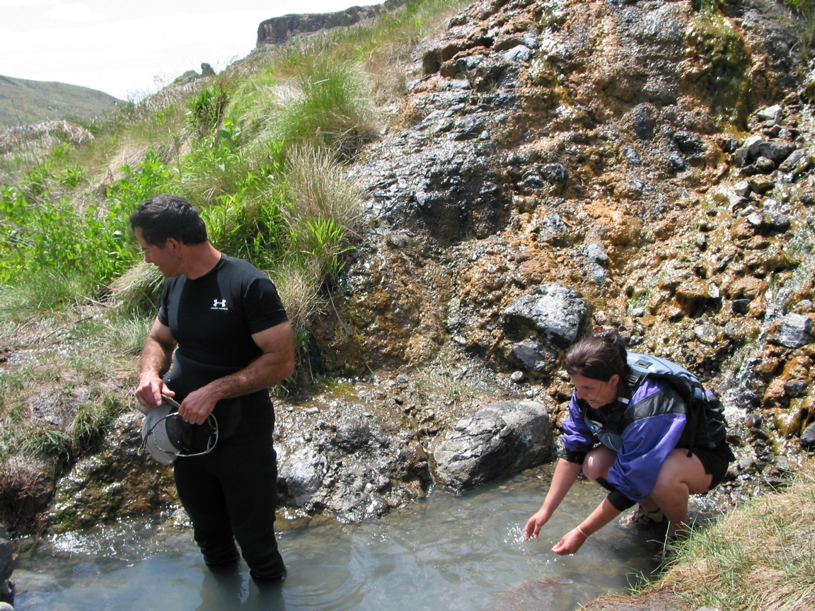
- 63.5
- Hotsprings complex on the right.
Some people say these are the best hotsprings along the lower Owyhee.
Picture here.
- 67
- Leslie Gulch boat ramp and take-out.
Shuttle Directions
To reach the Rome put-in,
drive west from Jordan Valley or east from Burns Junction on highway 95.
Just east of the Owyhee river bridge,
a dirt road leads south to the BLM river access.
Shuttle drivers can be hired out of Jordan Valley area,
for example Owyhee Adventure Shuttle Service,
Judy 458-224-9165 or Robin 208-506-1519.
To reach the Birch Creek take-out from there,
drive east and north on highway 95.
About 7 miles past Jordan Valley, at a sign for Jordan Craters,
turn west (left) onto Cow Creek Road.
Continue 11 miles to a fork in the road, bear right,
drive 12 miles to another fork, bear right again,
continue to the canyon rim, then steeply downhill for 5 miles.
On return, getting up this road can be difficult with a heavily loaded trailer.
To reach the Leslie Gulch take-out on Owyhee reservoir from there,
drive east on highway 95 to Jordan Valley,
then north 18 miles to Succor Creek Road.
Turn left (west) and drive 8 miles to the town of Rockville.
Turn left just past an old schoolhouse, drive .25 mile,
turn right just past a small bridge, continue 1.5 mile,
then turn left at a sign for Leslie Gulch.
Continue 15 more miles to the reservoir.
|
|
Creeks Navigation
Home
Recommended Runs
Map of Rivers
Alphabetic Index
Alphabetic Table
Text Search
Sponsored Links
|