| |
| Stretch: |
North Fork Kern from Little Kern to Fairview Dam |
| Difficulty: |
class IV+ with 3 class V rapids, harder above 2000 cfs |
| Distance: |
17.1 miles, 1 to 3 days |
| Flows: |
rafts 800 - 3600 cfs, kayaks 600 - 3600, IK minimum 250
|
| Gauge: |
similar to flow measured at Kernville
(by
Army Corps) |
| Gradient: |
64 fpm for 14½ miles, then 40 fpm |
| Put-in: |
down a 2 mile trail to Little Kern confluence, 5820' to 4670' |
| Take-out: |
above Fairview Dam (leave cars at Johnsondale bridge), 3635' |
| Shuttle: |
25 miles (1 hour) one-way, mostly on paved roads |
| Maps: |
USFS Sequoia NF, AAA Sequoia Region,
Topo
|
| Season: |
spring and summer, from snowmelt |
| Agency: |
USFS, permit
(apply in April)
required, guided Whitewater Rafting |
| Notes: |
© 1998, 2000 Bill Tuthill,
CreeksYahoo,
thanks to Calboaters e-mail |
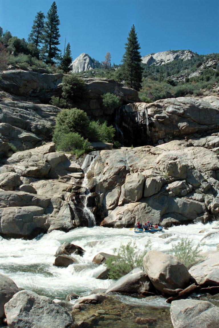
This is one of the most scenic runs in California,
perhaps in the entire world.
Aficionados of granite will appreciate the many needles and domes
along the river corridor, and in nearby Dome Land Wilderness.
Kern whitewater is fabulous,
interrupted in this section only by two miles of class II in the middle.
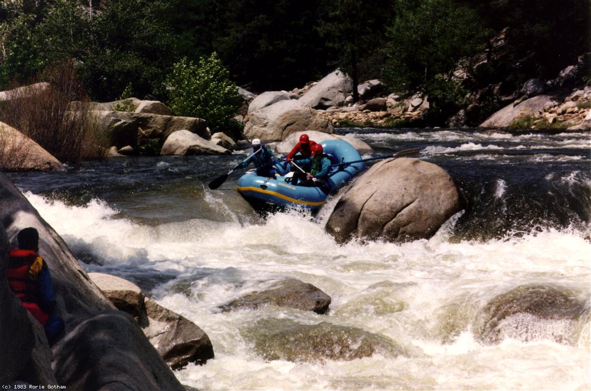
A lunch stop and waterslide at Dry Meadow Creek
has all the ambiance of the finest Sierra backcountry.
For a wonderful glimpse of snowpack in the Kern basin,
see this map
showing CDEC snow sensors. For a graph of the 2013 water year,
see this graph.
Many great wilderness campsites are scattered along the run
(firepan or fireblanket required).
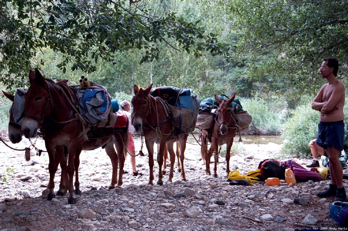
You can hire burros to carry your gear down to the river,
although this involves a delay while the burros are loaded.
A less gear-intensive approach is to leave your boats by the river
at mile 9.5 and hike up the Peppermint Creek trail to the shuttle road,
where you can spend the night with your vehicle.
Boaters who know the river often complete this trip in one day.
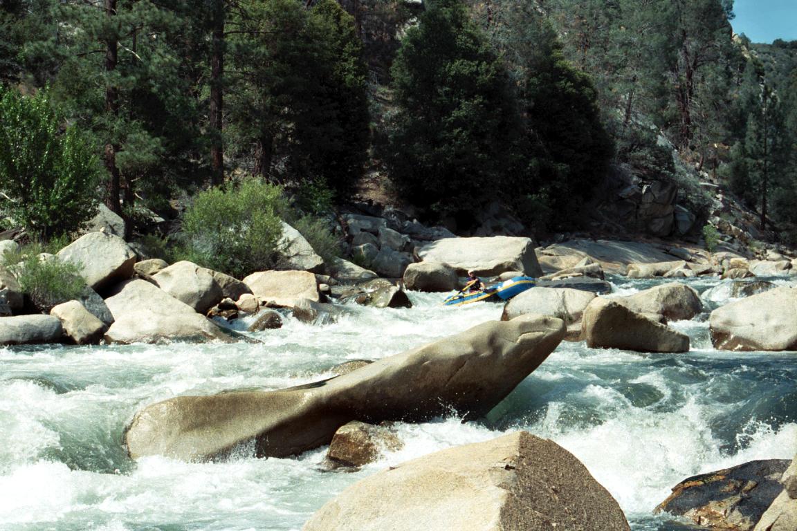
Vortex, Confusion (Westwall) and Carson Falls can be exceptionally hazardous;
the left-of-center slot at Carson Falls has killed one rafter.
Other than those passages, most rapids on this run
are not much harder than on the main Tuolumne below Meral's Pool.
- mile
- 0
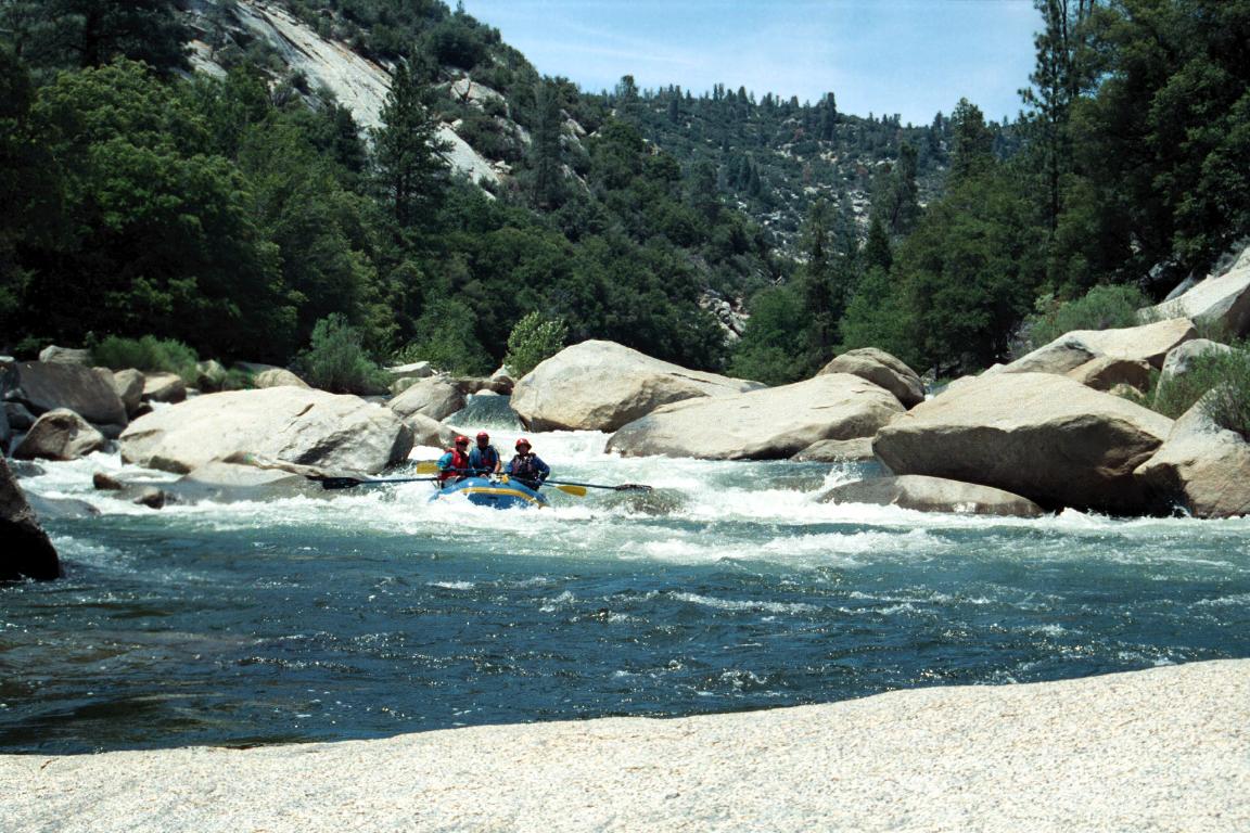
- Put in near the confluence of the North Fork and Little Kern.
Class III+ rapids begin right around the corner. Several good
campsites are located at intervals along the right bank.
-
- 2.8
- Freeman Creek enters on the right. Less than 100 meters up the creek
is a scenic waterfalls and swimming hole.
- 2.9
- Upper Freeman, class IV, scout right
Big rocks and holes everywhere, with a good route on the far right.
- 3.1
- Lower Freeman, class IV+, scout left (right works too)
Halfway thru the rapid there is a dangerous rock sieve on the left
side. When entering over some steep drops and working right, be sure
to stay upright and in your boat to avoid this sieve. The rapid ends
with a left turn into a large hole, which causes a lot of flips, but
the swim there is of no consequence. There was a downed tree stuck in
the right side (1998). If you elect to portage, the left is easiest.
-
- 3.5
- Wrapid (yuk yuk), class IV
An S turn feared by rafters because of the many huge boulders and
wrap rocks; easier to negotiate in a kayak. Difficult and not
necessarily recommended scout on the left bank.
- 4.3
- Needlerock, class IV, scout left (or right for the top)
The normal route is a steep, very narrow chute near the right bank.
Starting on the right, an ill-used trail climbs to your shuttle road.
- 4.4
- Needlerock Creek Falls cascades down the right bank.
Excellent campsite with great views on the left bank just below.
-
- 4.6
- Downhill, class IV, possibly scout left?
A steep and very long boulder garden with some maneuvering required.
- 5.1
- Slalom, class IV, possibly scout left
A shorter but still steep boulder garden with maneuvering required.
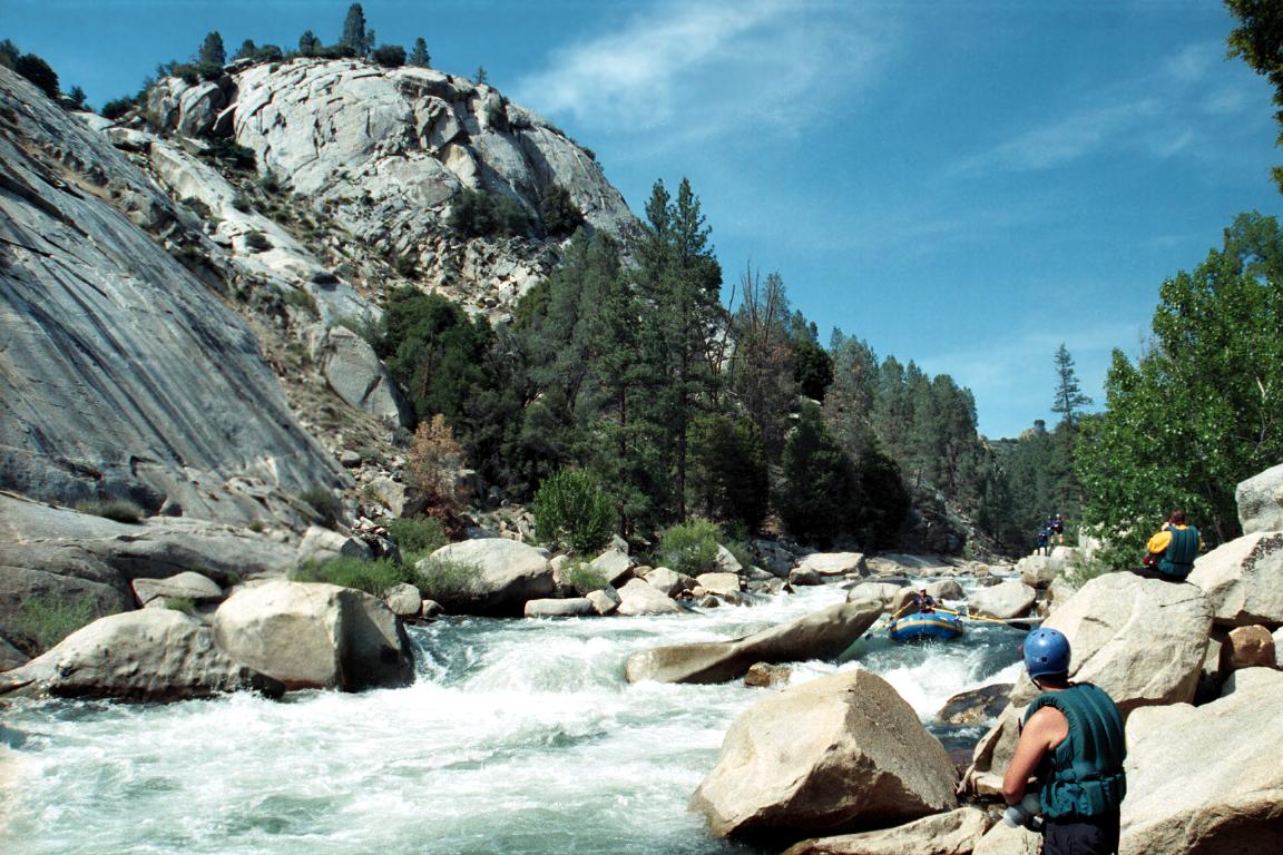
- 6.4
- Poker Flats on the left bank offers good camping and marvelous views of
the Needles, some 3000' granite peaks on the right side of the canyon.
This marks the beginning of two miles of relaxing class II-III water.
- 6.8
- Durrwood Creek enters on the left.
- 7.0
- Durrwood Lodge, home of a summer caretaker, is situated high on the
left bank. Two trails lead uphill from there to the Rincon Trail,
but make circuitous emergency exits. There is a cable crossing just
downstream, near the hardest class III rapid in this section.
- 7.4
- The trail that follows the north bank from the cable crossing
starts switchbacking steeply uphill, providing an emergency exit
or gear-saving hike to your vehicle. Fair campsite nearby.
- 7.7
- Little Bean, class IV-, scout right
The river splits around an island and enters a tight boulder field.
This is one of the likeliest spots for rafts to get stuck.
- 7.8
- Excellent but (some say) overused Bean Camp on the right bank, with
sandy beach and shade from tall pine trees.
- 7.9
- Big Bean, class IV+, scout left (right works too)
Rafts usually take a route on the left that ends in a big ledge hole,
which can cause swims but is not particularly dangerous. Kayaks
can take a more aesthetic line, catching a big eddy on river left,
ferrying to river right upstream of the big boulder, and finishing
on the right side to avoid the ledge hole.
- 8.1
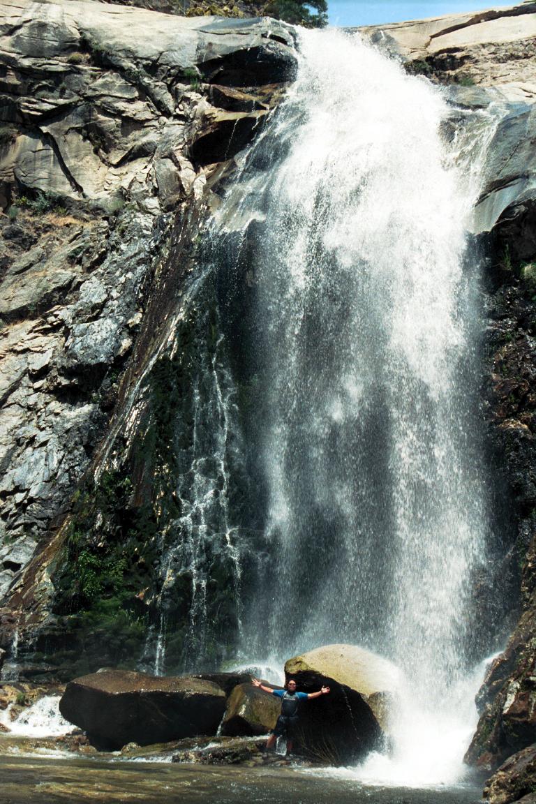
- Peppermint Creek comes in surreptitiously on the right. Good but
sometimes mosquito-infested campground at the mouth of the creek.
The side hike to Peppermint Falls is easiest starting here.
- 8.6
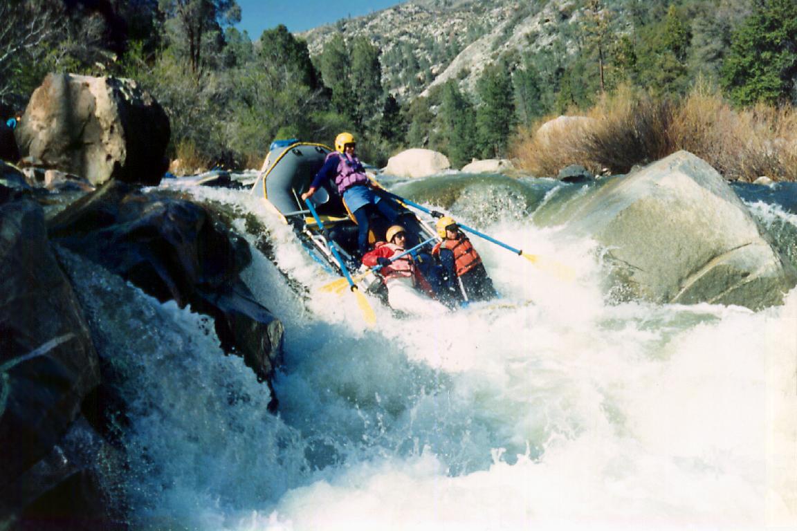
- Vortex, class V, scout right, raft portage on the left
Hazard: The Vortex itself is a concave hole that recirculates
for many meters past the main falls. Please avoid Vortex at flows
above 600 cfs. At flows above 1200 cfs, rafts can take a sneak route
on river right, as shown in the pictures below. Even the sneak route
is risky, however. Years ago a commercial trip was lining oarboats
down this side when one boat piled on top of another, completely
sinking the first boat. Not until autumn of that year did they find
shreds of hypalon raft fabric and a bent metal oar frame deep in the
rock tunnels below. Kayaks can portage easily on river right.
In the winter of 2008, the left side changed and reportedly has a
whirlpool formation at certain flows.
-
- 8.7
- Gauntlet, class IV+, scout left
A continuous boulder garden for several hundred meters. The most
hazardous section is the center rockpile at the bottom, which is
easily avoidable. Rafts sometimes finish on the left, but for kayaks
there is a very clean route that finishes on the right side. This
last drop of Gauntlet has been called Double Jeopardy.
-
-
- Below Gauntlet the river bends right, and is very steep according to
topographic maps, but few rapids require scouting.
- 9.2
- The Maze, class IV
A significant rapid, appropriately named.
- 10.7
- Four Mile, class IV-, scout left or right
The river bends around a bar and drops into several large holes,
with entrapment hazards on the far right.
-
- Note: From this point, a good trail follows the left bank
and is of great assistance for emergencies such as broken bones.
- 11.1
- The Isles, class IV, possible scouts
Layers of basalt are visible on a ridge high above the right bank.
Three class IV rapids in a row (Rincon, Metamorphosis, and Basalt),
all around miniature islands, within a .6 mile stretch. After the
river bends left, rapids taper off to semi-continuous class III.
- 12.1
- Chaos, class IV-, possibly scout left
Chaos is the long lead-in to Confusion. The two rapids merge at high
flows, but even at moderate flows there is plenty of time to eddy out
in between (unless you are swimming). Stay away from the center of
Chaos; a right-left-right-left slalom is recommended.
- 12.2
- Confusion, AKA Westwall, class V, scout left
Hazard: The whale's tail in the center of the first picture
is dangerously undercut with underwater tunnels nearby, and lies
just below the low-water raft route's likely right to left ferry.
Also, the large pyramidal house rock on the right side of the river
below the whale's tail is undercut.
-
Shortly after the entrance is a delicate maneuver on far right,
then a choice of going straight over underwater rocks, or ferrying
left behind the whale's tail.
At moderate flows kayaks can choose a lower-risk route on the far
right, exiting to the right of underwater rocks in the second picture.
At high flows, rock sieves on the far right come into play, so the
rapid becomes a straight shot down the middle.
-
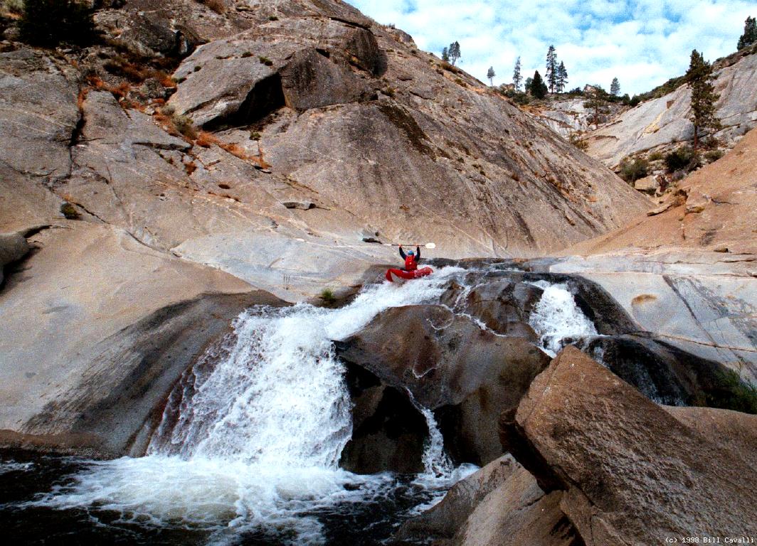
- 12.7
- Dry Meadow Creek drops dramatically over a granite teacup formation
on the right bank. Excellent lunch stop and playspot.
-
- 13.1
- Respect, class IV, scout?
Large boulders block your view of the river, and require running
several big drops and large holes. On the bottom right lurks a
sticky hole that can hold rafts for a long time, although you
might not believe it just by looking at the hole.
- 13.9
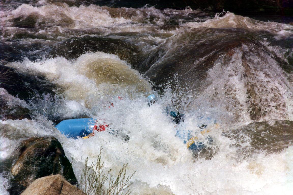
- Carson Falls, class V, scout right
The line shown in the pictures below is relatively straightforward
in a raft, but the hydraulics are very large for a small boat.
At low flows (~500 cfs) a big underwater rock in the second drop
can cause pain for rolling kayakers.
-
Hazard: Do not run the left-of-center chute, to the right of
the pointy partially submerged boulder in the first picture. Just
under the surface lies a wicked rocktrap, where rafter Melissa Toben
died in 1996. Kayaks can run the sluicebox line on extreme right,
visible on the left side of these photos. You can choose to line this
rapid on the right, or portage using the hiking trail on the left bank.
-
- 14.5
- Johnsondale Bridge. Gradient eases to only 45 feet per mile. Have
your shuttle drivers get out here and meet you above Fairview Dam.
- 15.1
- Brush Creek, class III. This rocky drop over boulders and around a
peninsula can be shallow at low flows. Nearby Brush Creek provides
excellent steep creekin' (360 fpm).
- 15.4
- Limestone, class IV-, possibly scout left
The river turns left and drops into some big holes, most of which
are either runnable or easily avoidable.
- 15.8
- Joe's Diner, class IV-, possibly scout left
In a straight section, the river crashes into a big hole along the
right bank, which can be avoided by working left.
- 17.1
- Last chance to take out before Fairview Dam. A steep climb leads to
a turnout along the highway. You can also take out further upstream.
Shuttle Directions
To reach put-in from highway 99 near Porterville,
take the north Earlimart exit onto county road J22 and drive east.
Where it crosses Old Stage road at Fountain Springs,
J22 becomes Hot Springs road and winds uphill to California Hot Springs.
Past there, near the Pine Flat ranger station, turn left onto Johnsondale road
and climb steeply uphill to where highway 190 goes north to Camp Nelson.
Continue straight ahead towards the small town of Johnsondale.
Above town, turn north onto a paved road towards Lloyds Meadow.
Drive about 19 miles until you see the “Forks of Kern 4” sign,
then turn right onto a dirt road and proceed 2 miles to the trailhead.
(The pack station is about 17 miles in, just past a Boy Scout camp.)
To reach take-out from there, return south to Johnsondale,
turn left and proceed downhill to the highway bridge,
where you cross the river and continue south on Sierra Way
about 2 miles to any turnout short of Fairview dam.
To reserve burros and wrangler,
call Golden Trout Wilderness Pack Trains
at 209-539-2744 or (summer only) 209-542-2816.
To find nearby food and lodging, type Kernville into the box and click Search.
|
|
Creeks Navigation
Home
Recommended Runs
Map of Rivers
Alphabetic Index
Alphabetic Table
Text Search
Sponsored Links
|