| |
| Stretch: |
Granite Slide to National Park Boundary |
| Difficulty: |
Class IV+ with possible portages and some brush |
| Distance: |
4.1 miles, 1 full day |
| Flows: |
kayaks 200 - 800 cfs
|
| Gauge: |
estimate 33% of Terminus inflow
(TRM) |
| Gradient: |
122 fpm average, first mile 170 fpm |
| Put-in: |
by hiking above Burnt Point Creek, 2230' |
| Take-out: |
park boundary at Yucca Creek, 1700' |
| Shuttle: |
hike 4 miles with 800' climb on an old road |
| Maps: |
USFS Sequoia NF, AAA Sequoia,
Topo
|
| Season: |
spring, from snowmelt |
| Agency: |
USFS |
| Notes: |
Pioneer © 1997 Preston Holmes. Photos © 2008 Bill Tuthill. |
If you don't mind hiking your boat in,
you should not miss this classic springtime river trip.
Full of granite slides and bedrock waterfalls,
it lies entirely within the confines of Sequoia National Park.
This is a seldom-visited corner of the park,
so don't expect to see rangers or backpackers.
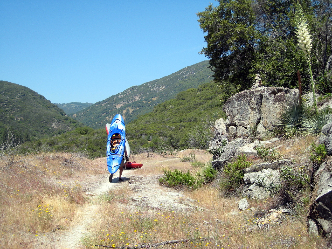
In the morning, leave your car at the Yucca Creek trailhead,
and hike your boats four miles upstream to the put-in
before temperatures climb too high.
Most of the elevation gain is in the first mile,
after which the old road descends a bit then mostly levels out.
For old photos and a useful guide to the upper run, see the
Upper North Fork Kaweah by Preston Holmes.
A bit of information about the upper run was added to
the third edition of the Holbek/Stanley guidebook.
Earlier editions described only the lower run.
You can combine the upper run with the lower North Fork run,
most likely on a separate day. For a guide to the lower run,
see the lower North Fork Kaweah,
or the Holbek/Stanley guidebook.
- hike
-
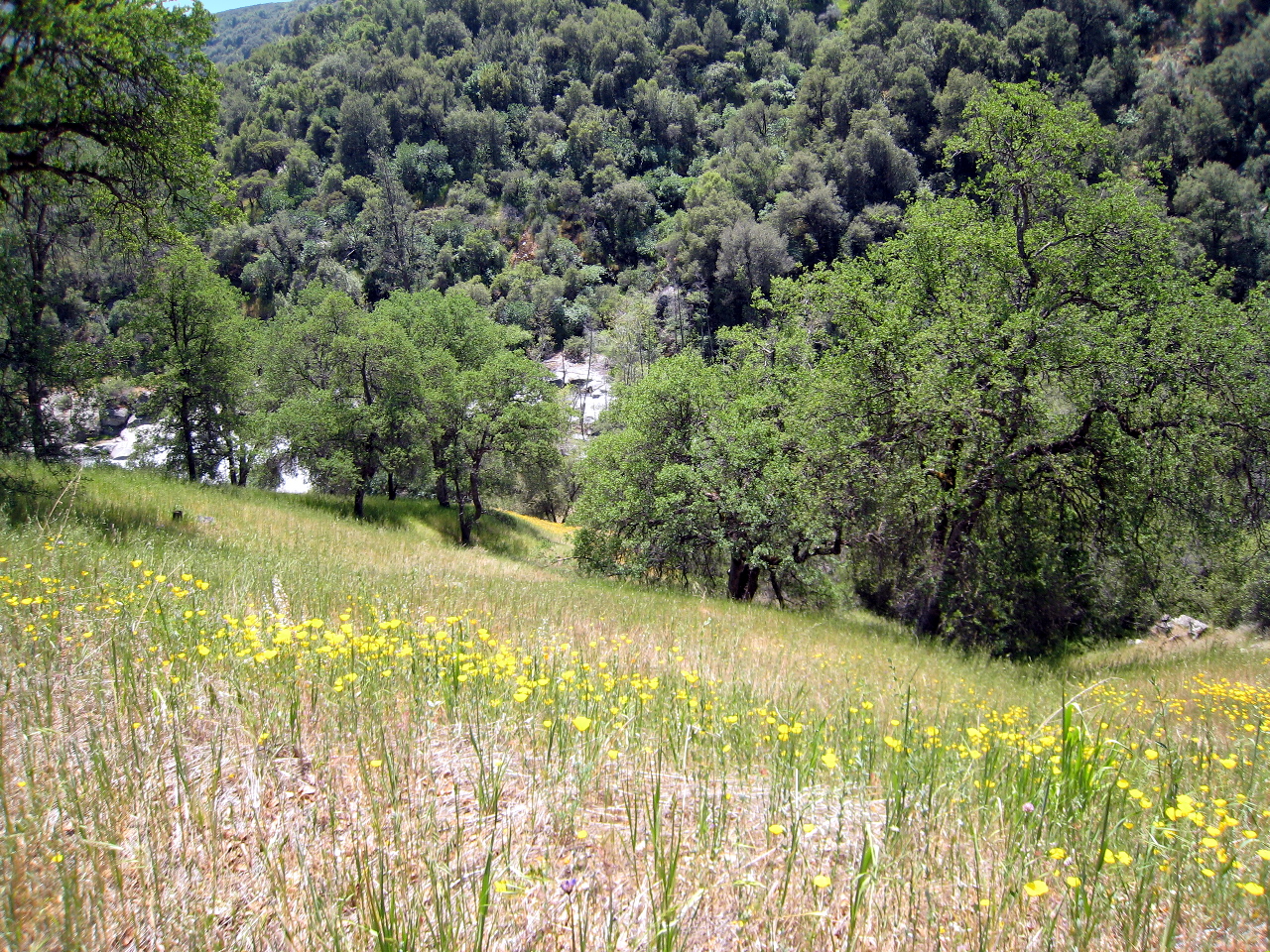
After crossing Yucca Creek, the trail turns right,
gradually ascending the right bank and a grassy meadow to an old gate.
After this the trail reaches a saddle then descends gradually
as the meadow turns to oak forest, where a roadbed becomes evident.
Watch for poison oak along the old road, especially in shady areas.
A clear passage was available everywhere in 2009.
-
- drop
-
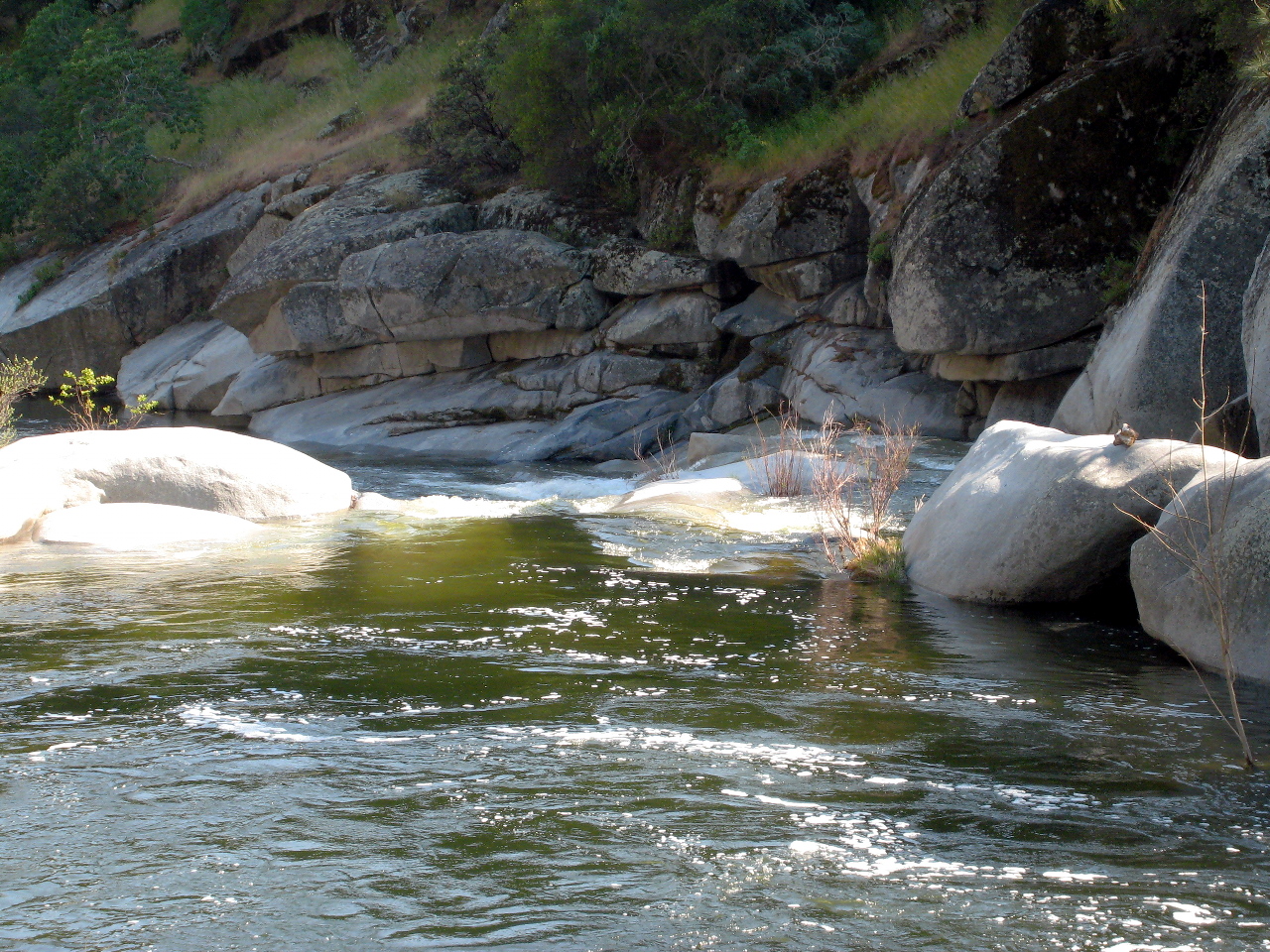
Not long after you start seeing glimpses of the river, the old road
descends a bit near a grassy slope where you hear loud whitewater.
If you continue on the old road as it ascends a bit into the woods
where the river is no longer visible, you have gone too far.
We did so, but eventually found a poison-oak infested trail
that descends diagonally upstream to a good put-in.
-
- -0.5
- If you hike too far and start here, wash off poison oak in the pool.
Expect creekin' style action: about half a mile of continuous class II-III.
- mile 0
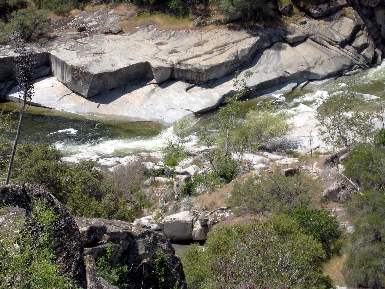
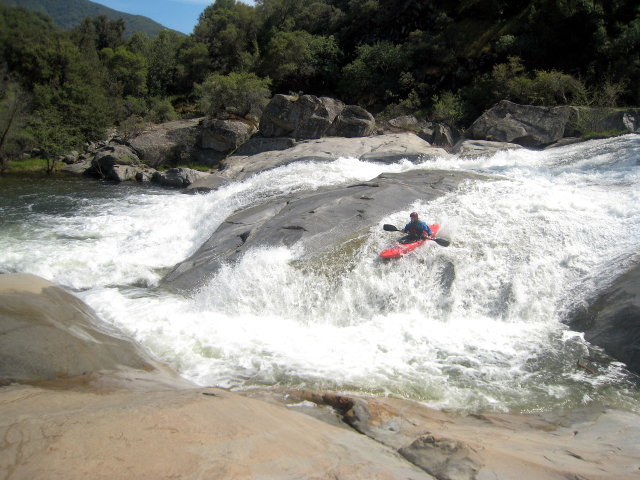
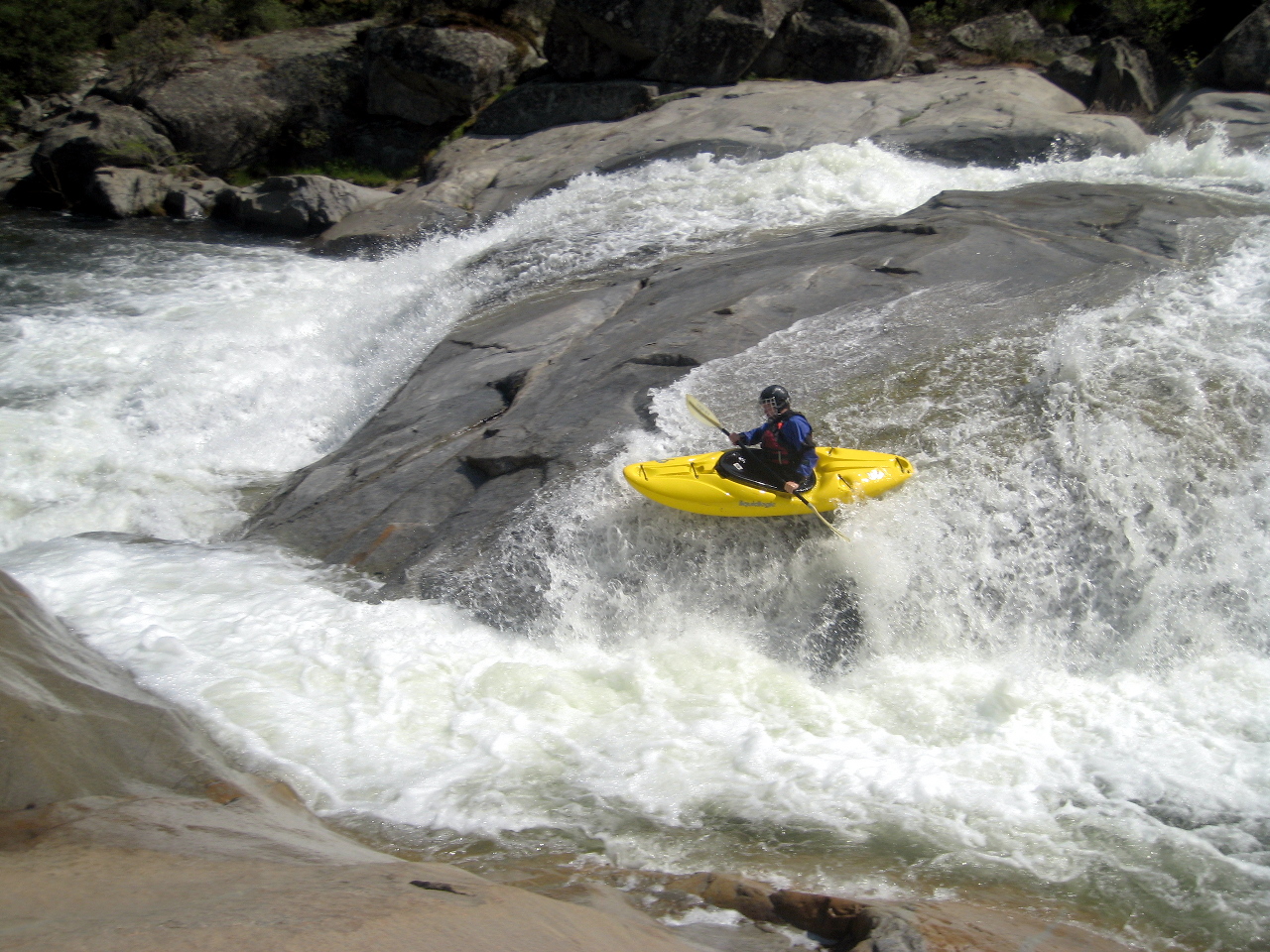
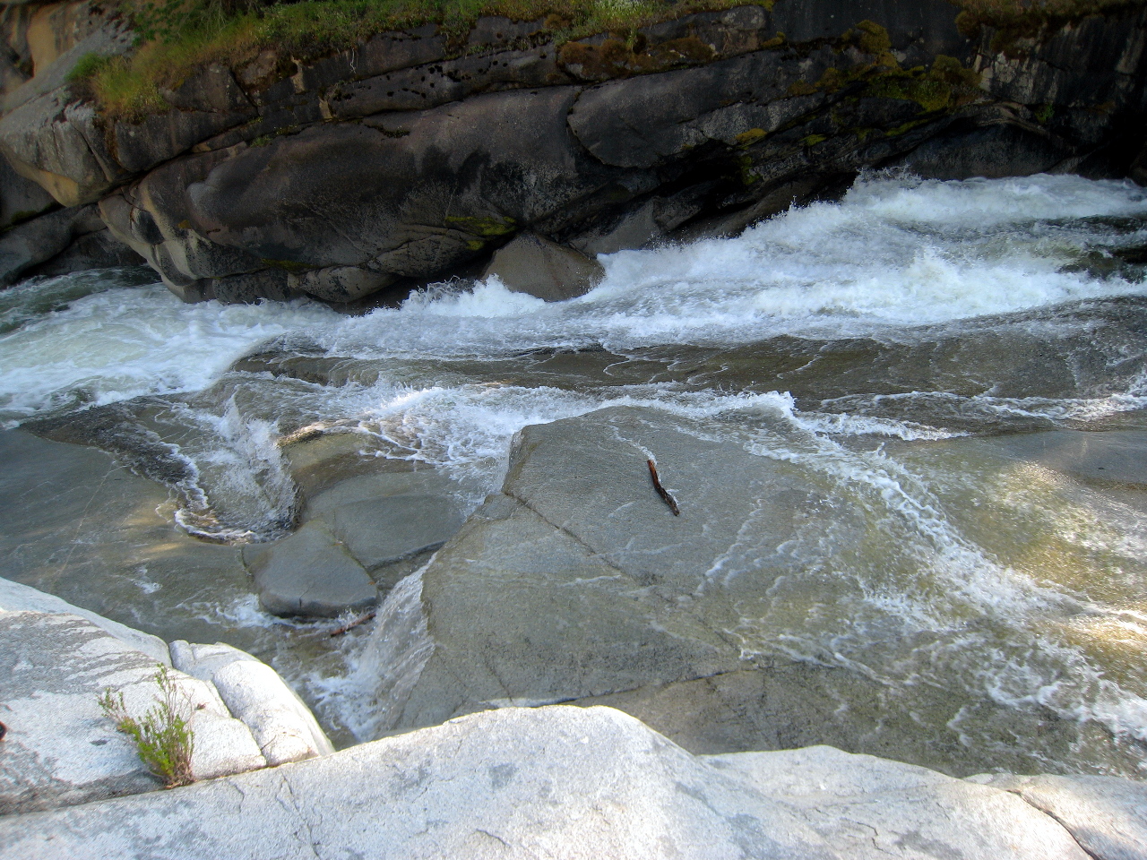
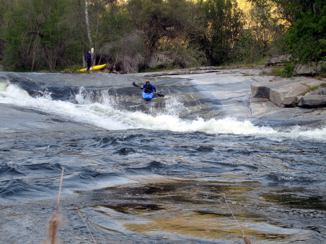
- Put-in Slide. Advisable routes start center and finish left.
The Holbek/Stanley guidebook warns about rocks on the bottom right,
but they appear to be covered at higher flows. You will probably
want to carry your boats back up and run this one repeatedly.
-
-
-
- 0.2
- Both sides of this rapid look nasty, and although the center
looks relatively safe, wicked cross currents in the pool above
make it tricky to line up correctly.
-
- 0.3
- Relatively easy boogie water thru a semi-wooded area.
- 0.5
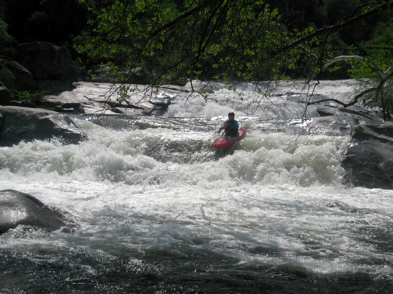
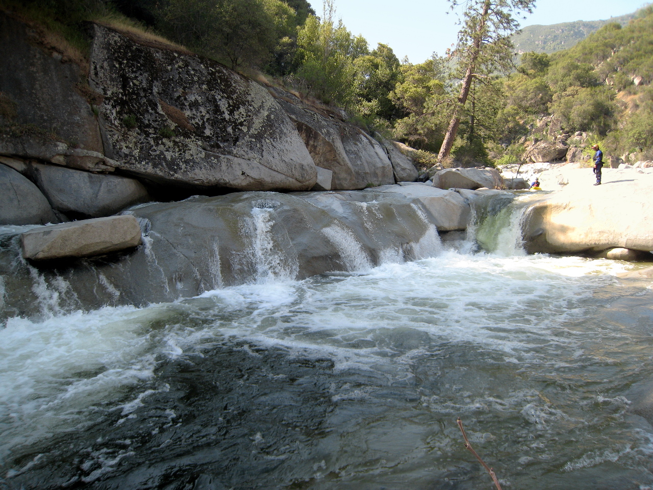
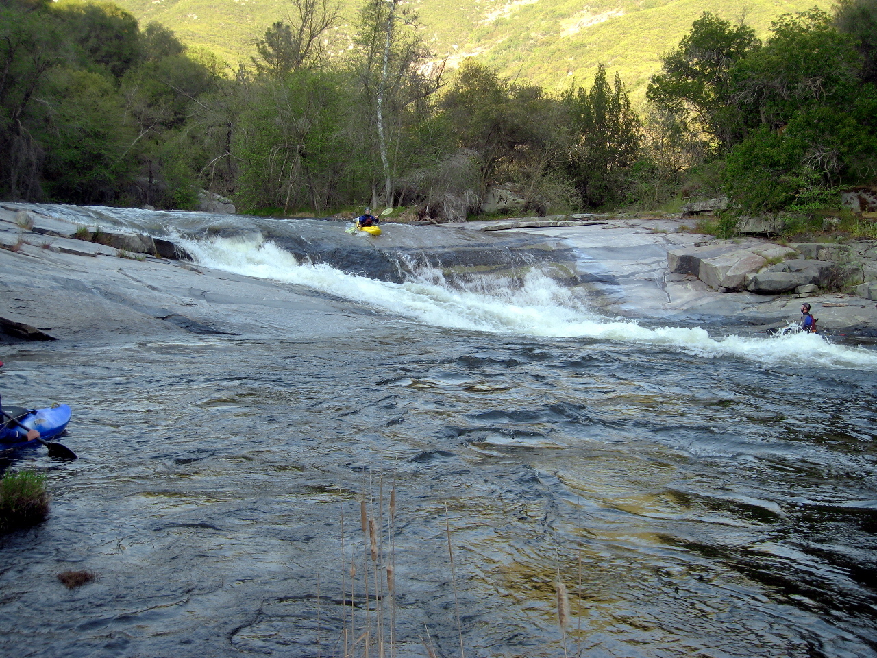
- Get It Right. The river funnels into a narrow chute
and drops over a bedrock waterfalls into a pool.
Two big rooster-tails block the left, hence the name.
Reportedly at very low flows, you want to get it left
(not right) to avoid getting stuck on rocks.
-
-
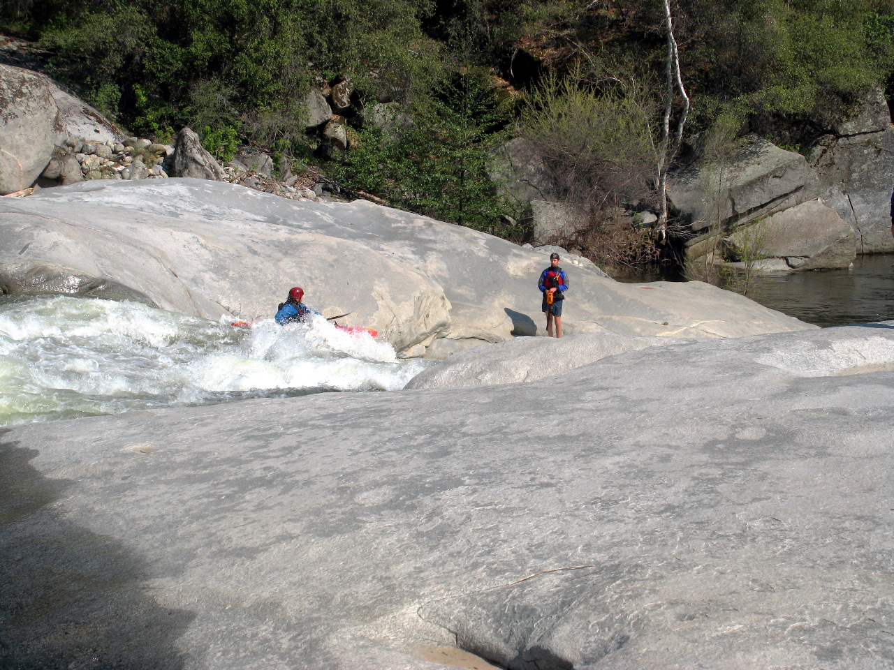
- 0.6
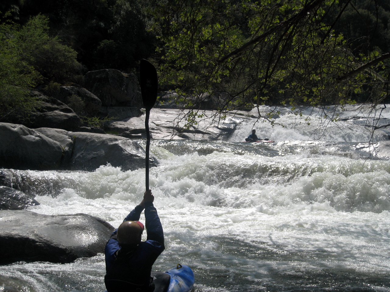
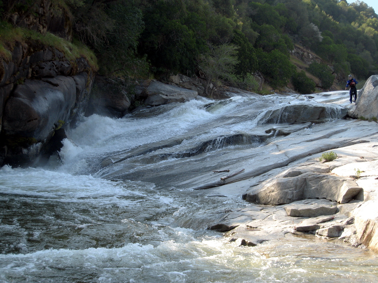
- Only a short pool separates Get It Right from Baby Niagara.
-
- 0.7
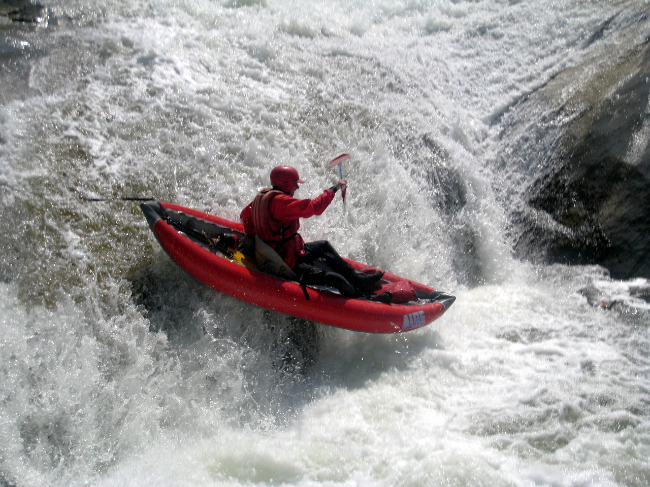
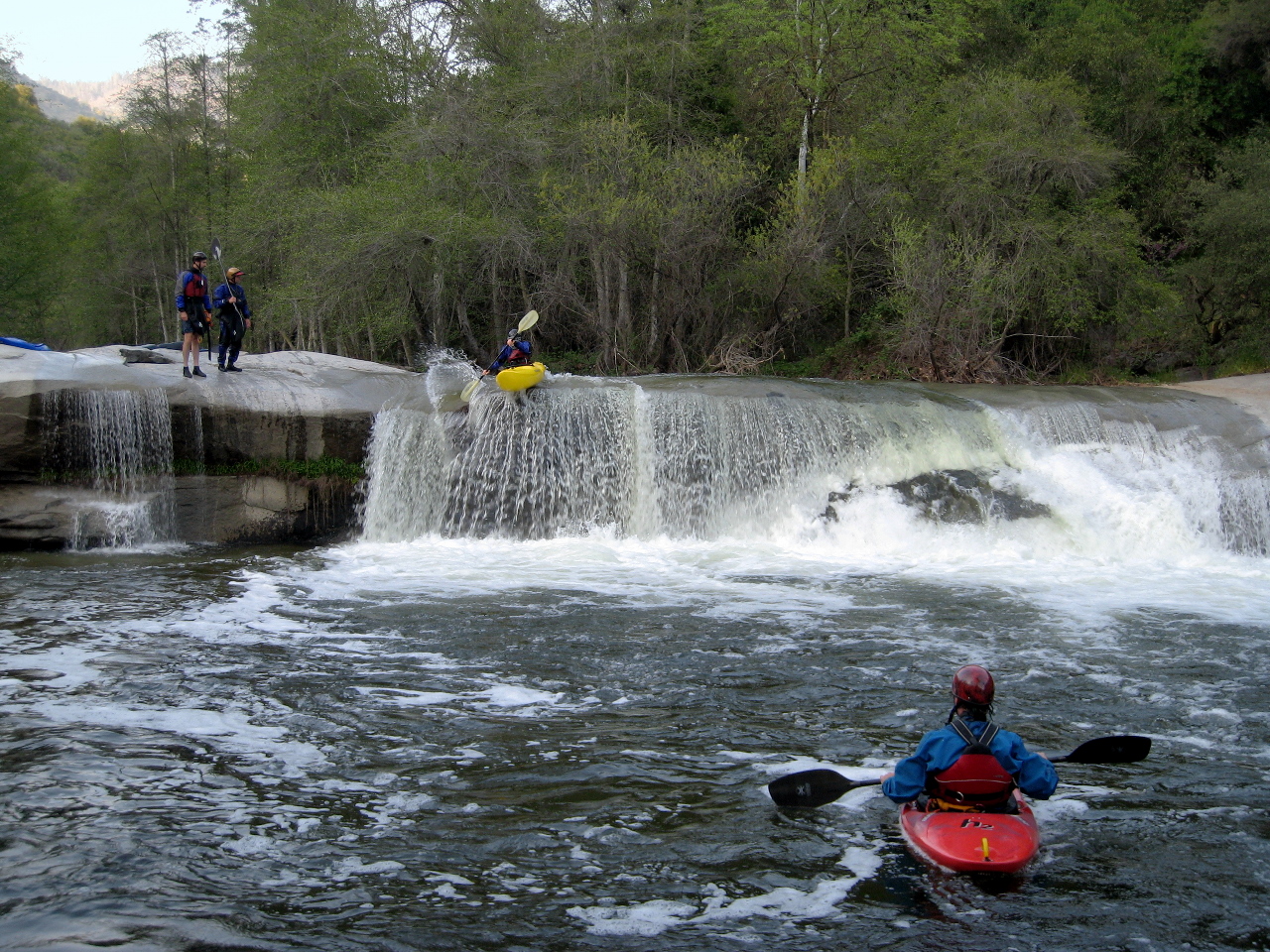
- Baby Niagara. The right side is a shelf and would make a good sneak route
if it were not for the undercut cliff on the right side of the channel,
which is less in-play at higher flows. The waterfalls on the left is steep
and has significant recirculation, so get your speed up.
-
- 0.9
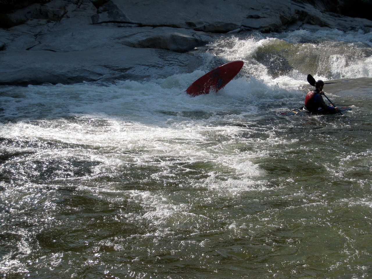
- This could be Another Slide, or Otis' Slide in Preston's original writeup
(out of order), or it could be undocumented in his writeup. Anyway,
at this flow it is best to stay as far right as possible to avoid the
wicked seam that flipped this kayak.
-
- 0.9
- Hum Dinger, hazardous on the right where a rock plugs the channel.
At moderate and high flows, a navigable trickle on the left side
is the best alternative.
-
- 1.0
- Burnt Point Creek enters on the left.
- 1.1
- Undercuts, class V-
At low flows, an undercut ledge on the top right encourages a short portage.
At higher flows, an undercut rock on the bottom left can be sticky,
so boaters can opt for the long but moderately easy portage on the right.
-
- 1.3
- Immediately below Undercuts is a steep narrow drop into a pool,
then a possible portage.
- 1.4
- Rhinitis (Congested), class V-
This might be more approachable if a willow jungle (2009)
did not make it so difficult to scout. You can portage quickly
by dragging boats over rocks in a flood channel on the left.
-
- 1.5
- Relatively easy boogie water through a wooded area.
Preston Holmes mentions Another Slide after this section,
but it was not remarkable enough for me to photograph it.
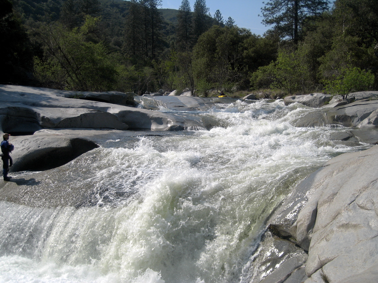
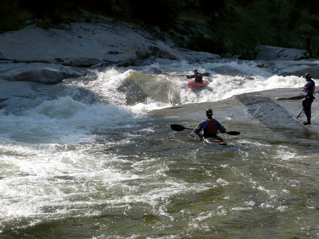
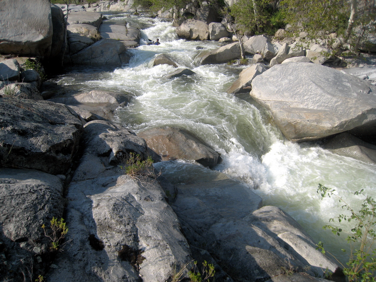
- 2.1
- Tiger Slide, AKA Slip'n'Slide. Most of the water enters a seam
that goes diagonally from right to left, but with sufficient flow
you can take a shortcut into the bottom of the diagonal seam.
From a distance, the rock appears striped like a tiger.
-
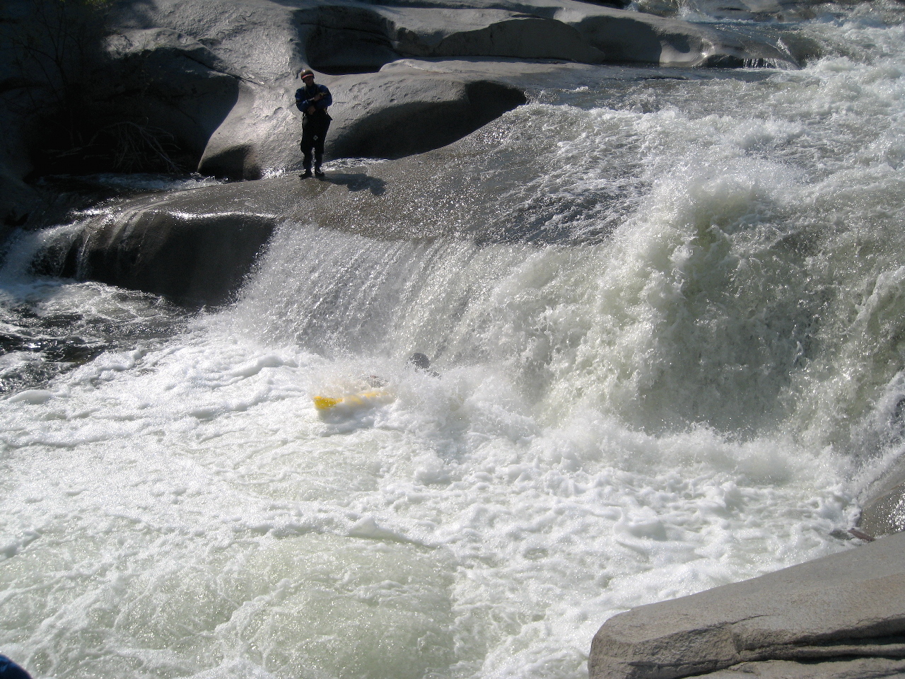
- 2.9
- Heaven's Gate. A beautiful 10' falls that seems totally safe to run.
-
- Below Heaven's Gate, the river loses its slide and bedrock character
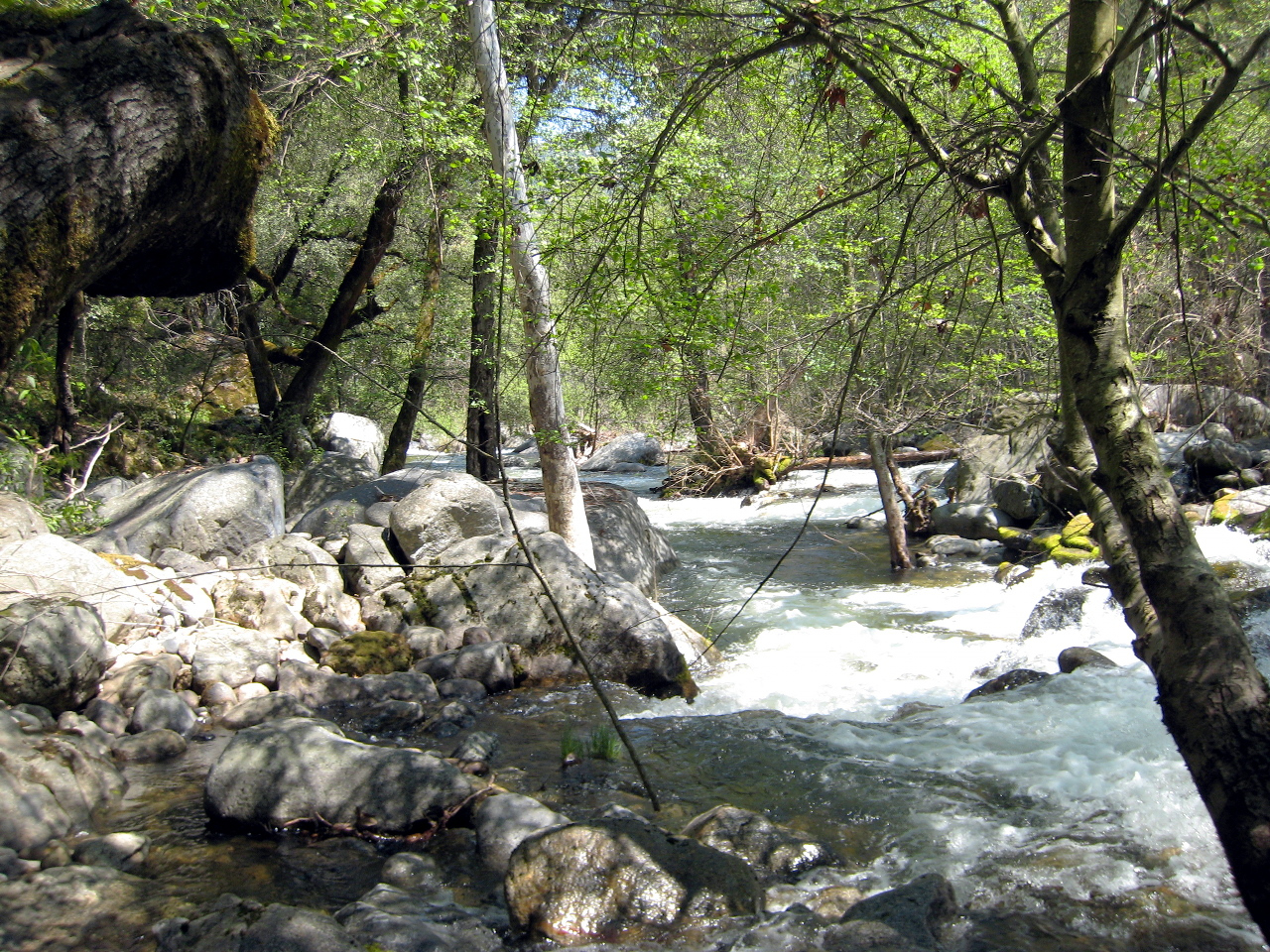
and becomes a regular creek with occasional brush and class III rapids.
Although some of the holes are big, boat scouting usually suffices.
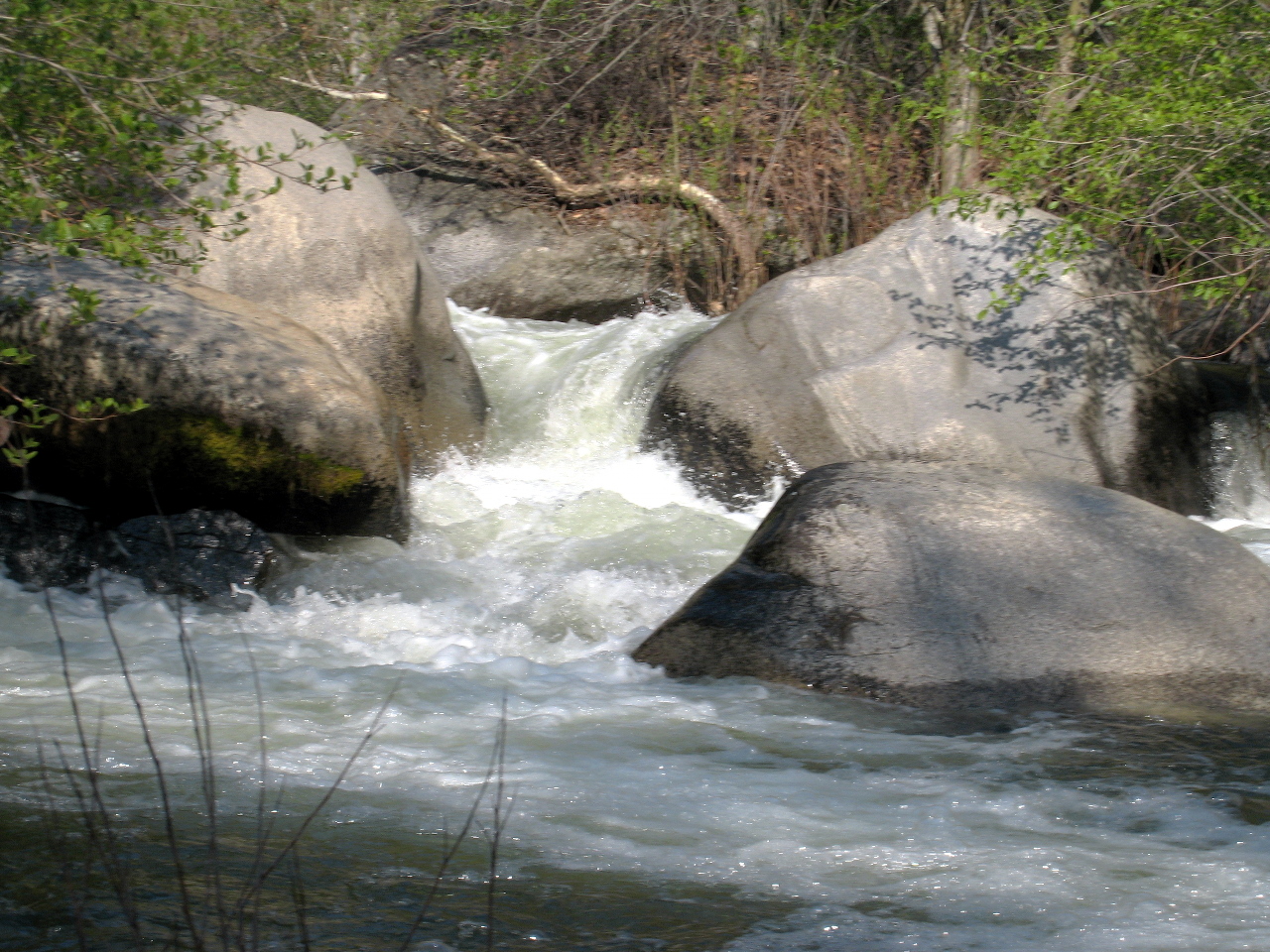
- 3.1
- Zig Zag, shortly below: a boulder maze usually run on the left.
- 3.3
- Otis' Slide? This could be a spot where we had a swimmer.
- 3.5
- Yuck! That is the actual name. Possibly scout right.
A boulder blocks the channel with a body strainer on its right side.
The left side is clear, if you can make the move past guard rocks.
There wasn't enough light to take a picture when we got there,
but Preston's writeup has a picture taken from the top right.
- 3.7
- Rapids ease as you get glimpses of Yucca Creek canyon on the left.
- 4.1
- Yucca Creek enters on the left. Shortly afterwards, take out
at a rocky beach on the left, with a large grassy area above.
Thanks to adventure kayakers
Brendan Curran, Nate Johnson, Brian Kennedy, and Paul Raffaeli
for help with photos.
Shuttle Directions
To reach take-out and the starting point of your hike,
drive east from Visalia on highway 198 past Terminus reservoir.
In the town of Three Rivers, turn left onto North Fork Drive,
cross the Kaweah river on a high bridge,
and proceed uphill to the end of the road at Yucca Creek.
|
|
Creeks Navigation
Home
Recommended Runs
Map of Rivers
Alphabetic Index
Alphabetic Table
Text Search
Sponsored Links
|