| |
| Stretch: |
Big Bend near Leggett to Benbow SRA |
| Difficulty: |
Class II with some class II+ |
| Distance: |
32.5 miles, multi-day in sections |
| Flows: |
rafts 600 - 6000 cfs, IK minimum 300
|
| Gauge: |
flow is measured at Leggett
(LEG) |
| Gradient: |
10 fpm average |
| Put-in: |
Big Bend cabins and fishing access, 810' |
| Take-out: |
at or below Redwood Flat along highway highway 101, 720' |
| Shuttle: |
each section about 11 miles (20 minutes) one-way |
| Maps: |
Delorme N California, AAA Northern California,
Topo
|
| Season: |
winter and spring, from recent rain |
| Agency: |
private, BLM |
| Notes: |
© 1998, 2000, 2009, 2023 Bill Tuthill,
CreeksYahoo |
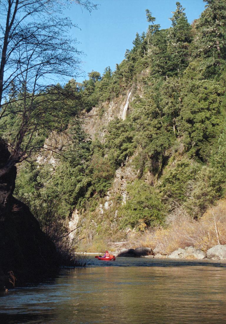
This easy stretch of the South Fork of the Eel
is quite beautiful for a river near a major highway.
The water remains green and relatively clear even after major rainstorms.
As a bonus, you can see a Yosemite-class waterfall.
If the Leggett gauge is not reporting, estimate 40% of the flow at Miranda.
- mile
- 0
- Highest class II put-in is Big Bend Lodge.
It is private land so they charge a per-person or per-vehicle fee.
Shuttle service might still be provided.
Cottages with hot showers and kitchens are available at reasonable rates,
and include river access, a short carry over a gravel bar down to the river.
For reservations see bigbendlodge.com.
- 1
- On the right, Grizzly Creek Falls plunges from a rocky plateau
almost 1000 feet into the river.
-
- 5
- Highway 1 bridge crosses overhead near the town of Leggett.
With steep banks and no significant beach, access is poor.
- Hazard! A persistent caved-in bank with downed trees
occurs on the right just before the bridge (2000).
- 5.6
- A dirt road turns north from highway 1 east of the 101 intersection,
and if still open provides beach access on river right.
- 7.3
- The river passes thru Standish Hickey State Park, where a low-water
bridge is installed in summertime, but not during boating season.
Access over that bridge to Redwood Campground on the left bank.
In winter, park gates are closed but you can walk up to highway 101.
- 9
- Houses and satellite dishes of Riverdale appear on the right bank
before a left bend, and again at a right bend.
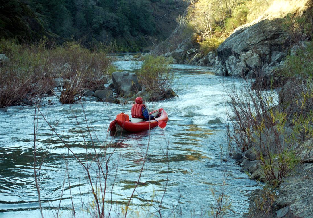
- 10.5
- After a left bend, one of the rapids around an island is steeper
and requires more maneuvering than others.
-
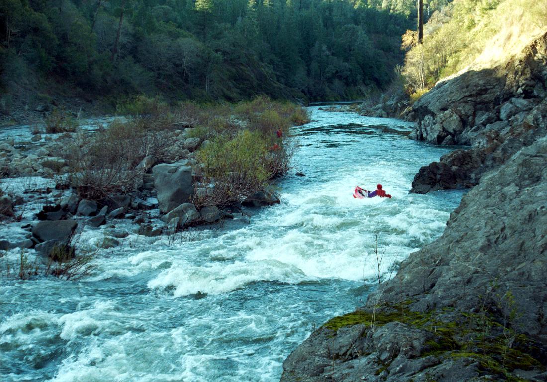
- 11.7
- Take out on the right at Redwood Flat, a large grove of redwoods
on a bench just above the river. A parking lot is supposed to be
available, although it might be closed by flooding and gated.
There are other access points downstream. We took out where the river
approaches highway 101 and a sidestream goes under a concrete bridge.
In between was a long and intricate boulder garden, which was
my personal favorite rapid on this run (December 1999).
- Zak Lieby sent this trip report about the next 12-13 miles:
“We paddled from Redwood Flat (Dora Creek) down to
Humboldt county line bridge [on March 28th 2009]. I thought
it was as much fun as the Leggett to Redwood Flat run.
There were a few decent rapids in there, maybe even a class II-III.
It was very scenic, with many little waterfalls and side creeks.
I was surprised! We saw no good intermediate access points.
The road was actually out of sight for most of the trip.
We had lunch under the 2nd new bridge. After lunch we thought
it got busier for a while including a couple II+ rapids. Then
it mellowed out until the final II-III a few miles before take-out.
There was one portage around a low water bridge kinda near the end.
I will definitely boat this stretch again!”
- 18.2
- Dirt road down to the river, just upstream from McCoy Creek,
accessed from highway 271.
- 24
- Town of Cooks Valley with low bridge after a 90 degree right turn.
The Mendocino Humboldt county line is just north.
- 27
- Richardson Grove State Park, with parking, rest rooms, and campgrounds.
Seasonal bridges are likely to be removed during boating season.
- 31.4
- Hazard! Deathtrap low bridge usually clogged with logs,
immediately after a highway 101 bridge overhead, the first one
crossing from right to left bank since Cooks Valley.
Pull over on the river-right gravel bar to scout or portage.
Or use the (free) takeout on the right between these bridges,
reached via the access road to Benbow SRA Campground.
- 32.5
- Benbow Lake State Recreation Area, with parking and rest rooms,
on the right bank. Historic Benbow Inn beyond.
To reach take-out, drive about 4 miles north of Standish Hickey State Park
to where the road descends to near the river. There is a parking lot
near a large stand of redwood trees, called Redwood Flat, part of Smithe
Redwoods State Reserve.
To reach put-in, drive south of Leggett to the top of the hill, and exit
on the parallel sideroad (sometimes called Drive-Thru Tree Road, once
known as highway 271). Drive south on this windy road until you see a
small sign on the right saying Big Bend. Bear right and descend on this
rock-strewn dirt road to the river.
To reach the Humboldt county line bridge from on highway 101, take the
Cooks Valley exit and park at the green bridge in the south side pullout.
|
|
Creeks Navigation
Home
Recommended Runs
Map of Rivers
Alphabetic Index
Alphabetic Table
Text Search
Sponsored Links
|