Carmel River near Ventana Wilderness
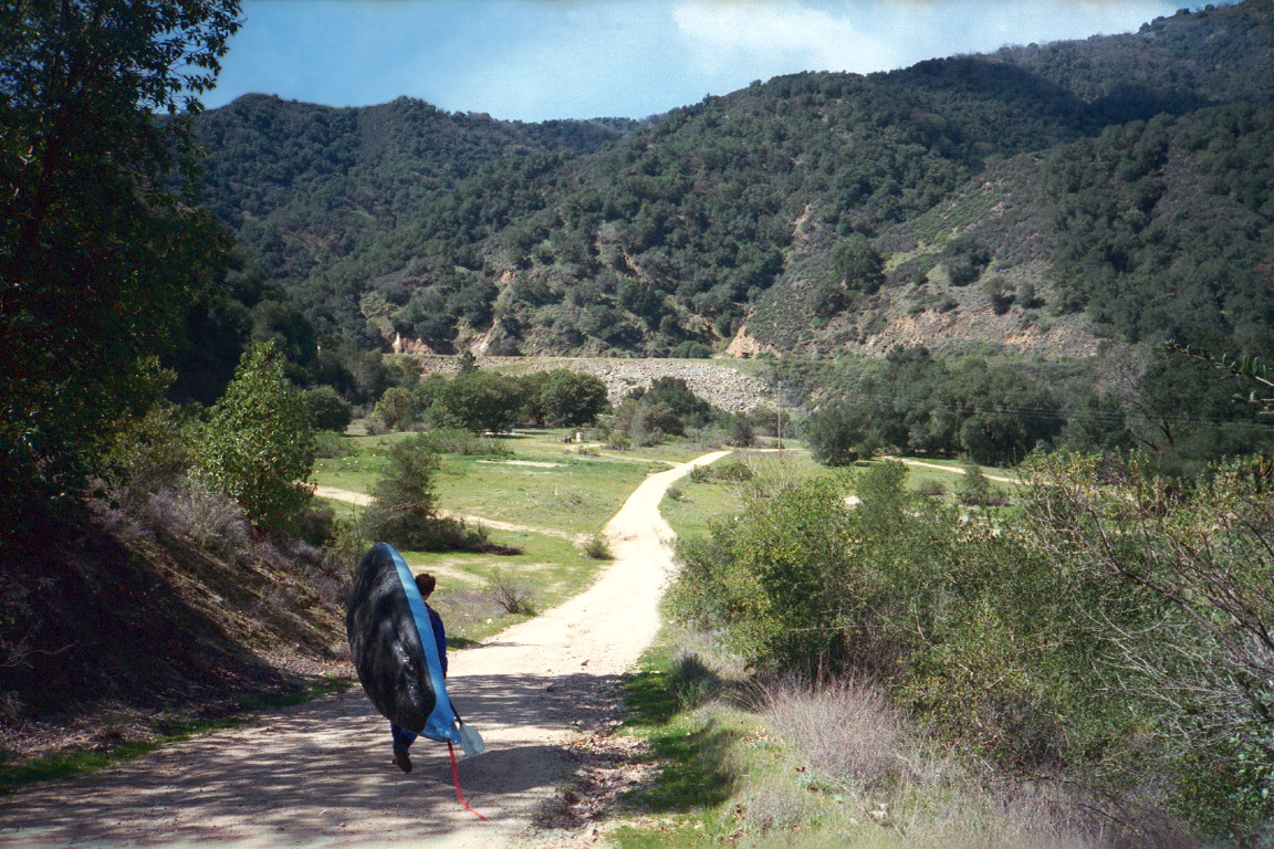
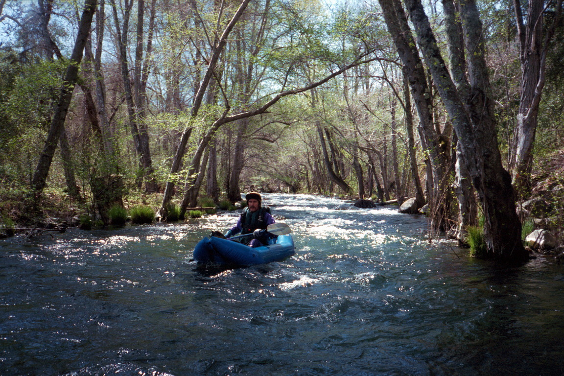
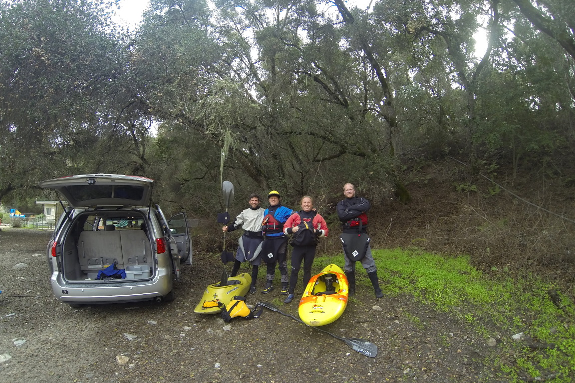
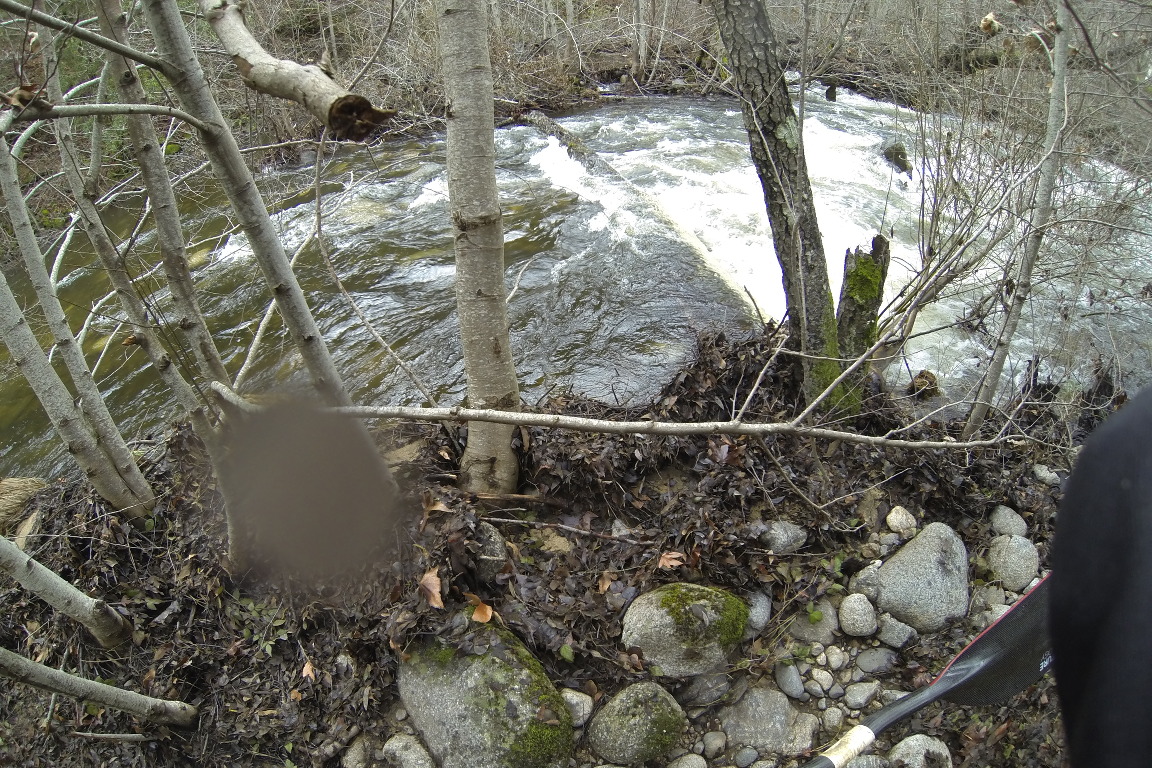
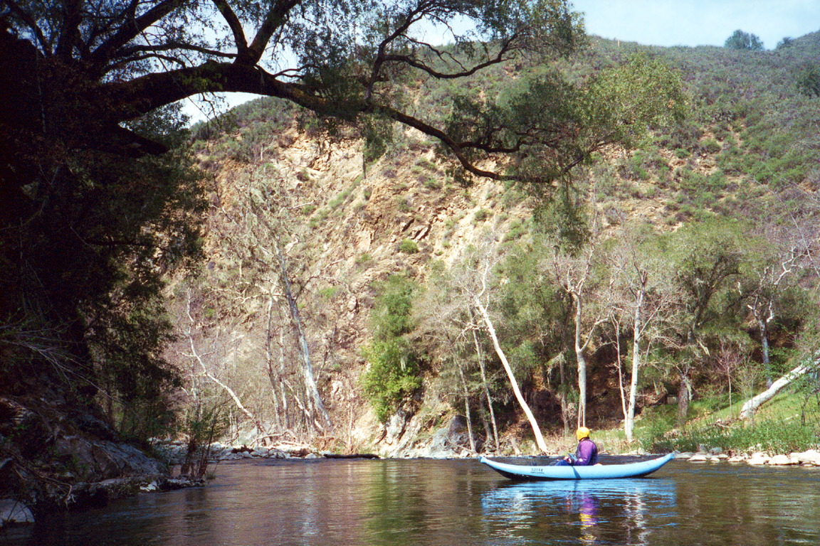
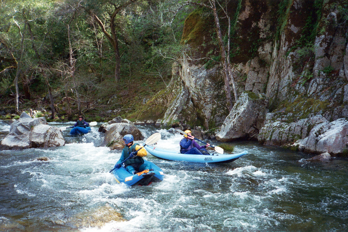
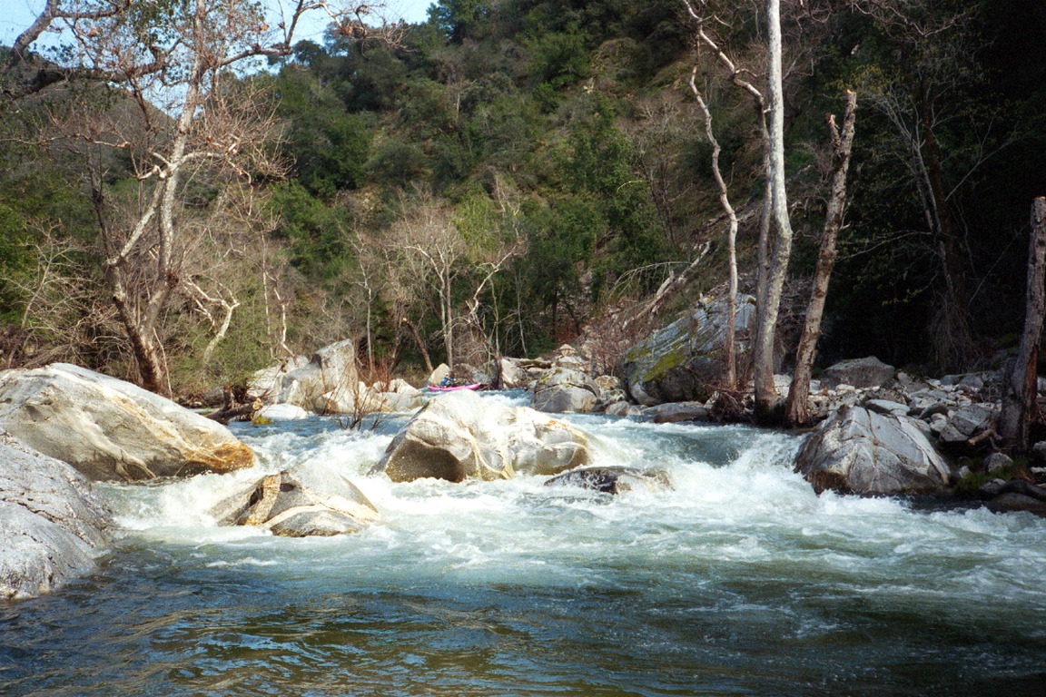
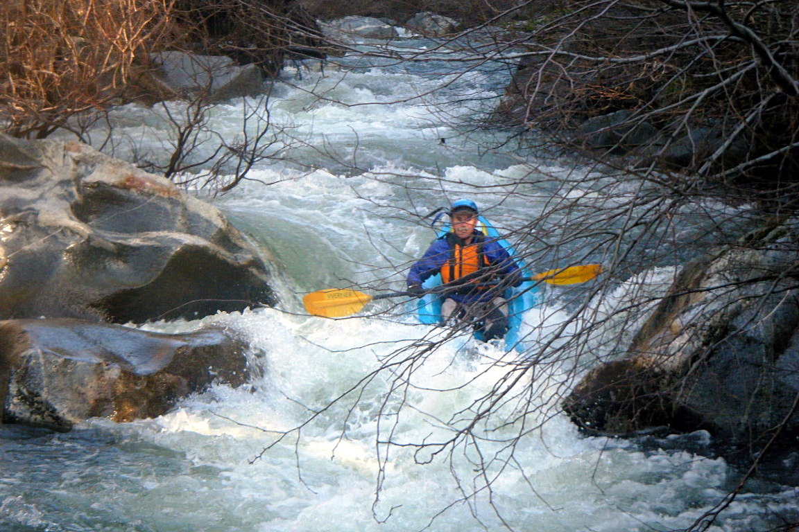
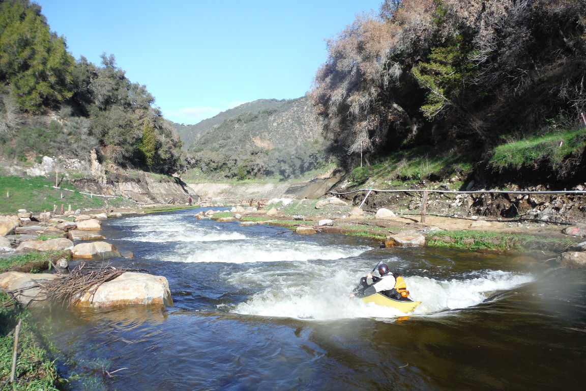
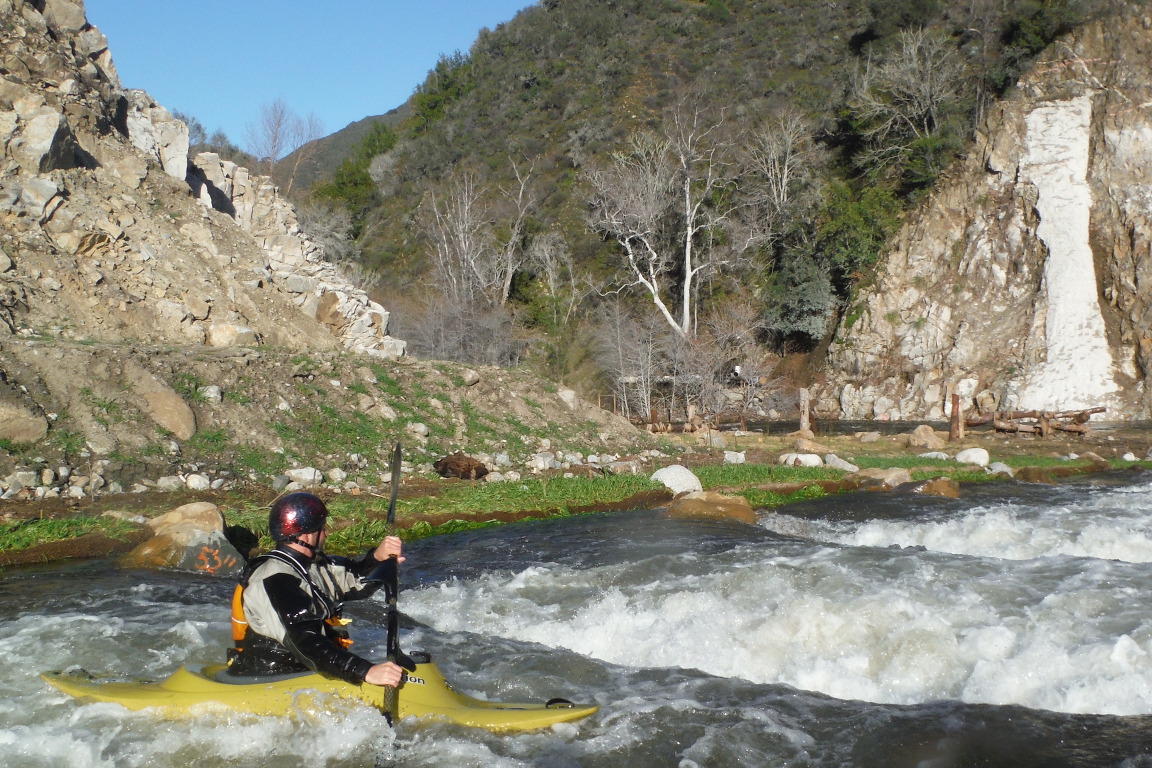
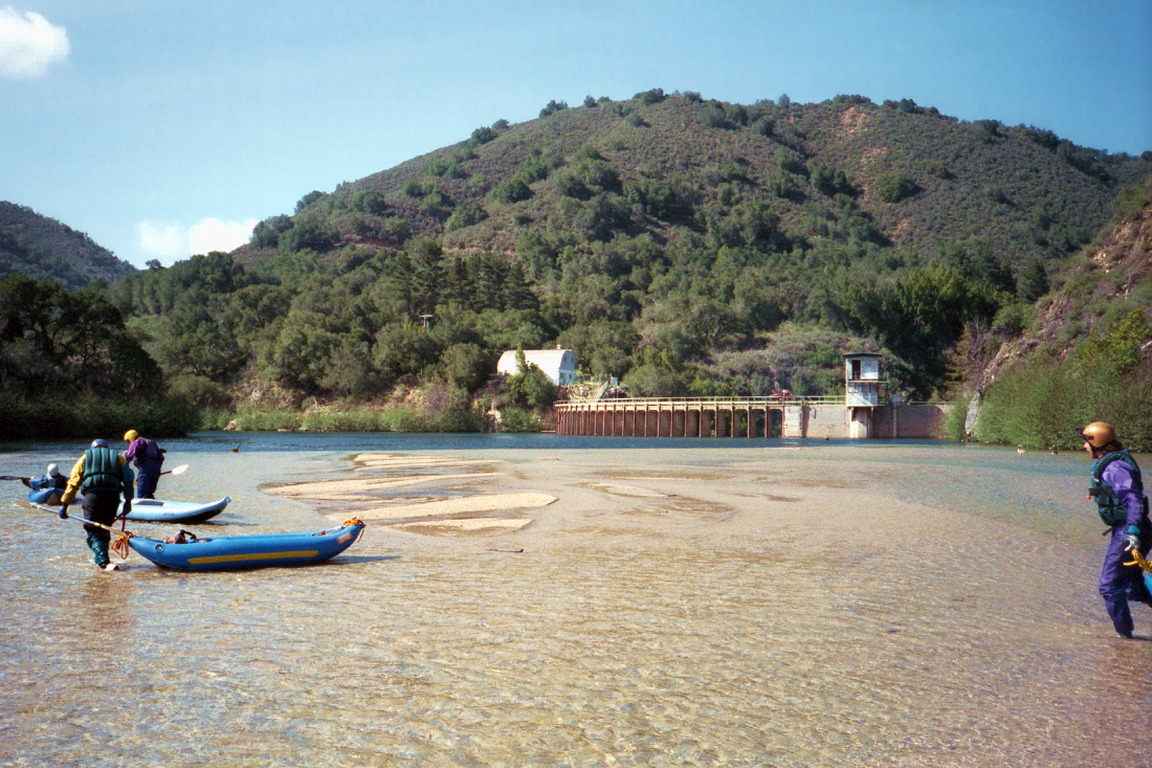
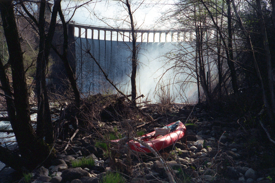
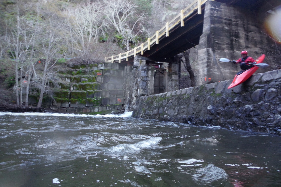
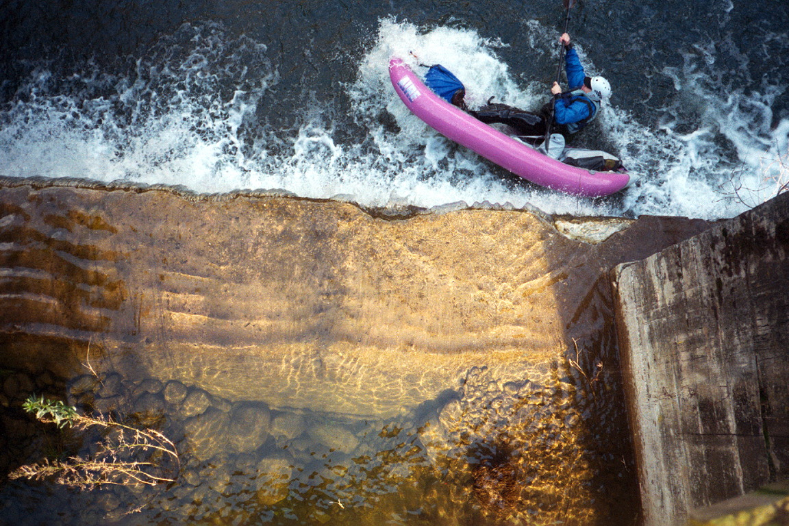
 

Stretch: Los Padres reservoir to Carmel Valley Village
Difficulty: class III with one big portage, brushy in places
Distance: 10 miles, 1 day
Flows: kayaks 300 - 600 cfs, IK minimum 200
Gauge: flow measured near Carmel Valley (USGS site)
Gradient: 60 fpm average
Put-in: below Los Padres reservoir, 900'
Take-out: Rosie's bridge on Esquiline Road, 300'
Shuttle: 15 miles (30 minutes) one-way, optional half mile hike
Maps: Delorme Southern California, AAA Monterey Bay Region, Topo
Season: winter and spring, depending on spill from Los Padres reservoir
Agency: county, city, private
Notes: © 2000, 2003, 2006 Bill Tuthill, CreeksYahoo

Note in early 2006: Probably due to lack of huge floods since 1997 combined with summer rains, this run is much brushier than it used to be. Last year a kayaker died in a brushy passage below San Clemente Dam. Until things clear a bit, this is no longer a recommended run.

It's hard to believe that such wonderful wilderness whitewater could exist so close to a tourist attraction like Carmel. Rapids are numerous and water quality is excellent. What's even harder to believe is that this stretch, comprising one of the most scenic class III runs in California, could have been so completely ignored by guidebook writers. I can think of no reason for keeping it secret. True, it runs only in springtime, if and when a reservoir fills. That reservoir is partially fed by snowmelt from 5000' mountains (Ventana Cones and Chews Ridge).

The run's only defects are occasional brush, especially toward the end, and a portage around 70' high San Clemente Dam. Your put-in is on public land, and your take-out is an uncontested right-of-way under a public bridge. However in fall 2001, two No Trespassing signs appeared left of the dam. Because there is no portage route to the right of the dam, this appears to be a blatant attempt to obstruct navigation, contrary to California law; see the Freedom of Navigation page.

There are houses in the early portion of the run, but after the river turns away from the road, you are in deep wilderness, which ends only when you encounter the bathtub ring of San Clemente, umm... reservoir (sandpit would be more apt). Because the Carmel arm of this so-called reservoir (only 75 years old) is completely silted up, moving water continues to the lip of the dam, so no flatwater paddling is necessary! Below the dam, water-district plumbing detracts from the scenery, but good rapids continue unabated.

Here are some excellent digicam pictures of the upper Carmel by kayaker Andy Laakmann.

Scott Cochran and I did this run in March 2000, not knowing what to expect. We estimated flows of 400 cfs at put-in and 600 cfs at take-out. That morning, the Robles gauge registered 420 cfs (probably too low) while the Carmel gauge registered 700 cfs (probably too high). The following weekend, I ran the river with a much larger group; with the Robles gauge reading 180 cfs and the Carmel gauge not reporting, we estimated 200 cfs at put-in and 250 cfs at take-out. After late rains in May 2003 we returned at only 180 cfs and it was fine.

Hazard! Down logs are present, and some parts of the run are brushy, so remain alert and avoid extreme highwater. After a string of drought years, brush conditions might worsen considerably. In 2003 there was one overhead log just below a rapid in the first mile, and bad brush in the flats approaching Carmel Valley, but none required portage if you chose the correct route (one brush maze near Tularcitos Creek is passable only on the far right).

mile
0
Hike your boats .5 mile up a dirt road to the earthen fill structure of Los Padres Dam. A good side road leads down to river right starting at the bottom of the hill.
Dan Dunlap takes the hike-in lead! Spillway falls into the raceway
Fairly continuous class II and III rapids begin immediately. One log portage is encountered in this section (March 2000).
.5
County park on the right bank, with plenty of free parking, an alternate put-in for those not inclined to carry their boats.
1
Rapids ease a bit as the river passes residences along Cachagua Road. Two log portages are encountered in this section (March 2000).
Semi-continuous rapids start at put-in The Carmel canyon starts to deepen
2
The river turns away from the road and enters a scenic wilderness. Gradient increases, and soon you find yourself in a canyon. Thus begins the most enjoyable part of this run. You might want to look at some of the rapids ahead: most have an easily visible route if you stand up in your boat or on the riverbank.
Congestion at a class III passage Paddlers at Pine Creek confluence
3.5
Pine Creek enters on the left, shortly below a class III rapid.
4 ?
Grinfest,* Class III+, marked by big boulders ahead. Visibility has improved in recent years due to the disappearance of a logjam. At low flows, this rapid is easily runnable down the left side. Near the bottom of the rapid, just above a large rock with water piling against it, is an undercut flat rock; slant left to avoid it. The far right channel could be a sneak route at high water, except for a large recirculation area near the undercut flat rock.
* Named by Scott Cochran.
Boat entering the class III+ rapid Above the narrow slanting drop
Another view of the slanting drop Current piles into this rock at high water
Good rapids continue.
5
Sandbar flats of former San Clemente reservoir begin. These areas could be covered with water if dam operators were to raise the gates.
6
San Clemente Dam ahead. Underwater sandbars might be difficult to traverse.
Hazard! Do not go near the lip of the dam. It is unlikely that a person could survive the 70' fall and backwash below.
Dragging boats across the sand flats Perilously close to San Clemente dam
Do not tarry in the mist below! San Clemente Dam has been declared earthquake-unsafe. Hopefully there will be no seismic activity during your visit. The California Division of Dam Safety wants the dam operator, California American Water Company, to spend $14 million pouring more concrete into what amounts to a diversion dam, but the NMFS (National Marine Fisheries Service) recommends dam removal.
See what I mean about that Hazard? In the mist below the dam
Portage on the left, from the deeper water of the San Clemente creek arm (not yet completely silted up). Climb up a metal staircase, turn right towards the dam, then carry your boat downhill on the fishladder maintenance trail. At the final hairpin right turn, continue straight onto an indistinct path down to the river.
6.2
Bridge of road leading to the dam, with a cement spillway beneath. The right side contains a narrow concrete channel, the only egress at low flows. At high water you may choose to run the left side. At low water, portage along the fishladder (the concrete channel looks too narrow for most boats).
Old bridge and cement spillway Top view, bracing below the 10' drop!
8.5
Tularcitos Creek enters on the right, and the river approaches Carmel Valley Road.
9
Maze-like willow garden. We got lost in it, but at the bottom discovered that a clean route exists on the far right (March 2000). You soon encounter houses and bridges of Carmel Valley. Rapids ease somewhat.
10
Take out on the left bank at Rosie's Bridge on Esquiline Road. Moderate rapids with occasional brush hazards and good scenery continue to Garland Park and beyond.

The remaining 13.4 miles to the Pacific ocean are described as the lower Carmel. At moderately high flows, you could combine both runs into a marathon paddle. Alternatively, select volunteers to run shuttle from Rosie's bridge while luckier paddlers spend a pleasant hour paddling down to Garland Park.

To reach take-out, drive southwest on Carmel Valley Road (G16). From highway 101, the easiest route is from Salinas on highway 68, then south over Laureles Grade (G20). Carmel Valley Village is two miles uphill from Laureles Grade. At the far end of town, turn right onto Esquiline Road, descend to the river, and park on the far side (left bank).

To reach put-in from there, continue uphill on Carmel Valley Road. After about 3 miles, turn right onto Cachagua Road. Climb steeply over Tularcitos Ridge, then descend steeply to the Carmel River and Cachagua Creek valley. Near the bottom of the hill after 5.9 miles, turn sharp right onto Nason Road. Cross several speed bumps to County Park on the right, where the good pavement ends. This is an alternate put-in, with public toilets and a children's playground. Continue uphill past the ranger station and park in a dirt lot where there is a fence with locked vehicle gate. Enter the unlocked hiker's gate and carry boats on a dirt road .5 mile to Los Padres Dam.

 Creeks Navigation

 Home
 Recommended Runs
 Map of Rivers
 Alphabetic List
 Alphabetic Table
 Text Search

 Sponsored Links