|
Butte Creek near Chico |
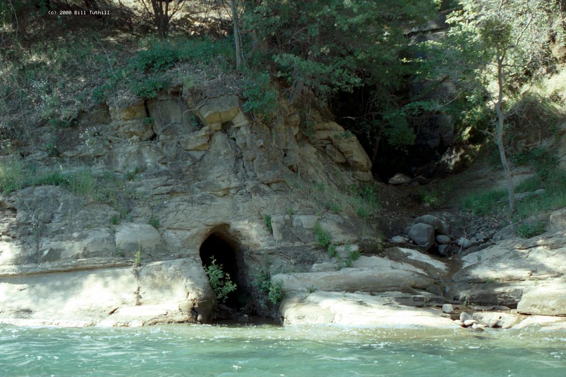
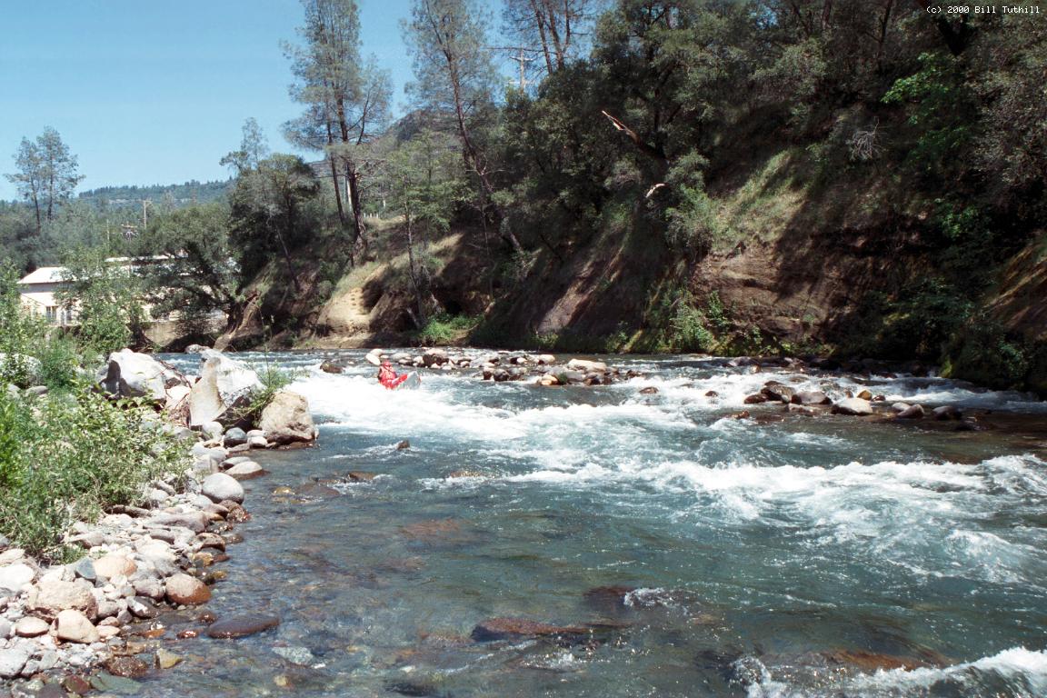
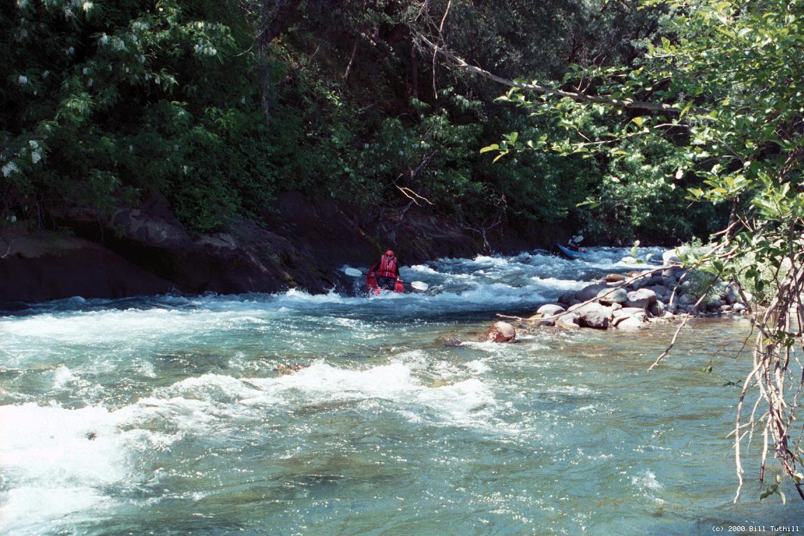
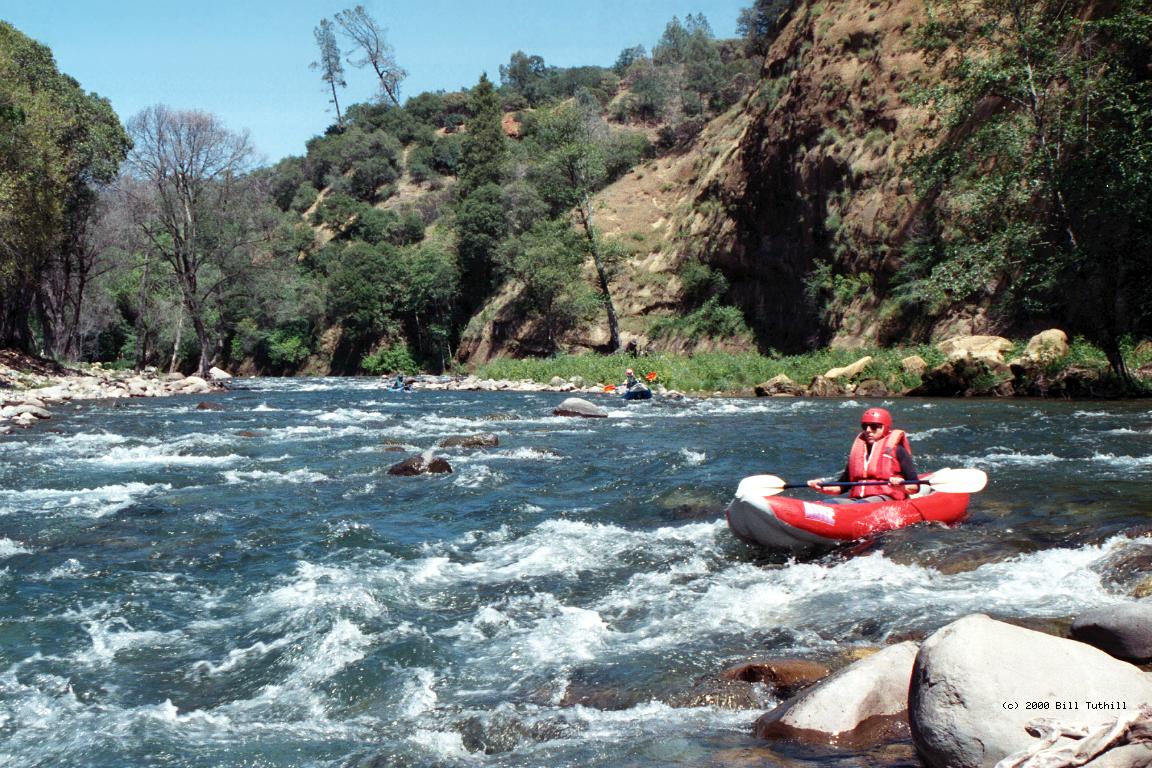
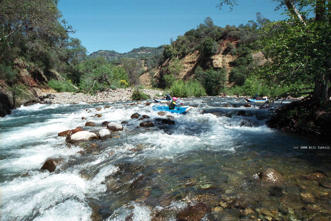
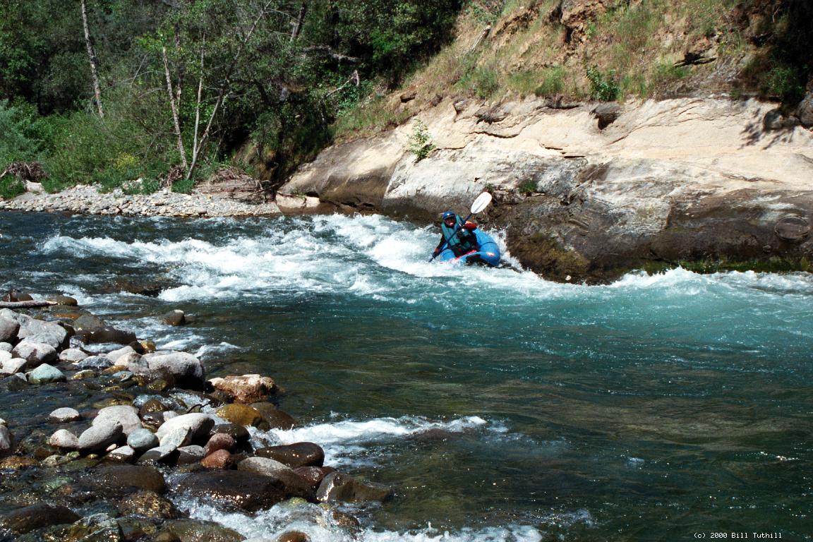
Although not described in any guidebook, this is one of the finest novice and training runs in California. Water quality is excellent, scenery is good, and varied class II+ and II rapids occur constantly throughout the run. Moreover, this stretch of creek contains few notable hazards, except for possible downed trees, and a dam below the recommended take-out. The only problem is that snowmelt runs out at some point in early summer, so flows drop to suboptimal levels. Butte Creek parallels Centerville and Honey Run Roads. Although there are mine tailings along the creek, they are mostly covered by vegetation now. Interesting hardrock mineshaft openings can be seen along the water. At low flows on sunny days, you might see many inner tubers along the run. Butte Creek has several salmon runs in normal years. In 1998 Bruce Babbitt announced removal of a Butte Creek dam (between this section and the Sacramento river) to improve salmon habitat. The migration of chinook salmon increased from 44 counted in 1987 to 20,000 in 1998. The first few rapids below put-in are the steepest and most continuous. Gradient eases during the run, as does overall difficulty of the rapids. In May 2000 there were two exceptions: a tight chute with tree branches overhanging the left bank plus a big hole below (Tree Hole), and a quick series of holes underneath and below a wood-and-iron railcar footbridge. Even at high flows these rapids aren't quite class III, and Tree Hole can be avoided by taking the right-side boulder-bar drop (not possible at low flows). Hazard: In May 2003 a downed tree made a short portage necessary just before Tree Hole. Choose the right-side channel for maximum safety.
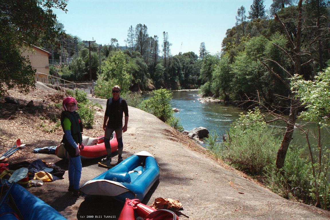
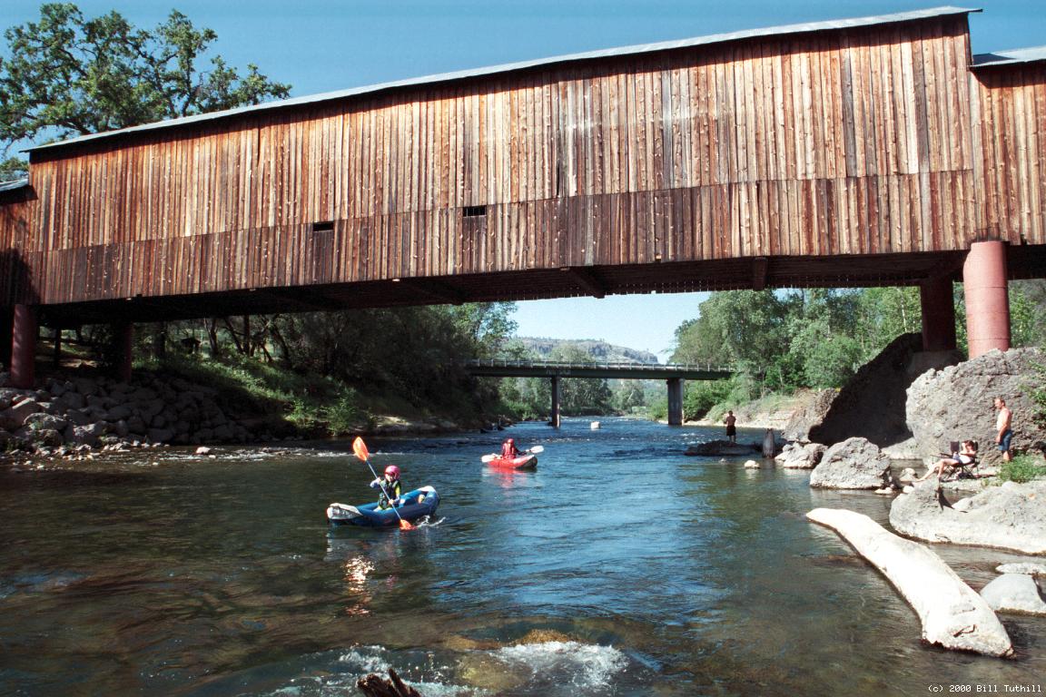
To reach take-out, exit highway 99 just south of Chico onto The Skyway. Drive east for about a mile, and turn sharp left on Honey Run Road. After about five miles, you see a municipal park and covered bridge on the right. If you cross a bridge to the south side of Butte Creek, you've gone too far! There is convenient parking (for $3) near the bridge, and less convenient parking (free) along the road outside the park. To reach put-in, turn left from Honey Run Road onto Centerville Road just before the aforementioned bridge over Butte Creek. Follow Centerville Road for about 6 miles and cross over a new one-lane bridge. After less than a quarter mile uphill there is a private road, with closed but unlocked gate, down to the PG&E powerhouse. The No Parking signs indicate that you should not leave your car there all day. If the gate is closed, open it temporarily, drive down to a parking lot near the powerhouse, unload gear, then drive up and close the gate. 2003 update from Steve Recher: There is a locked gate across the road that leads down to the put-in at the PG&E powerhouse. The gate looks fairly new and is located just a short ways after turning off the main roadway. We inflated our kayaks at the gate and then walked the 100 or so yards down to the put-in. There's new construction going on at the powerhouse; a cyclone fence is being erected on a section of property above the actual powerhouse, and we wondered if this is the reason for the locked gate. An alternative to the powerhouse/museum parking would be to launch at the Centerville Road bridge crossing Butte Creek downstream of the powerhouse put-in. There's a good amount of shoulder parking, a short trail down to the creek, and a BLM glassed-in display with information on running this section of the river. The nearby Centerville Museum is worth a visit. They have all sorts of pictures and artifacts from the olden days, and the entrance price is right: free! Turn left and continue .2 mile uphill to reach the museum. Above the PG&E powerhouse, which diverts up to 150 cfs from far upstream, Butte Creek becomes class III, then IV, then V. There is a fine class IV run (with portages) involving a drive to another powerhouse from near the town of De Sabla.
|
Creeks NavigationHomeRecommended Runs Map of Rivers Alphabetic Index Alphabetic Table Text Search
Sponsored Links
|