|
Arroyo not-so Seco near Soledad |
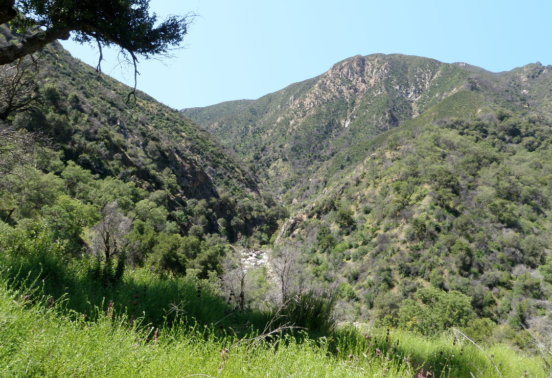
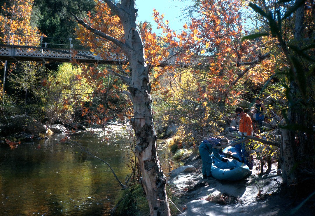
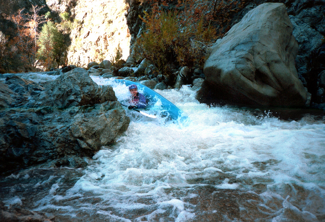
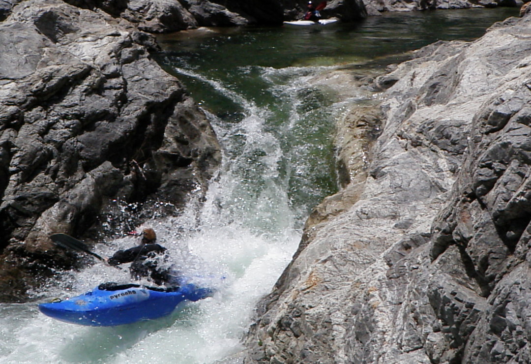
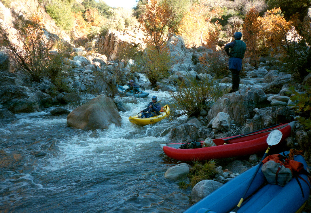
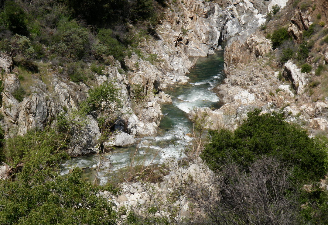
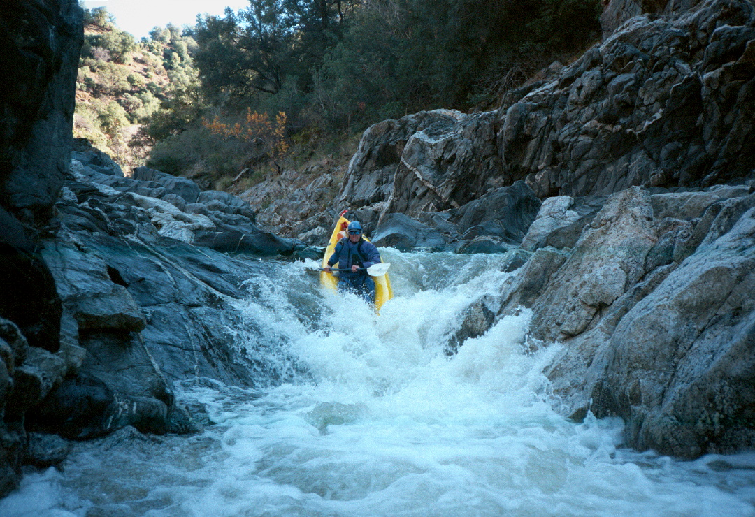
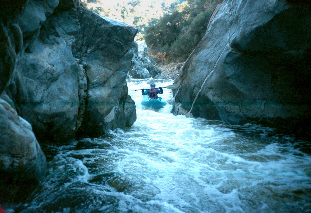
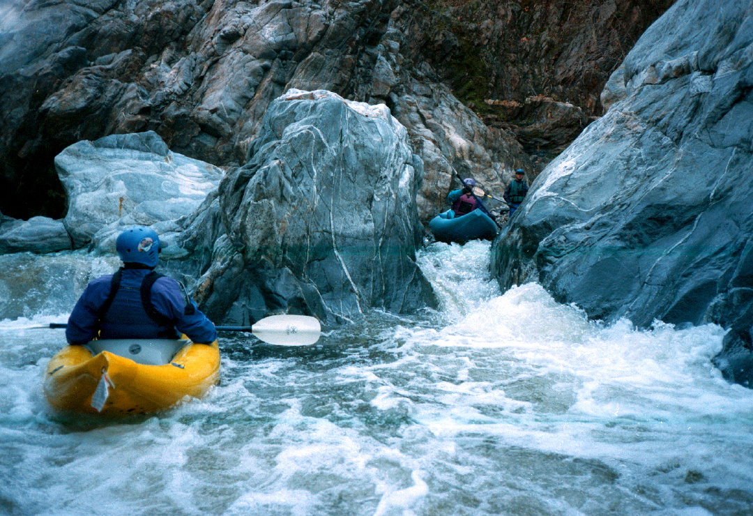
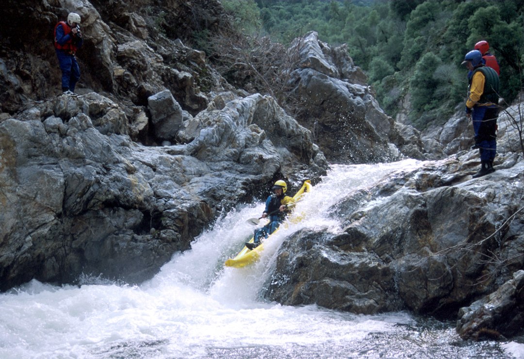
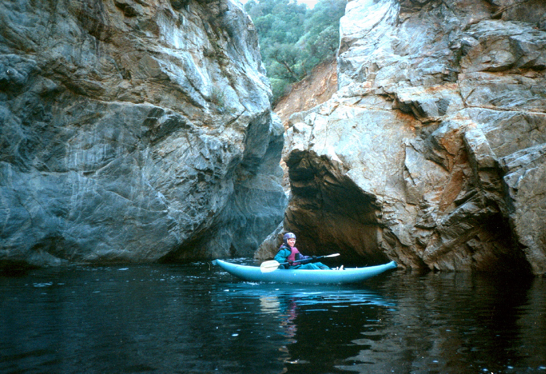
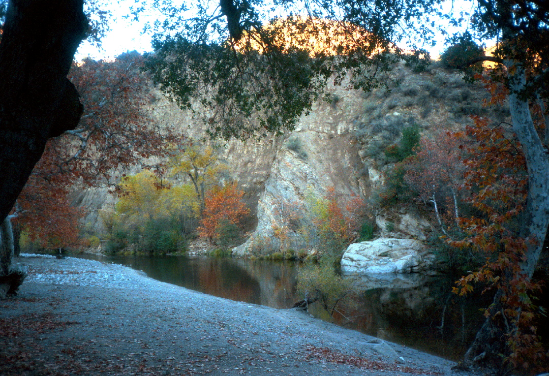
This is one of the most scenic class IV runs in California, although it was never described in any printed guidebook. You must carry your boat about three miles up an old dirt road (gated to minimize 4WD damage): a little bit up, a little bit down. The hike is pleasant, especially in November when autumn leaves create scintillating views of the Ventana Wilderness. You are amply rewarded with 2 miles of fun rapids in a narrow brushless gorge, then 2 more miles of boulder bar rapids in a deep canyon. Compared to this, the two lower runs described in Schwind's classic book are hardly worth the drive from population centers. This run does not require a vehicle shuttle! Water quality is excellent, even after recent rain. The gorge section is runnable down to 125 cfs or below, but the boulder bar rapids are more navigable above 150 cfs. As flows approach 500 cfs one rapid becomes class V, and pools disappear between other rapids, as you can see in these pictures. Volume flows (cfs) are available on a USGS website downstream, although this flow now seems somewhat reduced early-season by vineyard irrigation. Stage levels (feet) are available from a gauge at take-out, supposedly near Greenfield. Unfortunately the gauge pool has a muddy bottom and changes from year to year. In 2012 the minimum recommended stage was about 7.6 feet for IKs, and about 7.8 for hardshells (optimum 8.0 to 8.2). In 2017 floods the gauge pool radically changed, and now the dividing line between class IV and V is between 5.0 and 5.5 feet! Every year, be sure to compare the downstream gauge for sanity. At high flows it might be advistable to start on Santa Lucia Creek to avoid the high-water class V rapid. To start your trip, drive to the locked gate, and carry boats about 2.5 miles (slightly uphill and then down) to a bridge across Santa Lucia Creek. This is an alternate put-in, although the quarter mile of bump and grind on Santa Lucia Creek to the confluence is probably harder than the extra .5 mile boat carry, except at higher flows. Continue uphill on the dirt road to a trail junction, where there are excellent views southward up Arroyo Seco canyon. Turn right and descend to the Willow Creek pack bridge. On the hike we have seen hand-size tarantulas and cougar or big-bobcat tracks. Here are some good pictures of a November 2002 trip, including tarantula! If you arrive to find more water than you expected, as we did once (700 cfs after overnight rain), you can carry your boat up the road about 1.5 miles, where the road curves left around a less-steep area. There is a good trail down to the Seco just before the road curves right, climbs, then descends to Santa Lucia Creek. Even the class III section stomps at high flows! You might want to continue down to a run below. We abandoned the section to Miller's Lodge due to brush, but the section below that seems runnable again in 2023.
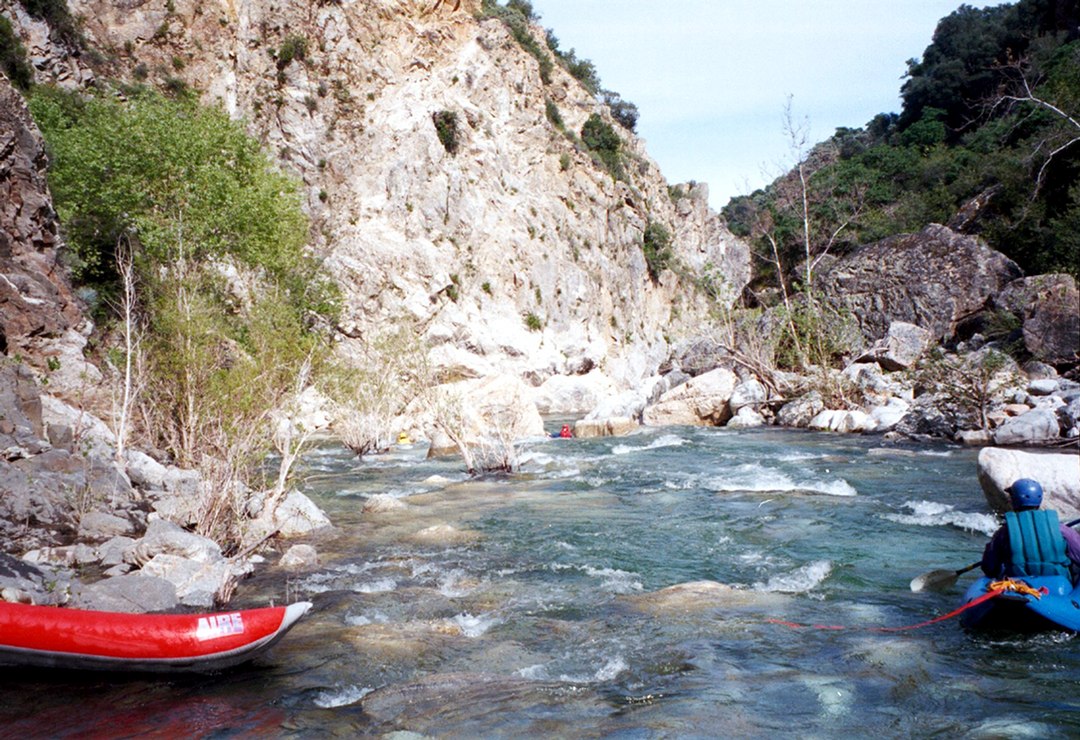
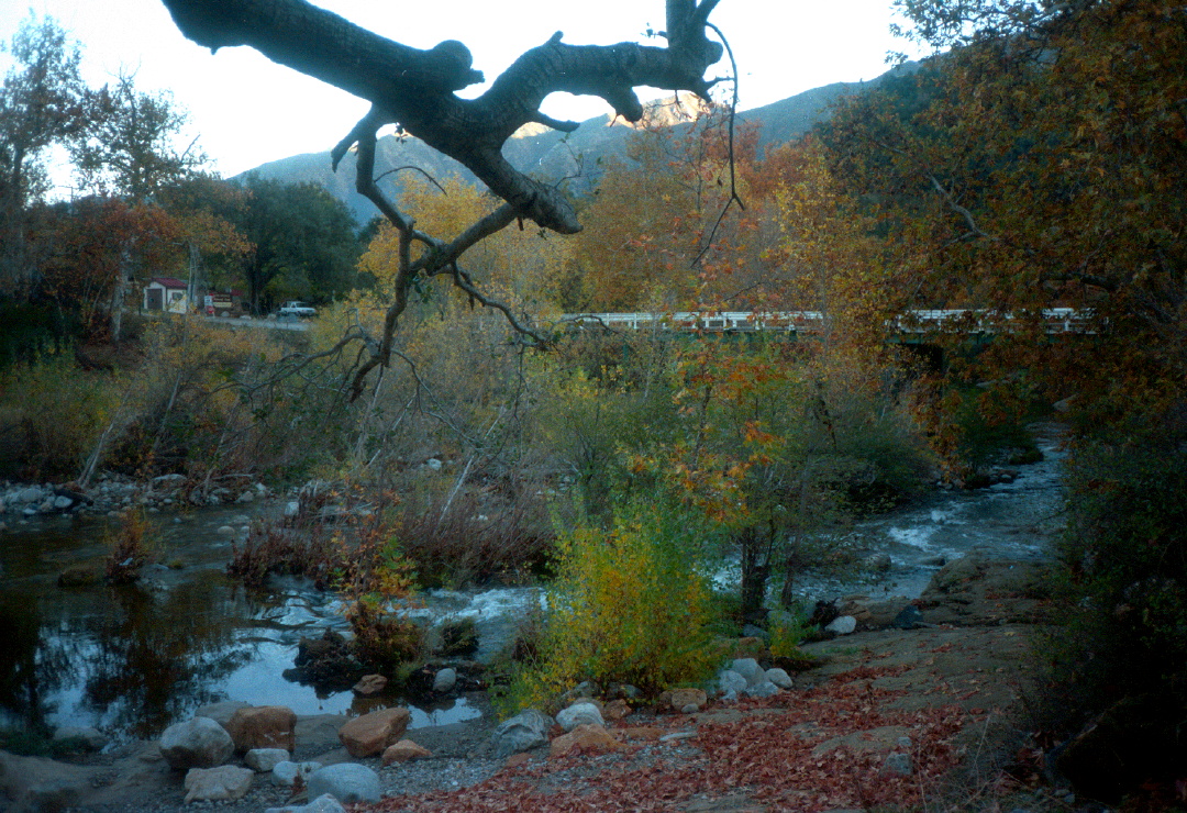
If you have time for lower runs, and the brush situation has improved, note that there is a brushy rapid with (exciting!) 1 meter waterfall against a sandstone cliff (Camel Rock) at a sharp right turn about a mile below the Arroyo Center bridge. There are two potentially hazardous low-water crossings, one shortly below the Arroyo Center bridge, and another near Miller's Lodge. Shortly past Miller's Lodge there is a good free take-out where the road comes near river level near a rockslide; be sure to choose the left channel after the low-water crossing, or you might miss this spot. It rained heavily during the winter of 2022-2023, which cleared out brush. Putting in at the free access below Miller's Lodge, here are the mileages. Keep your eye out for the best channel not blocked by brush and logs. At around 600 cfs, there are lots of fun class II rapids.
Shuttle DirectionsTo reach take-out: From the south on US 101 at Greenfield (north of King City) take G16 west 5.7 miles to Arroyo Seco bridge, take-out for lower 9.5 mile Schwind run. From the north on US 101 at Soledad, just after crossing the Salinas River, take G17 southwest 9.3 miles. G16 and G17 intersect on the south bank near Schwind's take-out bridge. Continue west for approximately 7 miles. Where G16 bears right uphill to Carmel, stay left on Arroyo Seco Road. Miller's Lodge, recommended take-out for the upper 5 mile Schwind run, is a short distance ahead. Continue 4 more miles uphill to the USFS camp and picnic grounds at Arroyo Center. There is a $7 entrance fee (2012). To reach put-in: Drive your vehicle as far uphill as possible past the west campground, to a locked gate. At the end of the day, walk uphill to retrieve your vehicle. Hot showers are available at the nearby campsite for a small fee.
|
Creeks NavigationHomeRecommended Runs Map of Rivers Alphabetic Index Alphabetic Table Text Search
Sponsored Links
|