|
Arroyo Mocho near Livermore |
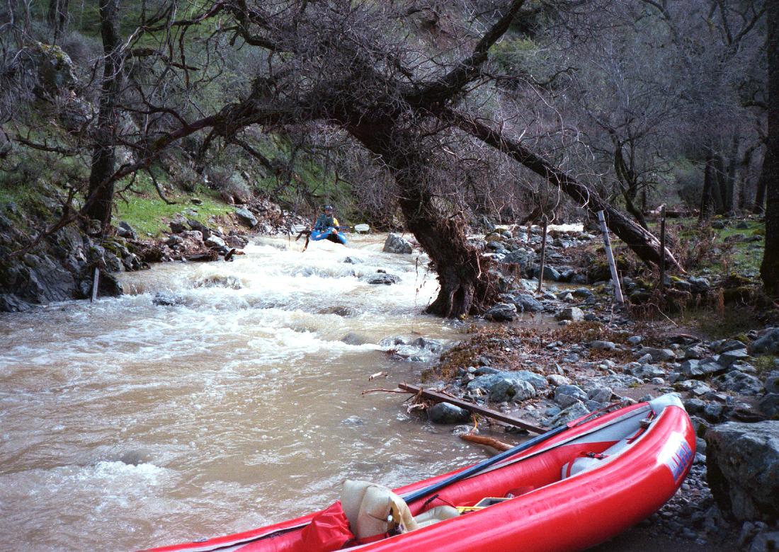
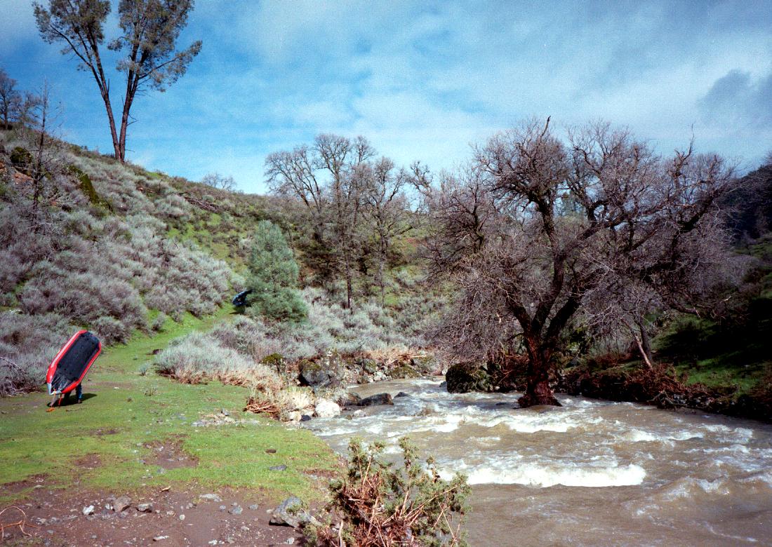
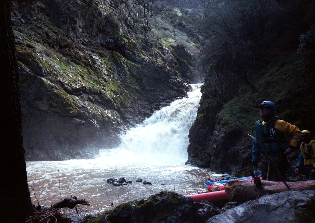
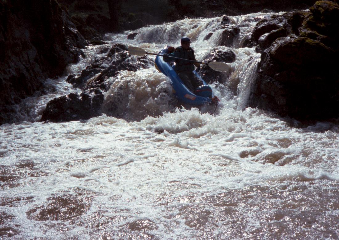
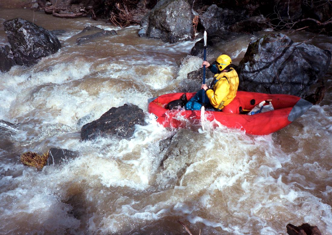
This run was first done by John Googins and friends in the 1980s (?). Either they enjoyed it so much that they kept it a secret, or they did not enjoy it. My friends wanted me to keep it a secret, because it is the most intense whitewater close to the bay area. The run starts off with some nice drops before plunging over a waterfalls, then settles into a challenging IV+ run with nicely spaced portages almost all the way to the Mines Road bridge. Watch out for the Arroyo Mocho at high water! When we first toyed around with idea of running it, we got spooked. Arriving at take-out where Mines Road turns left from Del Valle Road, the flow looked muddy but reasonable. However while doing shuttle we soon got scared by huge hydraulics where the gorge pinched down before exiting into the valley. Later, when we looked at the waterfalls (called Branding Iron) upstream, we had to get the toilet paper. That thing looked scarier than Niagara Falls!
Here is an e-mail I sent John Googins, to which he never replied. Dear John: I'm writing to say we recently ran Arroyo Mocho with inflatable kayaks. I heard you led an exploratory trip there years ago. Our hats are off to you: we can't imagine how you did it in hardshell kayaks. You must have had to detach and attach sprayskirts ad nauseum. I'm curious, did you have fiberglass or plastic boats? There is a lot of class IV action in there! Darren & Bill Cavalli & I all agree we'll go back next year if possible. It's nice having so many challenging rapids so close to home. We did a commando put-in, which appears to be necessary. A week earlier we inflated our boats near an apparently legal put-in but were chased off by a local landowner. Keeping a low profile is an absolute requirement. Our portage around the waterfalls was easy on the left, up a dirt road, down cattle trails, and into a creekbed. The pool below the falls is a beautiful spot. About a mile downstream, we quick-portaged a class V+ where all the water went into a big rock. Perhaps halfway down, there was another long portage around a class VI; we went uphill and downhill on the right (the rocky portage on the left looked exposed). A few miles before the end there is a concrete-lined channel with landslides on the right near a concrete bunker (or something) on the left. Because of the muddy water, we couldn't see below the surface, so we portaged this mess on the left, over chicken-wire bank supports. Other than those four portages, we lined our boats several times around trees and a low-water crossing to the concrete bunker. We lost track of the number of scouts. Nobody swam, and we didn't run anything that looked too dangerous. About 4-5 barbed wire fences had been pasted to the canyon by highwater. Near the end, Darren wrapped on a rock hidden in a standing wave (I've never seen anything so well disguised) so this told us there might have been nasty underwater things we couldn't see. Clear water is better, but this run is so intense that it's probably worth a drive down from Sacramento.
|
Creeks NavigationHomeRecommended Runs Map of Rivers Alphabetic Index Alphabetic Table Text Search
Sponsored Links
|